The Adventure Continues:
Tettegouche Redux
After the high of conquering Eagle Mountain and exploring Grand Marais, it was time to return to Tettegouche State Park and settle into my new campsite. The drive back along Minnesota’s North Shore was a scenic hour, and before heading in, I swung by the visitor center to officially check back in (see Part 1 of my adventure here).
This new site, tucked deeper into the Baptism River Campground, immediately impressed me. The layout here is top-notch — each campsite has breathing room, which means you’re not cheek-to-cheek with your neighbors. That said, there was one guy with a generator humming in the distance. I thought most of these sites had electricity? Maybe he missed the memo.
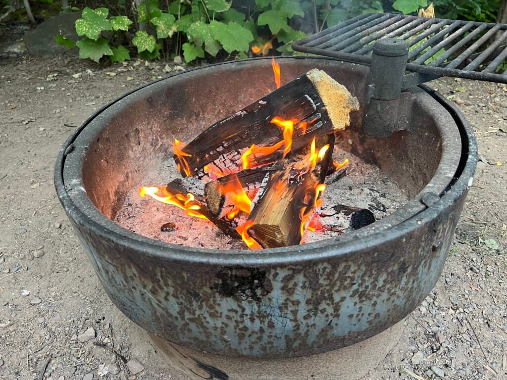
As evening settled in, I built a roaring fire, poured a glass of red wine, and pulled out one of my reliable camping staples: Yellow Tadka Dal from Trader Joe’s paired with Earthly Grains Basmati Rice from Aldi. Shelf-stable, easy, and surprisingly satisfying. Even better, I cooked it in my trusty cast iron skillet — which, frankly, is a miracle I managed to wedge into my suitcase.
Photo: Fireside Bliss Under the Evening Sky
Morning Visitor:
The Hare-Raising Encounter
Up and at it early — again.
I started the morning with cold brew coffee and a splash of Coffee Mate (not ideal, but it lasts longer than real half-and-half in the wild). While soaking in the stillness along the Baptism River, I had a surprise visitor: a snowshoe harecasually hopping through camp.
Here’s the fun part — in Minnesota, these hares are dark brown in summer. However, when winter arrives, their coats turn snowy white in a seasonal shift known as leucism. Nature’s wardrobe change at its finest.
Photo: My Morning Visitor
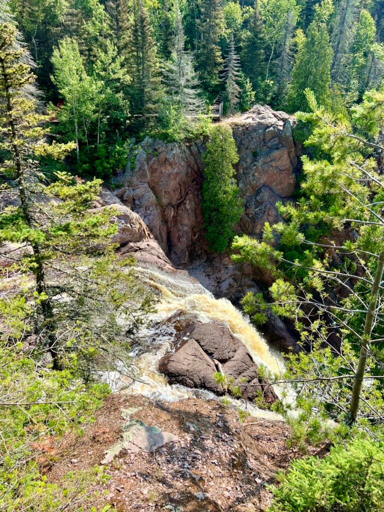
Two Waterfalls, Twice the Fun
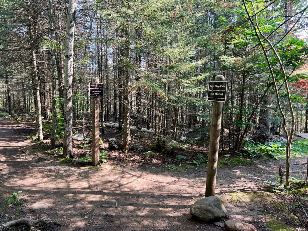
With clear blue skies overhead, I set out to revisit Two Step Falls and High Falls — this time from the opposite side of the river. The trailhead near Baptism River Campground offers a completely different perspective, and because of that, it felt like an entirely new experience.
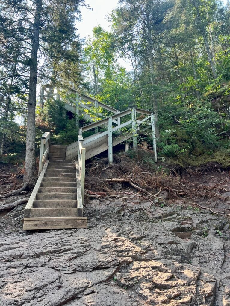
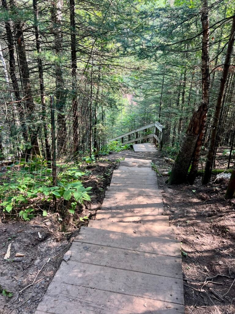
I began with Two Step Falls, which requires a 200-step descent. In other words, you earn this view.
Photos: The Trail and the Stairway to Two Step Falls
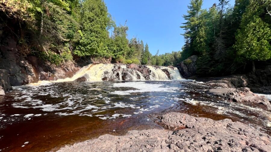
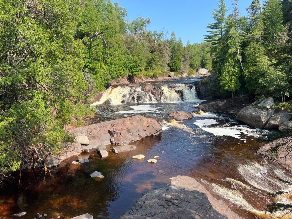
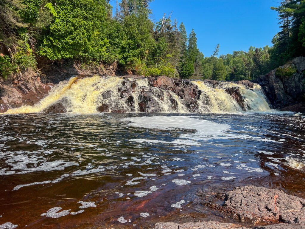
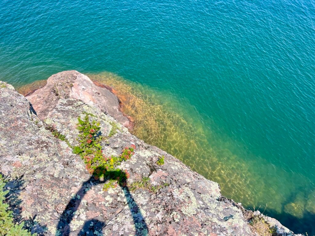
The payoff? Absolutely breathtaking. From this angle, Two Step Falls was easily my favorite viewpoint of the trip. The cascade felt more intimate, more powerful. Naturally, I waded through the shallow water to get closer.
Soon after, a couple of guys arrived with their dogs — who, I’m convinced, were eyeing the water longingly. If they could’ve ditched the leashes, they would’ve been splashing in seconds.
Photo: Descending to Two Step Falls—Morning Magic in Every Step!
Photo: Getting Up Close and Personal with Two Step Falls
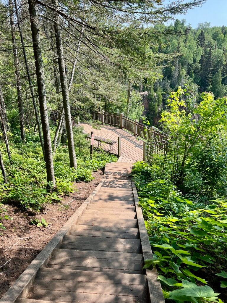
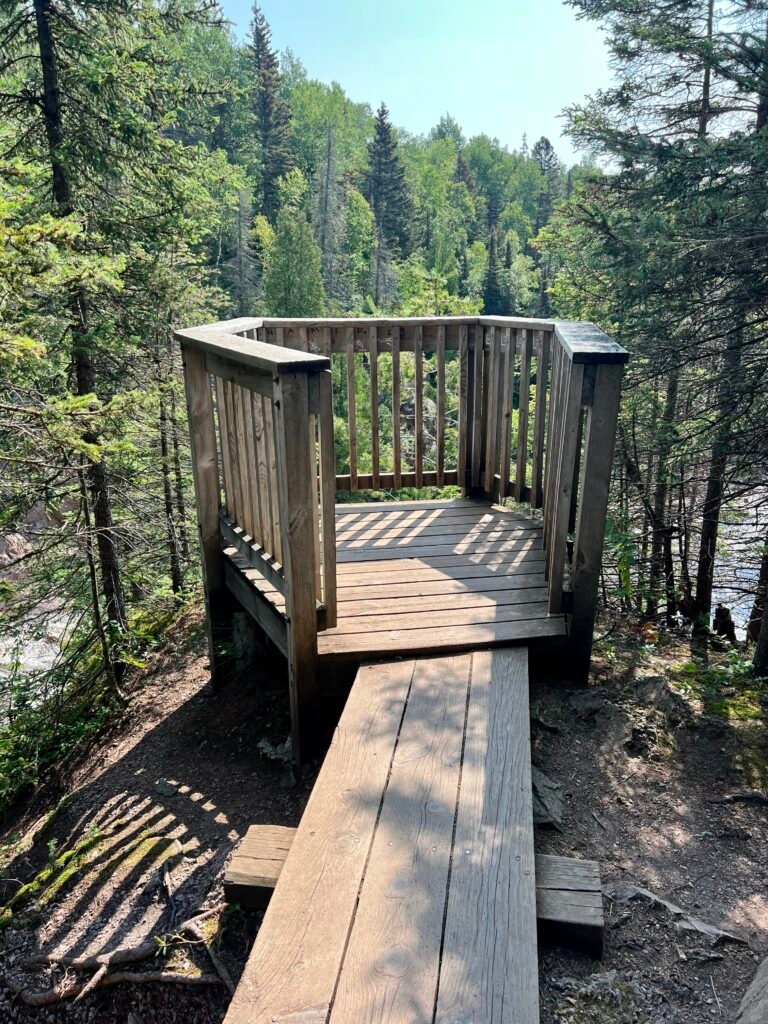
High Falls: The Pulpit and the Power
As I continued hiking, I reached a fork in the trail — left toward the parking lot or straight ahead to High Falls. Obviously, I went straight.
The overlook was spacious and dramatic, complete with what I can only describe as a pulpit-like platform. Naturally, I delivered an impromptu sermon to the forest creatures below.
Photos: High Falls Viewing Area | The Legendary Pulpit Spot!
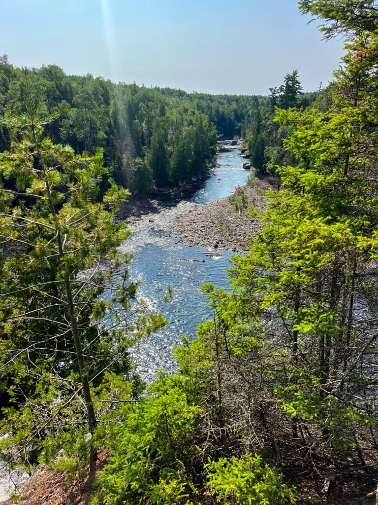
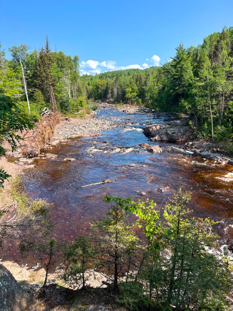
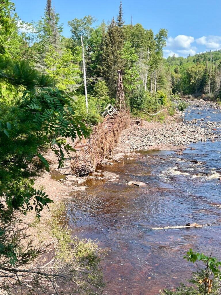
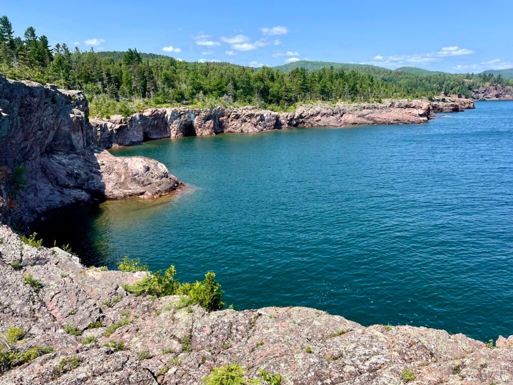
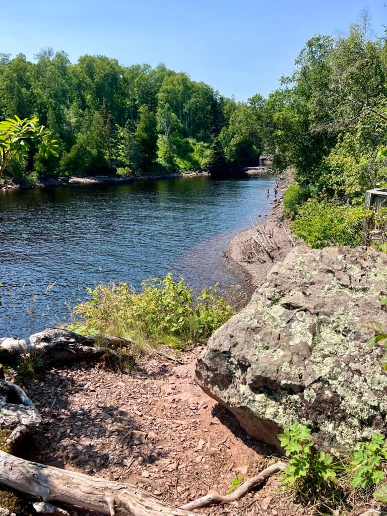
The views along the Baptism River were spectacular. Although the opposite side offers a more dramatic view of High Falls itself, this perspective gave a sweeping look at the surrounding gorge. Meanwhile, I also stumbled upon the twisted wreckage of the old swinging bridge — a powerful reminder of the storm that tore through the area.
Photos: Breathtaking Views of the Baptism River
Photos: High Falls from a Different Angle—Less Spectacular, but Still Stunning | The Twisted Swinging Bridge
Take Two:
Shovel Point and the River Mouth
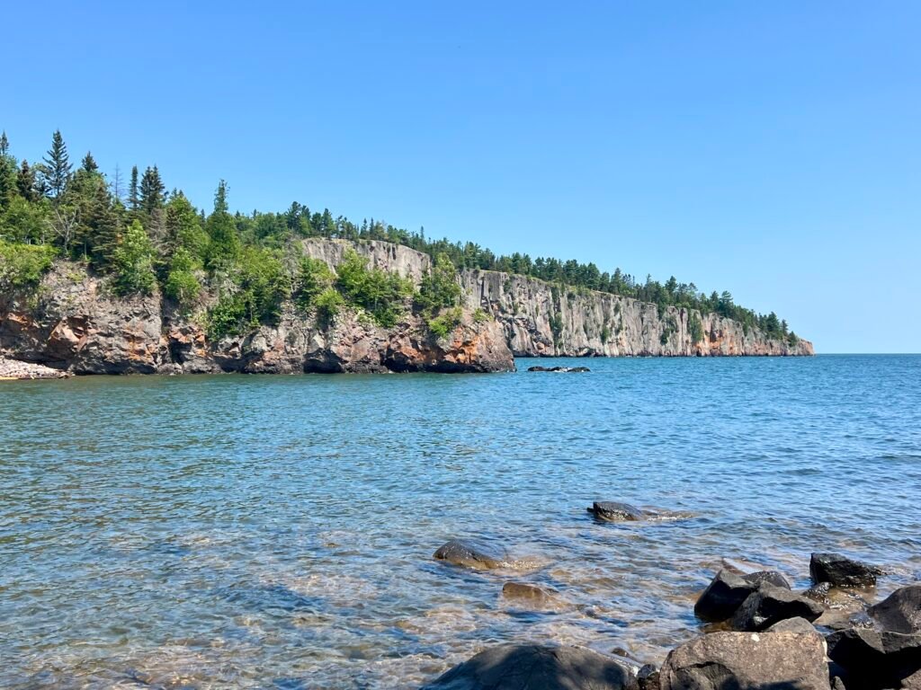
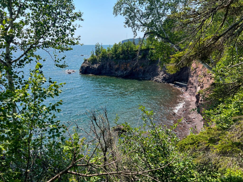
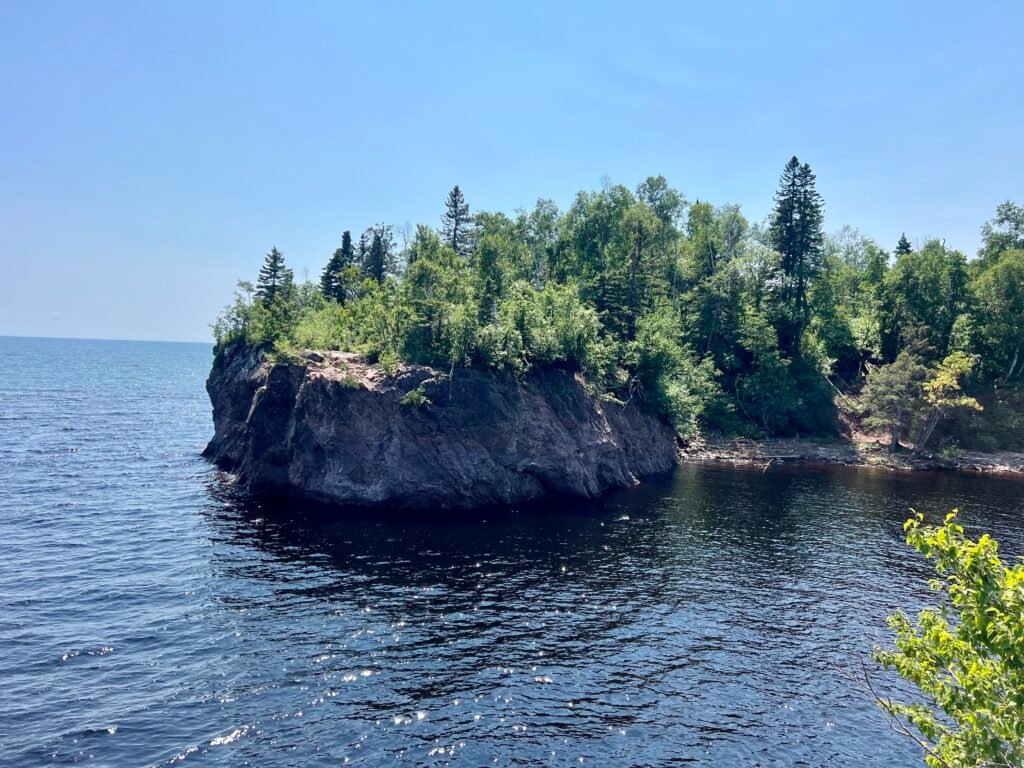
After packing up camp, I made my way back toward the visitor center and then out to Shovel Point and the Baptism River Mouth. What a difference a couple of days makes.
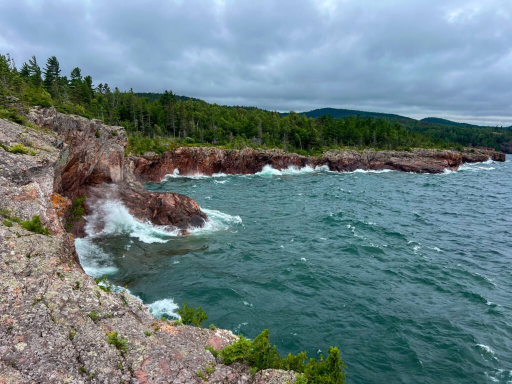
Previously, Lake Superior had been moody and gray. This time, however, it was calm, turquoise, and almost Caribbean-looking. The contrast was stunning.
At Shovel Point, I chatted with a friendly couple and simply soaked in the view. The cliffs, the clear water, the fresh breeze — this is why people fall in love with Minnesota’s North Shore.
Photos: A Calmer Lake Superior – View from the Beach |
Palisade Head in the Distance
Photos: Lake Superior’s Dual Personalities—Two Days, Two Vibes!
Photos: Lake Superior – Turquoise Water and Incredible Views
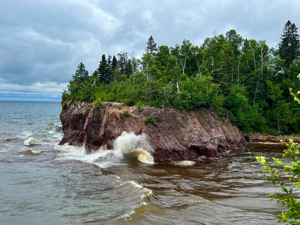
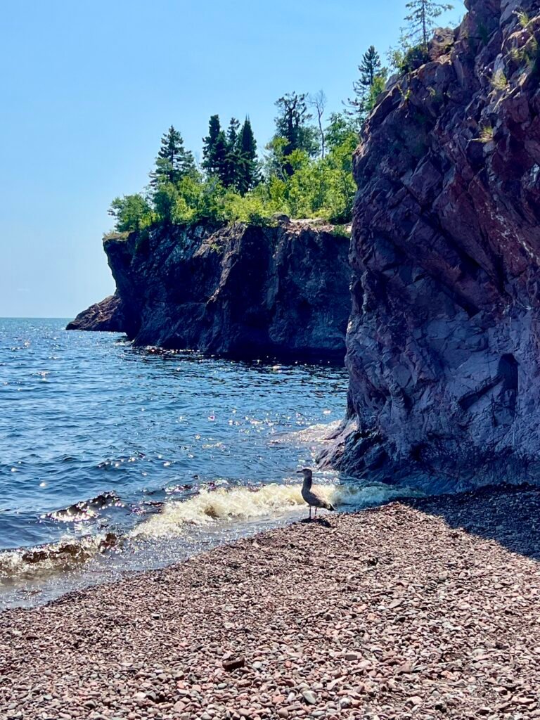
At the River Mouth, I climbed onto the rocks and, unexpectedly, found myself background scenery in someone’s FaceTime call. Seriously — do we need to broadcast every conversation to the world?
So instead, I slipped away to the rocky beach where I shared a quiet moment with a lone seagull. However, when a group of teens descended with towels and chatter, I knew it was time to make my exit.
Photos: The River Mouth—Totally Different Feels!
Photos: Chillin’ with a Seagull | The Baptism River—A Much Calmer Day
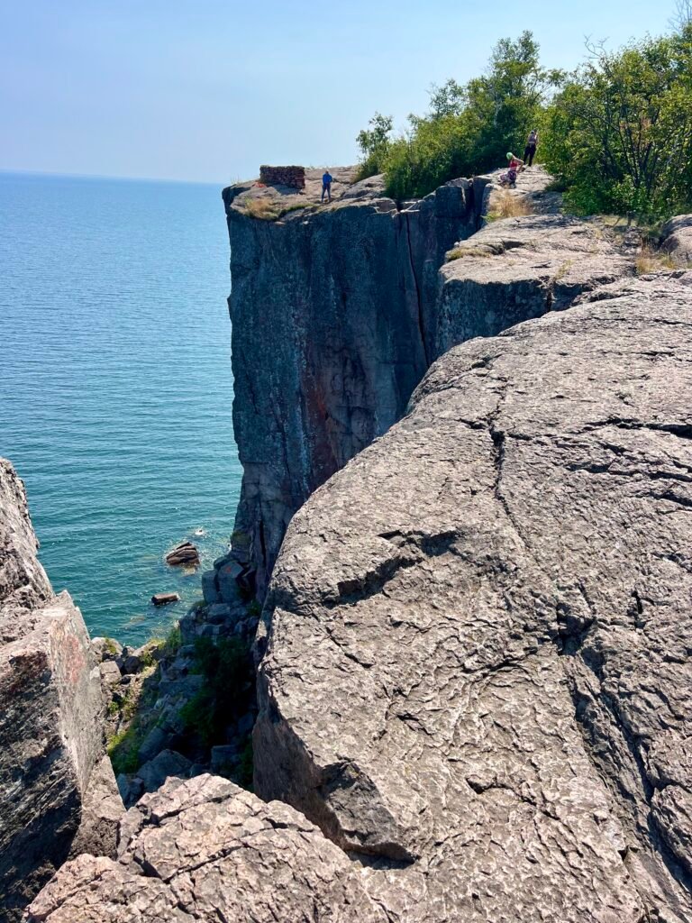
Palisade Head: Glad for Visit #2
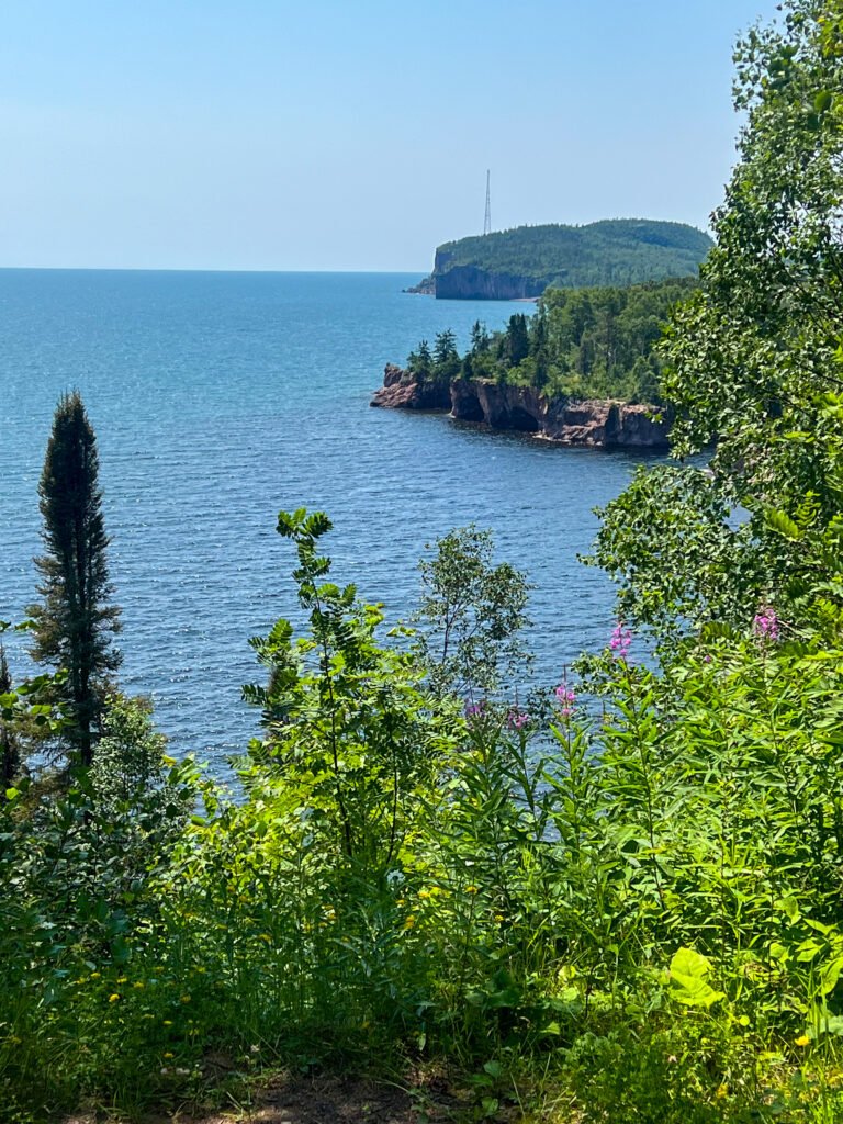
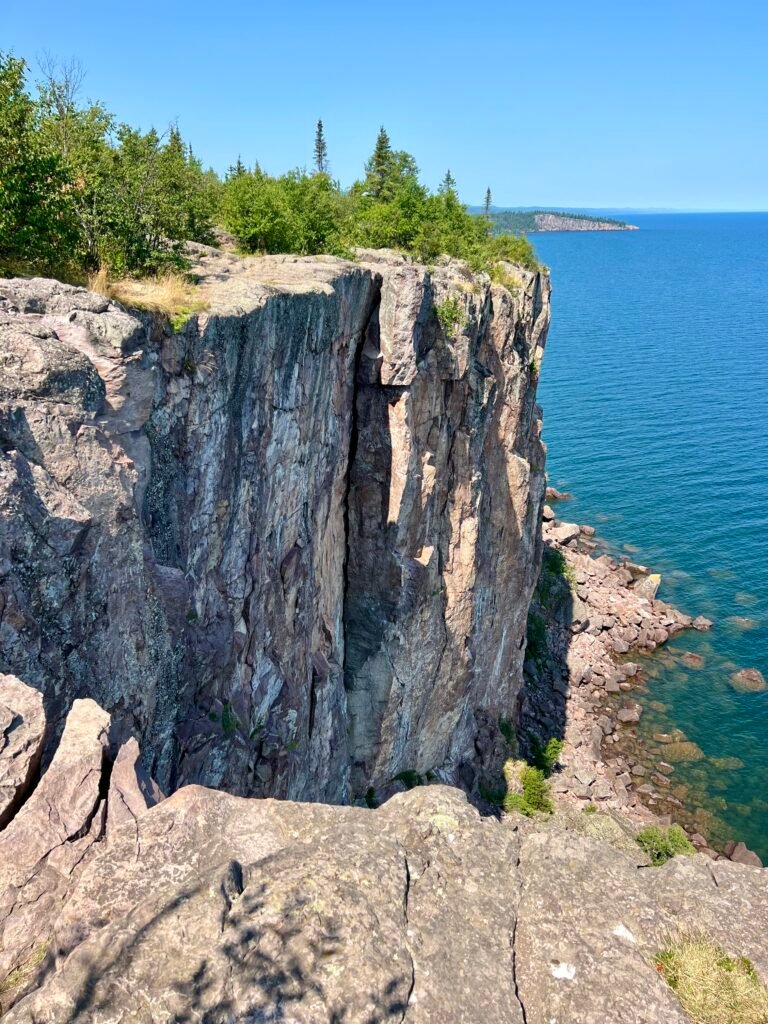
As I drove south on MN-61, I decided to give Palisade Head another chance — this time from the top.
The overlook was buzzing with motorcyclists, cars, and rock climbers prepping their gear. Now that I could fully explore the cliffs, I finally understood the hype. The vertical drop-offs are dramatic, and for climbers especially, it’s a playground of granite and adrenaline.
In short, I was glad I made the detour.
Photos: Palisade Head – Views Towards Shovel Point |
Climbers Preparing to Conquer Palisade Head
Wrapping Up: Tettegouche State Park, What a Gem
What started as a place I barely knew anything about quickly became one of the highlights of my Upper Midwest trek.
Tettegouche State Park exceeded every expectation. Between the rugged North Shore cliffs, the power of High Falls, the beauty of Two Step Falls, and the peaceful moments along the Baptism River, this park delivers diversity at every turn.
Moreover, this was my first deep dive into Minnesota’s North Shore — and it absolutely won’t be my last. If you haven’t explored Tettegouche State Park yet, put it on your list. The waterfalls alone are worth the drive.
Trust me — you need to see this one for yourself.
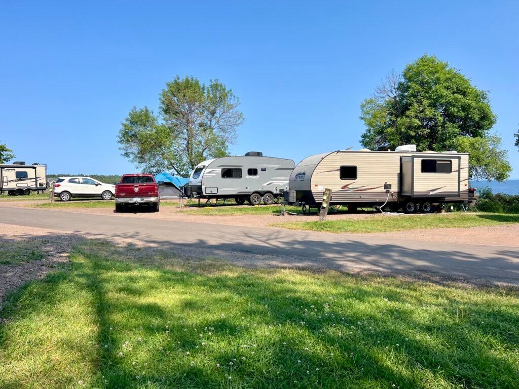
Two Harbors: Campground Chaos and Sweet Treats
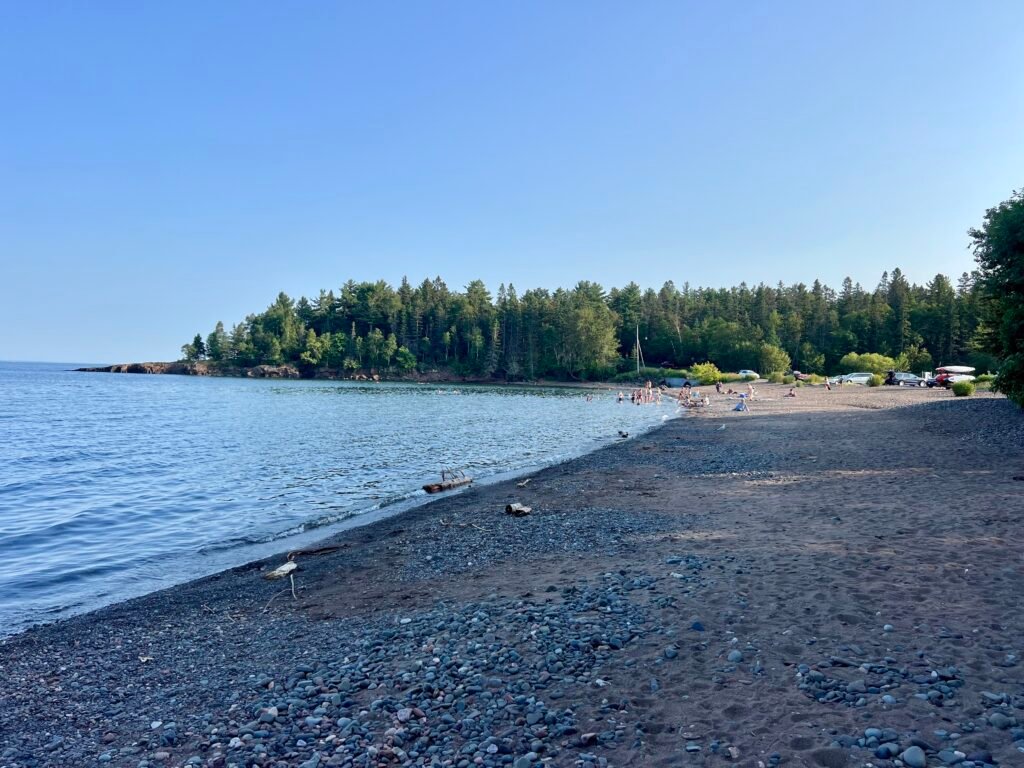
Next up was Two Harbors, just 30 minutes down MN-61. I stayed at Burlington Bay Campground, which, in contrast to Tettegouche, felt like sardine city. Campsites were tightly packed with little privacy.
Photos: Burlington Bay Campground—Sardine City! | Two Harbors Beach
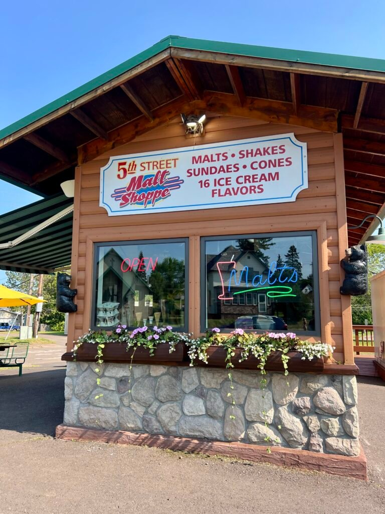
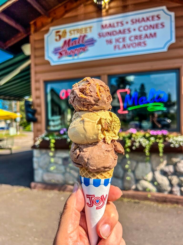
Naturally, I sought redemption in ice cream.
I made a beeline for the 5th Street Malt Shoppe and ordered Chocolate Peanut Butter alongside Coffee Ice Cream. Back at the campground, I ended the day with red wine on the beach, watching Lake Superior settle into evening.
Photos: 5th Street Malt Shoppe | My Delicious Reward!
Minneapolis Finds: Kowalski’s and More
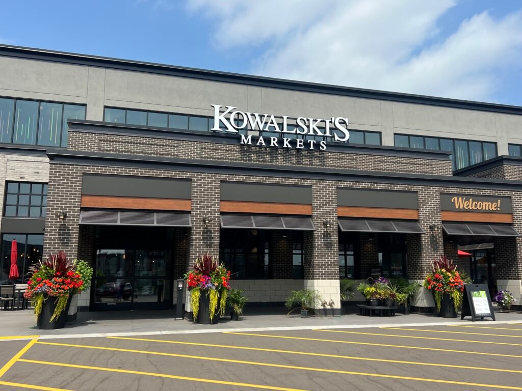
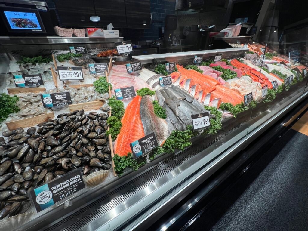
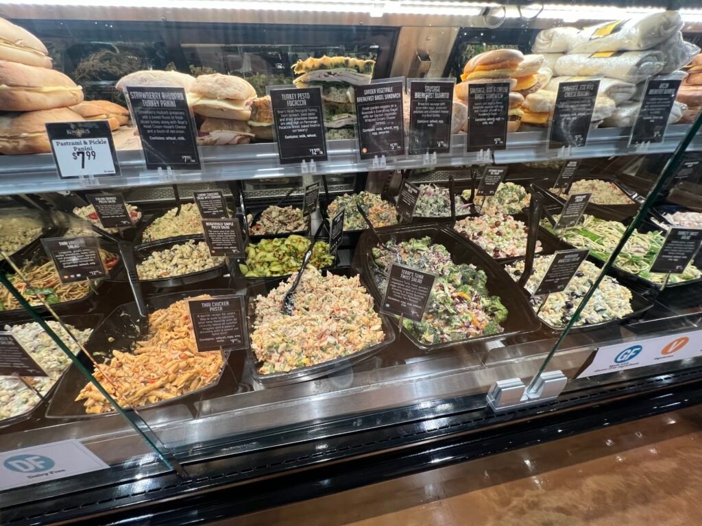
In Minneapolis, I had to check out Kowalski’s Grocery, a renowned local chain. It did not disappoint! The fish counter was impressive, the prepared foods section was next-level, and the pizza was tasty — though a bit light on basil. Definitely worth a visit if you’re in town. I also stopped by Goodwill to donate some camping gear I couldn’t take home — like a folding lounge chair that had served me well.
Photos: Kowalkski’s in Minneapolis | Impressive Fish Counter!
Photos: Epic Prepared Goods Counter | My Pizza—Needs More Basil
Finally, I was off to the airport and then to Chicago for an REI Backcountry Navigation and Map Reading class. Pro tip: Use TSA-approved locks for your luggage. I learned this the hard way when TSA had to cut off my lock due to my hastily purchased one not meeting their standards. Oh well — lesson learned.
Photo: Parting Shot—Oops, Lesson Learned!
And with that little adventure, my month-long trek through the Upper Midwest comes to an end. What a summer to remember!
Dates of Visit: 24 and 25 July 2024
Catch you on the Trail!