At 4,145 feet above sea level, Black Mountain is the highest point in the Commonwealth of Kentucky, ranking #27 among U.S. state high points and sitting quietly along the Kentucky–Virginia border. This was my 14th state high point, and while the hike itself turned out to be fairly uneventful, the experience surrounding it was anything but.
Instead, the most memorable part of the day came before I ever set foot on the trail. The drive up from Tennessee, winding through southwestern Virginia and the town of Appalachia, VA, set the tone. That stretch of road—steeped in history and character—was unexpectedly compelling, and it’s a place I’ll definitely return to. From there, the story shifted from scenery to people, which is often where these trips really come alive.
With that backdrop in place, the focus shifted from the road itself to the people and moments that would shape the rest of the day.
Parking and meeting new people
Despite the abundance of no-trespassing signs, you can legally drive up and park near Black Mountain’s summit. The land is owned by the Commonwealth of Kentucky, and the summit area is home to an abandoned fire tower, active radio towers, and a nearby FAA radar installation.
The access road—Black Mountain Ridge Road—is partially paved but mostly dirt. On the day I visited, it was riddled with deep mud puddles. Rather than drive it, I opted to hike the road instead: a 3.4-mile out-and-back with a modest 528 feet of elevation gain. Along the way, I passed one other car (likely another high pointer) and a single service vehicle.
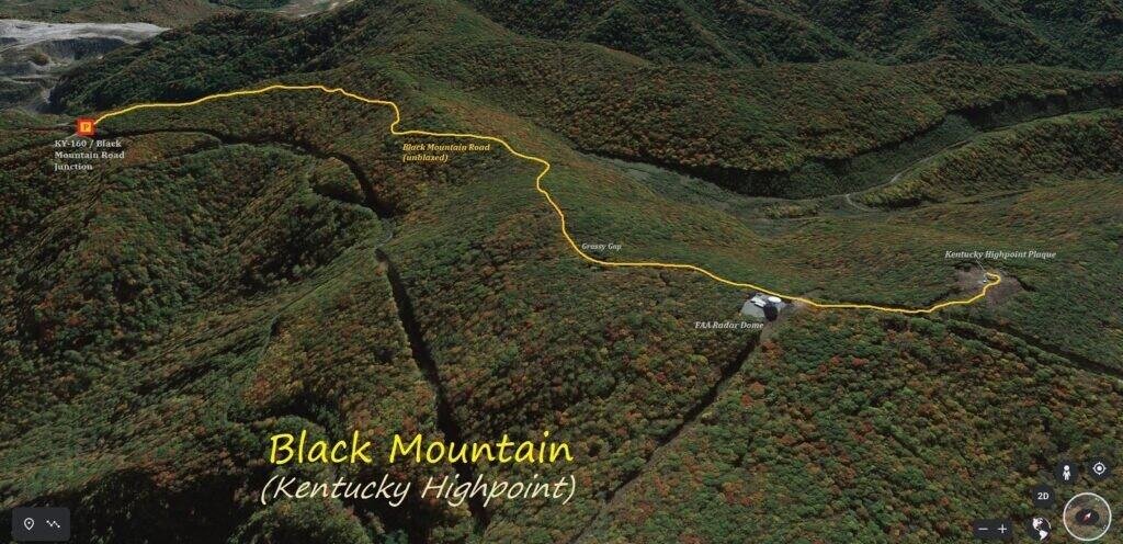
Photo: Hiking route — parking and start point on the left side of the map
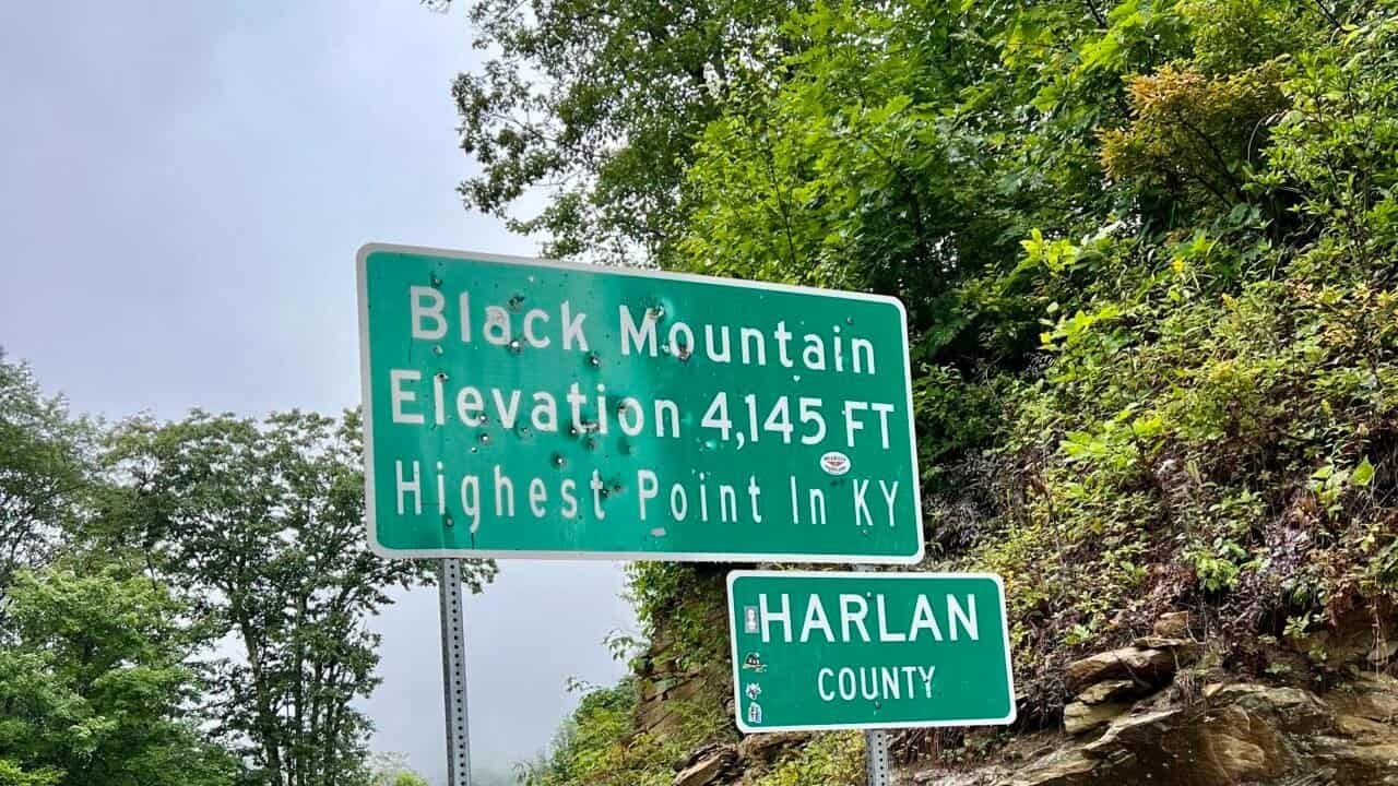
I parked at a small pull-off officially known as Jebediah Memorial Overlook, located on the Virginia side of Inman Road. Directly across the street is a sign marking the “highest point in Kentucky.” Confusingly, this sign does not mark the actual high point—something that could easily trip people up.
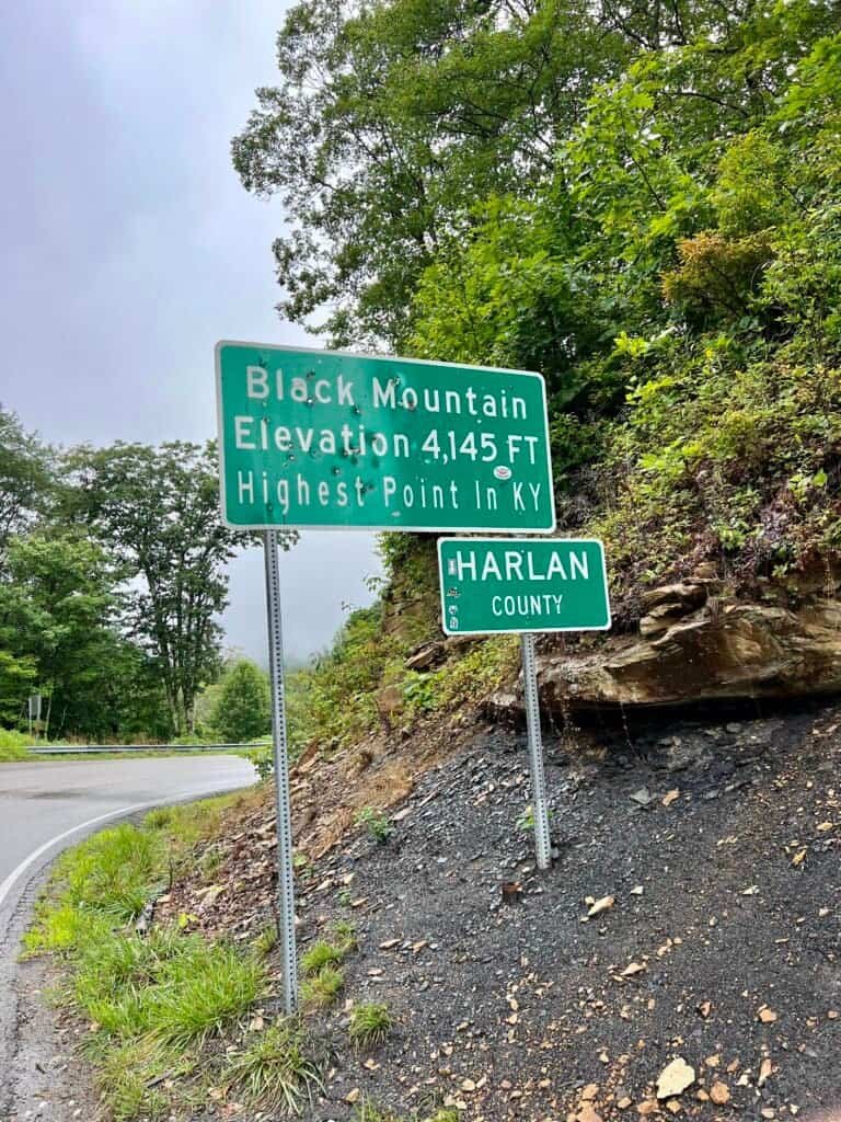
Photos: Jebediah Memorial Overlook | Black Mountain Sign
Meanwhile, while suiting up for the wet weather, a man rode up on his motorcycle. His name was Mark, an Air Force veteran on his way to Virginia to reconnect with a fellow serviceman he hadn’t seen in 35 years. I snapped a few photos of him in his leather vest, which was covered in military and motorcycle patches.
What stuck with me, though, was what he shared next. Mark has a severe fear of heights. He told me that the last time he visited, he could barely approach the overlook. This time, he pushed himself to the edge—and asked me to take photos to prove it.
Moments like that are one of my favorite parts of traveling. Brief encounters. Small stories. People you meet for ten minutes who leave a lasting impression. Those experiences tend to linger longer than the miles.
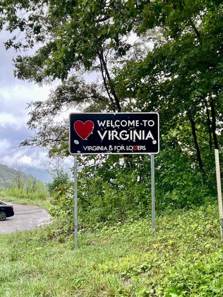
Photos: Welcome to Virginia sign (parking area visible to the left) |
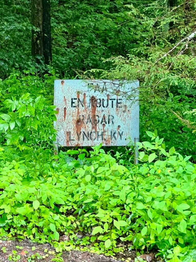
FAA sign at the entrance to Black Mountain Ridge Road
Should I be afraid?
With that, I set off up Black Mountain Ridge Road. The woods were quiet and surprisingly beautiful, though the road itself was a muddy mess. With all the warning signs posted along the way, my imagination wandered a bit.
I became convinced that one of two things was going to happen:
- A federal agency would appear and interrogate me
- I’d stumble into a scene straight out of Deliverance
Thankfully, neither occurred.
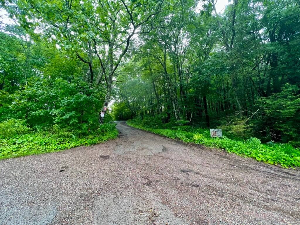
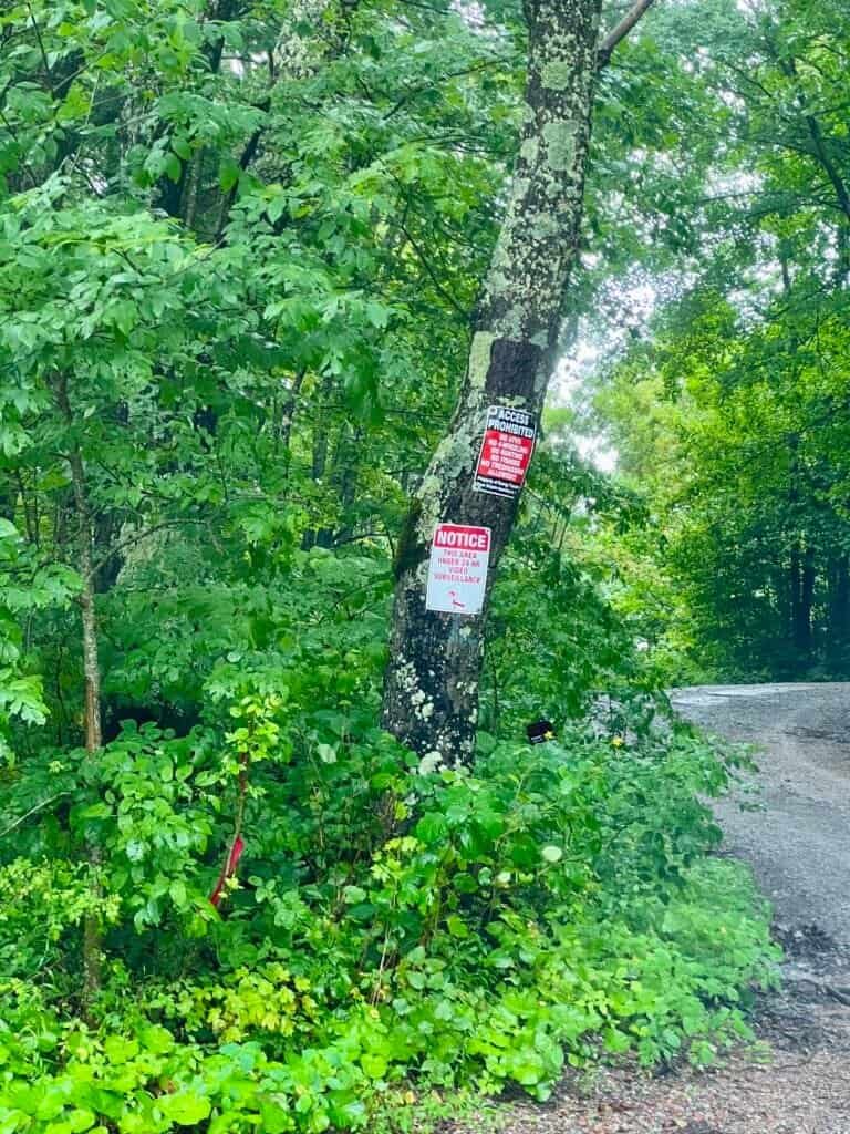
Photos: The start of Black Mountain Ridge Road |
No Trespassing signs along the road
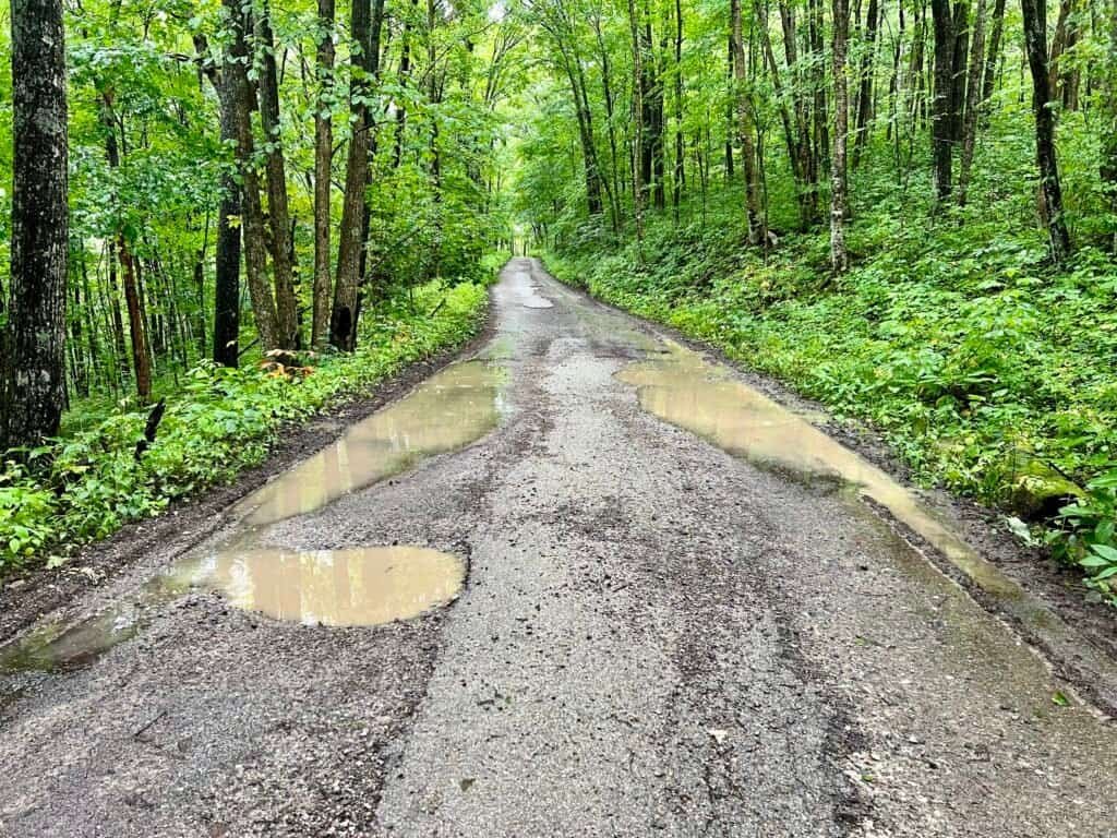
Photos: Muddy road to the summit
Big Brother is watching
Overall, with the exception of a few inclines and declines, the road climbs steadily and gently toward the summit. As you get closer, you pass the FAA radar installation, complete with fencing, cameras, and extensive security. I’m fairly certain someone was watching me hike by—and I’m probably logged in a database somewhere now.
Shortly after passing the radar tower, the road forks. Continue to the left, ignore the no-trespassing signs, and hike up a short hill toward the summit. At the top, you’ll find active radio towers and the remains of an abandoned fire tower.
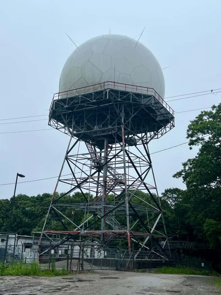
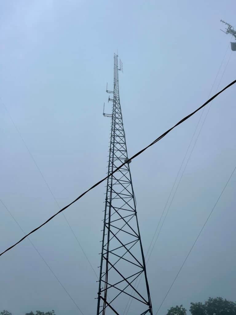

Photos: FAA radar installation | Active radio tower | Abandoned fire tower
A brief reprieve from rain and another summit without a view
The summit area features a small loop trail. As you make your way around it, you’ll come to a clearing with a modest monument honoring William Risden, a WWII veteran and cable television pioneer. Behind the monument sits a large boulder—and on its back right corner is the survey marker marking Kentucky’s high point.


Photos: Monument and plaque honoring William Risden |
Monument and boulder with survey marker
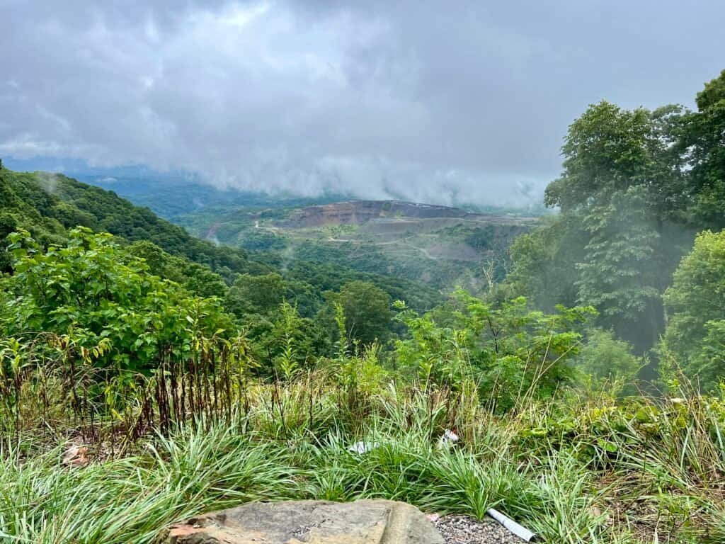
As I reached the summit, I asked the big man upstairs for a brief pause in the rain—just long enough to snap a few photos. Surprisingly, it worked. The rain stopped, if only briefly. There were no views to speak of, so it was a short stay.
Still, it counted.

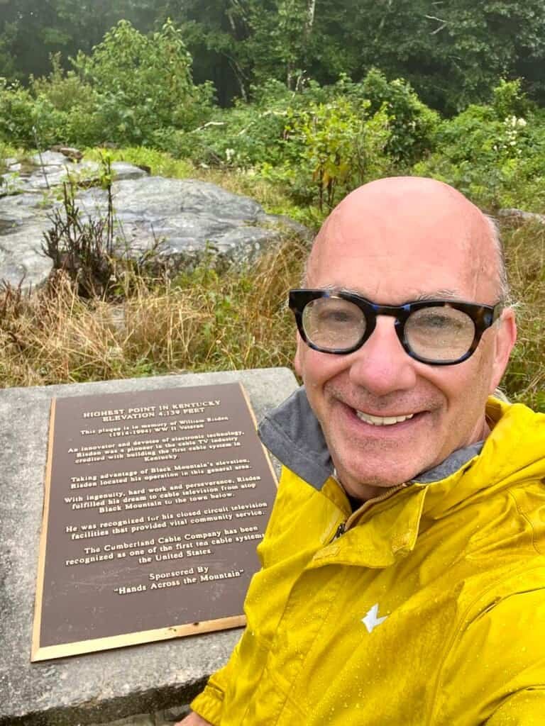
Photos: Survey marker | Wet summit selfie (rain visible on my glasses)
Fourteen summits down. Thirty-seven to go.
It took 29 minutes to reach the summit and 58 minutes round trip.
Next up: Woodall Mountain | Mississippi
Catch you on the summit!
Date of Visit: 10 August 2020
Discover more from love cook adventure
Subscribe to get the latest posts sent to your email.
Leave a Reply