At 8,751 feet above sea level, Guadalupe Peak stands as the highest point in Texas, ranking #14 among U.S. state high points under 10,000 feet. It’s located inside Guadalupe Mountains National Park and marked my 27th state high point.
The day I hiked Guadalupe Peak was filled with emotion. I had read plenty of reviews on AllTrails — my go-to hiking resource — and a few of them planted some doubt. One comment stuck with me: “The last 100 yards are a bit scary as you can see a long way down and the rocks are slick.” Combine that with an 8.4-mile out-and-back trail and nearly 3,000 feet of elevation gain, and yes — I was nervous. I even had flashbacks to my climb up Mt. Katahdin on Abol Trail.
In the end? Was it hard? Heck yeah. Was it as hard as Katahdin? Not even close. Was I glad I did it? One word: Ecstatic.
The Beast of Texas
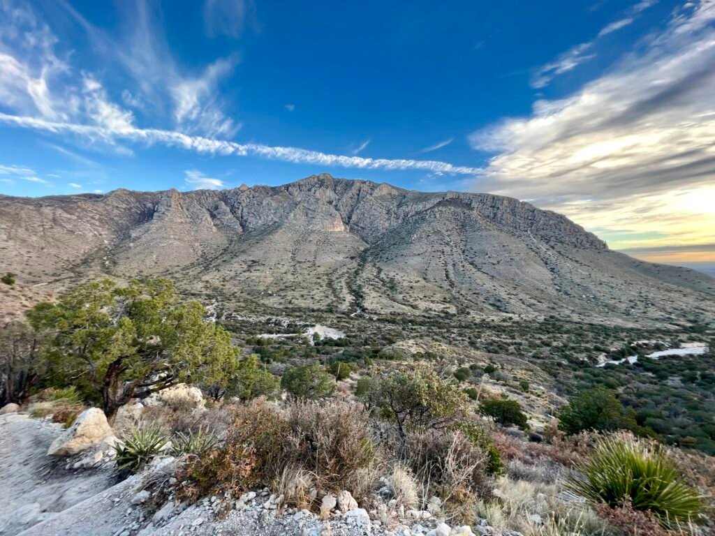
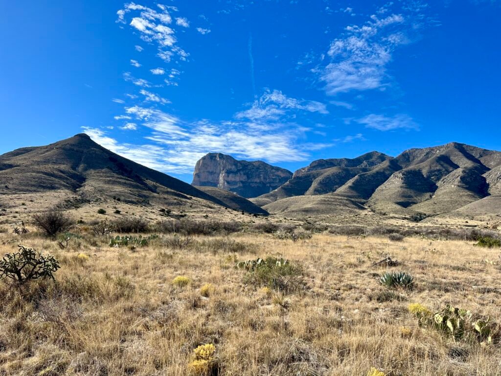
Guadalupe Peak rises dramatically from the Chihuahuan Desert, part of the ancient Capitan Reef, a marine fossil reef dating back more than 250 million years. Today, that reef forms some of the most rugged and striking terrain in the Southwest.
The summit offers sweeping panoramic views of desert basins, limestone ridges, and distant peaks. Because of its prominence, it feels taller than its elevation suggests. In fact, it’s often referred to as the tallest state high point under 10,000 feet.
The trail itself is straightforward but strenuous. The 8.4-mile round trip demands steady climbing, exposure to wind, and mental focus. Still, it rewards you with one of the most dramatic summit backdrops in Texas.
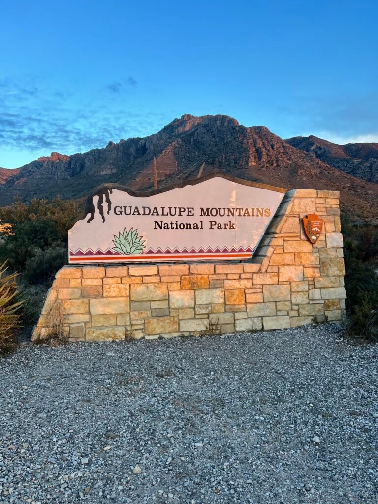
Photo: Park Entrance
The 42nd Largest National Park
Spanning more than 86,000 acres in western Texas, Guadalupe Mountains National Park is surprisingly vast. I still can’t believe there are 41 national parks larger than this one.
The park features limestone canyons, fossilized reefs, desert flats, and surprisingly lush pockets like McKittrick Canyon. Meanwhile, Walnut Canyon showcases rugged rock formations carved by time, and Frijole Ranch offers a glimpse into ranching history.
There are more than 80 miles of hiking trails here. In addition, the park is designated an International Dark Sky Park, making it a dream for stargazers. The entrance fee is $10 per person, though an America the Beautiful pass covers it.
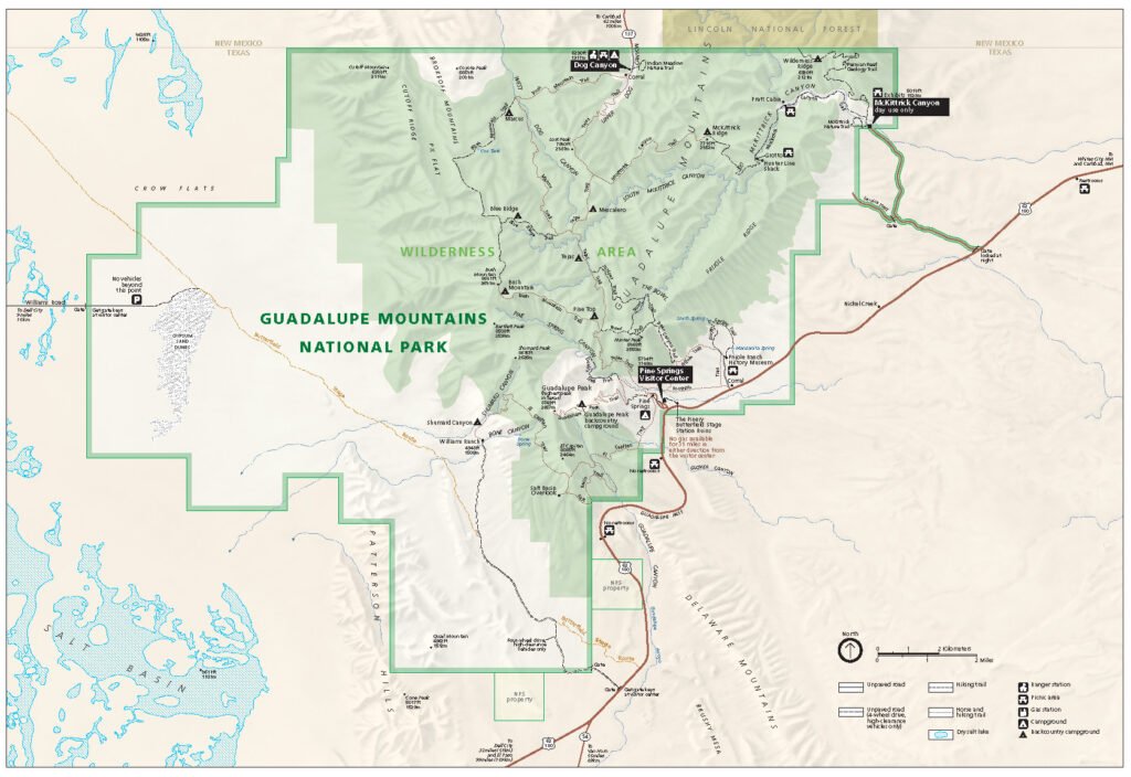
Photo: Park Map
Carlsbad, New Mexico
Carlsbad sits about 50 miles northeast of the park and served as my home base. I stayed at the Karbani Inn, a modular hotel built from office trailers along US-180. Its primary guests are oil field workers and truckers. However, I found it clean, affordable, and perfectly functional for a night’s stay.
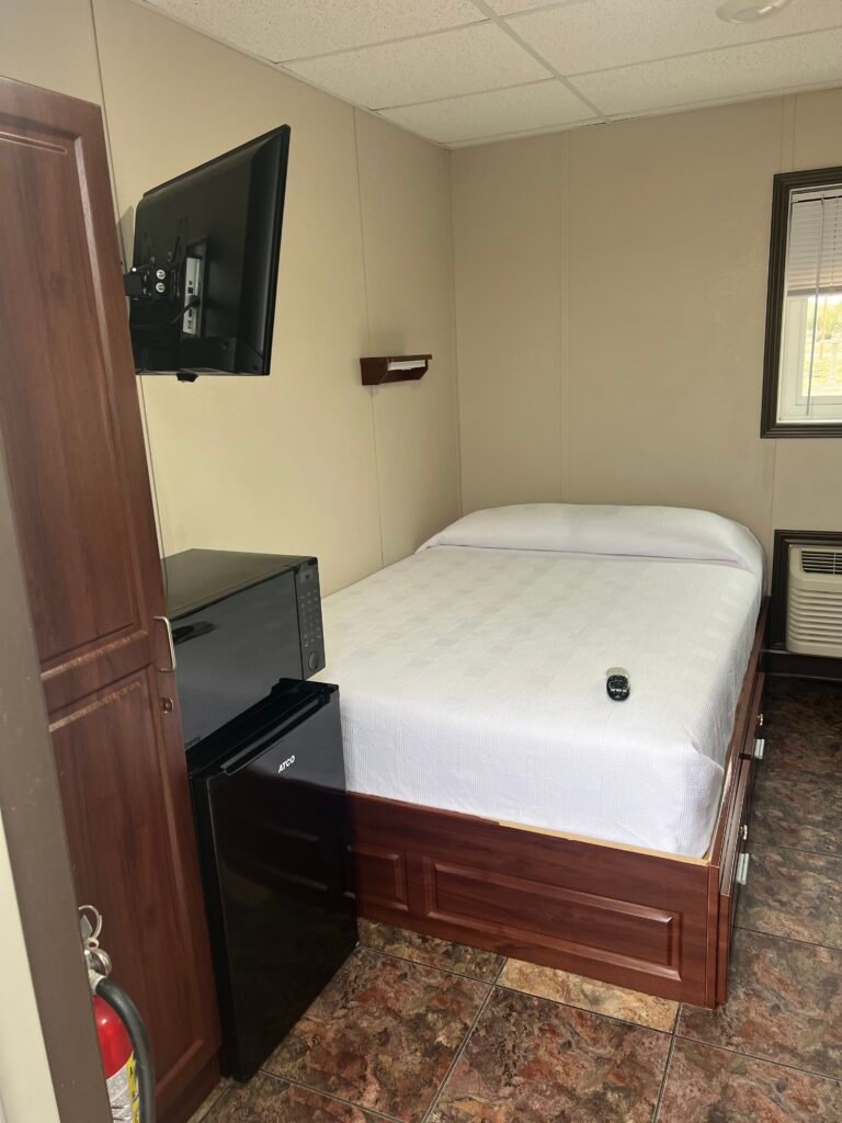
The rooms were simple: clean bed, microwave, refrigerator, bathroom, and free parking. Most guests went to bed early and woke up early — just like hikers. The staff was friendly and accommodating, which always goes a long way.
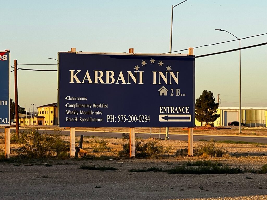
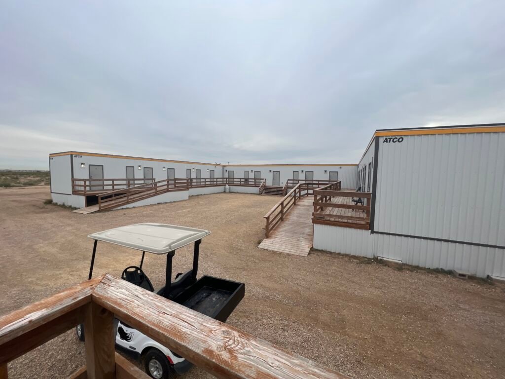
Photos: Hotel Entrance | The Karbani Inn
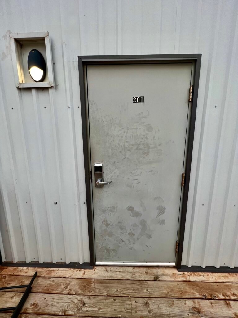
Photos: My Room
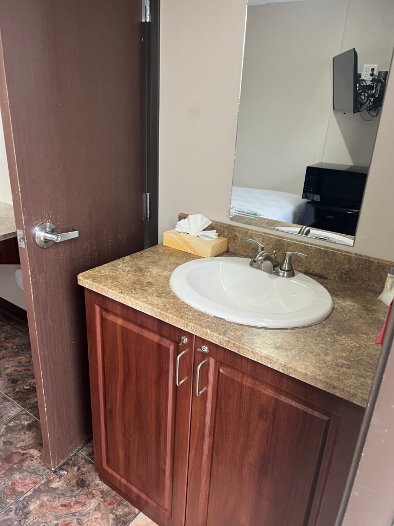

Photos: Everything you need to be comfortable for a night
One important note: heading south out of Carlsbad, there’s only one gas station before long stretches without services. Also, you’ll cross into Mountain Time, but your phone may still show Central depending on cell towers. So don’t lose track of the hour.
An Epic Start to My Day
I was up at 6:00 AM, and the sunrise was unreal. Driving toward the Texas–New Mexico border, I watched El Capitanand Guadalupe Peak glow against the desert floor.
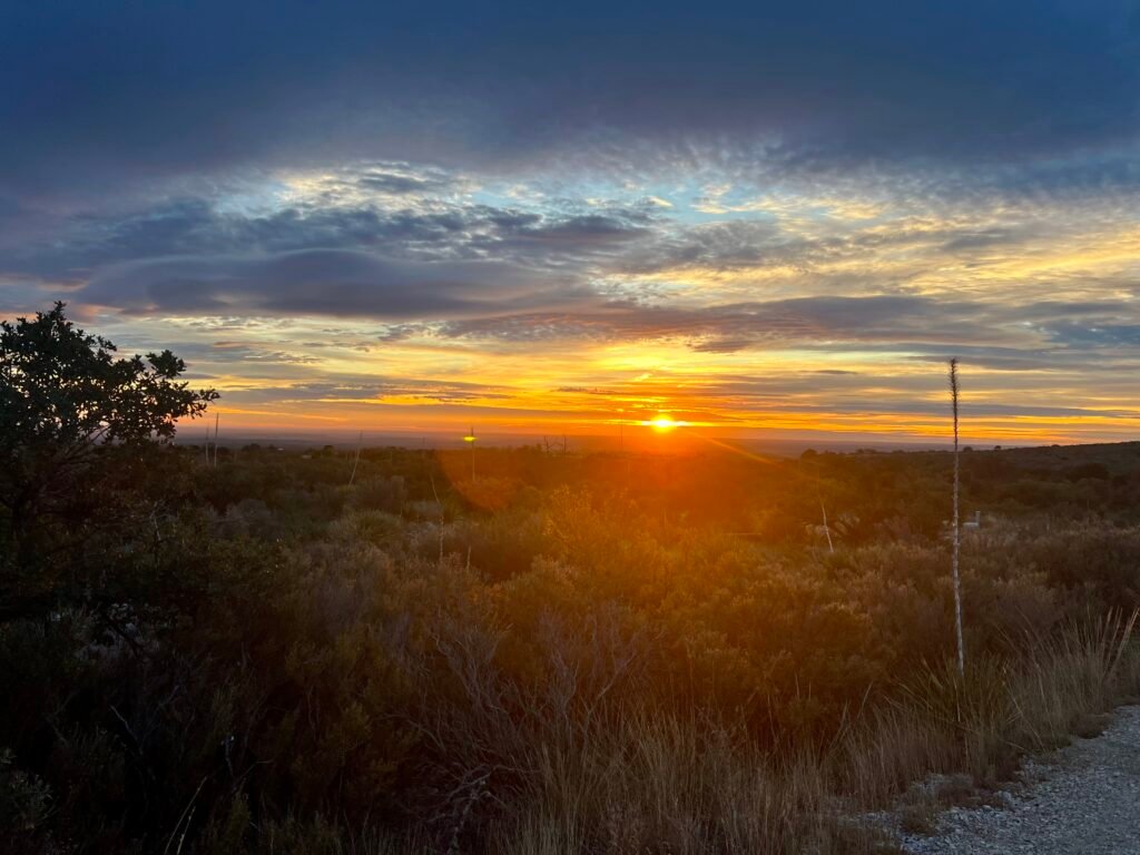
Photo: Morning Sunrise
Soon after, I reached Pine Springs Visitor Center and grabbed an early parking spot. Starting just before 7:00 AM made all the difference.
If you’re planning to hike Guadalupe Peak, here are a few lessons I learned:
- Know yourself. It’s not technical, but it’s not easy either.
- Layer up. The higher you go, the windier it gets.
- Go slow. “Pole, Pole, Pole” — slowly, slowly, slowly — just like on Kilimanjaro.
- Hydrate constantly. Pack high-energy snacks.
- Be prepared. Carry a map, first aid kit, and know local wildlife precautions.
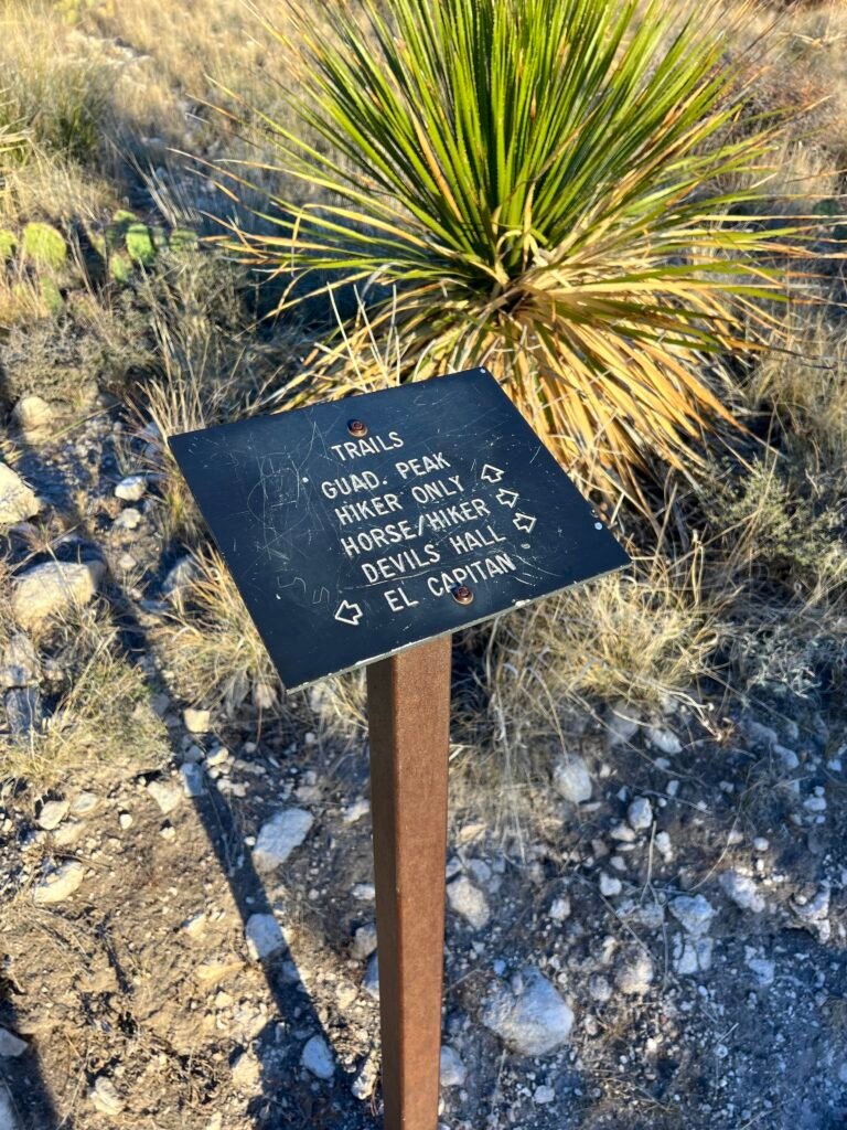
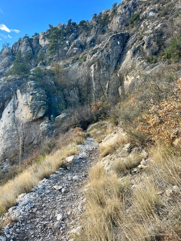
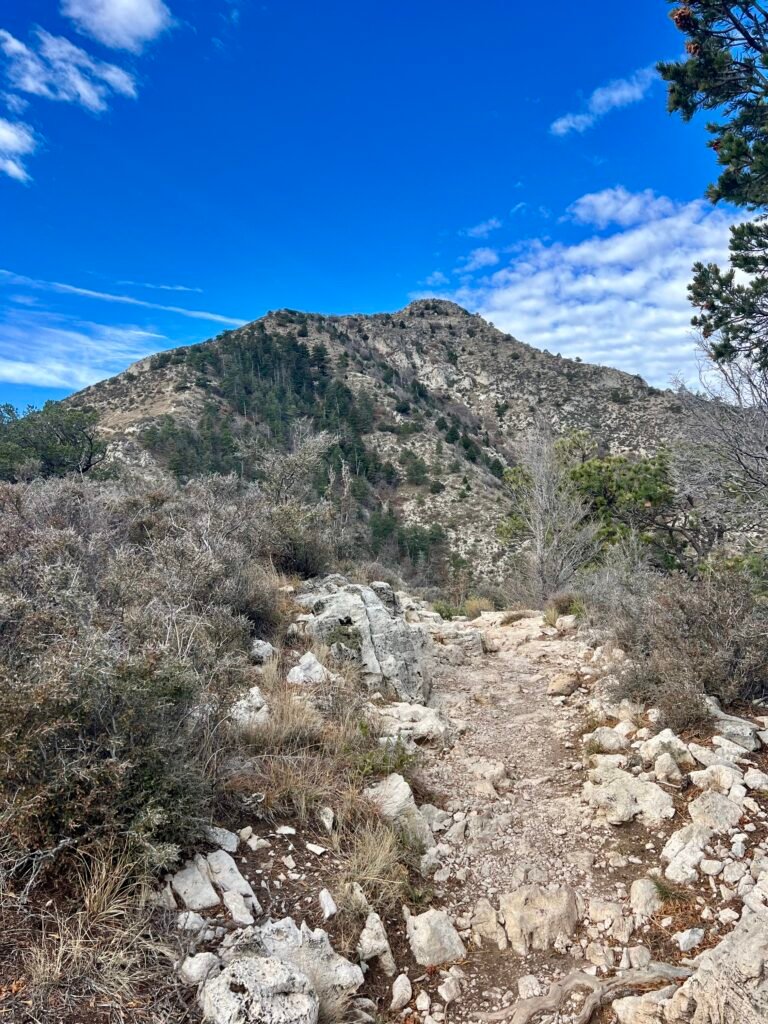
From the Pine Springs Trailhead, you can access Devil’s Hall Trail, El Capitan Trail, The Bowl, or the Guadalupe Peak Trail — the one I chose. The first stretch is gradual, almost deceivingly so.
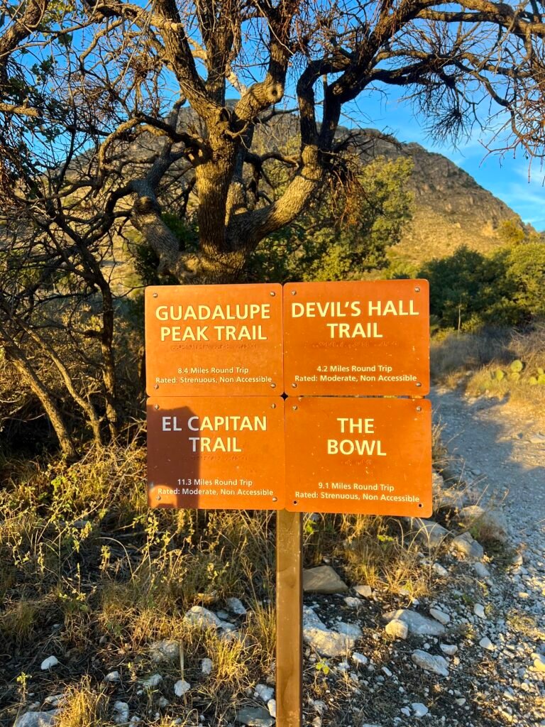
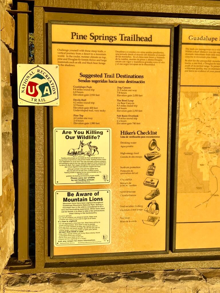
Photos: Trailheads | Information about the trails and wildlife, as well as a Hiker’s Checklist
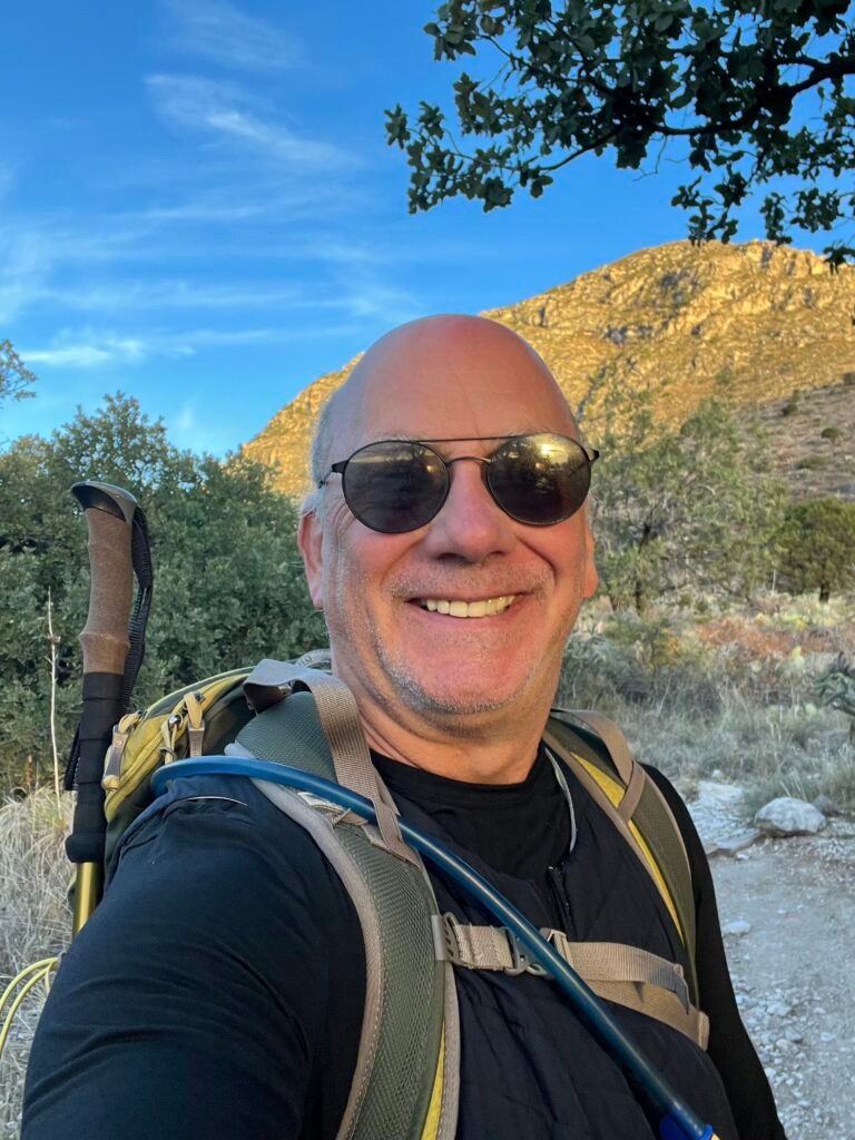
Photos: Ready for an epic hike! | First trail junction
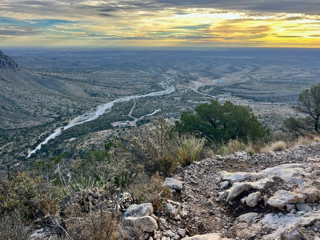
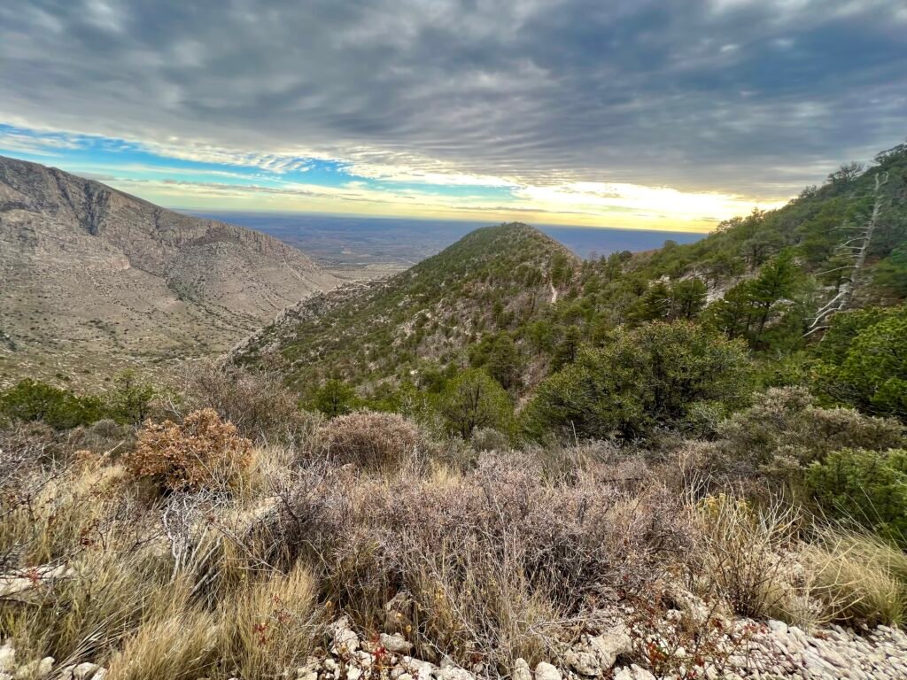
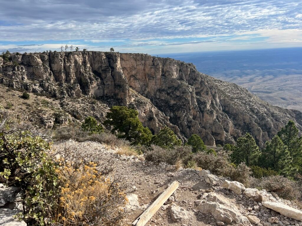
As you reach the mountain’s edge, the switchbacks begin. The higher you climb, the better the views get. Eventually, you can look down and see the parking lot and US-62 far below.
Photos: Looking towards the Devils Hall Trail area |
Looking down at the Parking lot and US-62
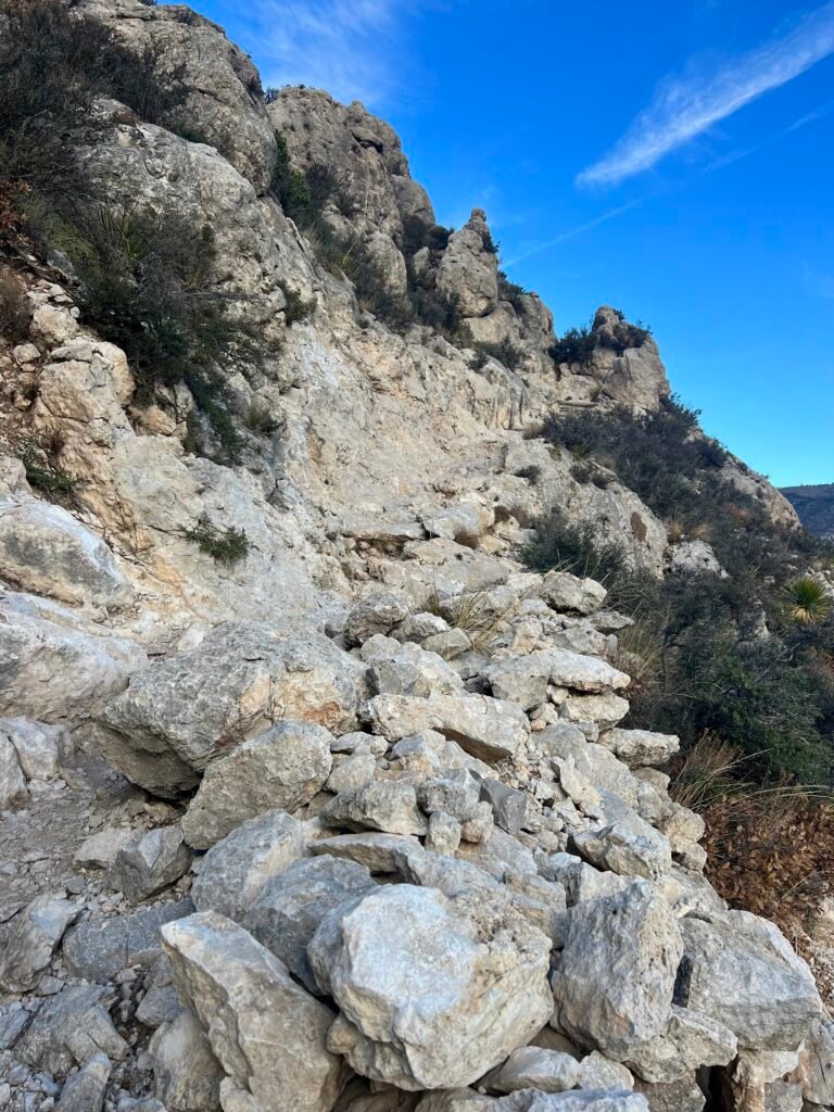
Photos: The Switchback Up | Just before you circle to the backside of the mountain
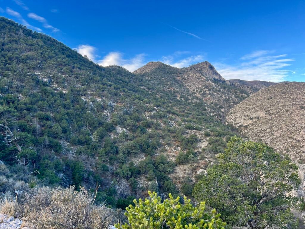
Photos: As the trail levels off and you circle around the backside of the mountain
Photos: Another breathtaking view | Looking up towards Guadalupe Peak
George!
As you circle to the backside of the mountain, you’ll come across one of the coolest parts of the hike — a narrow bridge spanning a fissure in the rocks. At first, I thought it would be terrifying to cross because of the height. Instead, it turned out to be a piece of cake.
It was here that I first met George, as we both stepped onto the bridge at the same time. I snapped a couple of photos of him there and continued on my way. Then, as one of us would stop for pictures, water, or a snack, we kept leapfrogging each other toward the summit.
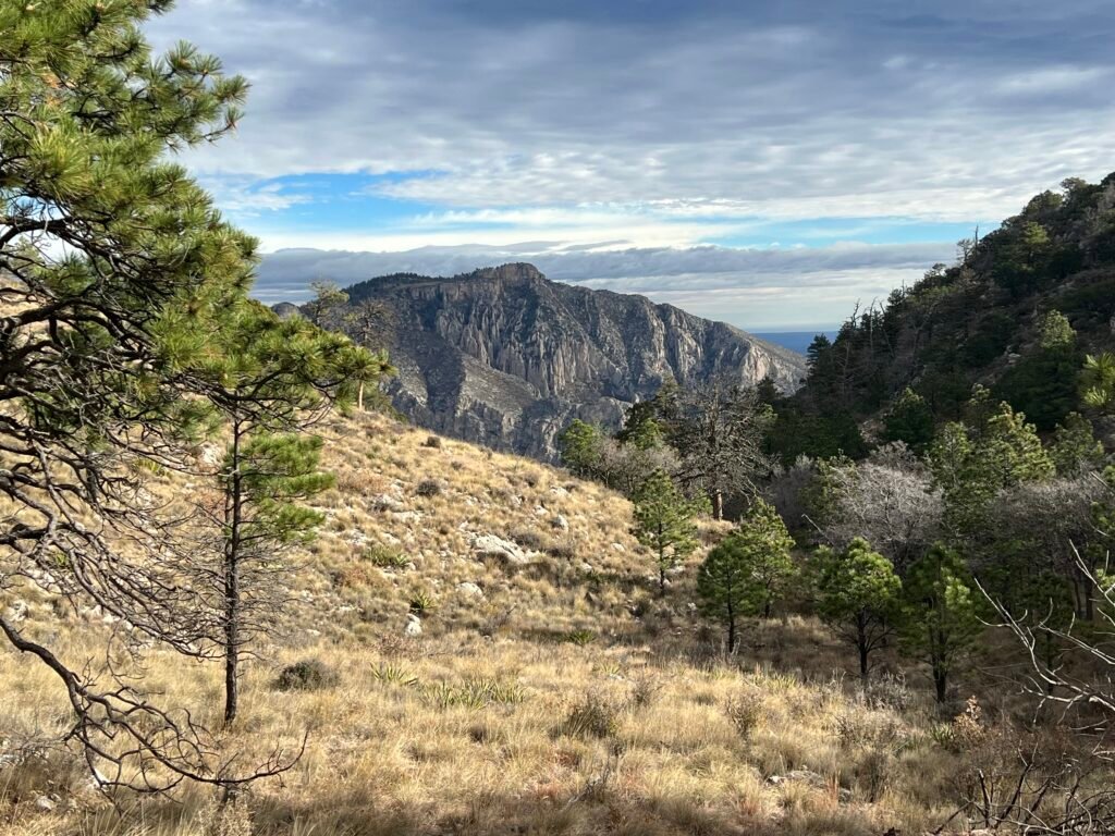
Once around the mountain, the trail begins its final ascent to Guadalupe Peak. From that vantage point, you can see El Capitan, and that’s when it really hits you — how high you’ve climbed.
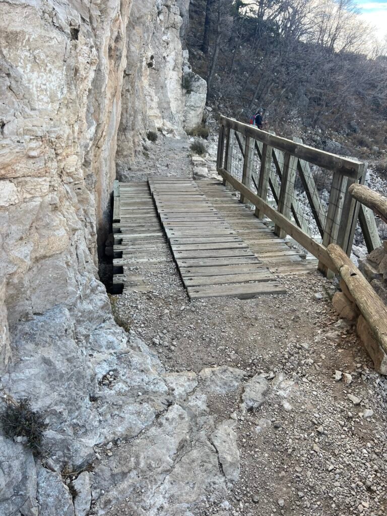
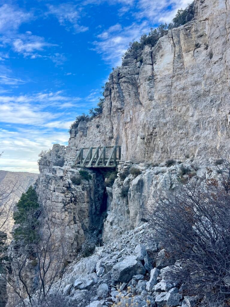
Photo: The Bridge
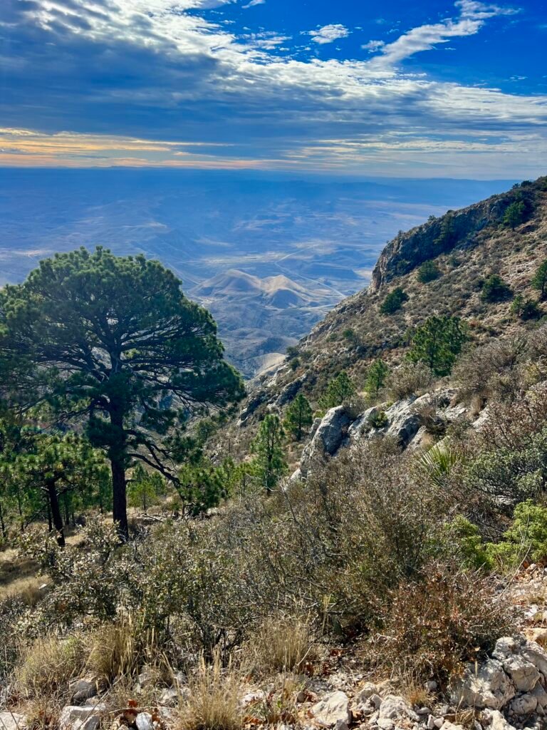
Photo: Looking down at how high you have hiked up
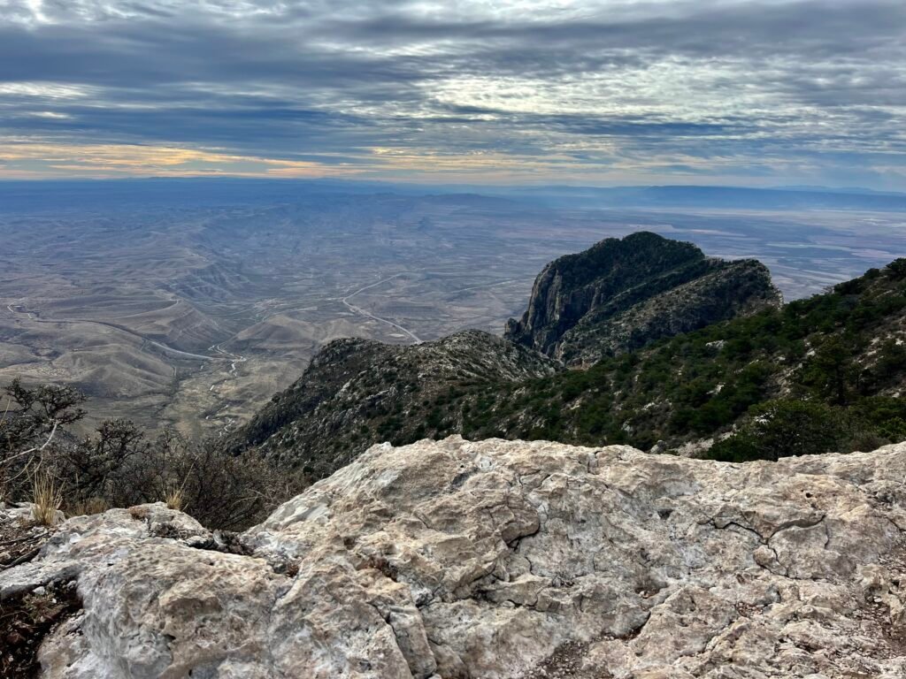
Photos: Another breathtaking view | El Capitan sighting
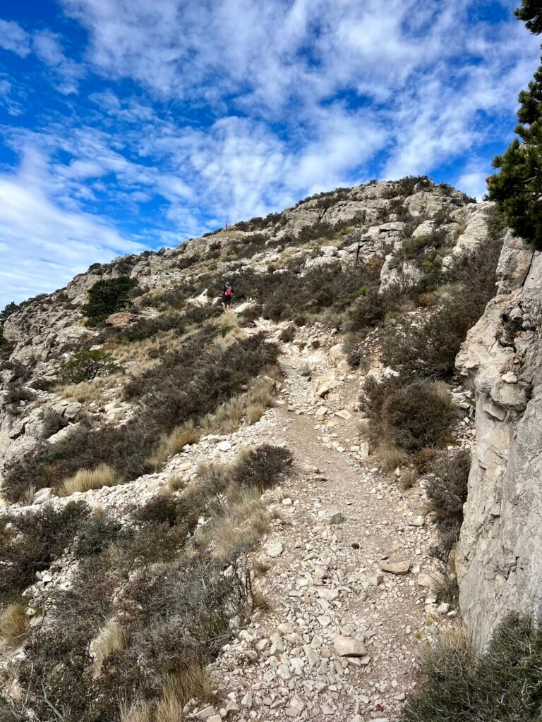
Photo: Getting Closer! That’s George in the distance.
Remember AllTrails?!
As I approached the last stretch of my hike toward the summit, I kept thinking about that comment on AllTrails: “The last 100 yards are a bit scary as you can see a long way down and the rocks are slick.” The words echoed in my head as I stepped carefully toward what felt like the final 100 yards.
I caught up to George right in that exposed section. He was having trouble with his footing, so I slowed down and helped guide him through it. It wasn’t nearly as terrifying as I had imagined — but it did require focus and steady movement.
Ahead of us, a father — about our age but in incredible shape — and his two grown sons, who had passed us earlier, were sitting just below the summit. They offered encouragement and let us know we were almost there. That small boost of energy made all the difference.
On the Summit
Moments later, I stepped onto the summit in 2 hours and 45 minutes.
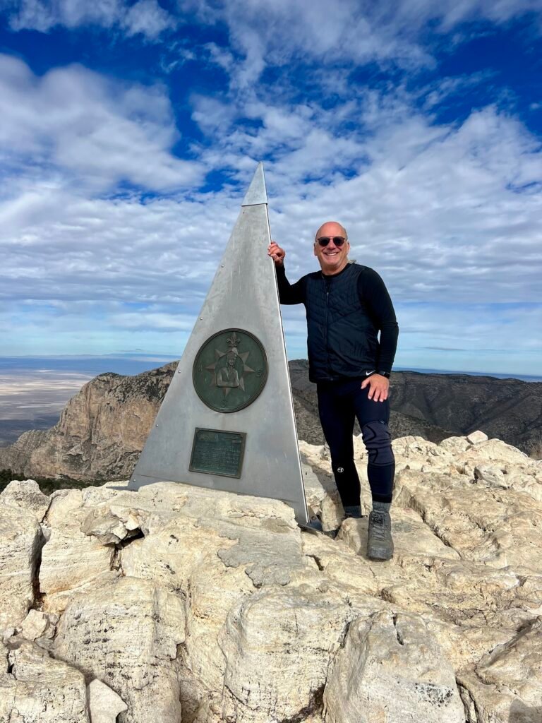
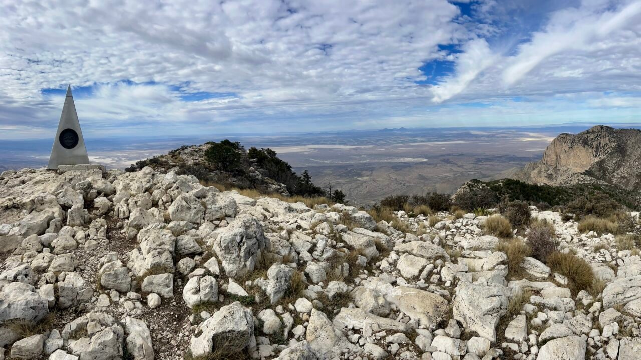
Photo: High Point #27 in the books!
At the top stands a stainless steel pyramid, placed by American Airlines in 1958 to commemorate the 100th anniversary of the Butterfield Overland Mail — a historic stagecoach route that once passed south of the mountain. It’s unexpected. It’s polished. And somehow, it fits.
The view from the summit was absolutely breathtaking, instantly making this hike one of my favorites so far. High Point #27 felt earned.
George and I took photos of each other, grabbed a few selfies, and tried to steady ourselves in the wind. It was gusty enough that I didn’t linger too long. Still, I had time to soak it in.
Afterward, I descended just below the summit where it was calmer and had lunch in the same spot where the father and his sons had been sitting earlier — a quiet, wind-sheltered reward after a big climb.
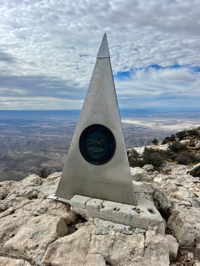
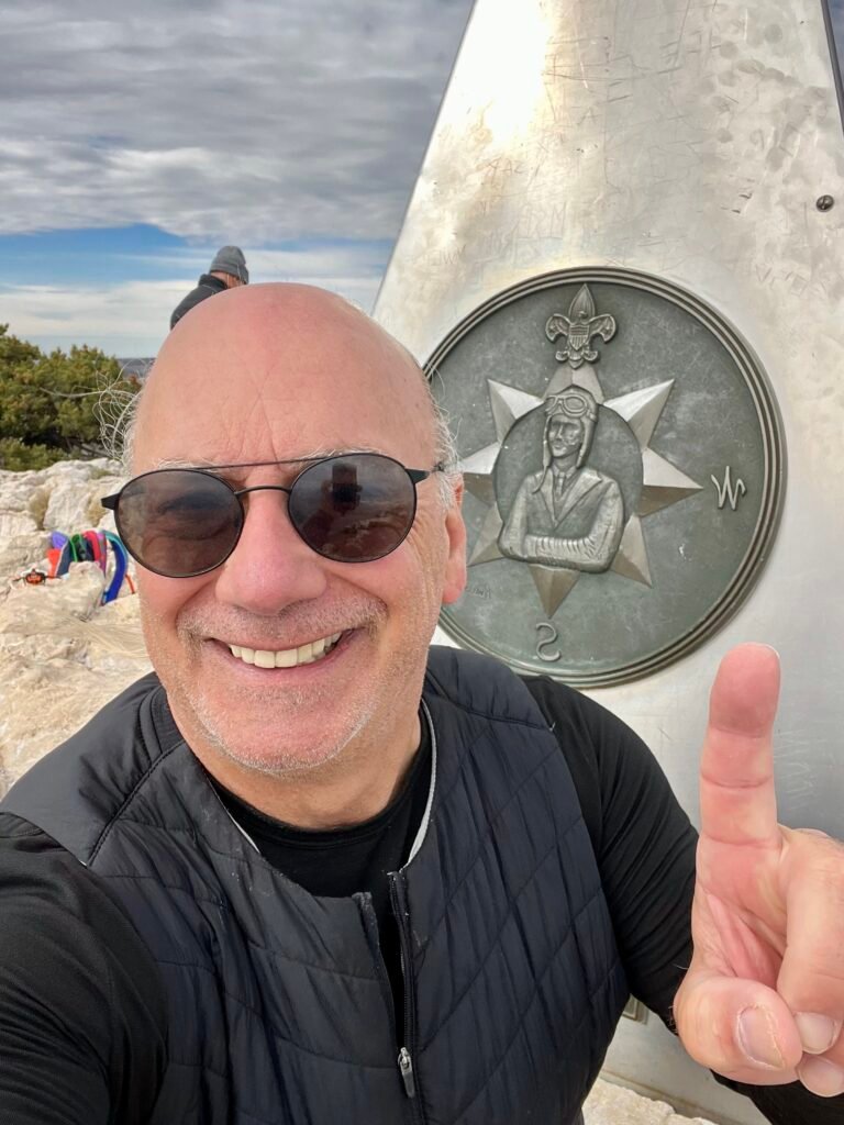
Photos: Stainless Steel Monument | Summit Selfie
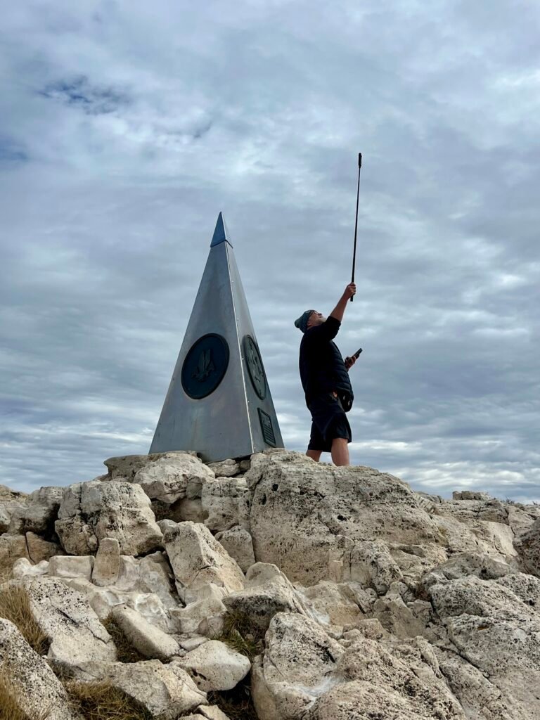
Photo: George taking his Summit Selfie and trying to get a 360-degree picture
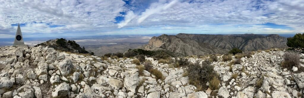
Photo: View from the Summit
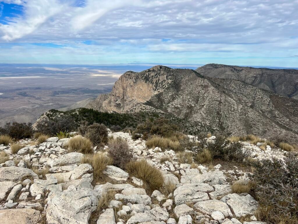
Photo: Another view from the Summit
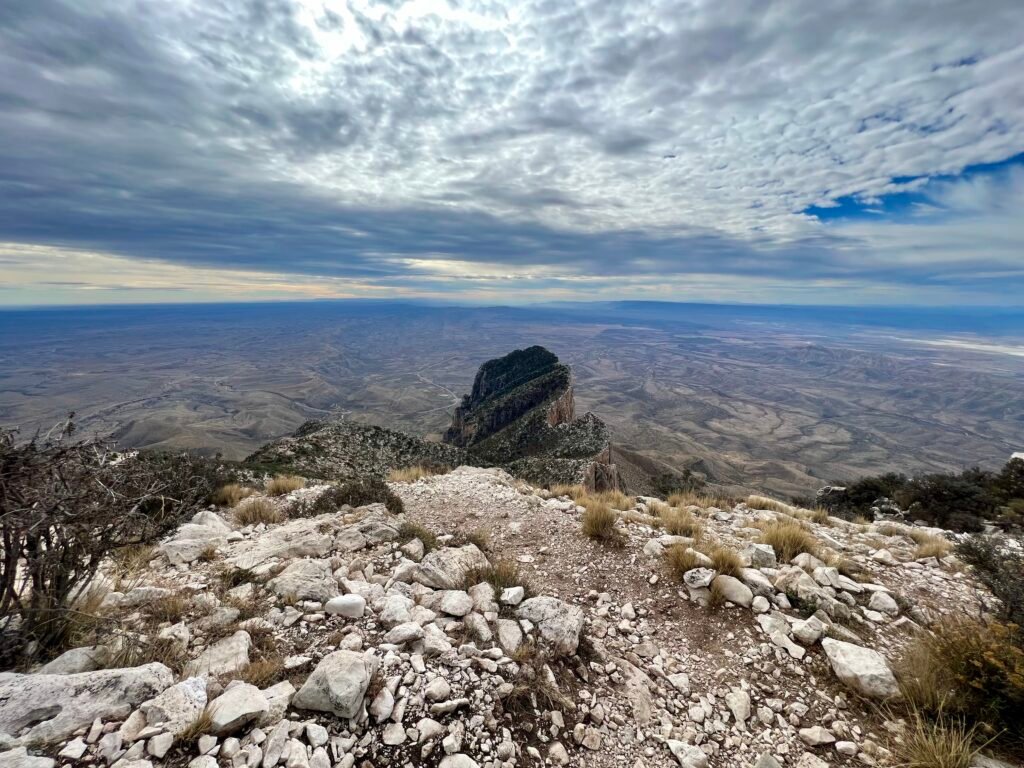
Photo: El Capitan from the Summit
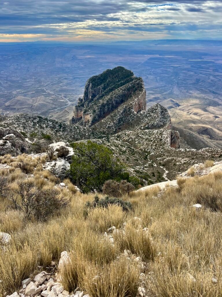
Photo: My view while eating lunch – El Capitan
Celebrity Sighting!
On my way down the mountain, I made sure to check on George and help him through the tougher section that had given him trouble on the way up. Once he was steady and confident, I let him know I was going to pick up the pace and head down. We parted ways there.
Even so, I didn’t make it down nearly as fast as I expected. I passed a steady stream of hikers coming up and ended up chatting with quite a few of them. That’s one of the things I love about these summits — the shared energy on the trail.
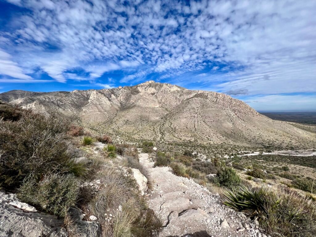
Photo: One last view before I’m back at the parking lot.
As I worked my way down the final switchbacks, I met the nicest backcountry volunteer named Pam from New Hampshire. Pam volunteers at different national parks and receives housing in exchange for her work. During our conversation, I mentioned my family’s connection to Mount Washington, where she had worked earlier in her career.
We talked hiking. We talked weather. And then she casually shared stories about rescuing people right here on Guadalupe Peak. Later, I learned she had probably summited this mountain more than 200 times. Let that sink in.
I continued my descent and passed a sign for Palo Duro, which caught my attention since I had just visited Palo Duro Canyon State Park. Come to find out, the Spanish name for Mountain Mahogany is Palo Duro, meaning “hard wood.” The name comes from the extreme toughness of its trunks and branches. Somehow, I had missed that detail on my earlier trip.
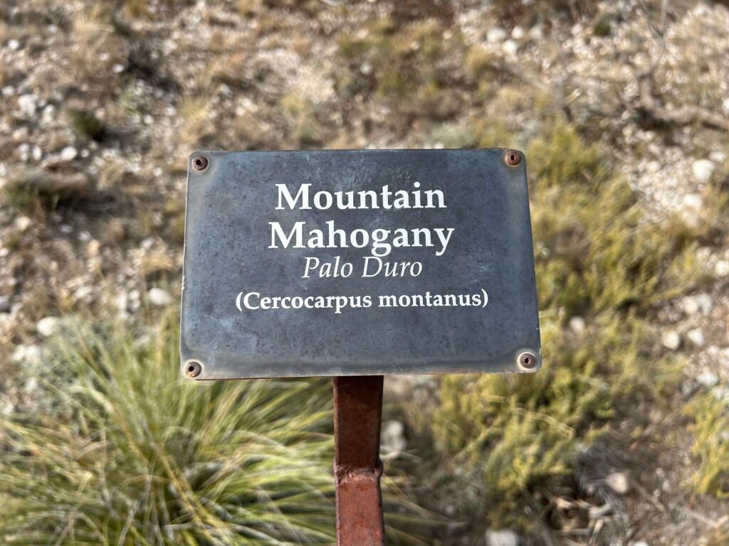
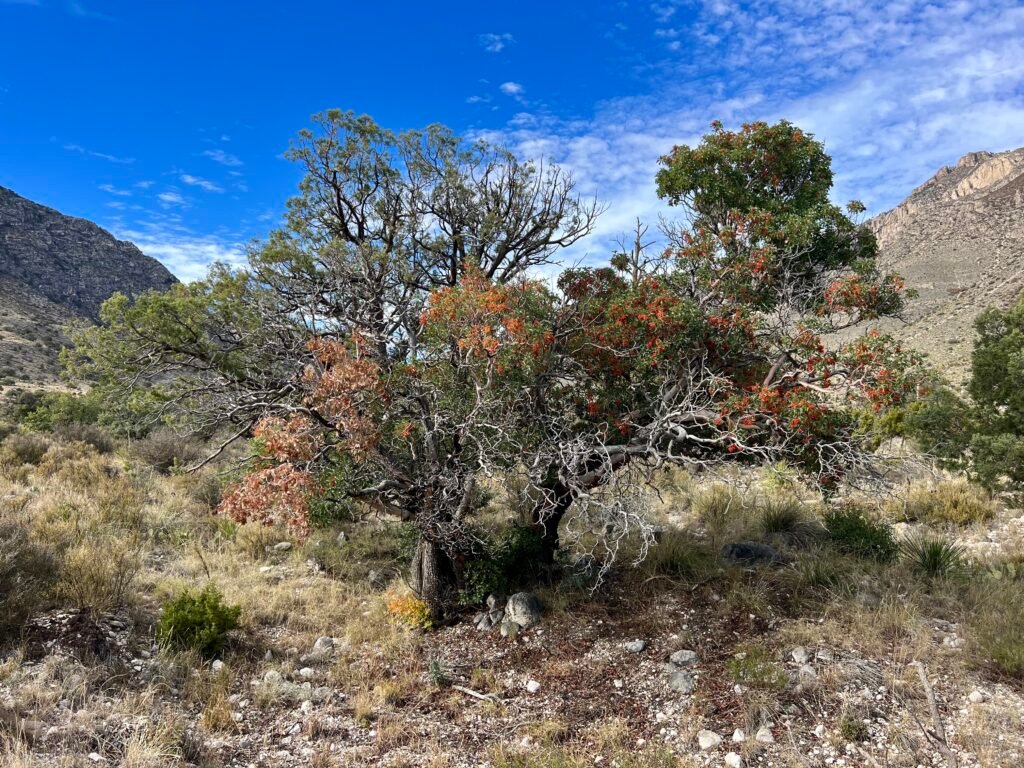
Photos: Mountain Mahogany or Palo Duro
Wait… That Pam?!
After finishing the hike, I stopped at the visitor center and chatted with another volunteer. That’s when I learned something unexpected.
Pam’s full name is Pam Bales.
She’s the real-life inspiration for the movie Infinite Storm, where Naomi Watts portrays her. The film tells the true story of Pam heading up Mount Washington when a sudden storm rolls in. She notices tracks in the snow from someone wearing only sneakers and eventually finds an incoherent man she calls “John.” Together, they fight brutal weather and near-impossible conditions to make it down alive — nearly drowning at one point.
And here she was, calmly volunteering on Guadalupe Peak.
I headed back to my car, preparing for the drive west toward El Paso. Just as I was about to leave, there was George again. I asked if he had run into Pam. He grinned and told me he had snagged a selfie with her.
That’s when I filled him in on who she really was.
As a quiet little side note, I had mentioned George’s name to Pam earlier. So when she greeted him with a casual, “Hi George,” he was completely caught off guard. The look on his face? Priceless.
It was one of those days that gives you more than just a summit — challenge underfoot, connection on the trail, and an unexpected story I didn’t see coming.
Before leaving the area, I made one last stop for a view of El Capitan — this time from the opposite side. It’s amazing how different a mountain can look from a new perspective.
Photos: El Capitan from the side
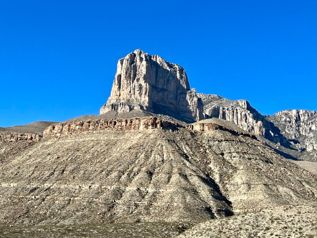
Photo: El Capitan – another perspective
Catch you on the summit!
Date of Visit: 17 November 2023
Discover more from love cook adventure
Subscribe to get the latest posts sent to your email.
4 Pingbacks