Home of Potato Chip Rock
Some places become famous quietly. Others explode thanks to Instagram, hashtags, and gravity-defying photos. Potato Chip Rock is firmly in the second category.
Normally, I avoid viral trail spots like the plague. Between the wannabe influencers, endless selfies, and people blocking narrow trails for “just one more shot,” it can feel like more work than fun. But every once in a while, curiosity wins. And honestly? This one earned its hype.
Add in the fact that it’s a legit cardio workout, and suddenly I was in. So yes — I did take that photo on Potato Chip Rock. No, it never made it to Instagram.

Photo: Here it is — my IG-inspired photo!
When to Visit Potato Chip Rock
Because of its fame, timing matters. Weekends can feel like a chip bag on Super Bowl Sunday — packed and loud. Instead, aim for a mid-week hike, ideally early in the morning.
That said, keep one thing in mind: there is zero shade once you’re climbing. On sunny days, the heat adds another layer of challenge. Still, with the right prep, it’s absolutely manageable — and worth it.
What to Bring for Your Adventure
Preparation makes or breaks this hike. Here’s what I never leave behind:
- Water: Hydration is non-negotiable on this 7.3-mile round-trip hike with over 2,100 feet of elevation gain.
- Sun Protection: Hat, sunscreen, and sunglasses. The sun is relentless up here.
- High-Energy Snacks: You’ll burn more calories than you expect — trust me.
- Lunch: There’s nothing better than earning your meal with a view.
- First-Aid Kit: Ever since taking a Wilderness First Aid Course, this is a permanent part of my pack.
- Hiking Poles: Especially useful during snake season — both for balance and awareness.
- Fearlessness:If heights make you uneasy, take your time. You don’t have to rush the experience.
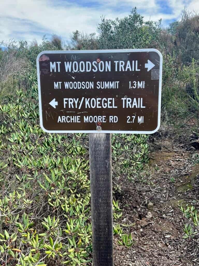
Which Trail Is Best for Mount Woodson?
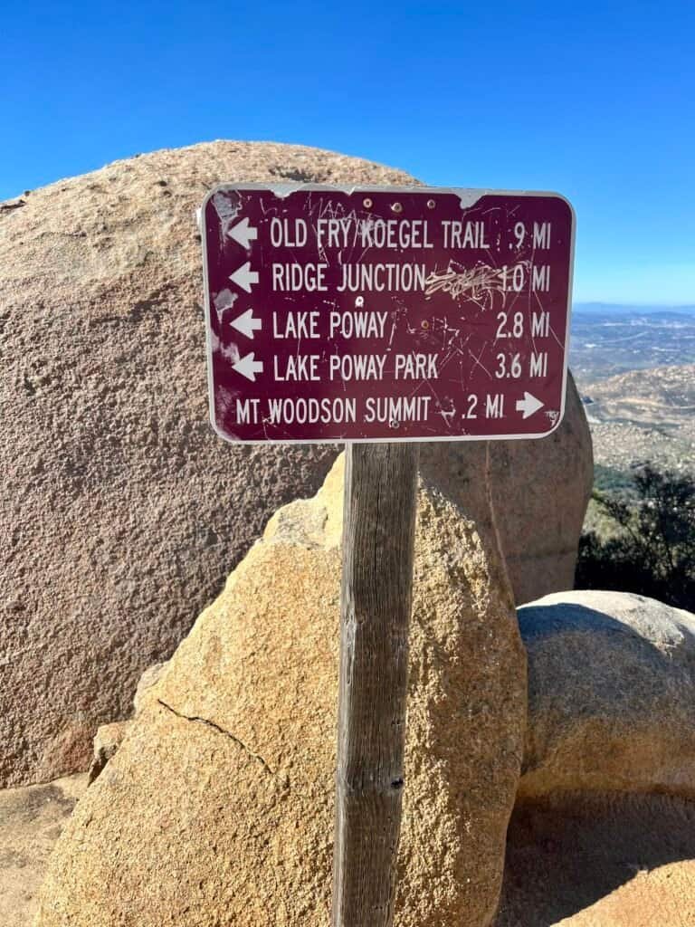
There are several routes that lead to Mount Woodson and Potato Chip Rock, which makes this hike flexible depending on distance, elevation, and surface preference.
My Go-To Route: Mount Woodson Trail (Trail #15)
Start at the Lake Poway Trailhead for a 7.3-mile hike with 2,129 feet of elevation gain. It’s a grind, no doubt — but the payoff comes in waves. Also worth noting: the trails here are well marked, which helps at key junctions.

Photo: The many trails to Mt. Woodson
Other Popular Routes
- Fry/Koegel Trail (Trail #17)
Starting near Archie Moore Road in Ramona, this 7.0-mile route climbs 1,624 feet and eventually connects with Mount Woodson Trail. - San Diego County Trail
A shorter, partially paved option off Hwy 67. At 4.1 miles with 1,220 feet of gain, it’s smoother but still rewarding. - Fry/Koegel + San Diego County Trail Loop
A 5.4-mile loop with 1,369 feet of elevation gain — a nice balance of variety and challenge. - Warren Canyon Trail
Steep, rugged, and undeveloped. This 10.4-mile beast gains 2,398 feet and is best saved for seasoned hikers.
Beat the Clock — Especially in Winter
Here’s something people overlook: park closing times.
When my sister and I hiked Mount Woodson in January, the gates at Lake Poway closed at 5:15 PM. Fast-forward to summer, and sunset stretches closer to 7:30 PM. Either way, it’s on you to plan accordingly — getting locked in is not the adventure you want.
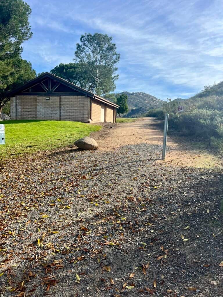
Luckily, Lake Poway makes logistics easy: a large parking lot, clean restrooms, picnic tables, and a great staging area. If you still have energy afterward, the 4.9-mile Lake Poway Loop is a solid bonus lap.
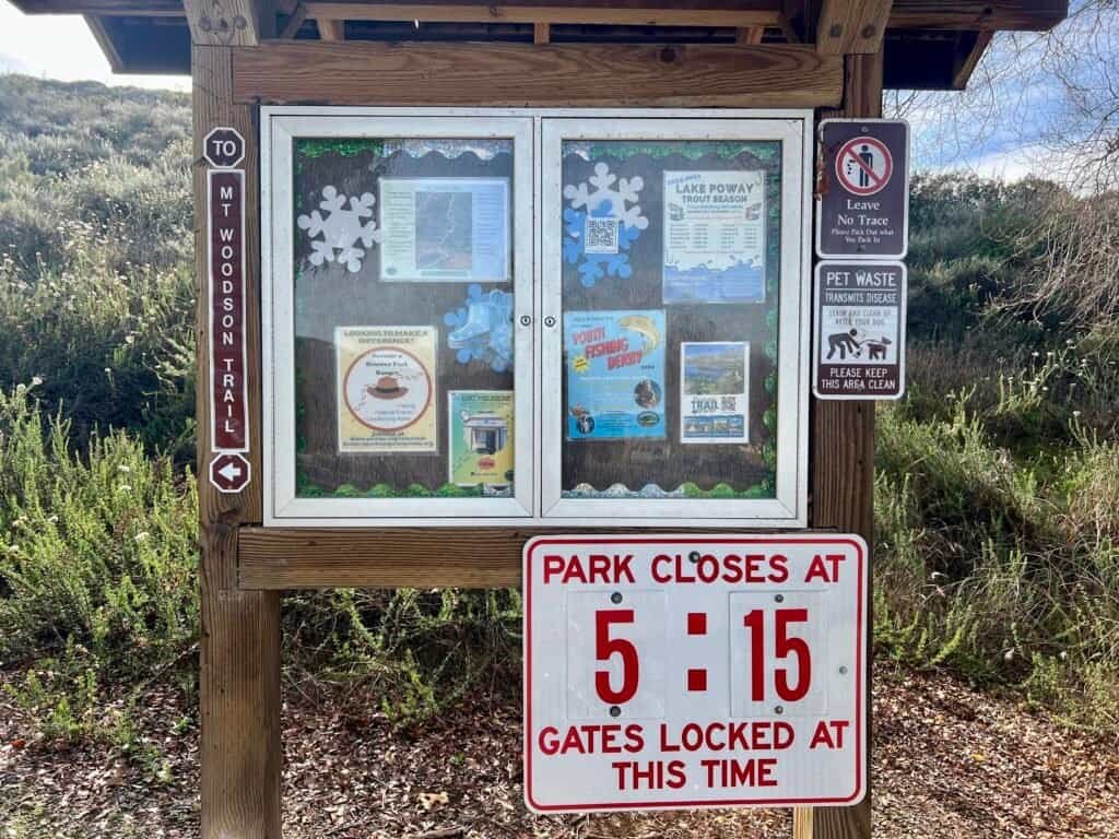
Photos: Informational Sign with Park Closing Time |
Trailhead and Restroom
The Climb Begins
The hike kicks off on Lake Poway Trail (#13) with a steady uphill and scenic lake views — deceptively friendly. However, once you transition onto Mount Woodson Trail (#15), things get serious.
Inclines steepen. Legs wake up. Focus sharpens.
This is also mountain lion country, so staying alert matters. It’s rare, but awareness is part of responsible hiking.
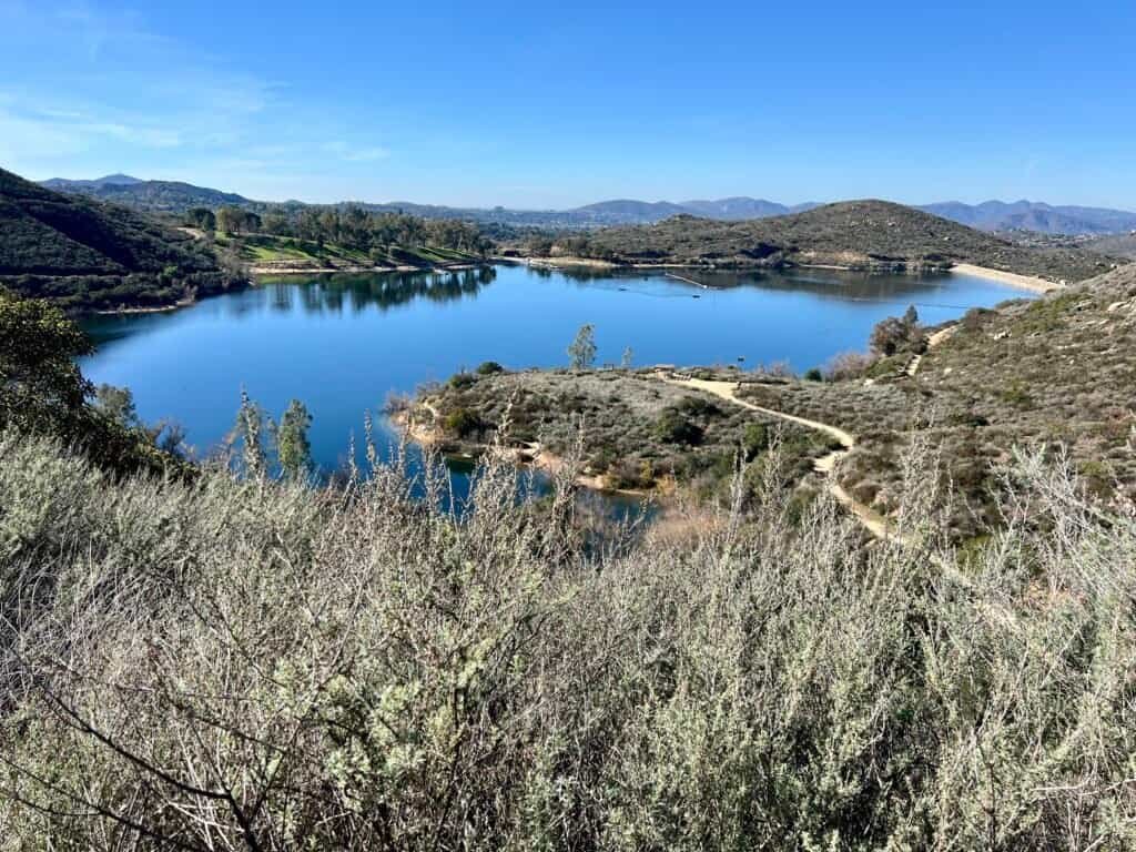
Photo: Lake Poway
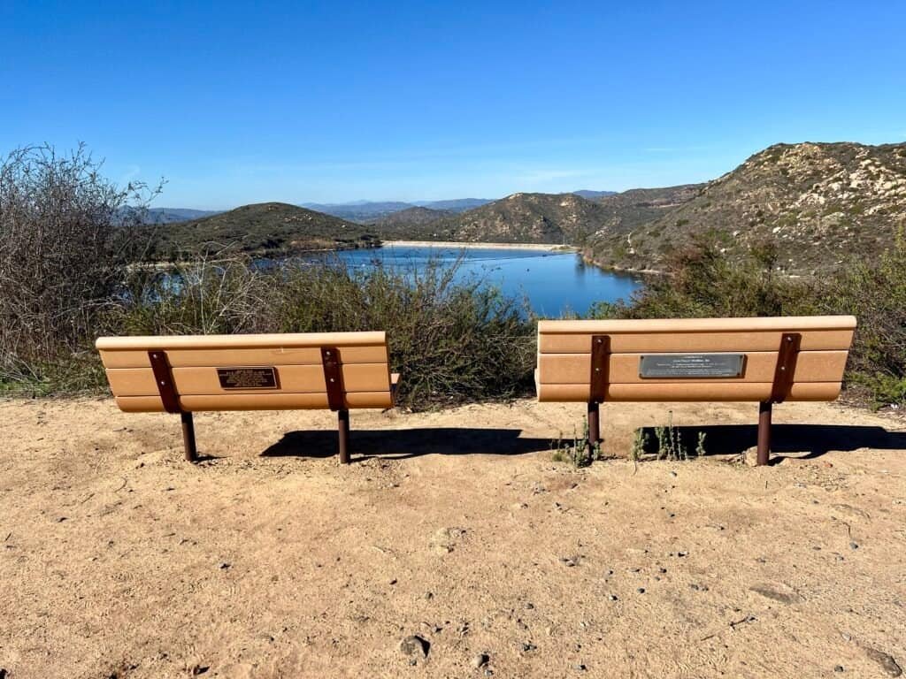

Photos: Scenic stop: benches with a view! |
Trail Marker and Watch for Lions!

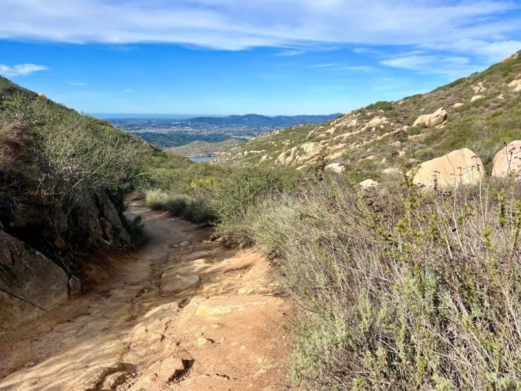
Photos: Mt. Woodson Trailhead | Upward we go: snapshots from the initial climb!
Potato Chip Rock — Almost There
After the initial grind, the trail briefly mellows out. Just briefly.
Soon enough, a helipad appears — a surprising landmark — followed by a junction with Warren Canyon Trail. From here, switchbacks return with purpose. The trail winds upward toward Lookout Point and the Fry/Koegel Trail junction.
As tempting as side trips are, momentum matters. Potato Chip Rock is close — close enough to feel it.
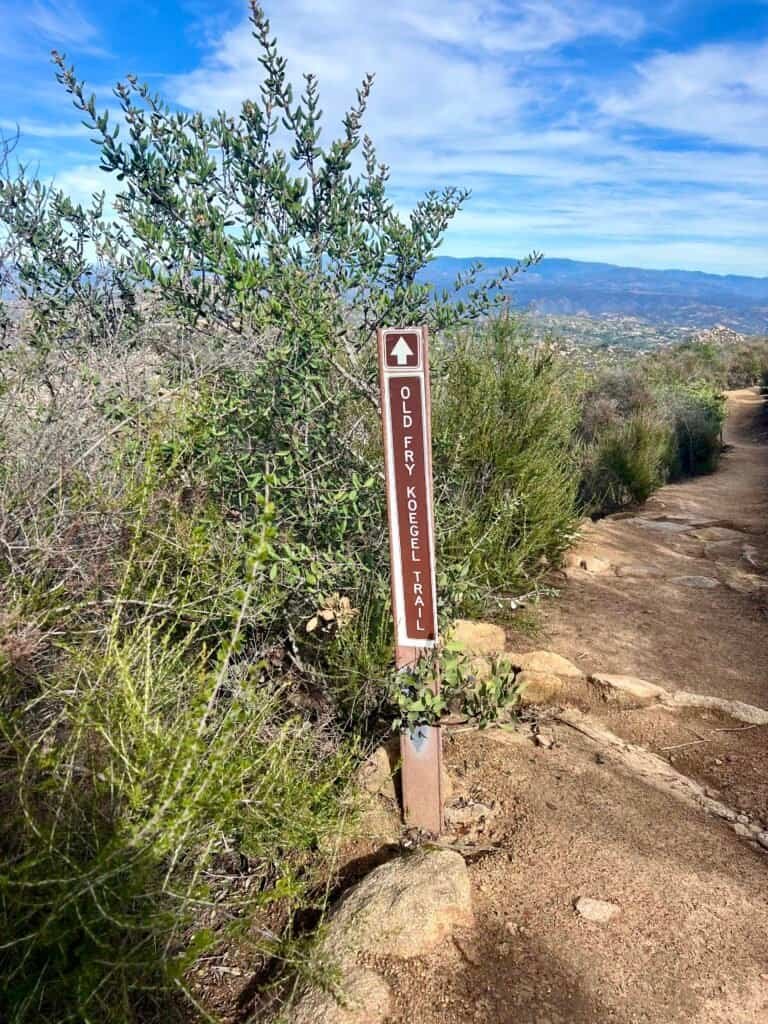

Photos: Spot the Trail Markers, Helipad Sign Included!
So Close, Yet Still Climbing
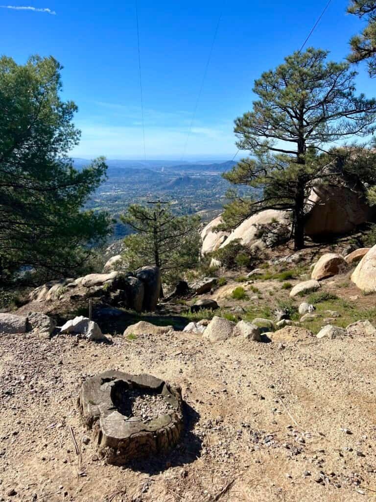
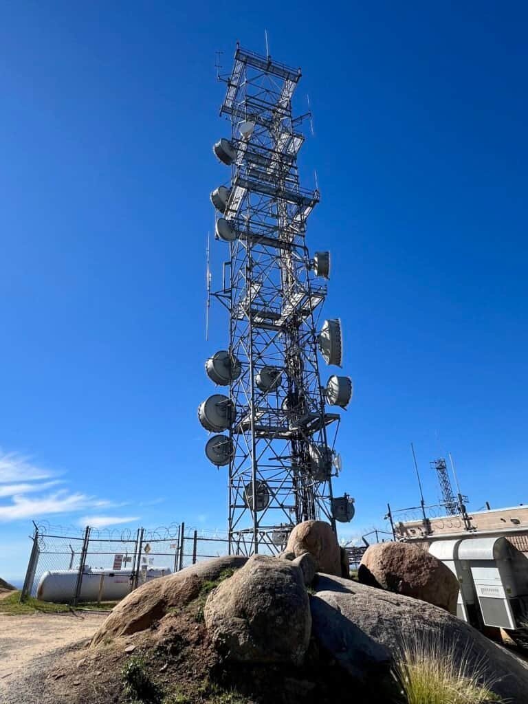
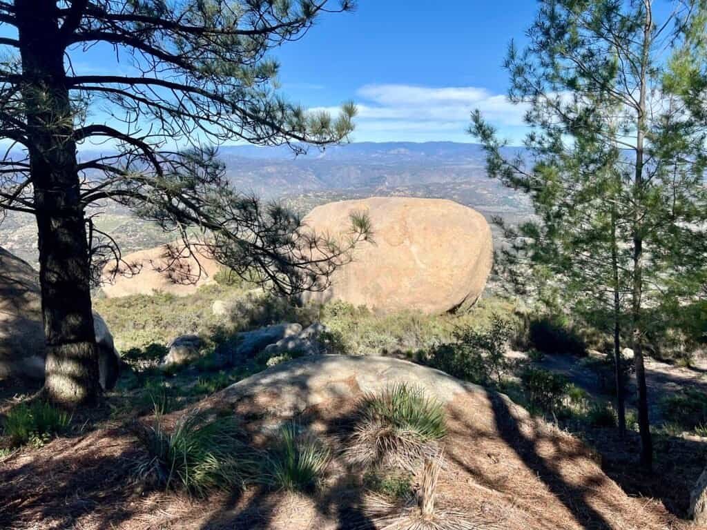
From here, the climb stays challenging but steady. Massive boulders line the trail, views expand, and eventually the radio towers of Mount Woodson appear ahead.
That’s your cue: Potato Chip Rock is just before the summit.

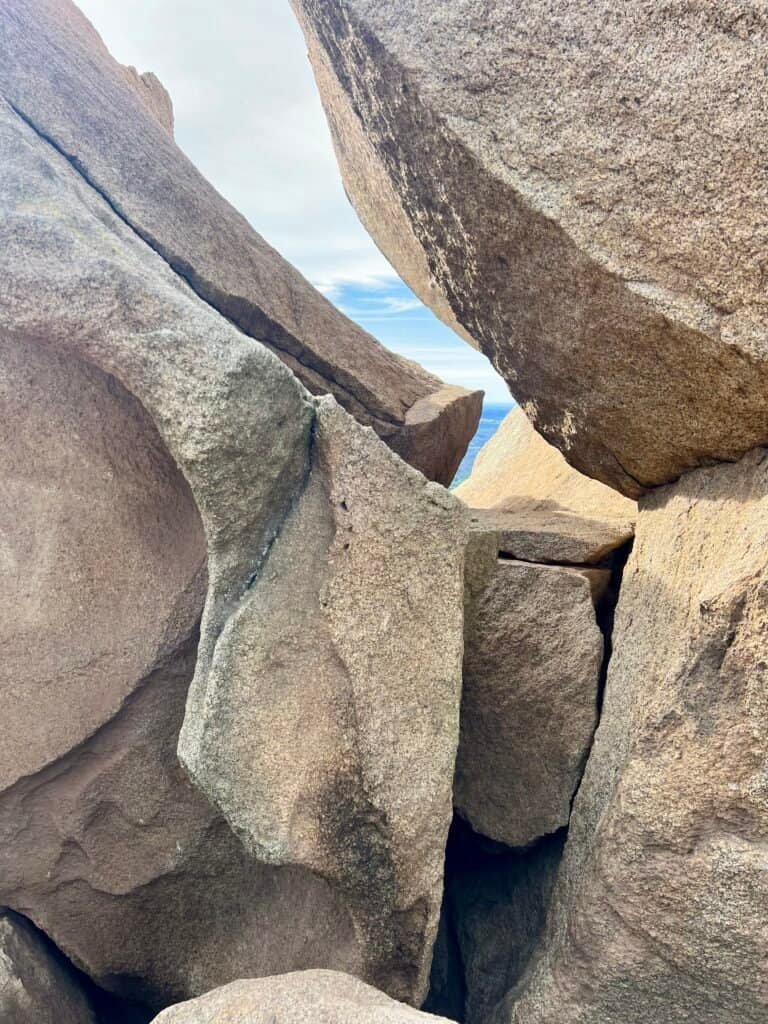
Photos: Some of the Larger-than-Life Boulders you’ll encounter!
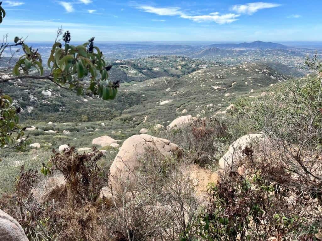
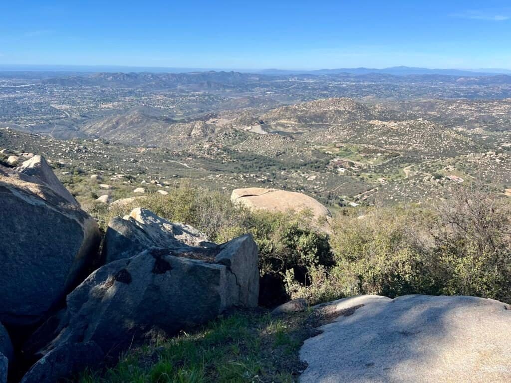
Photo: The Breathtaking Views as you gain Elevation
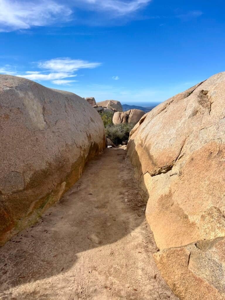
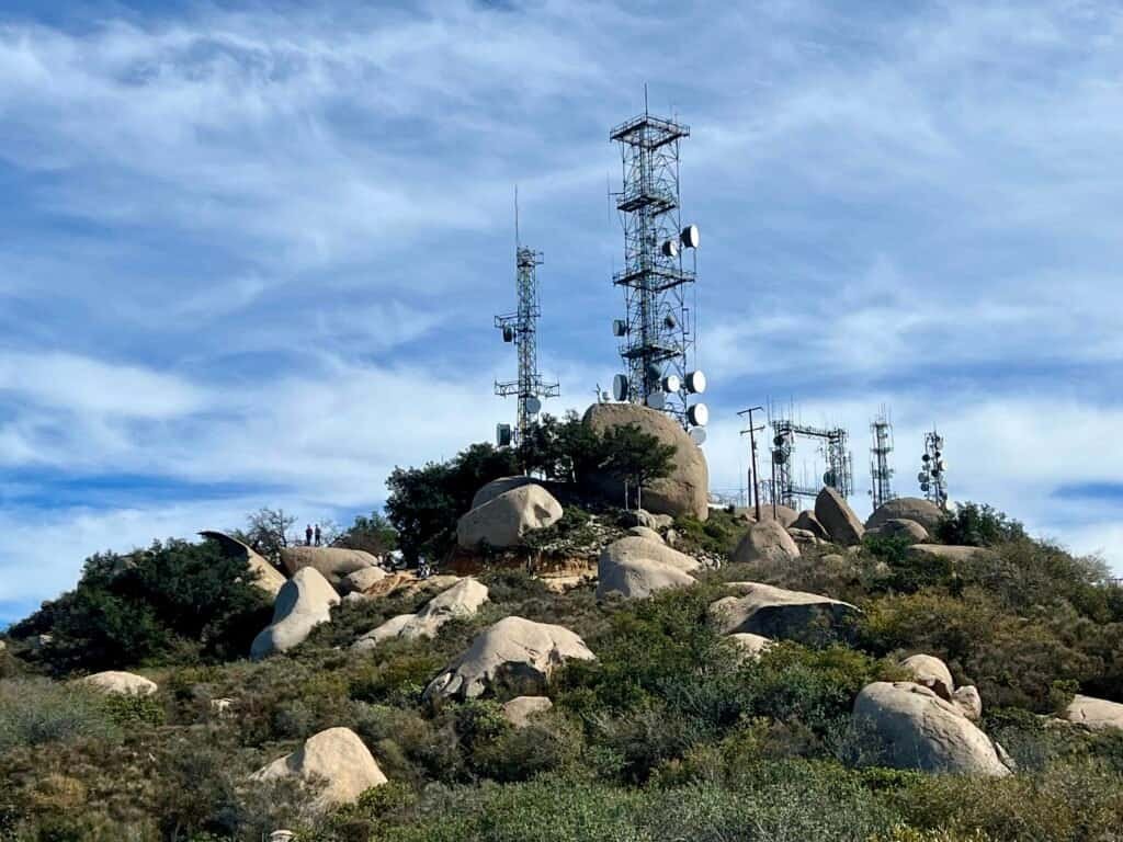
Photos: Passing through the Boulders | Radio Towers and Mt. Woodson in the Distance
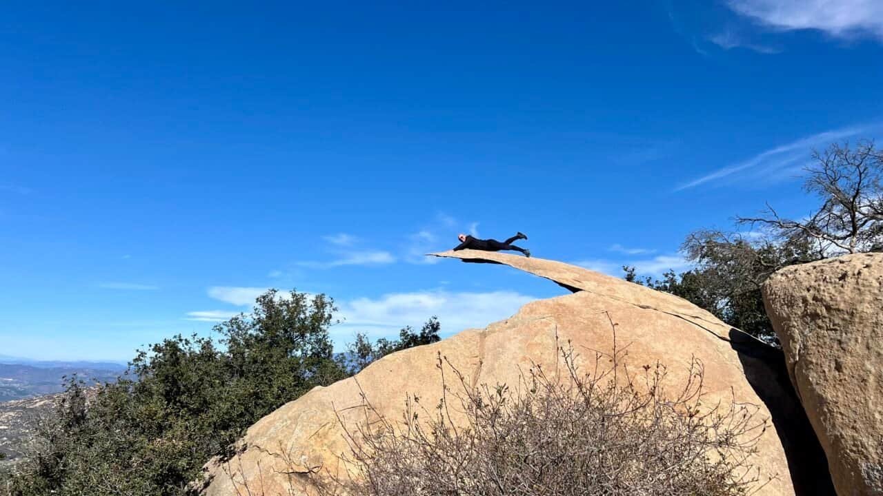
And Then, Voilà!
You round a corner, and suddenly Potato Chip Rock reveals itself — perched, thin, and absurdly dramatic.
Despite how it looks, it’s solid. Still, climbing onto it takes effort, coordination, and a little courage. Packs come off. Strangers help strangers. Cameras get passed around. Fear gets negotiated.
I’m not a fan of heights, so I sat first. Then I stood. Then — briefly — I flew.
It’s not just about the photo. It’s about the shared moment, the encouragement, the collective “you’ve got this.”
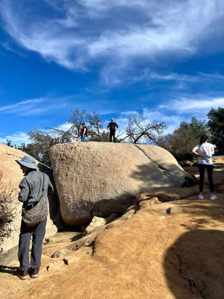
Photos: Me Standing on the Initial Boulder |
Looking Down from that same Boulder
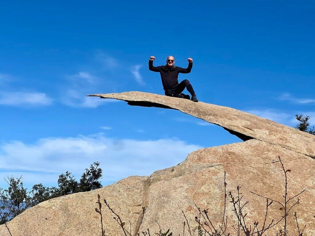
Photo: Conquering my fears and Potato Chip Rock!
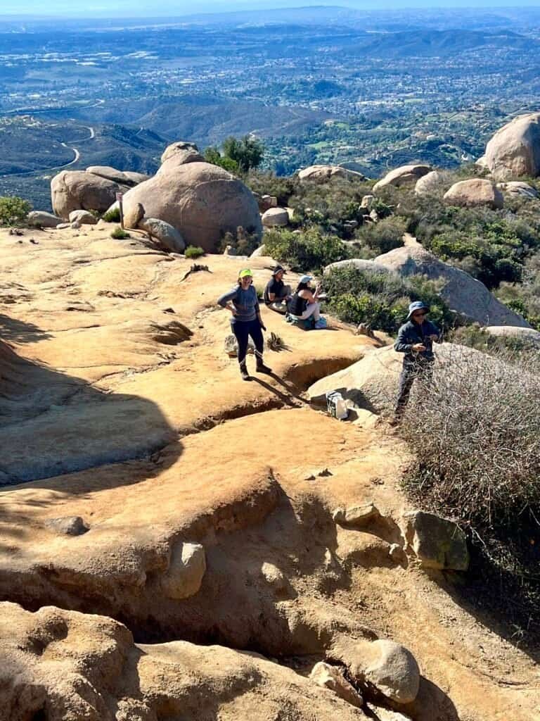
Peak and Picnic!
From Potato Chip Rock, it’s a short quarter-mile push to the summit. Near the top, you’ll find perfect spots to sit, snack, and — yes — eat potato chips.
The descent brings a whole new perspective. Different light. Different details. Boulders you barely noticed on the way up suddenly demand attention.
Photos: The Summit | Top of San Diego: Snack Central
Photos: Panoramic Summit Views

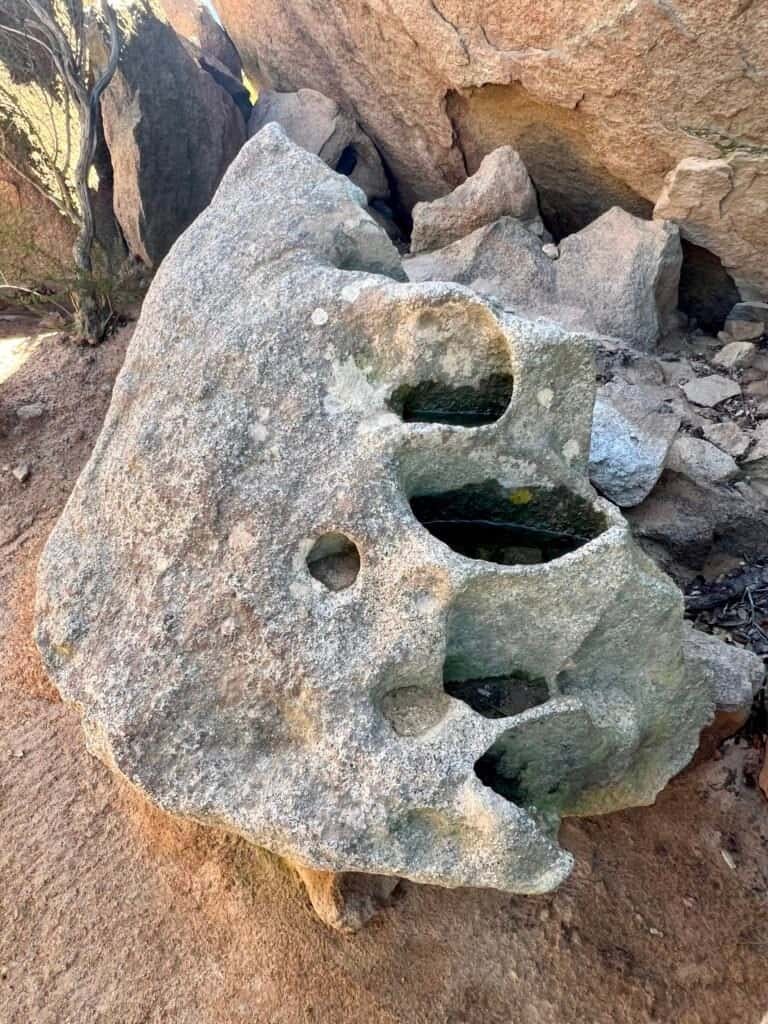
Photos: Exploring Another Boulder |
Nature’s Quirk: Meet the Fountain-shaped Boulder!

Photos: Some of Nature’s Beauties |
Check Out this Perfectly Round Boulder!
Whether you came for the challenge, the views, or the iconic photo, Potato Chip Rock delivers. It’s popular for a reason — and when approached with patience and preparation, it’s an unforgettable hike.
If you’re planning more Southern California hikes, check out my posts here for more great trail ideas: Southern California Hikes.
For official trail conditions and park updates, the City of Poway Parks & Recreation site is a helpful external resource. They also offer a newer interactive online trail map, which breaks down individual trails and trail segments by distance, elevation, and difficulty — pretty cool. You can explore it here: Poway Trails.

Catch you on the trail!
Date of Hike: 26 January 2024

Photo: Back Where It Started — Mount Woodson with My Sister
Discover more from love cook adventure
Subscribe to get the latest posts sent to your email.
Leave a Reply