Mission Trails Regional Park |
Five Peaks and a Story Years in the Making

It didn’t start out as anything more than a single hike.
On February 23, 2024, my sister Vicki and I went up Cowles Mountain—one of those San Diego classics that feels almost too easy to take for granted until you’re standing at the top, wind in your face, looking out at a city that suddenly feels smaller.
A couple months later, on April 27, 2024, I came back for South Fortuna and North Fortuna. I thought that would be the whole story. Two summits. One loop. Done.
But Mission Trails has a way of doing this thing where you start out chasing a peak… and you end up accidentally building a relationship with an entire park.
By May 2025, I was stringing together big routes across different regions—South Fortuna → Kwaay Paay → North Fortuna in a single day. A week later, I returned to Cowles and pushed past the crowds to reach Pyles Peak. Then in November 2025, I brought Vicki back for the Fortuna pair again.
Over time, what felt like separate hikes started to look like one evolving “project”—and honestly, it made me appreciate Mission Trails even more. It’s not just a place to get steps. It’s a place you can keep coming back to and still find something new: a new junction, a new viewpoint, a new kind of tired.
About the Park
Mission Trails Regional Park is massive—over 8,000 acres of rugged hills, valleys, and open space, just eight miles northeast of downtown San Diego. It’s often described as one of the city’s “jewels,” alongside Balboa Park and Mission Bay, and for good reason. With 60+ miles of trails, access to Lake Murray, the historic Old Mission Dam, and a dedicated visitor and interpretive center, it offers an impressive range of ways to explore—whether you’re out for a quick climb or a long day on the trail.
Funny enough, as much time as I’ve spent here, I still haven’t made it to the visitor center. That’s usually my move—start there, get the lay of the land—but somehow this park pulled me straight onto the trails instead. Maybe next hike.

Photo: Mission Trails Regional Park Visitor Center
For me, though, what makes Mission Trails special is how quickly it pulls you out of the city. You can drive there in minutes, but once you’re hiking, you’re surrounded by chaparral, boulders, and ridgelines, with the San Diego skyline drifting in and out of view depending on where you are and how high you’ve climbed.
One thing I didn’t fully understand at first—and wish I had sooner—is how the park is laid out.
Mission Trails can feel like multiple parks stitched together, and the dividing line that matters most is Mission Gorge Road. Cowles Mountain and Pyles Peak sit on one side of the road. South Fortuna, North Fortuna, and Kwaay Paay sit on the other. Once I started thinking about the park in these terms, everything clicked.
Instead of feeling scattered, the hikes began to feel connected—like different chapters of the same place rather than separate outings. That shift in perspective is what turned a few isolated hikes into something I kept coming back to, year after year.
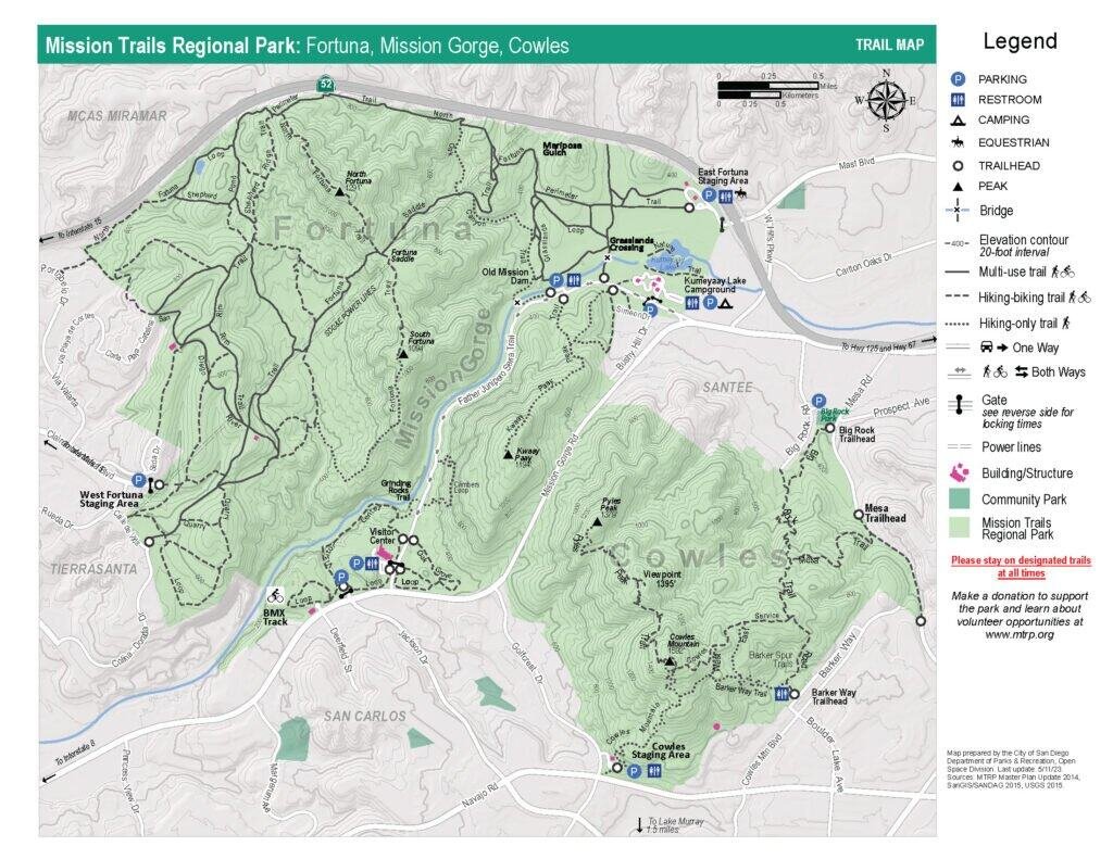
Photo: Mission Trails Regional Park Trail Map
Timeline: How This Post Became a Multi-Year Story
This wasn’t something I planned from the beginning. These hikes weren’t meant to connect, and there was no checklist I was trying to complete. They happened over time—sometimes with intention, sometimes just because I felt like being back on the trail.
Looking at them now, though, a pattern emerges. Each return added another layer to how I understood the park, until what felt like separate outings started to form a much bigger picture.
- Feb 23, 2024 — Cowles Mountain (with my sister, Vicki)
- Apr 27, 2024 — South Fortuna → North Fortuna (the original heart of this post)
- May 4, 2025 — South Fortuna → Kwaay Paay → North Fortuna (the “mega hike”)
- May 10, 2025 — Cowles Mountain → Pyles Peak (with a side of trailhead chaos)
- Nov 28, 2025 — South Fortuna → North Fortuna (back with Vicki)
A Quick Note on Trail Names
(and Why AllTrails Helps)
Mission Trails is full of intersections, and trail naming isn’t always consistent. Some trails are clearly labeled on the ground but don’t appear by name on the official maps, while others show up on maps without obvious signage once you’re hiking.
Even on the regional maps—which include more trail detail than the full park overview—it’s not always obvious what trail you’re technically on in the moment.
The first few times through, I made sure I had enough phone battery and used AllTrails at key junctions. Now I mostly know where I’m going—but I still respect how easy it is to drift onto the wrong path if you assume every intersection will be perfectly signed.
With that context, this is where my time in Mission Trails really began—on Cowles Mountain, the tallest of the park’s five peaks.
Cowles Region
Cowles Mountain (February 23, 2024)
At 1,592 feet, Cowles Mountain is the tallest peak in Mission Trails Regional Park—and on that February day, it became my first real introduction to the park.
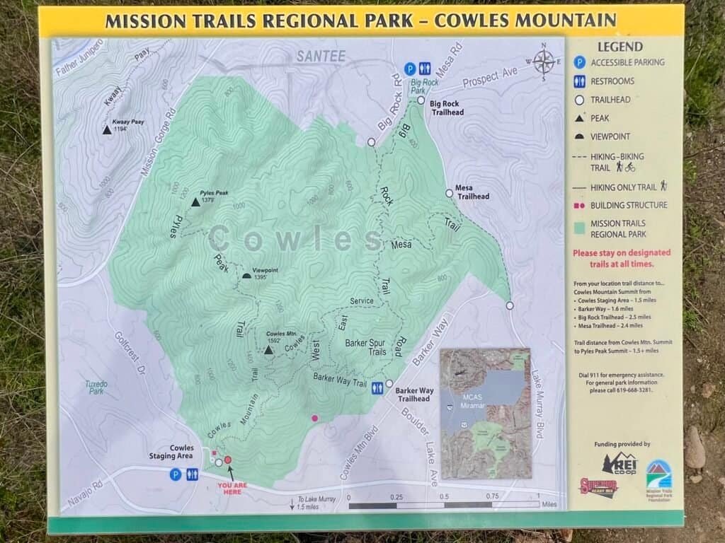
Photo: Map of the Cowles Mountain region
On a clear, beautiful morning, my sister Vicki and I headed out from our mom’s house toward Cowles, thinking of it as a straightforward hike and nothing more. She and I had already tackled my first state high point together—Mount Greylock—and whenever we’re together, we try to get outside. This felt like another easy win.
We arrived just after noon and managed to grab a spot in the small parking lot—no small feat given how popular this hike is. There’s also street parking along Golfcrest Drive, but on this day, timing worked in our favor.

Photo: Cowles Mountain Staging Area Sign at the Trailhead
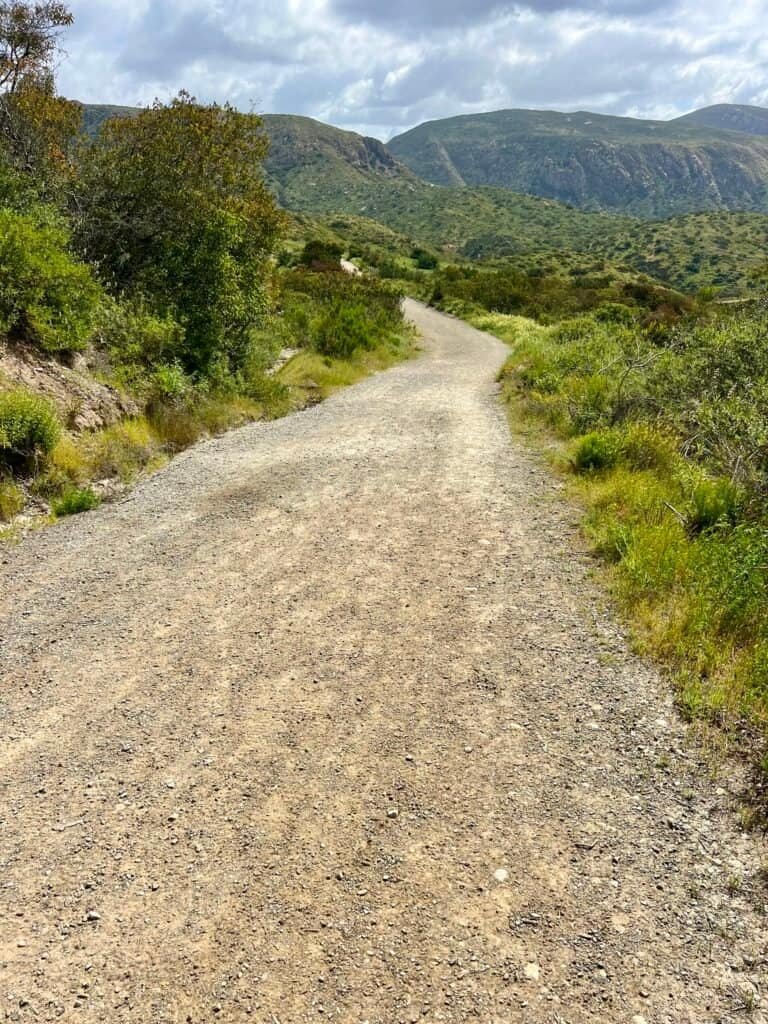
We geared up quickly—boots on, packs adjusted, and off we went. Cowles is classic Southern California hiking: no real warm-up, just straight uphill. The route is about 3 miles roundtrip with just over 900 feet of elevation gain, and most people finish it in 1.5 to 2 hours. We reached the summit in roughly 45 minutes and were back down in about the same time.

Photo: Early Views on the Climb Up Cowles Mountain
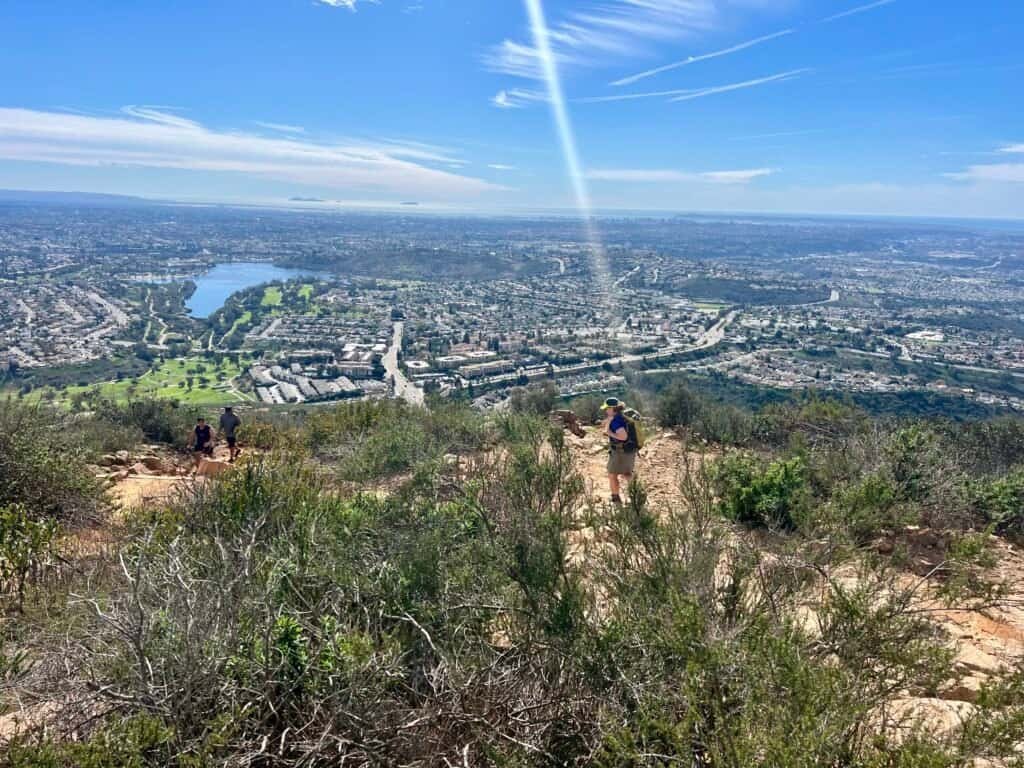
As you climb, the views open up fast. From the trail—and especially from the summit—you get a clear look at Lake Murray, spread out below on the west side of the park. On clear days like this one, you can even see the Islas Coronado off the Mexican coast.

Photo: Lake Murray below, the Coronado Islands faint on the horizon
Looking west, the landscape stacks up familiar names: Santee Lakes, Mount Woodson (home of Potato Chip Rock), El Cajon Mountain, and McGinty Mountain—all peaks I’ve climbed over time. Standing there, it quietly reinforced how connected this whole area really is.
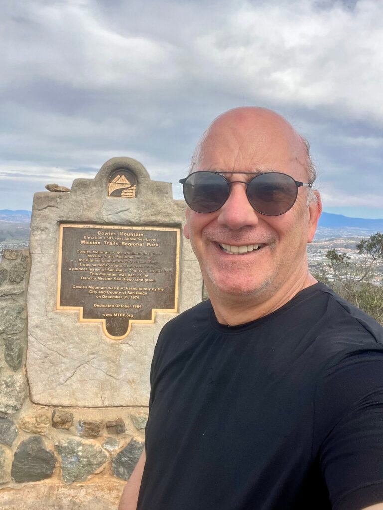
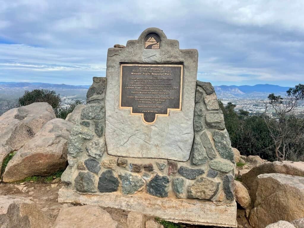
Photos: Summit Selfie | Cowles Mountain Summit Marker
One thing you absolutely need to be prepared for here is the crowds. Cowles is popular for good reason: short distance, big views, and easy access. It’s a fantastic hike—but it’s rarely a quiet one.
Photos: Vicki on the Summit | Heading Down Cowles Mountain
With the summit behind us, we took our time heading back down. Shoes swapped, packs tossed in the car, and we pointed ourselves back toward Vista. Looking back now, it’s funny that we didn’t even consider continuing on to Pyles Peak. At the time, Cowles felt like the destination. We didn’t yet know how much more of this park we’d eventually explore.
About two months later, I wanted something more challenging. Without even putting two and two together—or realizing this was all part of the same park—I headed for the Fortuna Mountains, on the opposite side of Mission Gorge Road.
Fortuna Region
South Fortuna → North Fortuna
(April 27, 2024)
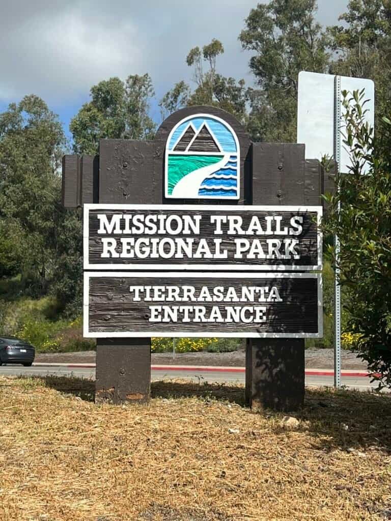
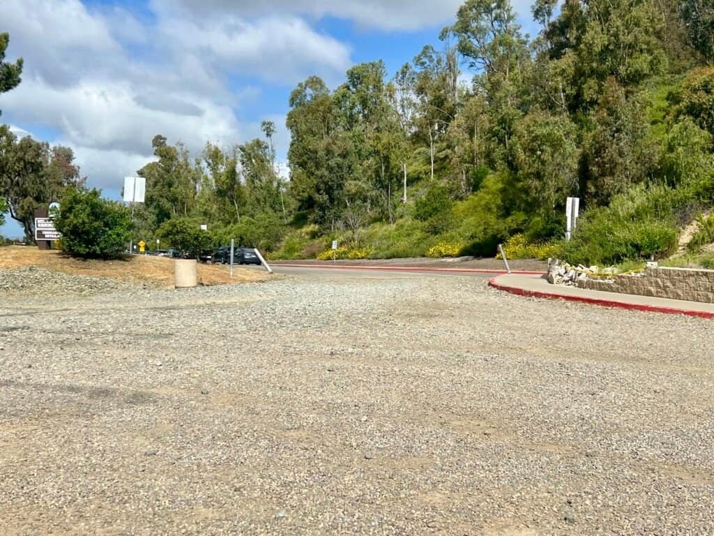
Photos: Entrance | From the Parking Lot looking at Clairemont Mesa Blvd.
When I pulled into the Tierrasanta Entrance at the end of Clairemont Mesa Boulevard that morning, I thought I knew exactly what the day would be: two peaks, one loop, and a solid workout before heading home. I’d read enough AllTrails reviews to have a plan, and like most people tackling the Fortuna pair for the first time, I decided to start with South Fortuna (1,094 ft)—the smaller of the two, but steeper, and better handled on the way up than down. North Fortuna (1,291 ft) loomed just beyond it, taller, broader, and waiting its turn.
What I didn’t appreciate yet was how much this hike would mess with my head.

Photo: Fortuna and Mission Gorge Trail Map
At a glance, the route doesn’t look complicated. The trail eases you in through chaparral and sagebrush, almost convincing you this might be straightforward. But Mission Trails has a way of quietly rewriting expectations. You drop into shallow ravines, climb back out, then descend again—watching the peaks you’re aiming for drift closer and farther away at the same time. You can see where you’re going, but the trail insists you earn it the long way.
Looking back now, this loop feels like the foundation—where Mission Trails stopped being just another hike and started becoming something more familiar.
Stats (my track): ~6.44 miles · ~2:33 total time (including summit stop) · ~1,300+ ft gain
Onto the Route


Photos: The Bridge – Parking Lot Side | Across the Bridge with Park Info
Leaving the parking area, the route crosses a bridge and immediately introduces one of Mission Trails’ defining traits: intersections. Veer left after the bridge onto an unnamed trail, then turn right onto the Clairemont Mesa Trail, which is clearly signed but doesn’t appear by name on the official maps. From there, progress is anything but linear. Just when you think you’ve climbed enough, the trail dips again—setting the tone for a day built around false summits and small mental negotiations.
After the bridge and Clairemont Mesa Trail, you eventually intersect with the Fortuna Saddle Trail, a wider path shared with mountain bikers.
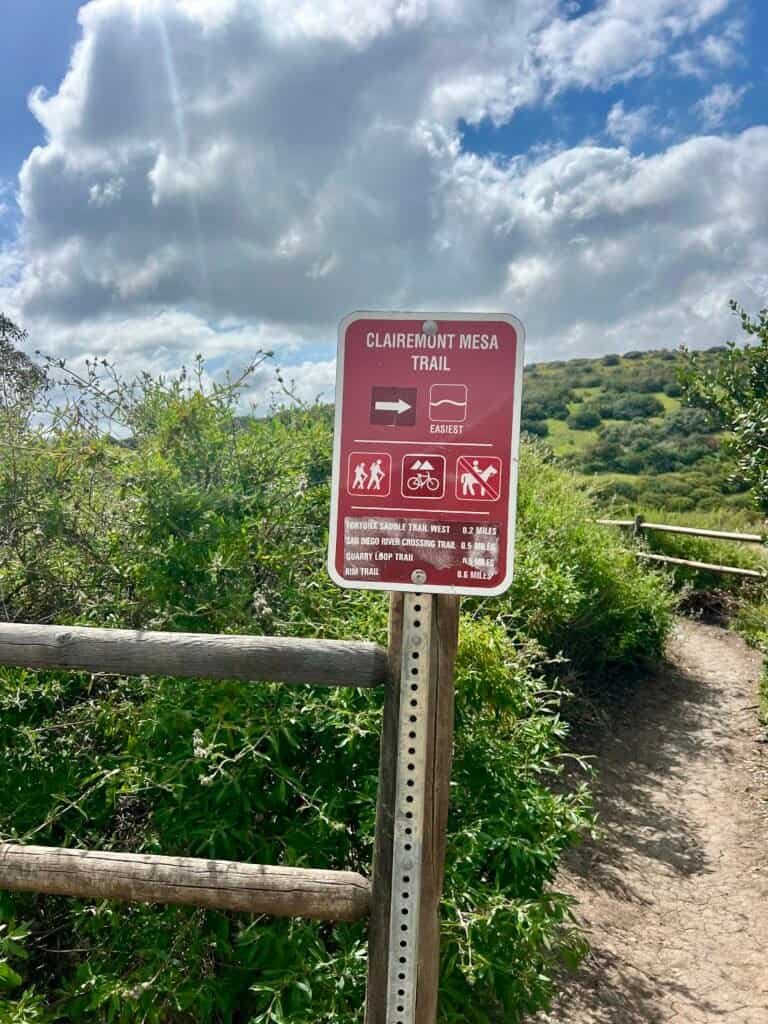
Photos: Clairemont Mesa Trailhead | Clairemont Mesa Trail
From here:
- Turn right onto Fortuna Saddle Trail
- Take your first left onto a wide downhill trail that clearly favors bikes
- Avoid the narrow uphill trail straight ahead (that one leads toward the Quarry Loop Trail)
Photos: Fortuna Saddle Trail (not the direction you go) | The wide downhill trail you take (you’ll often “come in” from the left side of the photo)
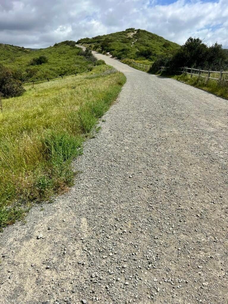
The summits begin to show themselves in the distance—close enough to motivate you, far enough to feel deceptive.
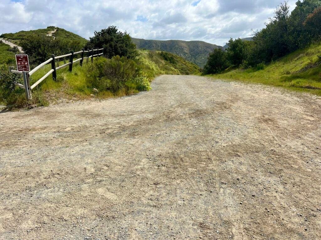
From this unnamed connector, the route briefly joins the San Diego River Crossing Trail before reaching the turnoff for the Suycott Valley Trail. This is where the mental side of the hike really kicks in. You descend again, knowing full well you’re about to pay for it on the climb to South Fortuna.
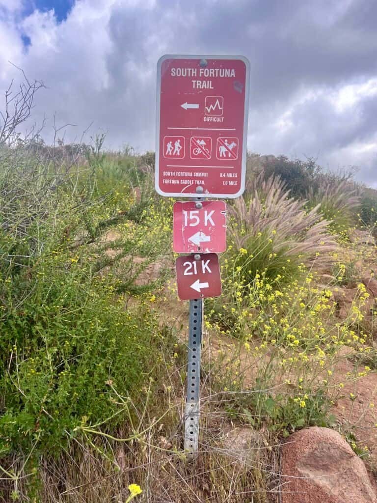
At the base area, resist the temptation to continue straight. Follow the signage toward the South Fortuna Trail and commit to the work ahead.

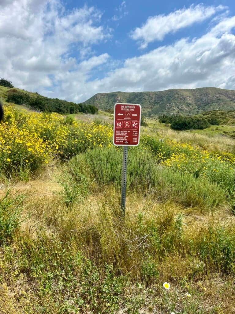
Photos: The Summits in the Distance | San Diego River Crossing Trail

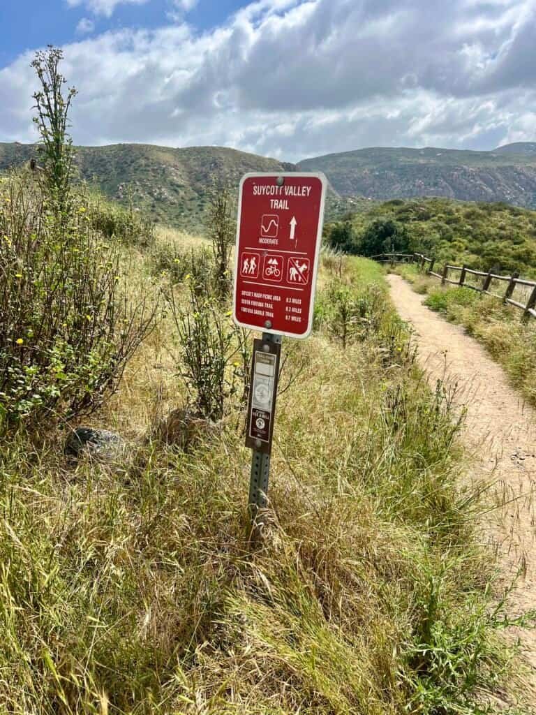
Photos: Suycott Valley Trail Turnoff | Suycott Valley Trail


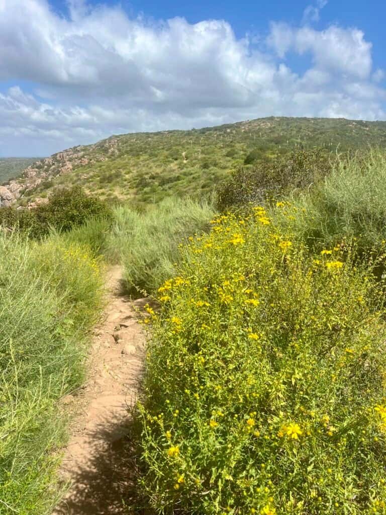
Photos: South Fortuna Trail (turn right) | Yellow Wild Flowers
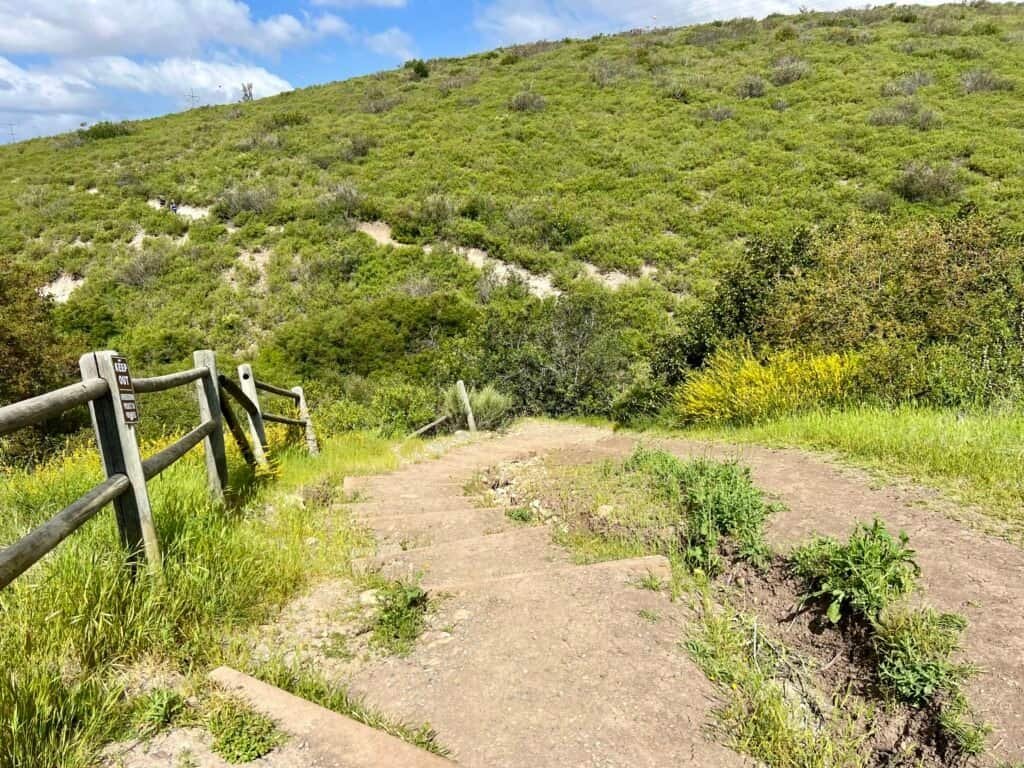
The Stairs: Where the Real Work Begins


Photos: The stairs begin to come into view
Eventually, you see them—the stairs.
This is the moment where the hike shifts from pleasantly challenging to okay, we’re doing this. I’ll say it plainly: I’d rather climb these than descend them. Going up feels controlled. Going down feels like negotiating with gravity.
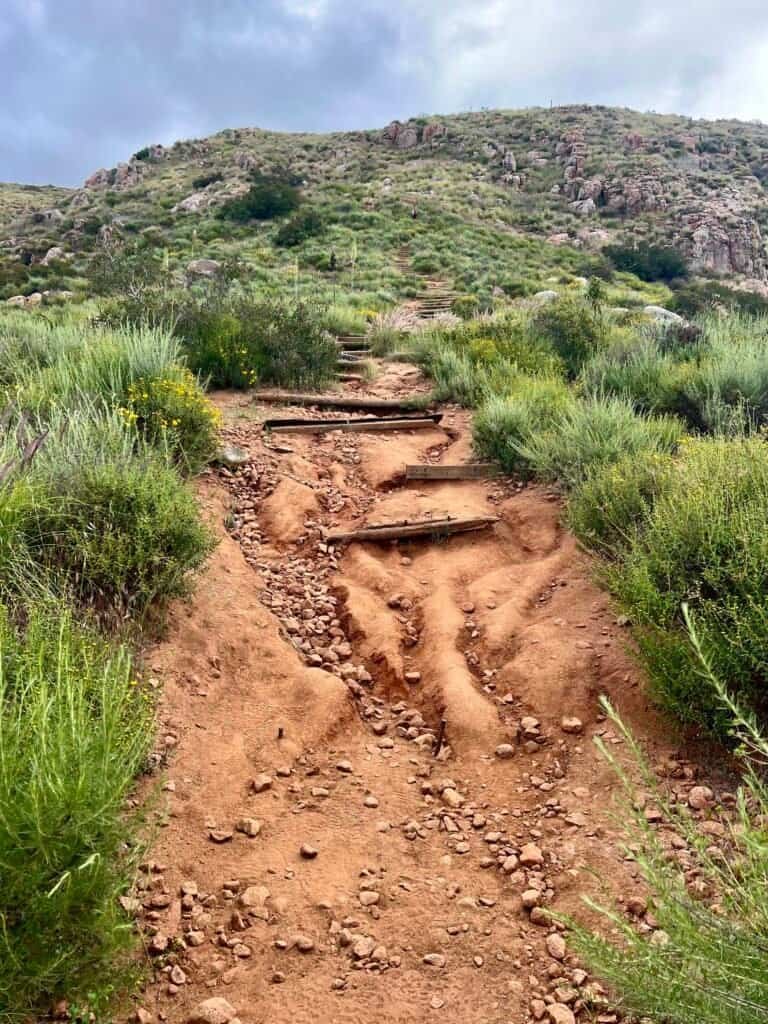
Photo: The Infamous Stairs – aka the “Stairway to Heaven”
Near the top, the trail demands attention. I took a wrong turn here and ended up scrambling up a narrow ravine, including one boulder move that required more effort than I planned on spending that day. Lesson learned: follow the trail carefully near the top, even when you’re tired and convinced the summit must be right there.


Photos: On the climb | Looking back down
The Plateau Trick
(and the Actual South Fortuna Summit)
When you reach the top of the stairs, you hit a plateau that feels like the summit.
It isn’t.
Photos: At the top of the stairs – 0.4 miles to go! | Summit in the distance
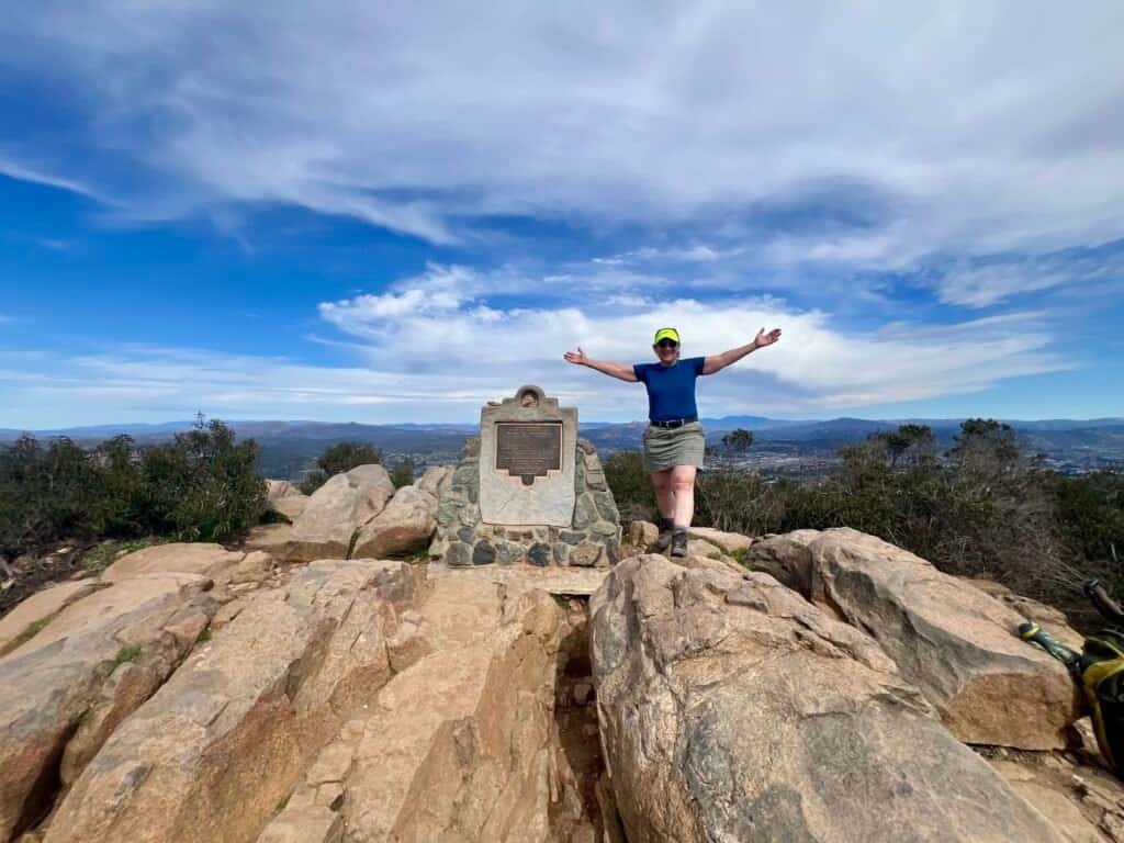
The real summit sits farther out, clearly visible in the distance—because Mission Trails is nothing if not consistent about false hope. Stay on the South Fortuna Trail, and you’ll eventually reach the summit marker.
And when you do, it’s a great feeling. The quiet kind of satisfaction. Wind, views, and that simple I earned this moment.

Photo: Closing in on the South Fortuna Summit

Photo: South Fortuna Summit with North Fortuna Beyond

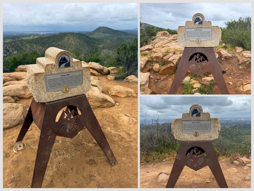
Photos: Summit Selfie | South Fortuna Summit Marker
“Wait… We Have to Go Down First?”
From South Fortuna, North Fortuna looks close enough to be a formality.
Then you start moving toward it and realize the trick.
You have to descend before you can climb again—and North Fortuna has its own version of the false summit experience waiting for you.

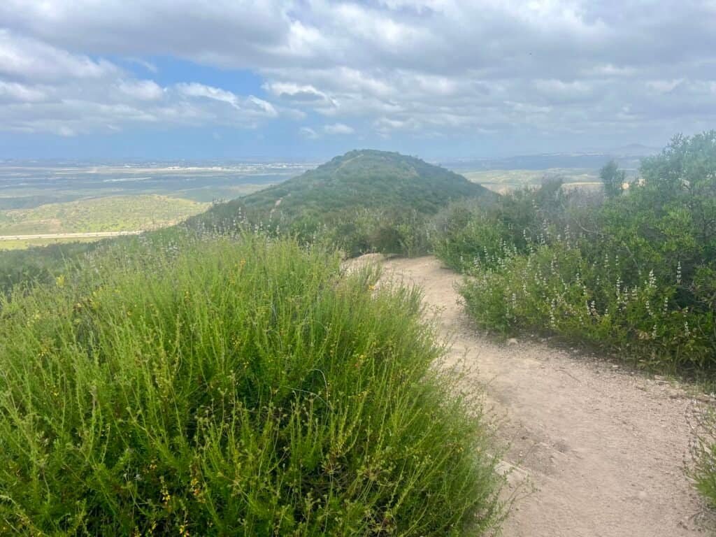
Photo: Heading down from South Fortuna toward North Fortuna
North Fortuna: False Summit, Then the Real One
At the base of North Fortuna, where the power lines cross the trail, the climb begins in earnest. The trail steepens quickly, and if you’re new to this hike, you’ll likely hit the false summit thinking you’ve arrived—only to see the real summit still teasing you ahead.


Photos: Trail from the Powerlines | Last incline to the False Summit

Photos: View from the false summit | North Fortuna in distance
But once you reach the true rocky outcrop, the reward is obvious: big views, real accomplishment, and the satisfaction of having knocked out both peaks. I took a break up top, ate lunch, and let the moment settle.

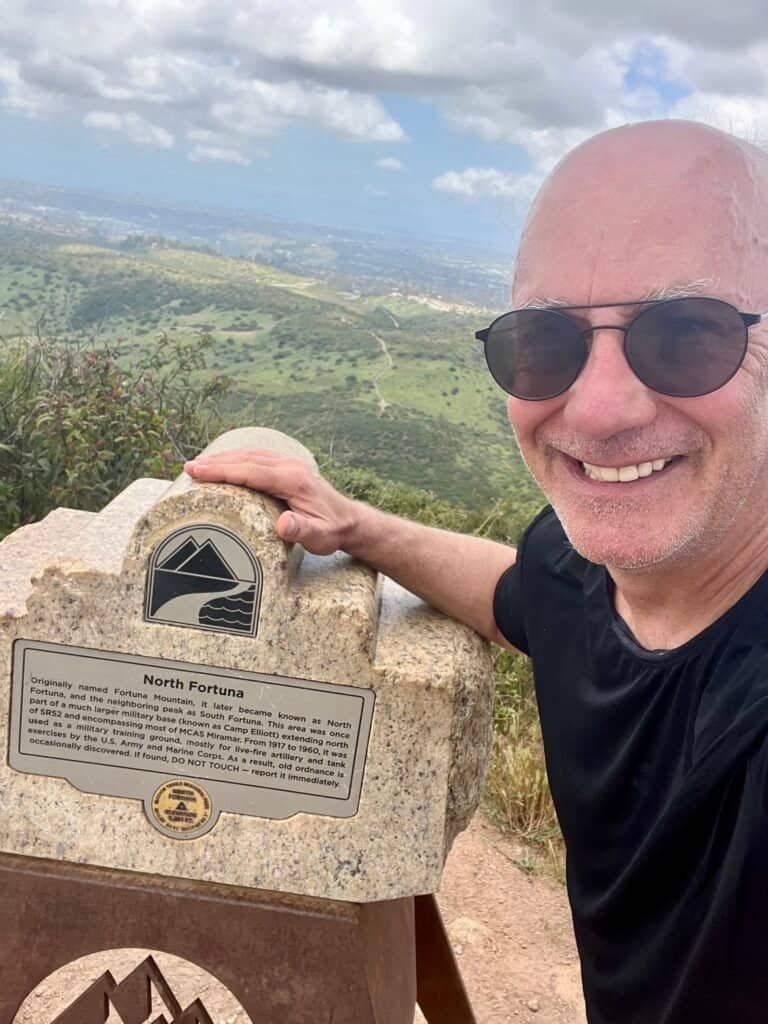
Photos: North Fortuna Summit Marker | Summit Selfie

Photo: View from the Summit of North Fortuna
The Descent and the Navigation Puzzle
The descent off North Fortuna is gentler thanks to switchbacks—until the park turns into a choose-your-own-adventure book.
I also had a memorable pause for a Pacific gopher snake crossing the trail. He got the right-of-way. Always.

Photo: California Gopher Snake
From the base of North Fortuna, the sequence that worked for me:
- Turn left onto North Fortuna Perimeter Trail
- Take another left onto Shepherd Ridge Trail
- Continue straight at branching trails
- At the “Y,” stay left
- At clustered intersections, continue straight / slightly right, then head toward Rim Trail
- When the trail looks like it continues straight, veer left onto Rim Trail
- Watch for the cutover marked “To San Diego River Crossing Trail”


Photos: Approaching the Rim Trail Junction | Rim Trail Sign |
Cutover to San Diego River Crossing Trail
From there:
- Turn left on San Diego River Crossing Trail
- Take the trail that veers slightly right (not the sharp right)
- Near the lot, veer gently right, then right again to cross the bridge back
AllTrails saved me more than once on this descent!
Date of Hike: 27 April 2024
Mission Gorge Region
The Mega Day: South Fortuna → Kwaay Paay → North Fortuna (May 4, 2025)
This was the day I stopped pretending Mission Trails was “just a couple peaks” and admitted I was using it like a playground—with consequences.
Start time: 10:25 AM
Distance: 12.51 miles
Elevation gain: 3,163 ft
Moving time: 4:39:06
Elapsed time: 5:35:29 (I pause my watch during breaks)
Average pace: 22:19
If you want a legit workout, this is it.
The opening climb up South Fortuna followed the same route and rhythm as the previous hike—steep, direct, honest. Likewise, the push up North Fortuna and the eventual descent back toward the West Fortuna Staging Area were familiar ground.
What made this day different lived entirely in the middle of the loop.
From South Fortuna to Fortuna Saddle
After tagging South Fortuna, I continued toward Fortuna Saddle—where the power lines cut across the landscape—and this is where the hike stopped feeling routine and started demanding intent.
Instead of pressing on toward North Fortuna, I dropped down.
That decision matters.
Dropping down Fortuna Saddle Trail feels generous in the moment and immediately files a complaint with your future self. You know you’re going to pay for it later—but you do it anyway.

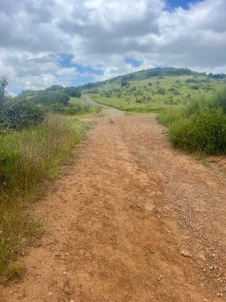
Photo: Fortuna Saddle Trail – Where you decide to make the day harder.
Partway down, I cut onto Oak Canyon. The terrain shifts immediately: creekbed energy, boulders underfoot, shade, and a completely different feel from the exposed ridgelines. The trail funnels you toward the Old Mission Dam area, and the contrast is striking.

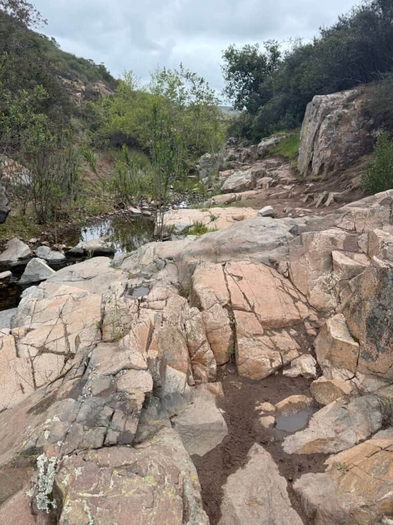
Photos: Oak Canyon Trail – Same hike. Completely different energy.
Built between 1803 and 1815 by Kumeyaay laborers and Spanish missionaries, the dam was part of the first major irrigation project on the Pacific coast, supplying water to Mission San Diego de Alcalá.
It’s easy to pass through quickly, but it’s worth pausing. After hours on modern trails and open ridgelines, the dam feels grounded—quiet evidence of how long people have been shaping this landscape.

Photo: Old Mission Dam – A good place to slow down and remember how old this place really is.
Father Junípero Serra Trail
From there, I picked up Father Junípero Serra Trail—more road than trail—and made a classic mistake: I went right when I should’ve gone left.
Nothing dramatic. Just one of those small detours you definitely feel on a 12.5-mile day.
Mission Trails has a way of reminding you that familiarity doesn’t equal immunity.
Kwaay Paay Peak
From there, I headed out on the Kwaay Paay Peak Trail (out-and-back), climbing to 1,194 feet.
Compared to Cowles—or even Fortuna—Kwaay Paay felt quieter. Not empty. Just calmer. Fewer people. Less noise. More space to think.
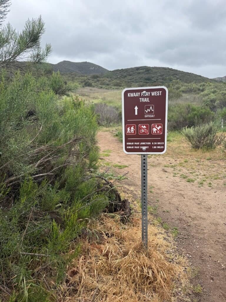
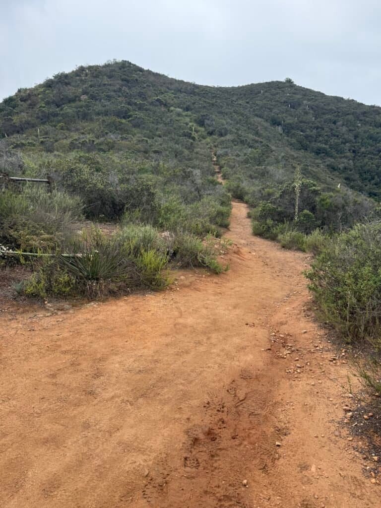
Photos: Start of the Kwaay Paay Trail | Kwaay Paay Trail – the last push to the summit!
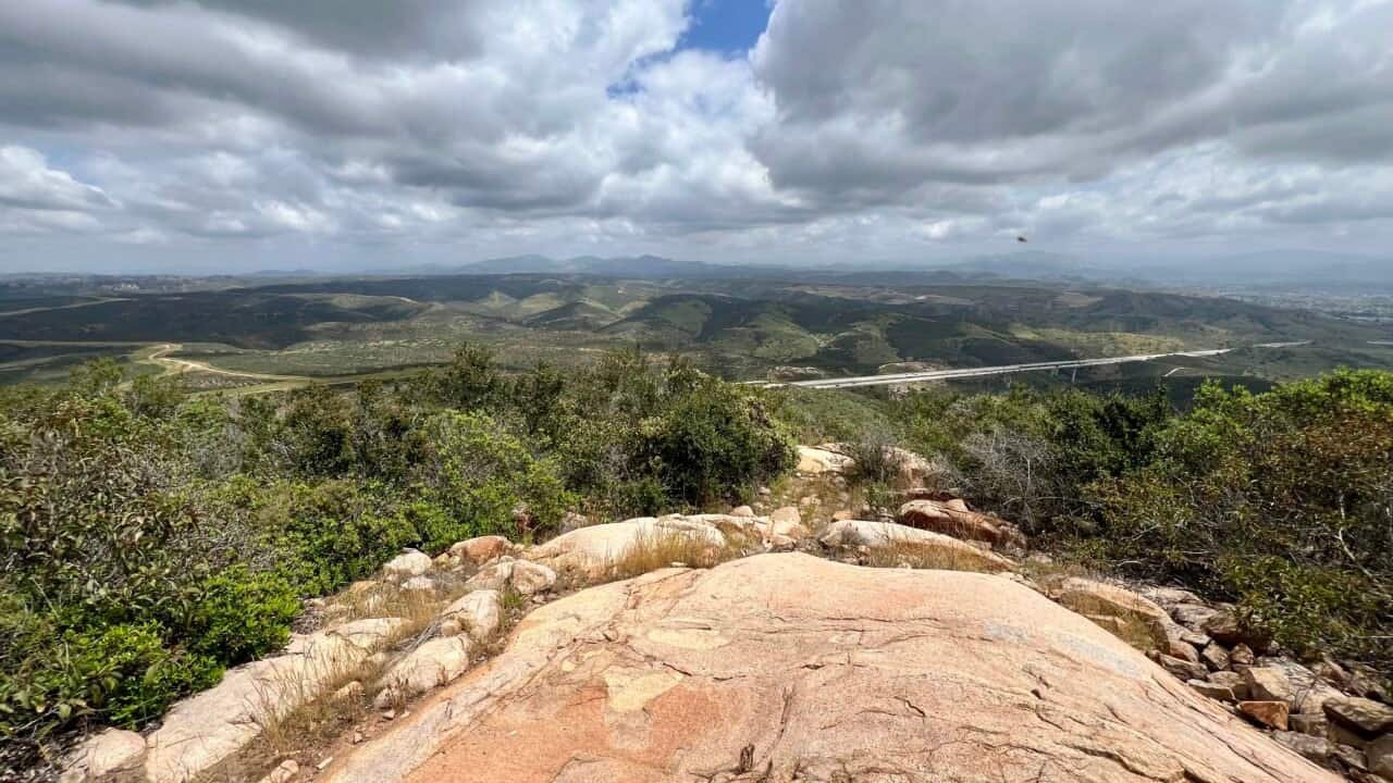
The overcast skies softened the views, but honestly, that worked. One of the best moments came when I turned around and saw South and North Fortuna stretched across the ridgeline in the distance.
I’ve been there.
I still have to get there.
And then you just… keep walking.


Photos: Summit Selfie | Kwaay Paay Summit Marker with both South and North Fortuna Summits in the distance
Grasslands Crossing & the Hiking Poles Conversation
From Kwaay Paay, I retraced my steps to Father Junípero Serra Trail and worked my way back toward North Fortuna via Grasslands Crossing and the Grasslands Loop Trail.


Photos: Some of the Flora on the Hike – Thickleaf Yerba Santa and San Diego Morning Glory
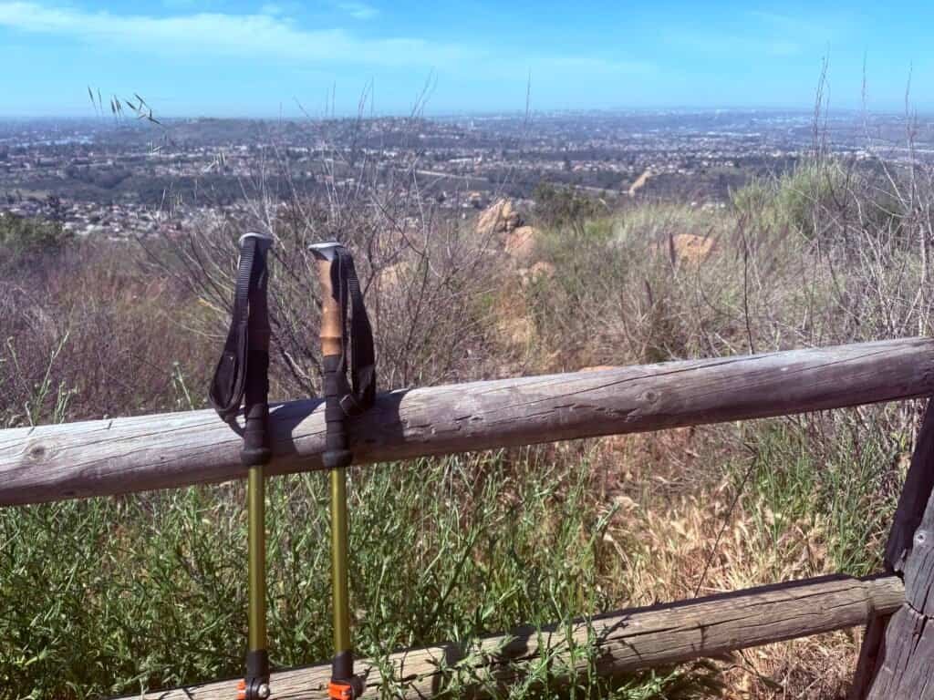
On the way back, a woman stopped me and asked about my hiking poles.
It turned into one of those trail conversations that sticks with you.
I told her the first thing people don’t usually expect: on long hikes, your hands and arms can swell, and poles help reduce that. Then the obvious—extra balance on steep, dusty descents, especially when the silt gets slick.
And finally, the Southern California reality: rattlesnakes.
Best-case scenario, if something goes wrong, the snake strikes the pole—not you.
She paused, nodded, and said, “I might need to get some poles.”
Exactly.
Back Toward North Fortuna
From there, it was back to work.
I continued until North Fortuna Perimeter Trail, then quickly found myself back on Fortuna Saddle Trail—the same steep beast I’d enjoyed on the way down earlier, now demanding repayment on the way back up. Climbing back to Fortuna Saddle is no joke, and it’s the price you pay for detouring out to Kwaay Paay.

Photo: The long way back to the top. North Fortuna in the distance.
Once back at the saddle, I followed North Fortuna Saddle Trail, reconnected with North Fortuna Trail, turned right, and climbed to the summit.
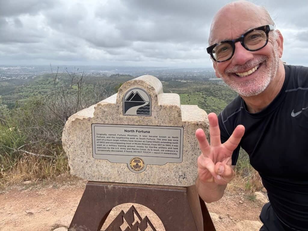
Photo: Mission Accomplished! Third Summit for the Day.
Once I descended the other side of North Fortuna, it was the familiar navigation puzzle again—Perimeter → Sheppard Ridge → Rim Trail → cutover back to the West Fortuna Staging Area—the same sequence detailed in the April 27, 2024 hike.
AllTrails earned its keep more than once.
And somewhere along that final descent, it fully sank in: this wasn’t just a long hike. It was a full circuit of effort, decision-making, patience, and payoff—one of those days that leaves you tired in the best possible way.
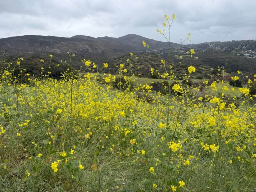
Photo: The kind of ending that doesn’t need words.
After a day like that, there was only one acceptable reward.
I stopped at SomiSomi in Mira Mesa for soft serve and taiyaki and ordered an unexpectedly perfect swirl: ube and chocolate. Sweet, a little indulgent, and exactly what my legs—and brain—needed after 12.5 miles and over 3,000 feet of climbing.
Completely earned.


Photos: epic day → quiet satisfaction → sweet full stop. 🍦🥾
Date of Hike: 4 May 2025
Cowles Region
Cowles → Pyles (May 10, 2025)
I’d hiked Cowles before with my sister, Vicki, but we never continued on to Pyles Peak. This time, I finally did—and it felt like unlocking the next chapter of the Cowles side of Mission Trails.
Coming off the South Fortuna → Kwaay Paay → North Fortuna hike just days earlier, this one had a clear purpose. Between the two outings, the goal was simple: all five summits. Not in a single push, but across two deliberate hikes.
Garmin Stats (because I messed it up)
I accidentally saved the activity mid-hike and had to restart, so the stats are split:
- Activity 1: 3.95 miles · 948 ft gain · 1:26:59
- Activity 2: 1.81 miles · 978 ft gain · 39:05
In real life, it was one continuous out-and-back: trailhead → Cowles → Pyles → back.
Trailhead: Cowles Staging Area off of Golfcrest Drive area near Navajo Road.
The Trailhead Scene
When I arrived, there were two fire engines, an ambulance, rescue trucks, and a park ranger. Someone had fallen and they were bringing him down. He looked sweaty and shaken—no obvious broken bones, but it was hot, and it screamed dehydration.

Later, on my way down, a guy asked if anyone had extra water because his dog was panting hard and lying in the shade.
Cowles is one of those peaks that attracts a lot of people who don’t hike often—and sometimes that means:
- not enough water
- the wrong time of day
- and decisions that aren’t fair to a dog in the heat
I’ll keep my soapbox short, but if there’s one mountain where I’d beg people to bring water and respect the conditions, it’s this one.
Cowles to Pyles
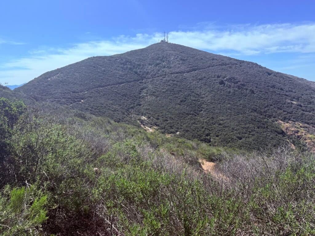
Cowles is impossible to miss once you’ve been there a few times. The summit crowds gather in one place, but just off to the side sits the radio tower—steel, cables, antennas—quietly reminding you that this is both a mountain and a working piece of infrastructure. A few people wander over that way, but most never do.
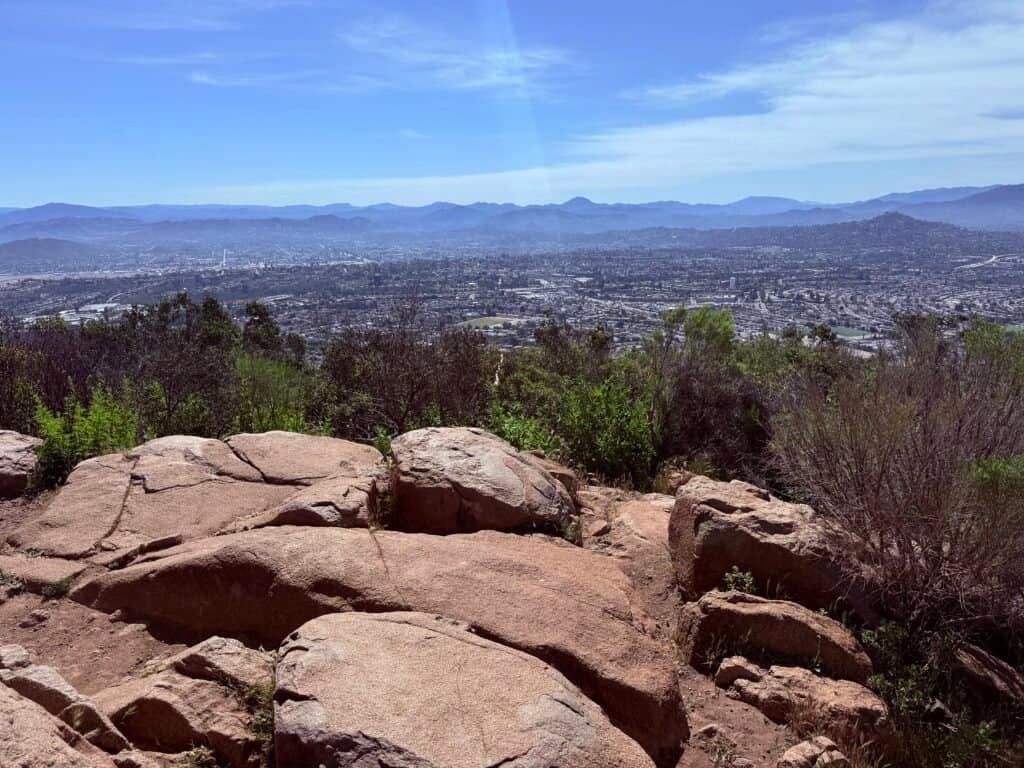
Photo: View from Cowles Mountain – near the Radio Towers.
But the real shift happens once you leave Cowles behind.
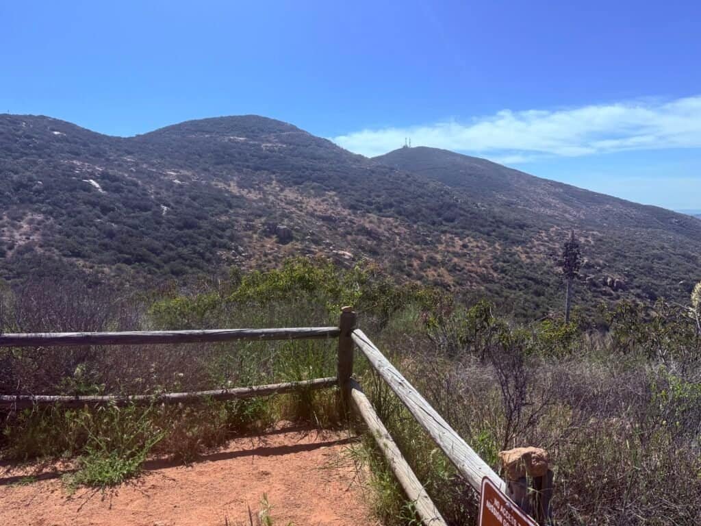
The trail drops away in a long series of switchbacks, pulling you down into a shallow valley before climbing again toward Pyles. It’s a familiar Mission Trails rhythm by now—down first, then back up—but the farther you move from Cowles, the more the park opens up.
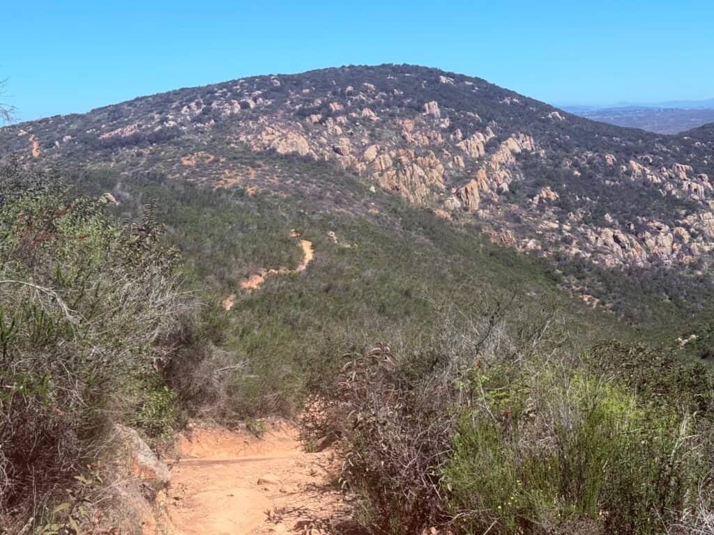
Photos: Looking ahead to Pyles Peak | Looking back at Cowles Mt.
By the time you reach Pyles Peak, even if a few people are around, it’s easy to find your own corner—your own view, your own quiet.

Photo: Pyles Peak Summit Marker with the Fortunas in the background.
It was hot enough that I ended up hiking part of the way with my shirt off, one of those subtle signals that the day is asking a little more from you than expected. I passed a couple of trail runners, moving fast and light, but otherwise it felt unhurried.
I ate a snack at the summit and looked back toward Kwaay Paay and the Fortuna summits, the park quietly reminding me how connected all of this really is.
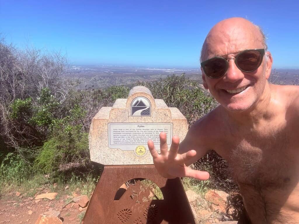
Photo: Summit Selfie – 5th and Final Peak at Mission Trails!
Reward
Afterward, I stopped at Golden Spoon in La Mesa for frozen yogurt—a chocolate/vanilla twist.
Cold, simple, and earned.


Photos: Earn the miles. Enjoy the swirl. 🍦🥾
Cowles may get the crowds and the attention, but it’s the space beyond it—the descent, the valley, the quiet climb back up—that stayed with me. Pyles didn’t feel like an endpoint. It felt like closing a loop.
Date of hike: 10 May 2025
Coming Back With Vicki
South Fortuna → North Fortuna
(November 28, 2025)
In November, I brought my sister, Vicki, back to the Fortuna side and we did South Fortuna first, then North Fortuna—the same rhythm I’d followed before.
For me, this was a return. By this point, I knew the route, the false summits, and where the trail demands your attention. But for Vicki, this was all new. We’d hiked Cowles together before, but she had never been on either of the Fortuna peaks.
That contrast changed the day.
I’ll admit something: I didn’t tell her about the stairs on South Fortuna.
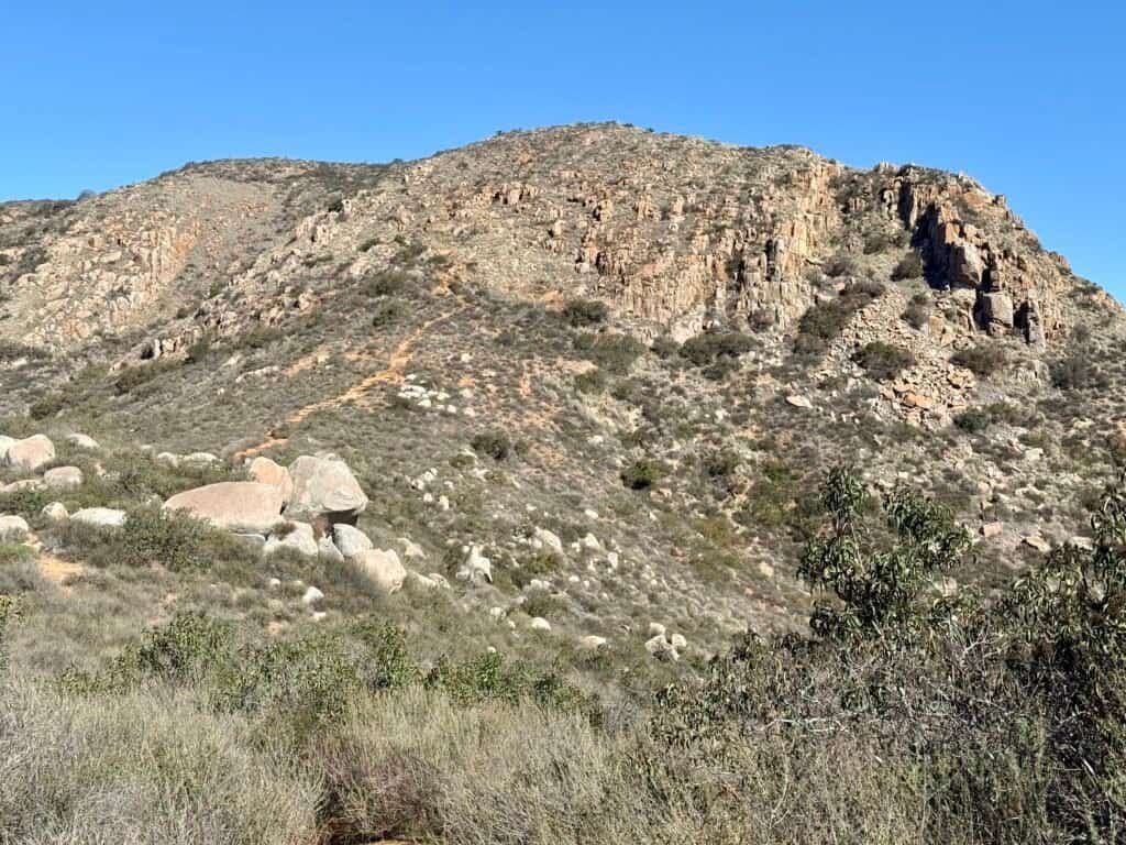
Photo: What I didn’t tell my sister, Vicki.
I knew that if I’d explained that part in advance—the exposure, the height, the way the trail asks for your full focus—she might not have said yes. Vicki has a slight fear of heights, and those stairs can feel a little hairy, especially the first time.
But she made it up.
She stayed focused. She moved deliberately. And once we were past that initial climb, the rest of the day unfolded without issue. Descending South Fortuna and climbing back up North Fortuna didn’t faze her at all.

Photo: Vicki on North Fortuna.
Watching her experience these peaks for the first time—while I moved through them with familiarity—was a quiet reminder of how different the same trail can feel, depending on where you’re standing in your own journey.

Photo: On the way down from North Fortuna, with the summit behind us.
It wasn’t about the mileage or the elevation that day. It was about trust, focus, and doing something hard without overthinking it.
Date of hike: 28 November 2025
Final Thoughts & Trail Notes
What stayed with me most after these hikes wasn’t any single summit. It was the realization that all of this exists right here—in the heart of San Diego. Freeways nearby. Neighborhoods in every direction. And yet, within minutes, you’re climbing ridgelines, dropping into valleys, and working through the same mental negotiations you’d expect deep in the backcountry.
Mission Trails isn’t one hike. It’s dozens of choices, stitched together into a park that lets you decide how hard the day needs to be—and how much you’re willing to give. You can show up for something quick and iconic. You can chase false summits and play games with your own patience. Or you can start linking routes, stacking effort, and slowly realizing you’re capable of more than you thought.
Over time, that’s what these five peaks became for me. Not a checklist. Not a goal to rush through. Just a quiet accumulation of days—some hard, some humbling, some shared—until the park stopped feeling like a puzzle and started feeling familiar.

If you’re new here, my simplest advice still stands:
- bring more water than you think you need
- don’t underestimate the sun (even when it’s overcast)
- and expect navigation to require a little attention at intersections
But more than anything, give yourself permission to keep going—past the first summit, past the obvious turnaround, and past the moment where it would be easy to say, that’s enough for today.
Because as John Muir put it:
In every walk with nature, one receives far more than he seeks.
Mission Trails has a way of proving that—one ridge, one return, one honest climb at a time.
Catch you on the trail.
Discover more from love cook adventure
Subscribe to get the latest posts sent to your email.
Leave a Reply