
The Area & Why This Hike
Set between Lake Elsinore, Temecula, and Menifee, this stretch of Southern California feels like a pocket of open space wedged neatly between growing communities. These low, rugged peaks rise out of the valley almost unexpectedly, creating a small network of trails that offer big views without committing to a full mountain day. It’s the kind of place where you can park, start climbing almost immediately, and still feel removed from the surrounding development.
I knew I wanted to hike somewhere in the Lake Elsinore–Temecula–Menifee area, so I spent some time digging around on AllTrails to explore my options. I seriously considered San Mateo Peak (closer to Lake Elsinore), but it would’ve added at least another half hour of driving — and that was enough to tip the scales. This loop kept standing out, both for its elevation gain and the promise of multiple viewpoints packed into a relatively short distance.
That decision turned out to be the right one.
The Climb Starts Fast
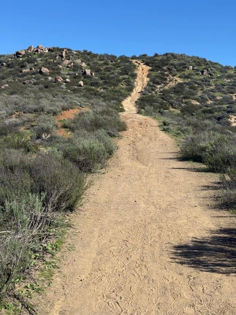
You’ve gotta love California hikes. They don’t always look intimidating on paper, but they waste zero time letting you know what you signed up for.
This one started with a quarter mile straight up — almost 200 feet of elevation gain. Not much, technically. But it was enough to get my attention. (Truth be told, coming off a holiday hiatus, I felt it immediately.) And even then, I knew there was more coming. Still, right out of the gate, I had that feeling: this is going to be a fun hike. I thought it would be good — turns out it was already shaping up to be unexpectedly great.

Photo: Short, steep, and honest — this hike doesn’t ease you in

Photo: Looking back on the initial climb as the trail drops quickly into the valley below. Snow-capped San Jacinto Mountains in the distance
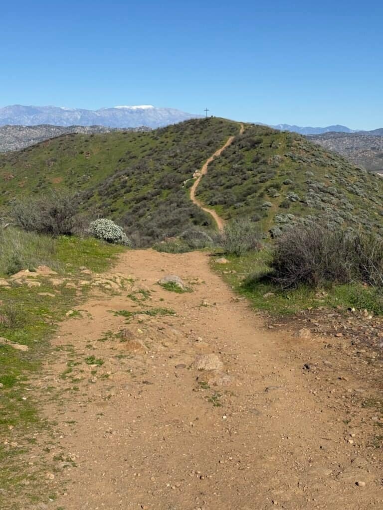
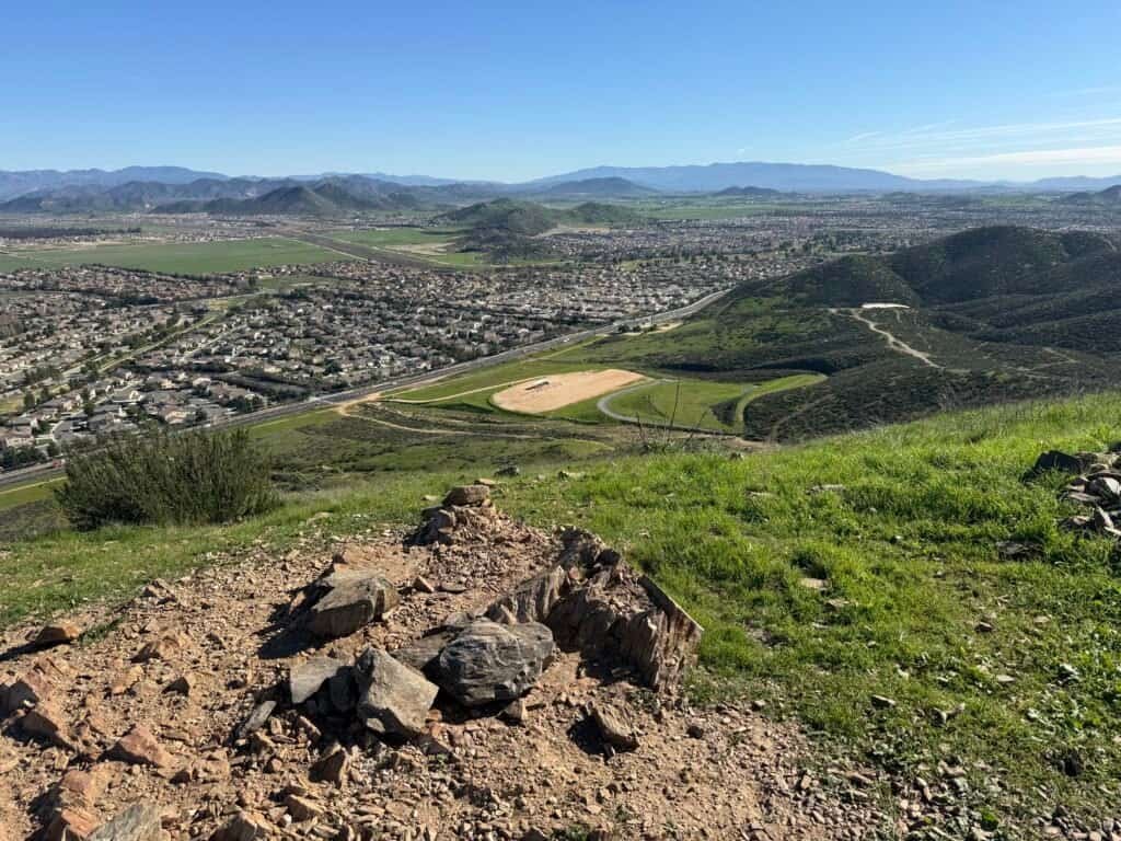
The climb continues until you reach a small plateau — a natural pause point just shy of the half-mile mark. There’s a wooden cross here, not one of the three summit crosses, but it feels like a moment to stop and take stock. From this spot, you get a clear view of the first true summit in the distance, rising ahead as an obvious target. It’s one of those moments where the hike starts to reveal its shape.

Photo: A panoramic view from the first plateau


Photos: Cross on the first plateau | First summit in the distance – next up!
Hitting the First Summit
This is the kind of trail that messes with your head a little — a steady rhythm of uphills followed by short downhills, which really only means one thing: a bigger climb is waiting. There’s no gimmick here. No long flats pretending to be recovery. Just honest elevation, delivered in pieces.
One thing I didn’t fully appreciate going in is that each summit requires a short side trip off the main loop. At the first junction, that becomes obvious quickly. The trail breaks away and climbs directly toward the first monument, forming a small loop of its own — and yes, it’s steep.

Photos: Looking back toward the first plateau | Last push to the first peak
I hadn’t noticed on AllTrails that the first summit loop didn’t really specify a direction. You could go up either side, and in the moment, I just did what felt right. I took the wider route up and improvised a few switchbacks along the way. Highly scientific.
I reached the first summit at 35:23, 1.12 miles, and 674 feet of elevation gain. Like the others on this loop, the monument here is a cross — but this one stood out thanks to a simple plaque that read: “Live to hike. Hike to live.” It felt fitting, especially standing there catching my breath.
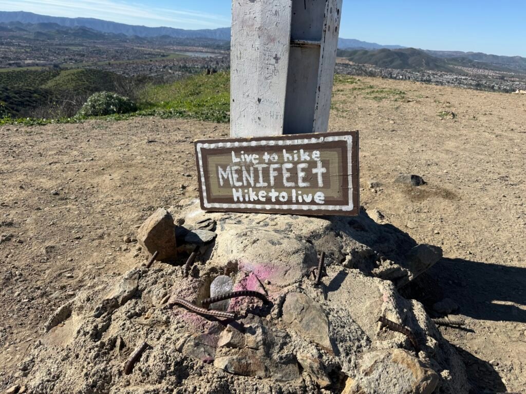
Photos: A simple message at the first summit that fits the day perfectly |
First summit cross — a milestone with plenty more climbing to come
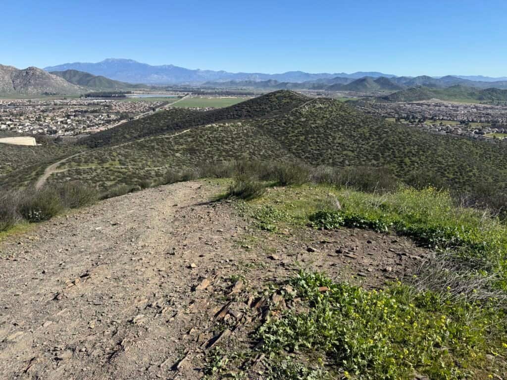
From here, the rest of the route finally reveals itself. The other two peaks are already in view — close enough to feel attainable, far enough to remind you there’s still work to do. The valley stretches out below, and the surrounding ridgelines frame what’s coming next.

Photo: Snow-capped mountains in the distance, an unexpected bonus
Not Choosing the Hard Way
Looking ahead, one trail went straight up toward the second summit — the kind of line that dares you to make a bad decision. Absolutely not. Instead, I followed the traverse shown on AllTrails, wrapping around the base before climbing more gradually.
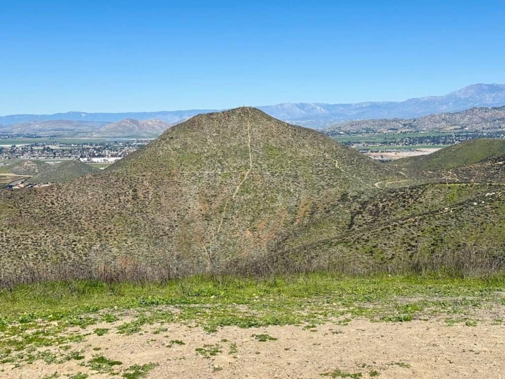
Photo: Looking across at the direct line to summit #2 — not today
This stretch is full of little offshoot trails. At first, it feels a bit chaotic — paths heading in every direction — but most of them reconnect quickly. Still, it was hard not to notice that some of these lines probably exist because people wanted a shortcut, not because the trail needed one. It’s a good reminder that just because a path exists doesn’t mean it’s the right one to take.
And then, out of nowhere, I hit a massive puddle — sitting squarely in the middle of the trail. In this dry, open landscape, it felt completely out of place, like the mountain was messing with me just a little.


Photos: Trail surprise | A good example of all the trail offshoots ahead
The Beast of the Hike
At the next offshoot, I could see the third summit off in the distance, with two hikers making their way to the top. But as I turned around to look at my next task – I paused – I knew this was going to be the biggest climb of the hike.
It was a beast.


Photos: Looking up at the toughest climb of the hike — and back down at the descent waiting on the other side.
This section reminded me of parts of Lake Calavera in Oceanside — wide, open, silty terrain where you know your foot is going to slide. Going up was one thing, but all I could think about was the descent. We’ve all been there.
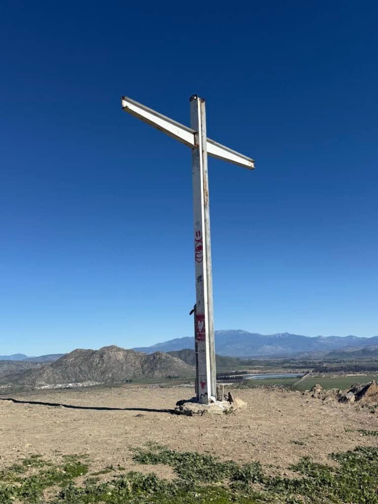
By the time I topped out, I was now at 1 hour, 37 seconds, 1.99 miles, and 993 feet of elevation gain. That last push alone was well over 200 feet.
This summit came complete with another monument – you guessed it – a cross. And two rocks with messages “God Loves You” and “God is Coming.”
The views from here are equally spectacular.


Photos: Summit #2 Cross | Views that stretch forever
From here there is another viewpoint, a short dip down – worth the detour for a few more photos.

Photo: From the second view point – a super short detour
Slow Descents
With summit #2 under my belt, it was time to head down. And honestly? At this point, I really wished I had my hiking poles. This was one of those descents where every step is slow, deliberate, and negotiated.
All I kept thinking was: don’t fall on your ass. It wasn’t about speed — just slow and steady. It took me close to 15 minutes to descend this roughly 0.15-mile section, but I’m happy to report: no incidents.
The Final Summit
On to the third and final summit. The start of this off-shoot trail is — you guessed it — steep. From there, the trail levels off briefly, drops back down, and then asks for one last push to the top.
Photos: The offshoot looks harmless, until you hit the final climb
And finally… the third summit.
I reached it at 1 hour, 19 minutes, 58 seconds, 2.4 miles, and 1,167 feet of total elevation gain. Waiting at the top was a wooden cross — surprise, surprise — along with a simple wooden bench that felt perfectly placed.
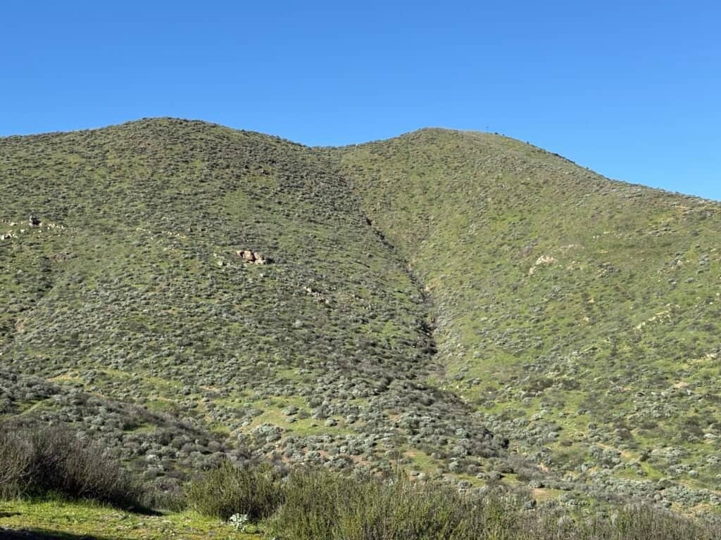
From here, the views open up in a big way. Several lakes come into view, scattered across the surrounding communities, with Heritage Lake standing out the most. You also get a clear look back at the second summit, which makes it very obvious just how steep that climb really was.
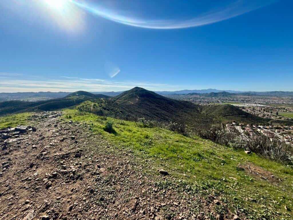
Photo: Looking back toward the second summit — the ridgeline makes it very clear just how steep that climb really was
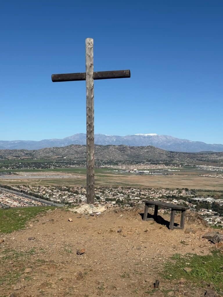
Photos: The cross on the 3rd Summit | Look down towards the parking lot
The Way Back Down
As I started toward the loop back to the parking lot, I chose a different off-shoot trail — more direct and not the steep route I had just climbed. Earlier, I’d watched a woman and her two dogs come up this way, which felt like all the confirmation I needed. It turned out to be a much saner descent, and a good call.
About halfway down, at another flat section, there’s a fourth cross. One last pause, one last view from above, and then it’s downhill to the parking lot. And yes — there are still a couple of steep-ish sections on the way down, the trail’s subtle reminder to bring your poles next time.
I say that as someone wearing trail runners with great traction — just not quite enough for dry, loose silt.


Photos: One last cross | One last look, before the long, careful walk back
Final Thoughts & Trail Notes
Photos: Where it begins, where it ends — and everything in between
All told, I clocked this hike at 3.11 miles, 1 hour, 34 minutes, 45 seconds, and 1,207 feet of ascent. That said, I accidentally turned my Garmin off a couple of times on the descent, so both the mileage and time are almost certainly a bit short of what I actually did.
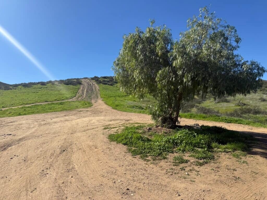
There was plenty of parking at the trailhead, but it’s a dirt lot — more of a cleared patch than anything formal. Probably not where you want to bring a fancy car.
This hike reminded me a lot of Mount Rubidoux — that feeling of an outdoor oasis tucked into a developed area. Mount Rubidoux is far more urban, but the idea is similar.
One thing to be very clear about: there is absolutely zero shade. No trees. None. Bring more water than you think you’ll need.
Despite that, it was quieter than expected. Fewer than ten hikers total, a couple of dogs, and plenty of space to move at your own pace.
Three distinct climbs, constant elevation changes, big open views — and just enough challenge to keep things interesting the whole way.
Catch you on the trail!
Date of Hike: 16 January 2026
Discover more from love cook adventure
Subscribe to get the latest posts sent to your email.
Leave a Reply