sharing my love for philanthropy, cooking, and adventure

Sunrise illuminating the summit glacier on Mount Kilimanjaro, with ice formations in the foreground and a sea of clouds in the background.

Author: Stephen Page 8 of 14

Franconia Notch State Park | New Hampshire

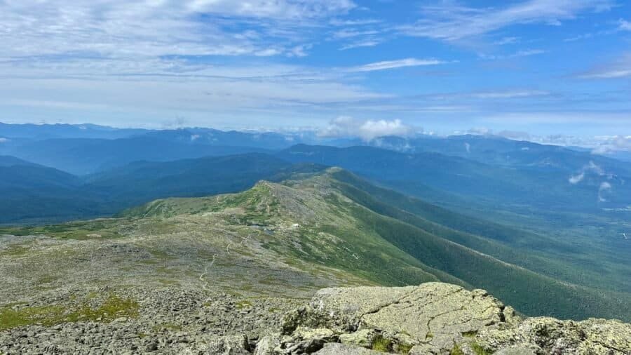
Franconia Notch State Park is located in the heart of the White Mountain National Forest and about 1 hour north of the state capital, Concord, NH. Franconia Notch is a spectacular mountain pass traversed by a unique parkway which extends from the Flume Gorge at the south to Echo Lake at the north. For eight miles, I-93 winds between the high peaks of the Kinsman and Franconia mountain ranges. The park offers a wide range of activities from swimming at Echo Lake to trout fishing at Profile Lake, to riding a bike on the Recreational Trail, to hiking the Appalachian Trail, to camping, and to riding the aerial tramway at Cannon Mountain.

Picture: Map of the different areas of the park along I-93

A tale of two cities….

I decided to start my adventure visiting the famous Flume Gorge. Oh boy – where do I begin?! For starters there is a fee to visit this area – $18.00, plus a processing fee of $1.00! I understand the need to support parks, but I also have a disdain for high park fees, which limit park accessibility to those less fortunate and in my opinion these parks in essence become elitist. You also have to select a date and time for entry. This limits the number of people who are in the area at one time. Anyway, I paid my money and went in, your welcome State of New Hampshire. What I didn’t expect, were the amount of “city folk” in this section of the park, who honestly had a high disregard for the environment around them. More to come on this front.

Picture: Check-In Entrance, and note the sign “about only leaving your footprints”Take Only Photos…”

The trail is a relatively easy 2-mile loop (one-way), with some inclines and stairs, but nothing too difficult. It is a well maintained trail (which I would expect for $19!). So, the first major site is the Great Boulder – it’s a big rock, but there is some history with it.

Pictures: History about the Glacial Boulders | The Great Boulder

Soon after the Great Boulder, the trail begins the one-way direction to the right. Shortly after this turn you’ll see one of the famous covered bridges that New Hampshire is known for, spanning the Pemigewasset River. (Say that 5-times fast!)

Pictures: Covered Bridge | Pemigewasset River

Next up, Table Rock. This is a super cool flat rock that would be awesome to ride down, only if you could!

Pictures: Table Rock

You’re not a model….

Next up the famous Flume Gorge – which I will admit was pretty cool. It was formed nearly 200 million years ago during the Jurassic Period and was discovered in 1808 by 93-year-old “Aunt” Jess Guernsey when she accidently came upon it while fishing. Pretty cool, but enter in the city folk – if I go to one more park and get behind girls who think they are one of the Jenners and decide it’s time for an Instagram photoshoot, I may go postal. And you know the pose they do – they look at the gorge and turn their head back to the camera as if they are a super model. News flash – nobody cares and you’re not!

Pictures: Flume Gorge (sans super models)

As you exit the narrow portion of the gorge, you come up Avalanche Falls. I did take an opportunity to take a selfie – but rest assured, no one waited as I took my picture. (And yes I do look like a super model – lol)

Pictures: Avalanche Falls | My quick selfie

Some cool parts of the “city” (Tale of Two Cities)…

As you continue on the loop, you’ll come across Bear Cave, then cross the Pemigewasset River again.

Pictures: Bear Cave | Pemigewasset River

It was around this point, where I came across the next group of “city folk” – it looked like a couple of families – who were loud, obnoxious and their kids were running everywhere. In reality, I can get past all of this, but there is more to come . . .

I took the short detour to Liberty Gorge – where you can see the gorge and the Pool. The pool is surrounded by 80-foot cliffs, is 150-feet in diameter and 40-feet deep. I bet it would be a great place to swim on a hot summers day!

Pictures: Liberty Gorge | The Pool

As the trail winds around the pool, you cross a covered foot bridge. I waited for the city folk to clear the bridge, which seemed like an eternity.

Pictures: Covered Foot Bridge

Please go back to the city…

The Wolf’s Den was next, which I don’t have pictures of, thanks in part to the city folk. One of the fathers – Mr. Macho in his white tank top and knee-length jean shorts, decided to crawl up through the crack in the rocks – ignoring signs about the fragile eco-system in the area. Way to set a good example for your kids, dude. His wife was half terrified and half amused. Me – I was just thinking – go back to the city.

As you finish the loop, there is view point where you can see Mount Liberty, Mount Flume and Mount Osseo. Then you’ll come across more glacial rocks. I loved the tree growing around one of the rocks.

Pictures: Mount Liberty, Mount Flume and Mount Osseo | Glacial Rocks

I finished up this hike in the visitor center, ate a little snack and headed to the Lonesome Lake Trail.

Lonesome Lake Trail

I drove to the trailhead, which is near the Lafayette Place Campground and has a parking lot. I enjoyed my hike along the Lonesome Lake Trail, but again, ran into some city folk. The trail is 3-miles up, around the lake and back. It has a pretty good elevation change of 1,030 feet, so be prepared for a good cardio workout at the beginning. As you start your hike, you cross the Pemigewasset River, yet again, but at this point it is a much smaller river. You then hike up through the campground, then being the ascent up the hill to Lonesome Lake (cardio workout portion). On your ascent, you will come across some streams that feed into the Pemigewasset River.

Pictures: Pemigewasset River | Stream feeding into the Pemigewasset River

As I hiked to the lake, I was a bit worried as I had read on the park website and there were also signs posted about a portion of the trail being closed around the lake due to flooding. But as I passed other hikers, I asked them where they had been and if any portion of the trail had been closed. I was happy to learn that there were no trail closures. Lonesome Lake is a beautiful lake and away from the noise of I-93, which was nice.

Pictures: Lonesome Lake | Another Selfie

Enter in the City Folk…

The area around the lake is swampy, and for the most part this is not an issue as there are raised “walkways” in the wetter areas. This is generally not an issue and easy to navigate, that is unless you have to pass someone. Hopefully they are polite and wait if you are already on the walkway, but with city folk, that wasn’t always the case. I had more than one standoff on the walkways, but found a way to allow them to pass.

Around the backside of the lake is a camp, and an area that is easy to access the lake and swim. There was a group of girls swimming and they looked like they were having fun. If I were better prepared, I probably would have gone swimming as well.

Pictures: Raised Walkway | Swimming Area

As I rounded the lake, near the area which I thought was closed, I ran into my next group of city folk. It was a group of younger adults with a dog – which I have no issue with – however their dog was a bit aggressive and not on a leash. Don’t get me wrong, I love taking my dog on a hike sans-leash, but when I would come upon other hikers, I would put her on a leash. It’s about being courteous to others – in my opinion. I was able to maneuver around the dog as they yelled at it to behave itself.

At this point, I headed back down the hill. On my way through the campground I did pass the bathroom and shower area. I decided to check it out and it was a pretty nice facility. Good to know if I am in the area again and want to camp.

Franconia Notch State Park, despite all the city folk, was a really nice park. Next time, I’d probably explore some of the less traveled trails – those with significant elevation changes and with more distance. (map below) And for those who haven’t visited yet, you need to determine if the steep fee for Flume Gorge is worth it.

Date of Visit: 14 July 2023

Picture: Map showing all the other trails

Lincoln Woods State Park | Rhode Island

Lincoln Woods State Park is about a 15 minutes north of Providence, Rhode Island, and I would definitely classify it as an Everyday or People’s or City Folk Park (for more details on my classification – see my post on Starved Rock State Park). It is a popular getaway for northeastern Rhode Islanders and happens to be Rhode Island’s first state park.

About the Park (from their website)

Lincoln Woods State Reservation started officially on Abraham Lincoln’s birthday, February 12, 1909. Named after the 16th President of the United States, Lincoln Woods was acquired by purchase, gift, and condemnation of farmland and woodlots of the Olney, Arnold, Comstock, and Mitchell families of the Salyersville, Lonsdale, and Quinsnicket areas of Lincoln. Over the years since, Lincoln Woods has grown to 627 acres, which now rim the pond and include playing fields to the south. The facilities have grown and improved to include changing rooms for the swimmers, a snack bar, nature barn, and park administrative and maintenance facilities. With bridle and hiking trails throughout, the basic feature besides Olney Pond which also caters to fishing and boating including swimming, is a circumferential road favored by walkers and bicycle riders. In 1977, the swimming area was dedicated as the Frank Moody State Beach.

Picture: Park Map

My Visit

At the Breakneck Hill entrance, a covered bridge greets parkgoers as they enter the park to enjoy swimming at the freshwater beach, trout fishing, playing ball, hiking, jogging, horseback riding, or just relaxing under a shade tree. There is no entrance fee for the park (if you have read any of my other posts, you know that I am supportive of no fee parks), but permits are required for picnic areas and fields.

Covered Bridge and Entrance

I went on a Saturday in the summer and it was hot, humid and buggy. Definitely not my idea of a great park day – just saying. I hiked a combination of the Les Pawson Trail, which goes around Olney Pond, and the Lincoln Woods Trail which goes around the northern portion of the park, where many of the picnic areas and ball fields are located. In total I hiked 5.5 miles – parts of the trails were paved and other parts dirt – and as I mentioned in my All Trails review – the trails are poorly marked. With that said, it’s not as if you are really going to get lost very easily and we need to call out search and rescue.

First stop – Frank Moody State Beach

I parked near Olney Pond and Frank Moody State Beach was my first stop. It’s not the biggest beach and although somewhat crowded, there was still some open space on the beach. The beach was full of families, kids running around and lots of music playing. The beach area has a large concession stand, bath house, kayak rentals and a nature center. The nature center houses a myriad of live and taxidermized animals that represent the various species found in Lincoln Woods and across Rhode Island. I actually went in the nature center – as I always do – to learn more about the park and what to see. I think two young adults who worked there were thrilled to have someone walk in as they looked so bored. I also think they drew the short straw on assignments and would have probably been outside working. Honestly, I don’t think most of the people who go there, even care about the natural surroundings and what they may find in the park. The concession stand was a surprise as to the variety of food they offered. I didn’t try anything, but it looked good.

Pictures: Entrance to the Beach and Kayak Rental area

Pictures: Concession Stand

Pictures: Beach Area

Picture: View of the Beach Area as I continued around the pond

Why is this an Everyday or People’s or City Folk Park?

So as I continued around the pond – the trail parallels the road and as it was a Saturday – it was crowded with cars and many blaring loud music. So don’t go here if you’re looking for solitude or some peace and quiet. And if you are hiking or walking on the trails or walkways – be prepared for oblivious people and let’s say kid’s that are not the most behaved.

Eventually I connected to the Lincoln Woods Trail, and got away from the crowds for a brief moment. That is until I walked near the ball fields or large picnic areas – many of these areas were filled with large parties, and you guessed it more loud music. Don’t get me wrong, I love music and a good party, and I think this park is conducive to some great gatherings, but I do think there should be some limits on the music decibels.

Pictures: From my hike on Lincoln Woods Trail

As I looped south, I connected again with the Les Pawson Loop and Olney Pond where you get some nice views of the pond. I continued around the pond trying to take as many of the dirt spurs as I could to break it up walking on the paved road.

Pictures: Olney Pond

If I lived in the area, I could see going to Lincoln Woods State Park for a good run, perhaps a swim in the pond or a picnic with friends and family. However, I wouldn’t make a special trip (drive for hours) to visit the park. It’s an everyday or people’s or city folk park.

Date of Visit: 8 July 2023

Panoramic view from the summit of Mount Washington looking across the Presidential Range and the White Mountains in New Hampshire.

Mount Washington | New Hampshire (#11)

Mount Washington is New Hampshire’s highest point at 6,288 feet above sea level, ranking #18 among U.S. state high points and marking my 11th summit on this journey. It’s also one of those places where the mountain itself is only part of the story.

Before getting into Mount Washington, I should acknowledge the long pause in writing. There’s been a lot to catch up on—and if I’m being honest, I think I was procrastinating a bit. I knew this post carried more weight than most, both personally and historically, and I wanted to take the time to get it right.

Gillette Castle State Park | Connecticut

Gillette Castle State Park sits atop the most southernly hill in a chain known as the Seven Sisters and is located 1 hour E/NE of New Haven, Connecticut. The park spans 122-acres, offers hiking trails, picnic areas, river camping, beautiful views of the Connecticut River and tours of the Castle (which I didn’t do). The significance of Gillette Castle State Park lies in the history of the castle and that of the original owner, William Hooker Gillette, noted actor, director, and playwright. The focal point of his effort was a twenty four room mansion reminiscent of a medieval castle. In 1943 the the State of Connecticut purchased the property from the executors of Mr. Gillette’s will, Gillette Castle and the adjoining property with its fine woodlands, trails, and vistas are now administered for the enjoyment of present and future generations. This apparently would have pleased Gillette, since his will gave specific directions to see that the property did not fall into the hands “of some blithering saphead who has no conception of where he is or with what surrounded.” I guess his spirited demeanor is enough to warrant a visit. You can learn more about William Hooker Gillette and the Castle on the state website: Gillette Castle State Park

Pictures: The Entrance | Map of the Park

Pictures: The castle as you walk up from the parking lot.

Pictures: The Connecticut River side of the Castle | The Grand Central Station picnic area

Pictures: Views of the Connecticut River from the Castle Terrace

Nearby is the Chester–Hadlyme Ferry and I enjoyed the hike down to the Connecticut River.

Pictures: The Ferry | View along the Connecticut River

Outside on the grounds, Gillette’s influence is no less in evidence. The trails often follow, over trestle and through tunnel, the actor’s three mile long narrow gauge railroad. Gillette’s own walking paths were constructed with near-vertical steps, stone-arch bridges, and wooded trestles spanning up to forty feet.

Pictures: Both along the Red Trail | A bridge | A bench to stop and enjoy nature

My favorite Trail was the Purple or Train Trail on the east side of the park. There was this uber cool tunnel you had to hike through.

Picture: Uber Cool Tunnel

Overall, I’d categorize this park as your everyday park, it was nice to visit as I was in the area, but I don’t think I would make a special trip to go to the park.

Date of Visit: 6 July 2023

Starved Rock State Park | Illinois

As I continue to travel across the county visiting parks, I’ve come to the conclusion that there are two types of parks for me – destination parks that offer a great outdoors experience and everyday parks that would be great to visit frequently if I lived nearby. Both types of parks may have similar features such as waterfalls, lakes, miles of trails, and picnic areas, but the everyday parks tend to be busier, have more kids and definitely more “city folk.” For me – every day parks are good for trail running or a brisk hike to get my steps in or to take the dog. I’d classify Starved Rock State Park is an everyday park.

Located in Oglesby, Illinois – and about 90 miles or 1 hr. 30 minutes west to southwest of downtown Chicago – Starved Rock was voted the #1 Attraction in the State of Illinois and touts itself as a world apart from anything else in Illinois – with amazing, seasonal waterfalls (an important note as there are times during the year where many of the falls run dry); 13 miles of trails and 18 canyons to explore; and the Illinois River which offers fishing, boating, extraordinary views and great places to relax. The main parking lot gives you access to most of the park, however as go east, there are more parking lots making it easier to access some of the more “remote” canyons. As I pulled into the main parking lot, it became clear to me that this is a popular park – not only were there a ton of cars, but also 10 school buses. Keep in mind it was a Friday in May. I prepared myself for what I was about to encounter. Don’t get me wrong, I think it is great that the kids are getting out and “enjoying” nature, but not was I had prepared for. Oh well, we adapt.

Pictures: The Entrance | Trail Map

So how did the park get its name? It came from a Native American legend. In the 1760s, Chief Pontiac of the Ottawa tribe, was attending a tribal council meeting. At this council of the Illinois and the Pottawatomie, an Illinois-Peoria brave stabbed Chief Pontiac. Vengeance arose in Pontiac’s followers. A great battle started. The Illinois, fearing death, took refuge on the great rock. After many days, the remaining Illinois died of starvation giving this historic park its name – Starved Rock.

The trails in the park are well marked and easy to navigate – you’ll come across boardwalks, stairs, paved trails, and moderate elevation changes. The deeper you go into the park, the more natural the trails become and you may encounter mud and puddles as I did. My first stop and closest site to the parking lot, was the infamous Starved Rock, where you get some great views of the Illinois River.

Pictures: The Legend of Starved Rock | One of the boardwalk and stairs to Starved Rock

Pictures: Views from Starved Rock: Leopold Island No. 1 and The Dam

The path and boardwalk will take you parallel to the river where you will come upon Lover’s Leap Overlook and then the Eagle Cliff Overlook. Both of these overlooks offer similar views of the Illinois River and the Eagle Cliff Overlook gives you a closer look at The Dam.

Pictures: The Dam from Lover’s Leap | A closer view of the Dam | Looking East from Eagle Cliff

Now it off to the Canyons and Waterfalls. I started with Wildcat Canyon and Falls – one of the tallest falls in the park with an 80-foot drop. Unfortunately, it was full of school kids despite the trail map clearly saying, “Swimming and Wading Prohibited,” hence why I took a “waist up” picture of the falls and didn’t include the pool below. Don’t get me wrong, I am all for enjoying nature, but in this case, the park is worried about the long-term damage to the eco-system.

And as you continue through the park, you’ll also come across some amazing rock formations.

Picture: Wildcat Canyon Falls
Picture: One of the many amazing rock formations.

Next up, one of my favorite canyons – LaSalle Canyon. The falls aren’t as high as Wildcat, standing 25′ high, but the canyon is beautiful and I love that you can walk behind the waterfalls. And typically there is water here year round. Tonty Canyon can also be accessed as you go hike up the trail to LaSalle Canyon, however it was closed the day I visited the park.

Pictures: LaSalle Canyon and Falls

I continued down the trail as far as the Hennepin Canyon Overlook where I was able to get a great view of the overlook from below it, by the river.

Picture: Hennepin Canyon Overlook

Hennepin was as far as I could hike due to a trail closure, so I double backed to Lone Tree Canyon, then took the stairs up to the canyon rim. It’s cool to walk along the canyon rims as you get a different perspective of the canyons and waterfalls.

Pictures: The hike up Lone Tree Canyon and Lone Tree Canyon

Pictures: Views of the Canyons and Waterfalls from above.

Overall my hike was 6.6 miles and took 2 hrs. 5 min. with stops. I took a break back at the parking lot, refueled with a couple of energy bars and fortified water, then head down river to the canyons I wasn’t able to reach due to the trail closure.

I parked at the lot between Illinois and Ottawa Canyons. This too was definitely an interesting hike – to start – I ran into a local, walking barefoot and for some reason had to tell me he was headed back home as he thought he left the oven on. Ok? Then a group of guys started hiking in front of me with a boom box (as I mentioned earlier “city folk”), so I went down a different trail. And at one of the waterfalls, I took a picture of a group of older ladies from Wisconsin. They traveled a bit and gave me a wealth of information and some great recommendations for hiking in Wisconsin, the U.P. (Michigan’s Upper Peninsula) and Minnesota.

On this hike, I headed towards Ottawa and Kaskaskia Canyons, where you will first pass under the Council Overhang – an uber cool rock formation!

Pictures: Council Overhang

I decided to go up to Kaskaskia Canyon first. This waterfall is pretty short with a 15-foot drop, but it was peaceful (the boom box guys took a different trail) and quite beautiful.

Picture: Kaskaskai Canyon Falls

Ottawa Canyon Falls was next. This is one of the taller falls at 45′.

Pictures: Ottawa Canyon Falls

Picture: Ottawa Canyon Falls

I headed back and this time there was no one at the Council Overhang. So I got more pictures and took a goofy picture – making it look like I was hanging from the overhang. (well sorta). Despite the crowds, I enjoyed my visit to Starved Rock State Park.

Picture: Council Overhang

Pictures: Council Overhang | Me “Hanging” from the Overhang

Date of Visit: 19 May 2023

Bash Bish Falls State Park | Massachusetts

I have to be honest, after visiting Bash Bish Falls, I was somewhat disappointed. I guess up to this point I had been spoiled with some epic hikes and big parks with numerous activities, view points and sites. So fast forward – I have now visited 20 of the state parks on The Discoverer’s list of the Best State Park in Each State (yes I am behind in writing as Bash Bish is #8), and I’ve realized that there is something unique about each park. Not all parks have a ton of different activities, view points, and sites, nor are they all big. But if you seek out what makes the park unique and perhaps combine it with other parks/sites in the area, it will be worth the visit. This is especially relevant as I write about Bash Bish Falls State Park.

So, I had just finished a great hike at Mt. Frissell – the highest point in Connecticut and I was excited to visit Bash Bish Falls State Park. The park is 424 acres and the main attraction is Bash Bish Falls – the highest single-drop waterfall in Massachusetts – with a dramatic final pitch that drops about 80 feet into an emerald plunge pool. It is adjacent to the 4,000-acre Mount Washington State Forest, as well as New York’s 5,000-acre Taconic State Park – two places to add to your visit.

Picture: Park Map

I had done a little research and learned that the Massachusetts parking area was under construction, so I parked on the New York side – not the end of the world – but adds to the story.

Parking: Where you park determines your hike to the falls.

  • From Massachusetts Parking Lot: (When it reopens) Difficult ability (I can’t attest to this), about 0.6 miles round-trip. It’s shorter, more rugged, and strenuous per the park website.
  • From New York Parking Lot: Moderate ability (it’s really easy in my opinion), about 1.5 miles round-trip. It’s longer and gradual, but rocky and uneven per the park website.

Pictures: Views along the hike up to Bash Bish Falls

As you can see in the above pictures – more and more parks are asking that you refrain from stacking rocks or making cairns and rightfully so. This practice is disruptive to the environment – not only does it cause harmful erosion, but many insects and mammals head under rocks to live, reproduce or escape their predators. Now don’t get me wrong, people have been stacking rocks since the dawn of time, typically for directional or burial purposes. And more recently, park officials began creating them on hiking trails – especially potentially confusing paths – to help ensure hikers don’t get lost. But we shouldn’t be creating them for the sake of an Instagram post. Our future relies on a healthy natural environment and we need to abide by the motto – Leave no Trace!

Picture: Entering into Massachusetts and Bash Bish Falls State Park

The falls are beautiful and I really enjoyed hiking the gorge. It certainly was a relaxing visit and especially welcoming after a long hike up to Mt. Frissell.

Picture: Bash Bish Falls
Picture: Bash Bish Falls and the emerald plunge pool

Pictures: The deep, verdant gorge | Bash Bish Falls and the gorge

Picture: Back to New York

If you’re in the area, it’s definitely worth the visit and there are a ton of things to do in both the Berkshires and the Taconic Mountain Range.

Date of Visit: 12 May 2023

The former Longaberger Company headquarters in Newark, Ohio, a seven-story office building designed to resemble a giant woven basket

quirky find | Newark | OH

This is the first post in a new blog section I’m calling Fun Finds. While most of my travel posts fall neatly into state high points or best state parks, this is where everything else goes—the unexpected stops, oddball places, and things you only notice when you slow down and take the back roads.

Hope you enjoy these as much as I do.

View from the summit of Mount Katahdin overlooking Baxter State Park, Maine

Mount Katahdin | Maine (#10)

I’ve been hesitant to write this post. Not because I didn’t want to relive the experience—but because I’m not sure I fully recovered from it.

Climbing Mount Katahdin took more out of me—physically and emotionally—than any hike I had done up to that point. And yet, it gave me more in return.

The contrast alone was striking. Just days earlier, I had stood on Jerimoth Hill in Rhode Island, a gentle walk to a high point barely rising above the surrounding trees. Now I was staring up at Katahdin—the “Great Mountain”—rising to 5,268 feet above sea level, ranked #22 among U.S. state high points, and marking my 10th high point overall.

Katahdin didn’t just challenge me.
It exposed me.

And I loved it.

Liberty State Park | New Jersey

One of the State Parks that really surprised me was Liberty State Park | New Jersey. With the Manhattan skyline, Statue of Liberty and Ellis Island as a spectacular backdrop, Liberty State Park has got to be one of the state’s most dramatic parks. This 1212-acre State Park is one of newer State Parks – officially opening in 1976 to coincided with bicentennial celebrations. Much of the interior of the park is undergoing restoration due to hazardous material and severely contaminated land as much of the park is situated on landfilled tidal flats. But this shouldn’t be of concern and there is so much to enjoy at the park.

As many of you know, I am pretty passionate about making parks accessible to everyone, and Liberty State Park does not disappoint as there is no entrance fee. I parked at the Freedom Way parking lot and decided to visit the north end of the park first and then work my way south. Once past the parking lot and picnic area, you immediately see the dramatic Jersey City and Manhattan skylines.

Picture: Liberty State Park Map

Pictures: Jersey City skyline | Manhattan skyline with the North Cove in the foreground

The park has a rich history and you will find numerous monuments and memorials as you tour it. I first came across La Vela di Colombo, a two-story sail-shaped bronze monument designed by Gino Gianetti that commemorates the 500th anniversary of the westward journey of Christopher Columbus to America in 1492. The “Sail of Columbus” sits atop a stone base in the shape of a ship and features scenes of Columbus and his travels and was a gift from Government of Italy and the City of Genoa.

Picture: La Vela di Colombo

Next up – the historic Central Railroad of New Jersey Terminal (CRRNJ Train Terminal). From 1892 it was from this ferry/train station that two-thirds of all immigrants arriving at Ellis Island spread out across the US. And by the turn of the century, the CRRNJ Terminal accommodated between 30,000-50,000 commuters per day on 128 ferry runs and 300 trains. Still standing today are the Bush train sheds, housing 20 tracks and at the time the largest one ever built and the Communipaw Terminal, designed in a Richardsonian Romanesque style by architects Peabody & Stearns of Boston, Massachusetts and completed in 1889.

Picture: The Bush Train Sheds

Pictures: Historic Train | The Communipaw Terminal

As you come around the Bush Train Sheds, you are immediately struck by The ‘Empty Sky’ 9/11 Memorial. It’s the official State of New Jersey Memorial that honors the memory of the 750 people that lived in or had ties to New Jersey that lost their lives at the World Trade Center, the Pentagon, and Shanksville, PA on September 11, 2001

The names are placed randomly on the twin brushed stainless steel walls. Individuals’ names (4 inches tall) are within reach and engraved deep enough for hand rubbing. The memorial, designed by Jessica Jamroz and Frederic Schwartz, was dedicated on September 11, 2011, the 10-year anniversary.

The brushed stainless steel twin walls are 210 feet long, the width of each side of the World Trade Center Towers. They rise 30 feet, standing parallel to each other with a 12-foot wide paved path of bluestone between them. Like the World Trade Center, the stainless steel reflects the constantly changing light of day. The memorial invites visitors to literally and metaphorically look toward the empty sky in memory and look forward as a community.

Picture: The ‘Empty Sky’ 9/11 Memorial

Pictures: The ‘Empty Sky’ 9/11 Memorial

Picture: The ‘Empty Sky’ 9/11 Memorial

From the front of the CRRNJ Terminal, you can take a walk along the 2-mile Hudson River Waterfront Walkway. From the terminal you can also take a ferry to the Statue of Liberty and Ellis Island. As you walk along the waterfront, you will first pass Ellis Island then Liberty Island and the Statue of Liberty.

Picture: Ellis Island
Picture: Statue of Liberty and Liberty Island

At the southern end of the park is Black Tom Island and another monument – the Liberation Monument which commemorates the Holocaust and the role of the United States in preserving freedom and rescuing the oppressed. The memorial depicts an American soldier carrying a Jewish concentration camp survivor.

Pictures: The Liberation Monument

Picture: The Manhattan skyline with Ellis Island in the foreground

I finished up my visit with a walk through the Green Ring and Crescent Field. Liberty State Park is a great place for a run, to walk, to picnic and to enjoy spectacular views of the Manhattan skyline, Ellis Island and the Statue of Liberty. I would highly recommend a visit if you are in the area.

Date of visit: 11 May 2023

Picture: The Green Ring

Blackwater Falls State Park | West Virginia

Blackwater Falls lives up to its hype as one of the most photographed and visited sites in West Virginia! It was, yet again, the perfect “storm” of events – I stayed on site at the Blackwater Falls State Park Lodge, the leaves were starting to turn color, the hikes were amazing, and the scenery breathtaking.

Picture: Sign in The Lodge

About the Park – Located in the Allegheny Mountains, Blackwater Falls State Park is named for the amber waters of Blackwater Falls, a 57-foot cascade tinted by the tannic acid of fallen hemlock and red spruce needles. The falls, along with a few of the park’s other features like Elakala Falls, Lindy Point and Pendleton Point Overlook, are some of the state’s most photographed spots. Visitors can enjoy the scenic views year-round by taking the steps to the falls, using viewing platforms or hiking the 20 miles of trails the park has to offer.

Picture: Trail Maps and Sites

The Lodge was nice, comfortable and clean – it was originally built in the 1950’s and since then has been renovated. There is a restaurant called the Smokehouse – and as you can guess – heavy on meat, but even this pescatarian was able to navigate the menu. However, it was unfortunate that they were understaffed for the volume of people and the restaurant itself needs a makeover. The space is also very awkward and cavernous in my opinion.

Pictures: The Lodge | A King Room overlooking the Canyon

Pictures: Views from the back of The Lodge

The next day was dedicated to hiking. Elakala Trail was first hike – a modest 0.5 mile trail where you pass by Elakala Falls. The trail starts at the south end of Blackwater Lodge, bridges the upper section with a great view of Elakala Falls, continues along the canyon rim and ends at the main park road across from Balanced Rock Trail. And as a surprise to those who know me well, I did not check-in to win prizes. I must have been off my “challenge game” that day!

Pictures: The WV Waterfall Trail Challenge | Elakala Falls from the top

Picture: Elakala Falls

I continued on to Balanced Rock Trail – a 1-mile trail that is somehow marked as somewhat difficult to difficult by the park service – but I am not sure if I would go that far. The trail crosses Shay Trace and Red Spruce Riding trails, continues to Balanced Rock and ends near Cabin 13 and Park Forest Road. One of the things I learned about West Virginia is that the state flower is the Rhododendron and this was evident as I hiked Balanced Rock Trail – rhododendrons were everywhere. At the end of the trail there are a couple of surprise – a large Field of Cairns – if you build it, they will come – and of all things a pay phone. I guess because cell service is spotty, there’s an option to call home ET – provided you have exact change. Wow – two movie references back to back!

Pictures: Balanced Rock Trail

Picture: Balanced Rock

Pictures: The Field of Cairns

Picture: Phone home ET

From here, I took a short walk up Park Forest Road until it connected to Shay Trace Trail. If you go left on Shay Trace you will end up at the base of the sled run, and if you go right – which I did – you will end up back at The Lodge. Along this trail you’ll cross Shay Run – the stream that flows over Elakala Falls that will give you a real sense of the amber waters in the area. I finished this hike at The Lodge for a total distance for this hike 2.4-miles.

Picture: Shay Run

Next it was off to Lindy Point Overlook. I drove there from The Lodge and decided to stop by the Sled Run and Nordic Center. Although not much to see at the Sled Run and Nordic Center, it was cool to see both. Back in the car and up to the small parking lot at the Lindy Point trailhead. Lindy Point Trail is an easy 0.7 mile out-and-back trail that sits at 3,000 feet and ends up overlooking the Blackwater Canyon. It was a bit wet and muddy the day I was there, but well worth the drive and short hike as you can see by the spectacular views.

Pictures: Views from Lindy Point Overlook

Picture: Blackwater Canyon from Lindy Point Overlook

From Lindy Point, I drove back into the park past the Lodge to the parking area across from the maintenance area and the Gentle trailhead. Gentle Trail is a short – 0.25 mile out-and-back – paved path to an observation deck overlooking Blackwater Falls. You quickly realize why this park is so popular and why it is one of the most photographed places in West Virginia when you see the falls from the observation deck. You can also see the leaves had started to change and I can only imagine how amazingly beautiful this place would look in a couple more weeks when the leaves are in full color.

Pictures: The Gentle Trail | Blackwater Falls from the observation deck

Picture: Blackwater Falls

Next, I took a shirt drive across the canyon, over the Blackwater River – where the amber color is even more deep and intense – to the Trading Post parking lot.

Picture: The Blackwater River and its deep amber color

The Blackwater Falls Boardwalk Trail starts at the Trading Post parking area and leads to a stone patio and boardwalk more than 200 steps down to an observation deck beside Blackwater Falls. This is the main viewing area for the falls and you get a pretty awesome view of the falls. On the way back up, I stopped at the upper viewing area for another view of the falls, then took the trail to the left (not sure if it has a name) back up to the parking lot versus going up the stairs. The total distance for the loop is about 0.5 mile and you get a good aerobic workout on the way back up.

Picture: Blackwater Falls from the lower observation deck
Picture: Blackwater Falls from the upper observation deck

My next stop was Pendleton Point Overlook. It’s a short drive from the Trading Post parking lot, but as I felt like I was jumping in and out of the car, I decided to hike there. So I crossed the Blackwater Falls Road and up Picnic Acres Road to the Spudder Track Trail. In the winter time this trail is part of the beginner loop for cross country skiers. The trail goes behind the vacation-style cottages and by a picnic shelter, before you get to another parking area for Pendleton Point. It wasn’t the most scenic trail and only about 0.5 mile, but I did see some deer along the way.

Pictures: Someone has an itch | She didn’t like the fact that I interrupted her scratching

Finally it was out to Pendleton Point – a short 0.2 mile out and back trail. From Pendleton Point you get another breathtaking view of the canyon and you can see the Lodge across the canyon.

Pictures: Blackwater Canyon from Pendleton Point

Picture: Blackwater Falls State Park Lodge from Pendleton Point

The end of the hike was a bit anti-climatic as I walked along Blackwater Falls Road back to the Trading Post parking lot – about 0.5 mile. Total distance for this hike, including going down to the observation decks was 2.25 miles. All in all – a great experience, an amazing park and I’d highly recommend a visit!

Date of visit: 3-4 October 2022

Page 8 of 14

Powered by WordPress & Theme by Anders Norén