Black Mesa: Only 300 Feet Short of Katahdin… and About 300% Easier
At 4,973 feet, Black Mesa is the highest point in Oklahoma, ranked #23 among all U.S. state high points and my own #37. Tucked into the far western tip of the Oklahoma panhandle, it sits closer to New Mexico and Colorado than to most of its own state — the kind of place you don’t casually pass through unless you really meant to be there. Luckily, a cross-country drive from San Diego to Nashville created the perfect excuse to finally check it off.
Remote Roads and Big Skies
I stayed the night in Springfield, Colorado, a small town about an hour from the trailhead. On the map, the route looked straightforward. But what the map doesn’t tell you is that for about eighteen miles, the road turns into a classic Colorado county road — dirt, rock, washboard, and the kind of terrain that turns your confident “should be an hour” into a humbling “why am I only going 38 mph?” pretty quickly. That stretch cuts straight through working ranchland, so you find yourself easing past grazing cattle with the windows down, dust in the air, and nothing but open range and big sky for company.
Crossing that state line into Oklahoma adds another twist: you slip from Mountain Time into Central Time, quietly losing an hour without realizing it. And if you’re using Google Maps, make sure you navigate to Black Mesa Nature Preserve — not Black Mesa State Park — because only one of them leads to the actual high point.
Despite the remoteness, or maybe because of it, the approach feels like an appetizer for what’s ahead: wide-open space, silence, and a landscape that hasn’t changed much since the first settlers crossed it.
And with this summit done, I’m down to just two remaining high points under 10,000 feet — White Butte in North Dakota and Black Elk Peak in South Dakota — both waiting somewhere out on future adventures.
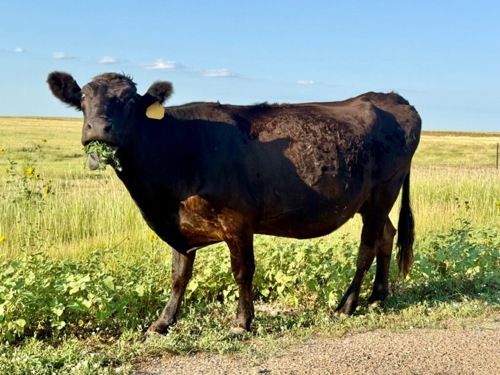
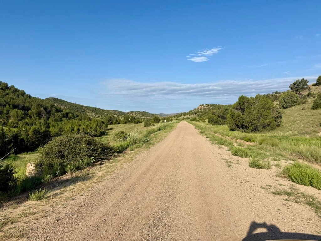
Photo: One very unimpressed cow. | The “scenic route” to Black Mesa
Trailhead Surprise: An Unexpected Hiking Partner
As I got closer to the trailhead, I noticed a car ahead of me catching the morning sun. I assumed it was someone who lived nearby — probably a rancher or one of the folks from the houses I’d passed. But when I pulled into the parking lot, that same car was still there… and instead of a local, a guy was lacing up his boots and getting ready to hike.
His name was Robert, from Boston, working on his 14th state high point.
We started chatting as we looked over the trailhead signs, comparing notes on high-pointing and swapping stories. Since we were the only two people out there, I asked if he wanted to hike together. Before we started, I gave my standard pre-hike line: “If you ever want to speed up or slow down, just let me know. No pressure.” He was totally on board, so we headed out.
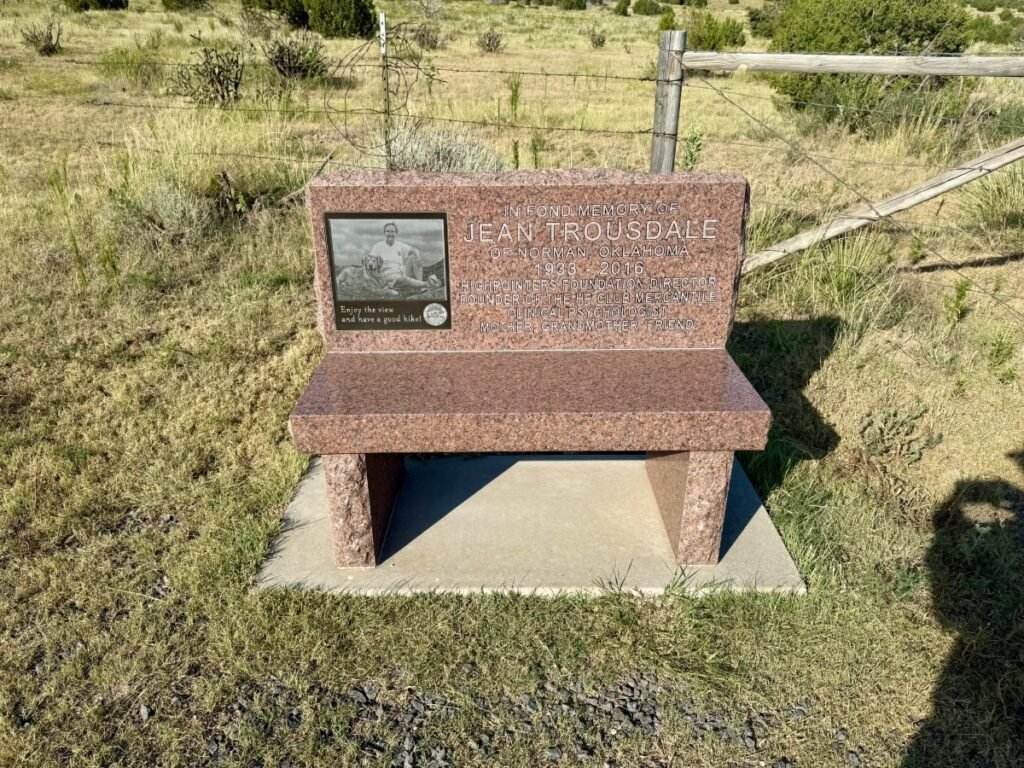
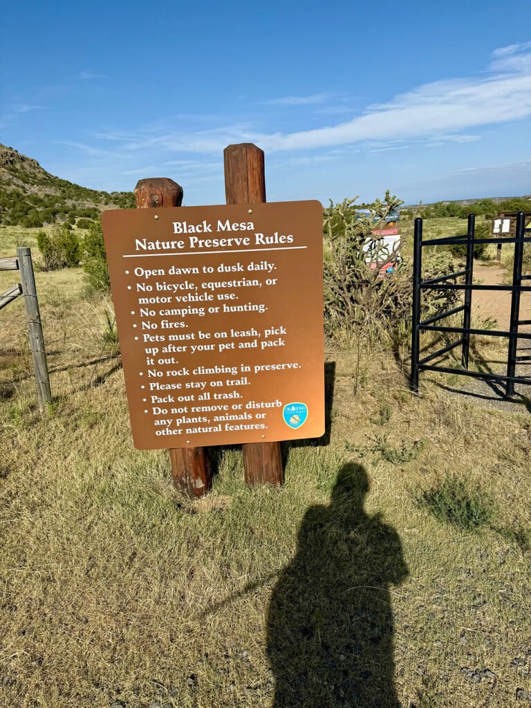
Photos: Black Mesa trailhead sets the tone — simple rules, memorial bench.
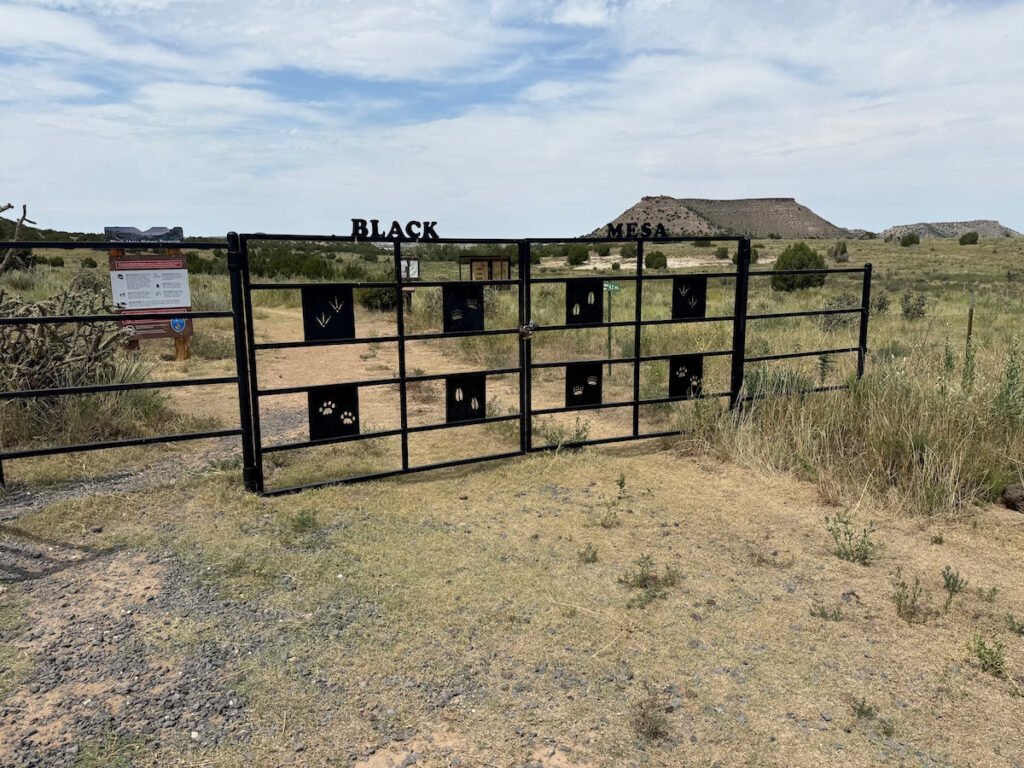
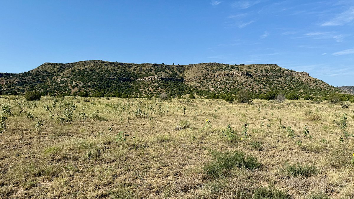
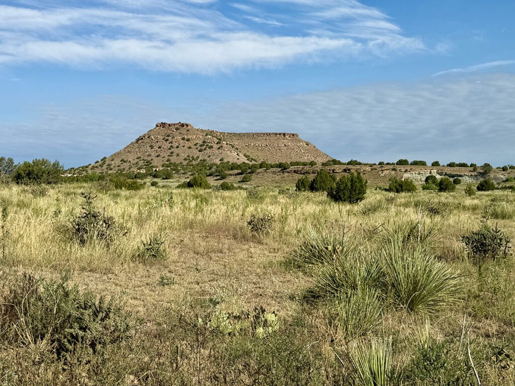
Photo: A gate opening into miles of open desert and quiet mesas.
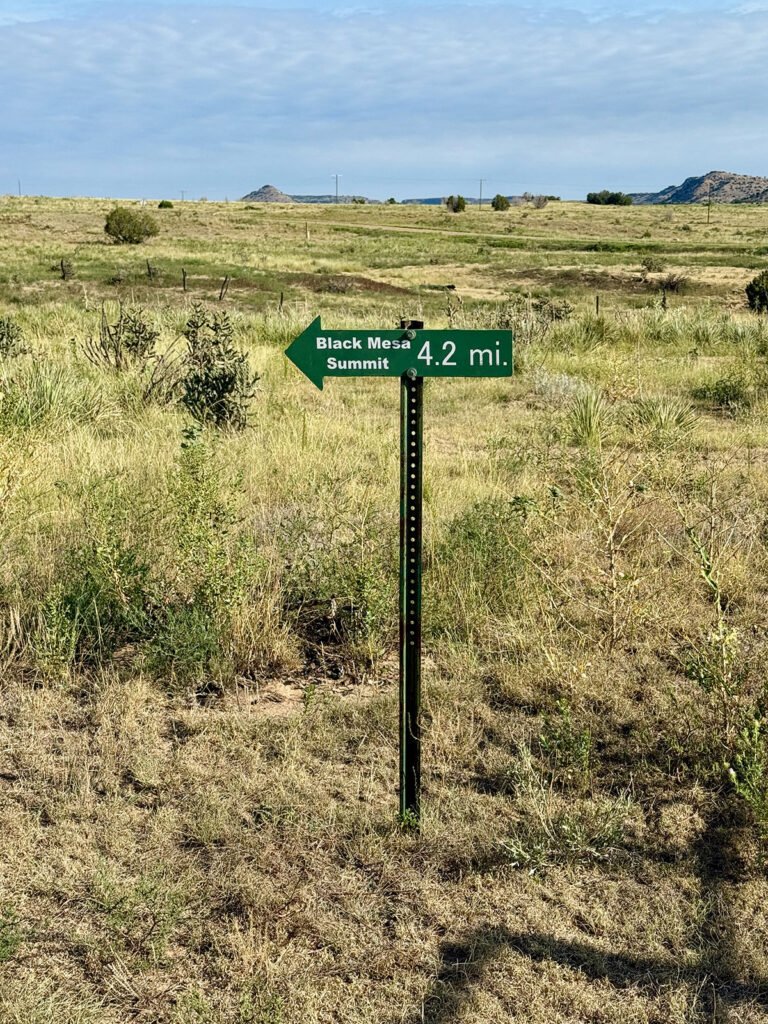
Photos: Trailhead markers getting things started — mileage, maps, and a little preview of what’s ahead.
Once we got moving, we fell into the same pace and the conversation just kind of took off. We even ended up talking about Boston — he was from Attleboro, and my family actually has roots there from way back. Before long, the miles were going by pretty quickly.
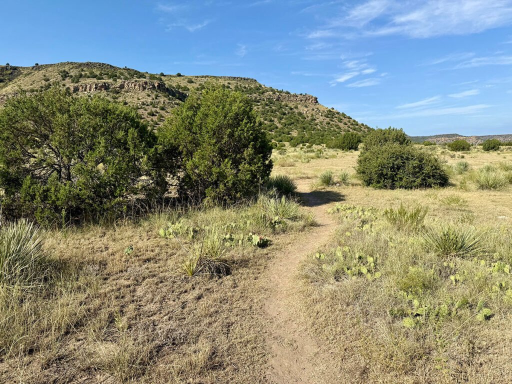
Photos: Early miles were easy cruising with big views.
Later, we found out something even funnier: we’d both stayed at The Cobblestone Inn the night before — in the two quirky rooms over the lobby with their own little corridor and step-up. As two people who travel a lot, those rooms definitely stood out, and the fact that we ended up right next to each other made it even better. We checked in about fifteen minutes apart and even missed each other at breakfast. Apparently, we were bound to meet on the trail either way.
The Hike: Long, Exposed & Quietly Beautiful
Black Mesa is about an 8.7-mile round trip with roughly 777 feet of elevation gain. It’s an easy-to-moderate hike overall, but it’s definitely exposed with little shade — just a few trees and those covered info shelters. It was in the mid-to-high 80s when we were out there, warm but still totally doable.
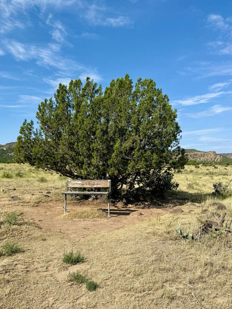
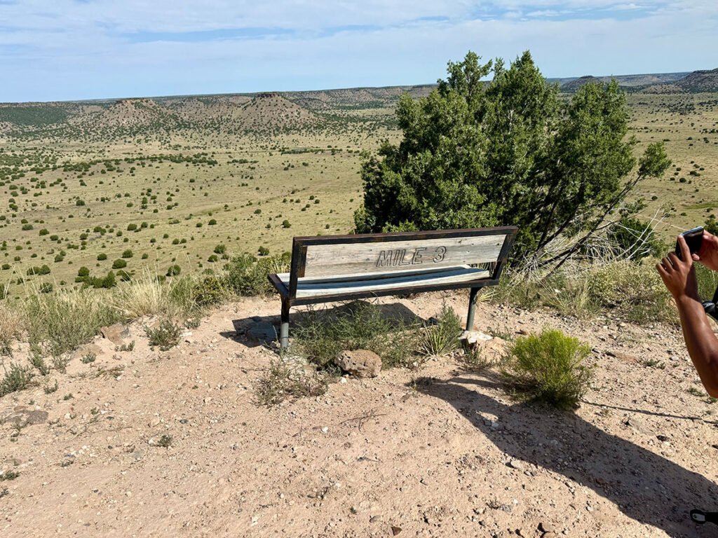
Photos: Bench at mile 2. No thanks — feeling strong | Black Mesa ahead.
The preserve is impressively well maintained, with benches at nearly every mile marker and informational signs that dive into the area’s geology, history, and wildlife. About halfway to the summit — just before the climb onto the mesa begins— there’s a wooden box stocked with bottled water and a small first-aid kit. It’s a thoughtful safety net in a place where heat becomes a real threat. In fact, the preserve doesn’t hesitate to close the trail during extreme temperatures; just a few days before our arrival, it had been shut down due to 100–105° heat for 4 days straight.
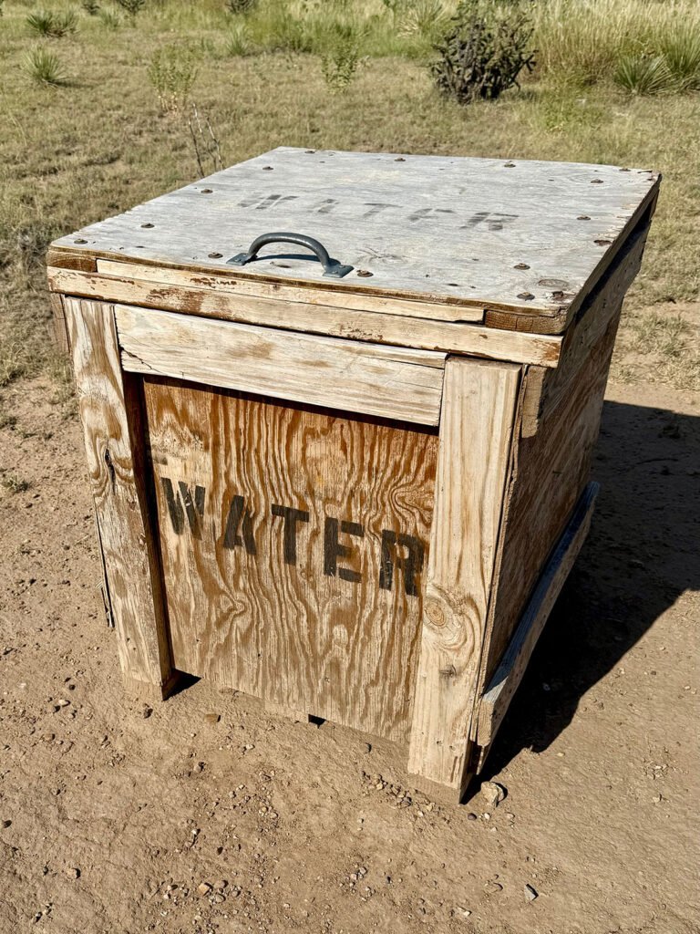
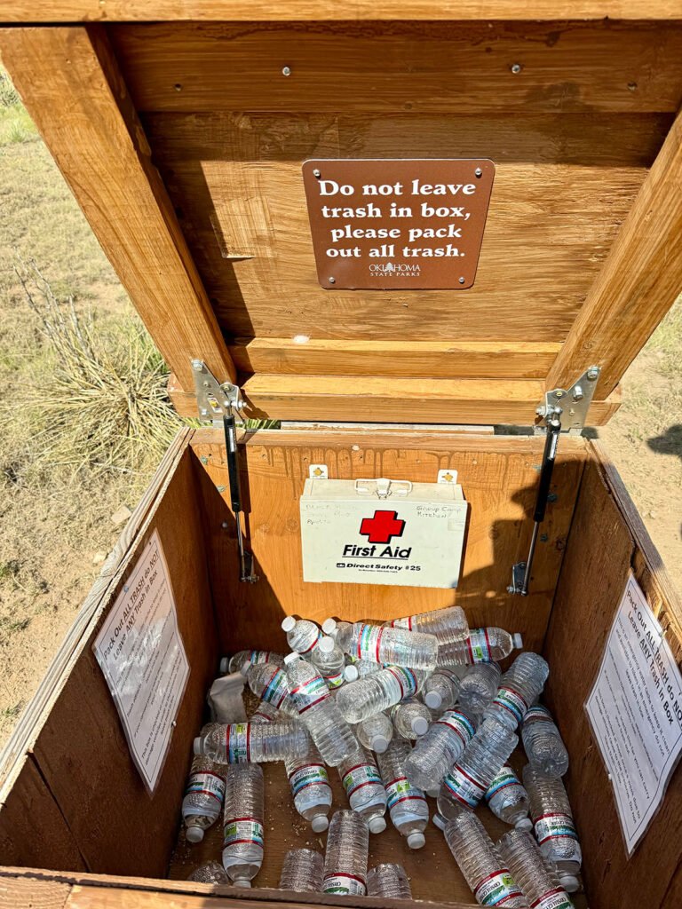
Photos: The halfway hydration station — Black Mesa’s polite way of saying, “Did you seriously bring enough water?”
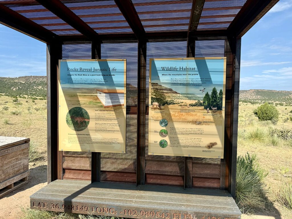
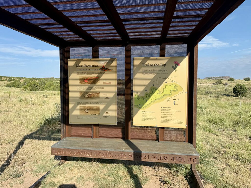
Photos: At the halfway point, you get geology lessons, wildlife facts, and one last flat stretch before the trail starts heading uphill.
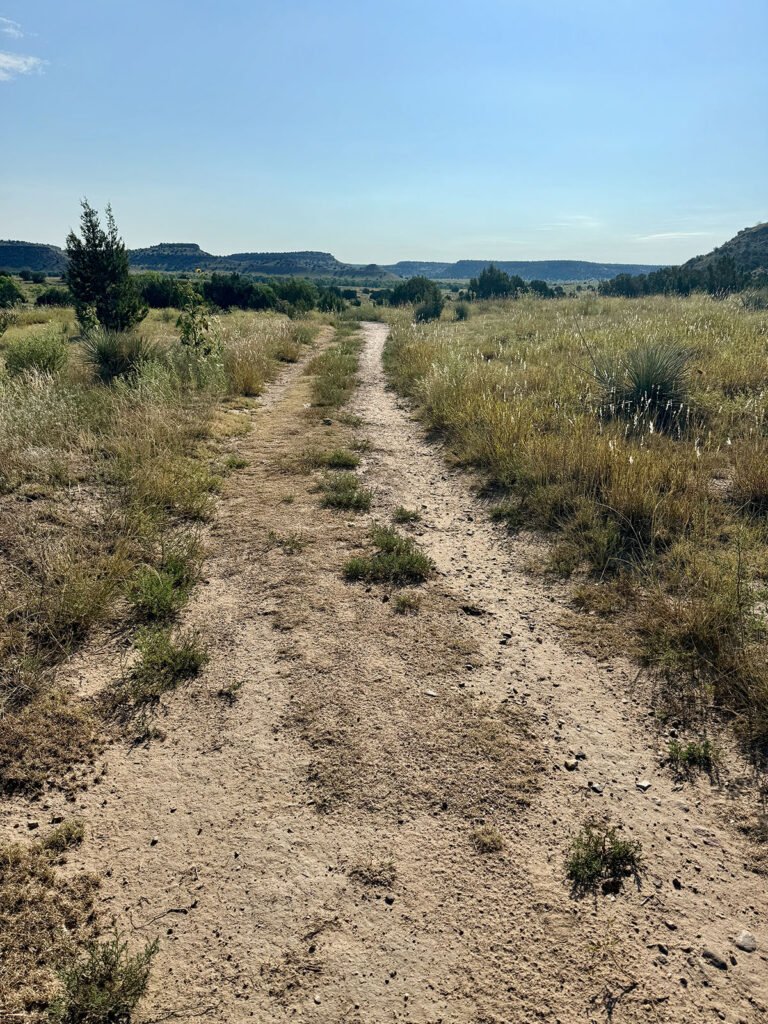
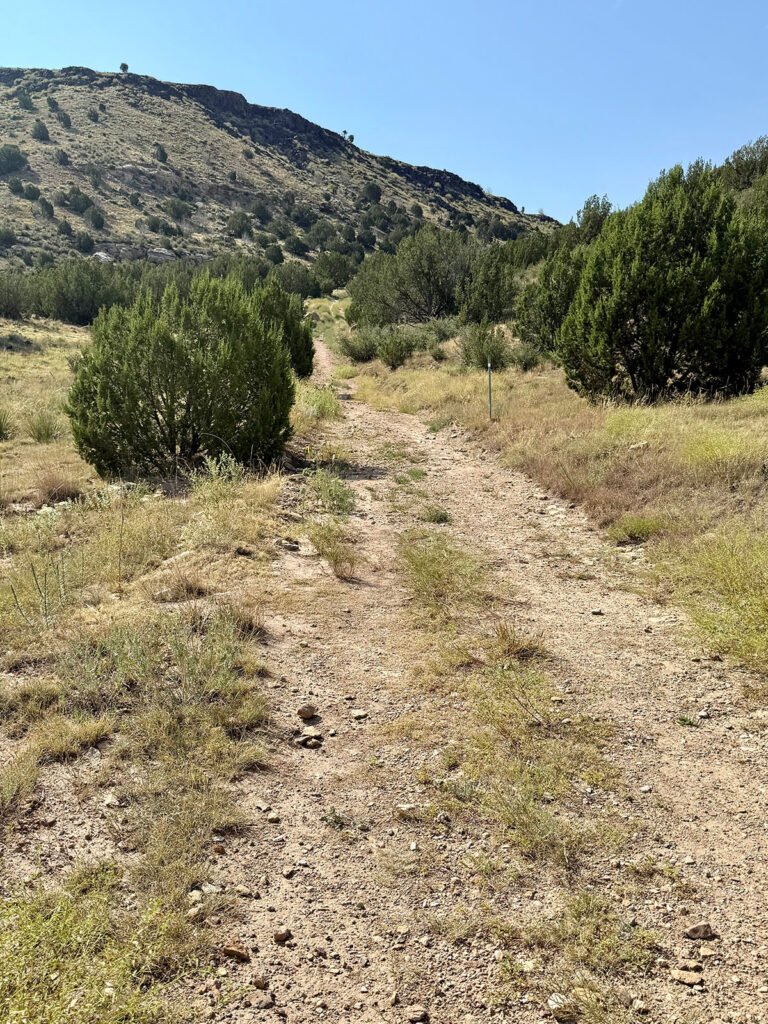
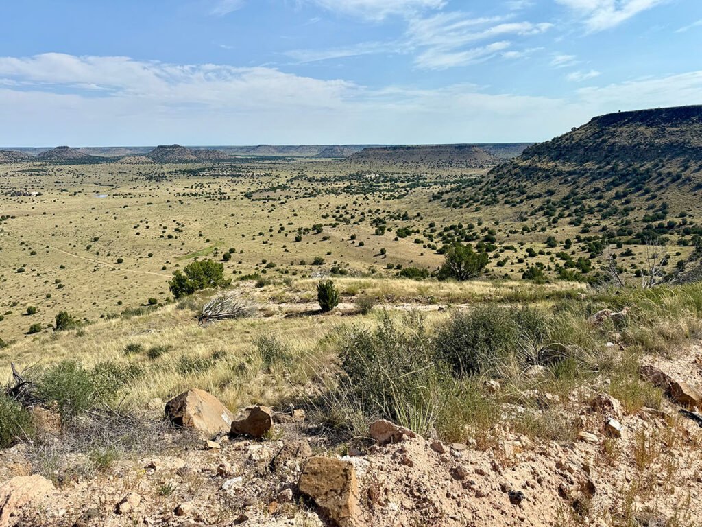
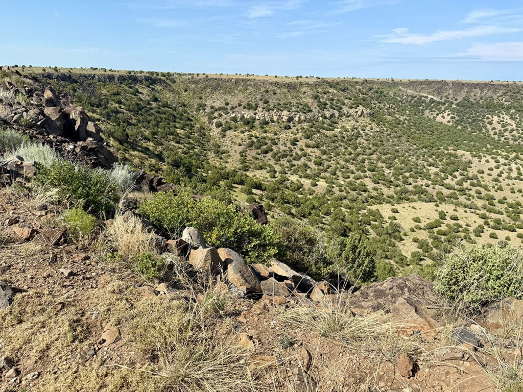
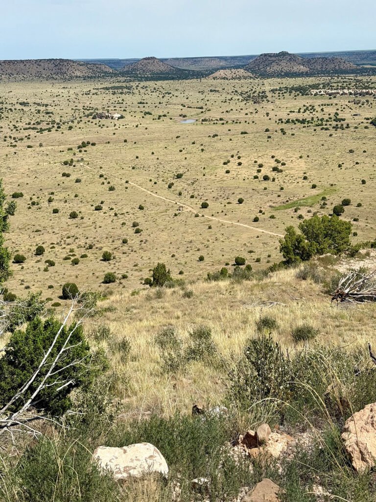
The first few miles are flat and wide open, offering panoramic views of the surrounding mesas. Most of the elevation comes in a single, steady climb from mile two to three, where the trail pushes up onto the mesa. Once you’re on top, the landscape shifts into a long, flat walk across a wide desert plateau.
Photos: The climb up wasn’t bad at all — reached the mile-3 bench with plenty of juice left in the tank!
Wildlife Encounters: Two Texas Horned Lizards & Zero Rattlesnakes
Given the desert environment, I spent a good portion of the hike scanning for rattlesnakes. But none appeared on this trip.
Instead, on the descent, just as we neared the water station, we spotted a Texas Horned Lizard perched on the dirt, perfectly still and surprisingly photogenic. A little farther down, we saw another — much more camera-shy. Those two sightings ended up being some of the best moments of the day.
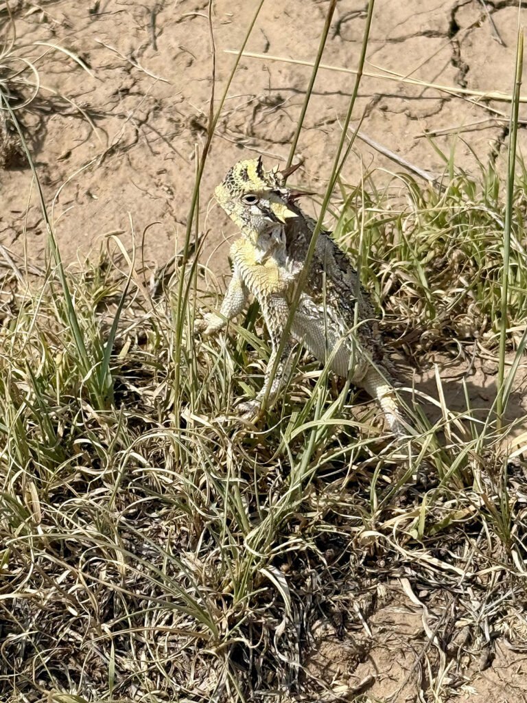
Photo: One of the day’s MVPs: this Texas horned lizard who stopped to strike a full-on glamour pose.
A Summit of Subtle Drama
Once you reach the top of the mesa, the landscape opens up dramatically, with the horizon stretching in every direction. It’s the kind of view that makes it easy to imagine what settlers saw when they crossed this region more than a century ago — vast, open, and untouched.
Photos: Looking off to the High Point | The Trail on top of the Mesa
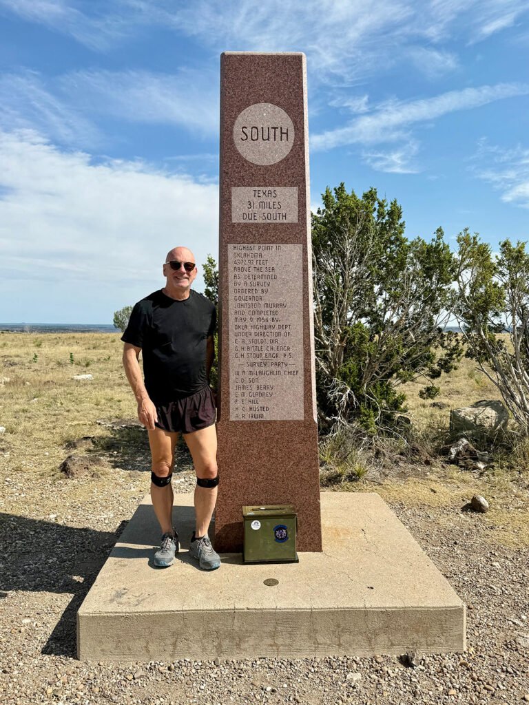
The summit itself is marked by a stone obelisk standing proudly in the middle of the mesa. At its base, there’s a USGS survey marker and an old ammunition box containing the summit register.
The obelisk notes the distance to neighboring states:
• Texas: 31 miles south
• Kansas: 53 miles east to northeast
• Colorado: 4.7 miles north
• New Mexico: just 1,299 feet west
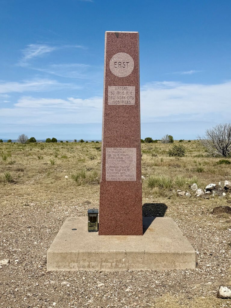
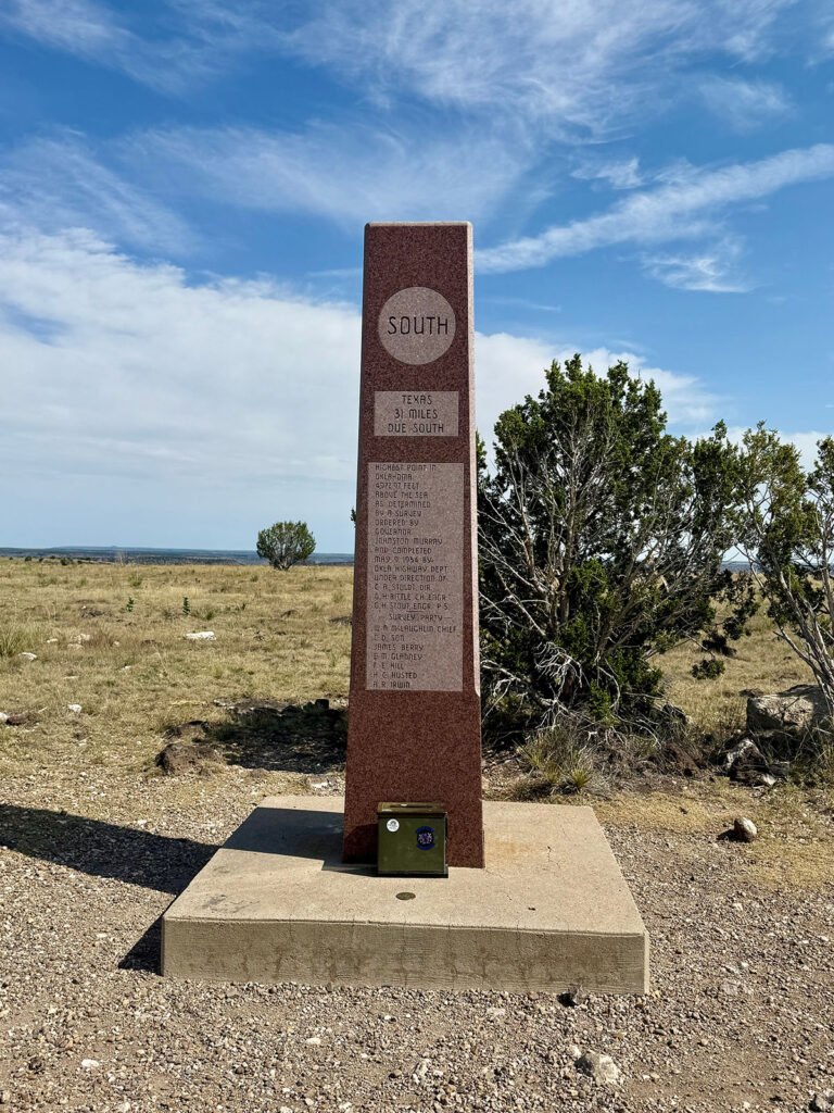
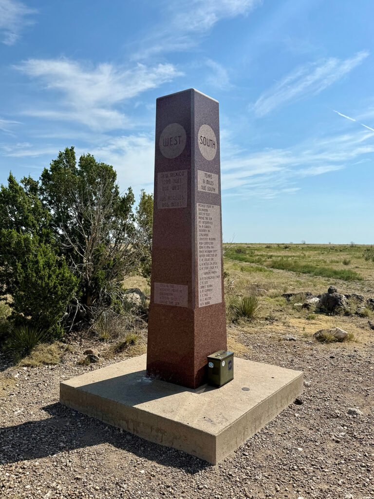
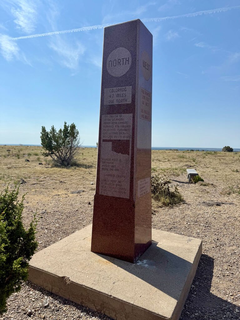
Photos: The summit obelisk marking the high point of Oklahoma.
It’s one of the few high points where you can stand in one place and feel the geography of four states pressing in around you.
We took photos for each other, signed the summit register, drank some water, and soaked in the quiet before starting the long, easy walk back.
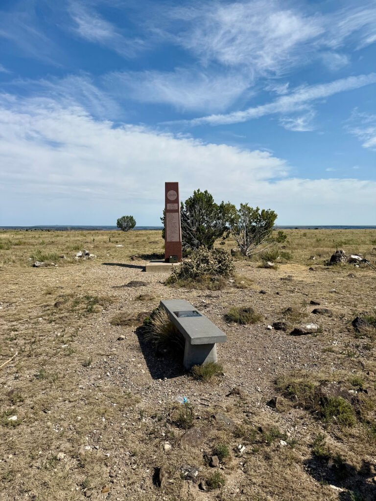
Photos: Summit Area | No Summit Selfie Today! But a Summit Shot with the obelisk, USGS marker, and the little green register box.
The Descent & A New Hiking Connection
The descent was peaceful, with only a few hikers heading up and long stretches where it was just the crunch of our footsteps. The desert heat radiated across the landscape, but the miles were easy. Along the way, Robert mentioned wanting to summit Kilimanjaro someday, a climb I’ve done twice, and I encouraged him to go for it. Later, he told me he’s planning for 2027.
He was heading to Colorado next to attempt Mount Elbert, still on my list, while I continued east toward Nashville. Before parting, we exchanged information and made a pact: if either of us is tackling another high point and timing works out, we’ll try to meet up again. A hiking partnership born entirely by chance — but one that made Black Mesa far more memorable.
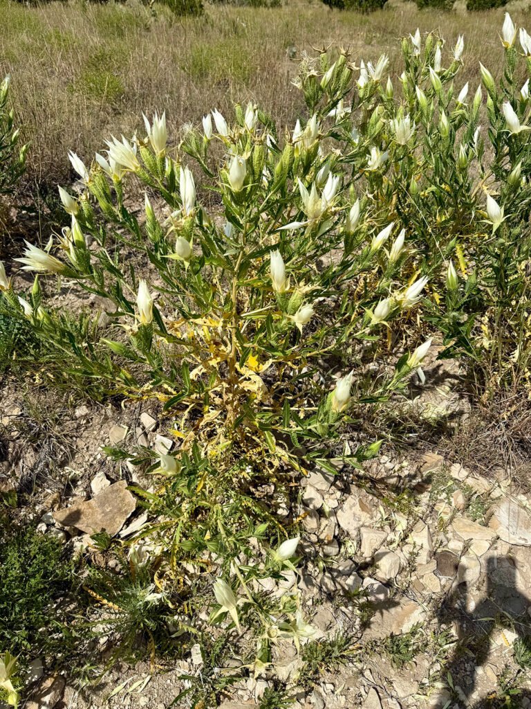
Photos: Heading down, the trail fading away | Ten-petal Mentzelia
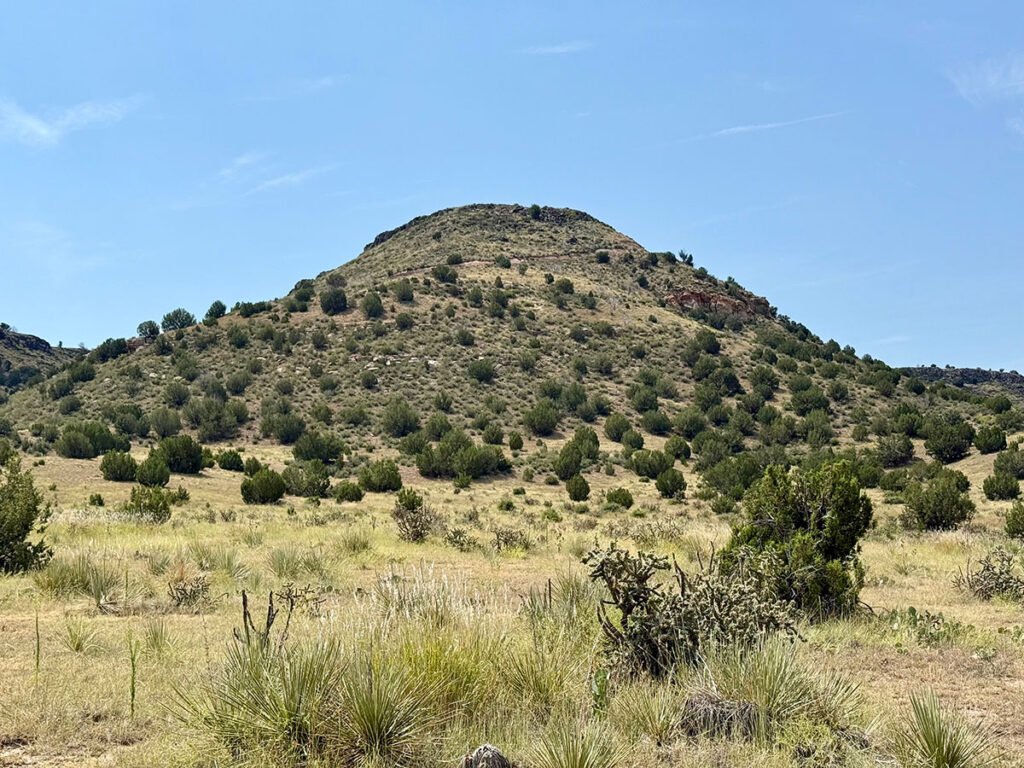
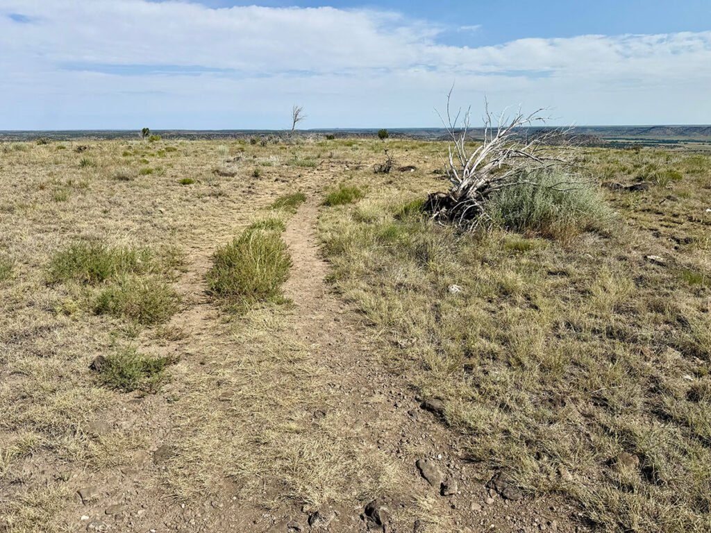
Photo: One last look back at Black Mesa — the etched trail marks our climb.
Final Thoughts
Coming off the difficulty of Wheeler Peak, I wasn’t sure what to expect from Oklahoma’s high point, but Black Mesa surprised me in the best ways. Black Mesa isn’t dramatic or technical, but it has its own quiet magic — wide-open spaces, layers of history, and a stillness that stretches for miles. And the unexpected experience of hiking it with someone on the same state-high-point journey made the day feel richer and far more memorable.
Catch you on the summit!
Date of Climb: 10 August 2025
Discover more from love cook adventure
Subscribe to get the latest posts sent to your email.
Diana
We definitely didn’t see any horned lizards on this hike (thankfully no snakes either) and I don’t remember the water station either. Perhaps that’s a newer addition. How fun to randomly connect with another high pointer!
Steve Anderson
Thanks for the read, Diana! And yes — meeting Robert was a lot of fun. We’ve stayed in touch and might try Mt. Whitney or Boundary Peak together next summer. High pointers really are a great community.
Diana
Oh fun!