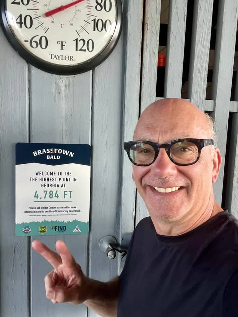
Brasstown Bald—Georgia’s highest point—was my 17th state high point, rising to 4,784 feet above sea level and ranking #25 among U.S. State High Points. After a full morning of hiking at Cloudland Canyon State Park, I decided to see if I could still make it to Brasstown Bald and reach the summit before dark.
Some might call that crazy. I call it seizing the moment.
Getting there
I approached Brasstown Bald by way of Chattanooga, heading east briefly through North Carolina before dropping south into Georgia. All told, the drive took about 2 hours and 45 minutes.
Yes—after hiking all morning, I drove nearly three hours… and then went for another hike.
Along the way, part of the drive followed US-74, which runs through Ocoee, Tennessee, alongside the Ocoee River. I stopped to watch whitewater rafting boats working their way downstream. While it definitely has a touristy feel, I could easily see myself coming back to try it out.
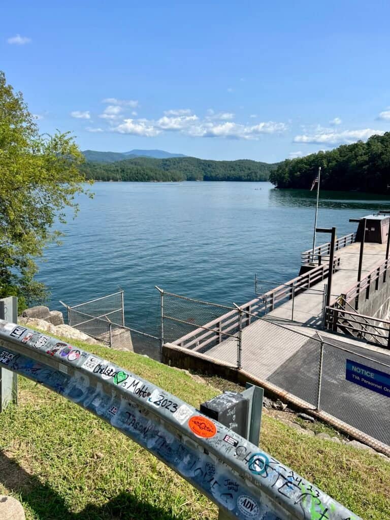
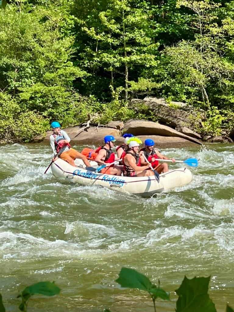
Photos: Ocoee River Dam #1 | Whitewater rafting on the Ocoee River
About Brasstown Bald
Brasstown Bald is located in the North Georgia Mountains, near the town of Blairsville, and is part of the Blue Ridge Mountains within the Chattahoochee National Forest.
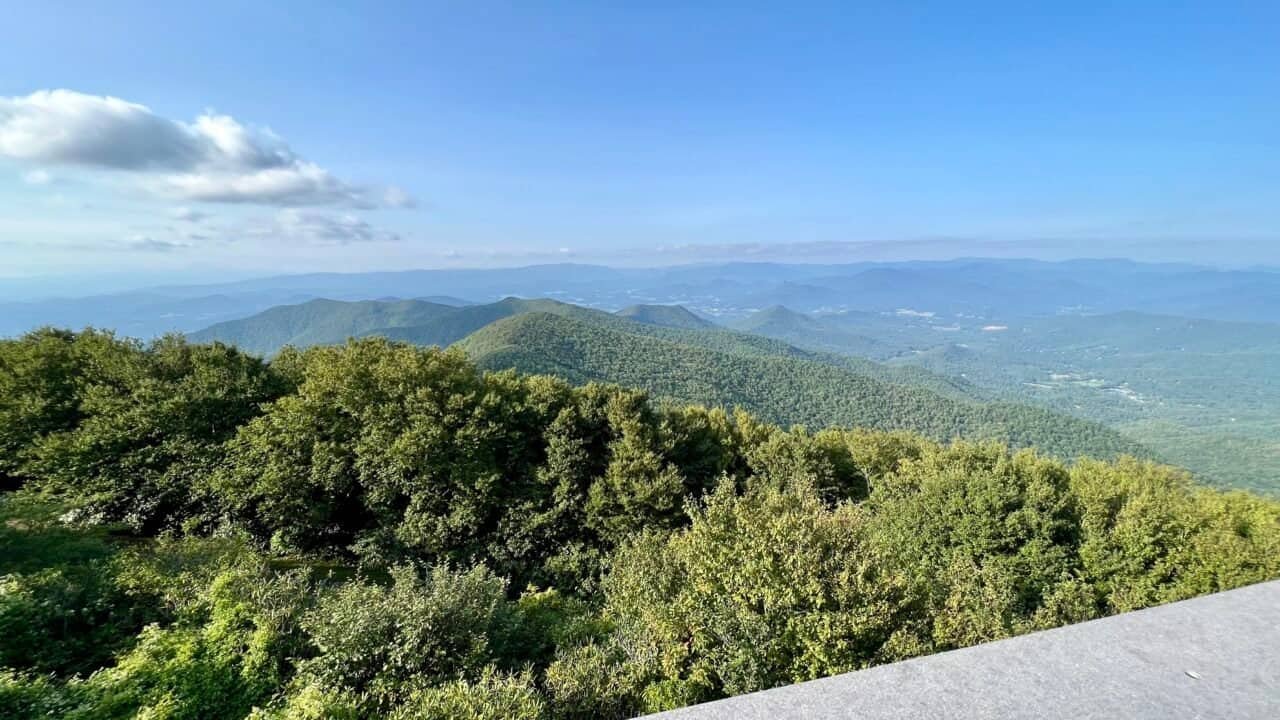
From the summit, you’re rewarded with sweeping panoramic views of the southern Appalachian Mountains and surrounding valleys. On a clear day, you can see into four states: Georgia, Tennessee, North Carolina, and South Carolina.
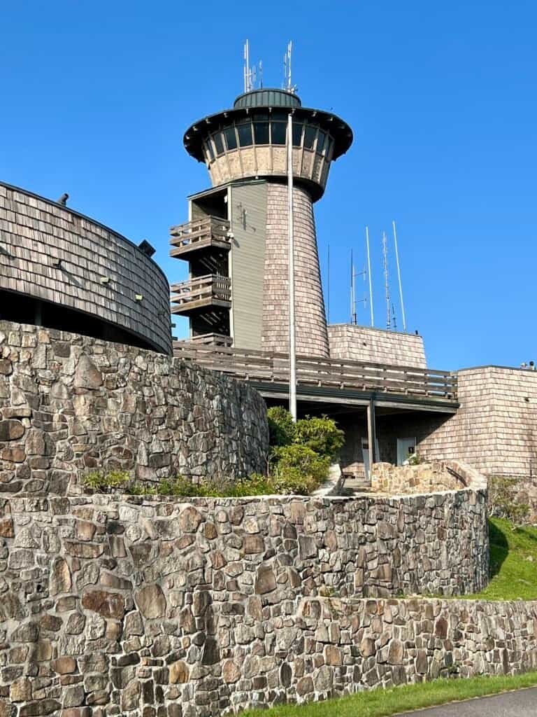
At the top sits the Brasstown Bald Visitor Center, which includes educational exhibits, a gift shop, and an observation deck. Entrance to the area costs $8 per person, or $5 after hours. If you have an America the Beautiful Interagency Pass or Golden Pass, admission is free.
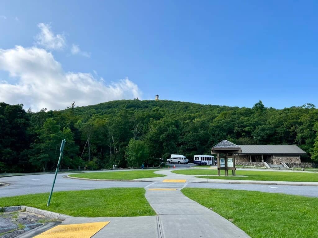
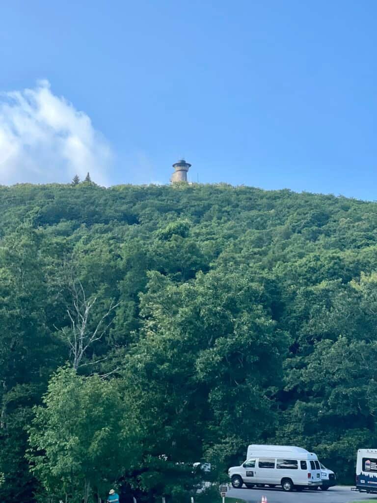
Photos: Parking Area & Visitor Center | Summit Tower on the Ridgeline
Fun fact
Brasstown Bald also serves as a watershed boundary point, where four major drainage systems converge:
the Tennessee River, the Gulf of Mexico, the Atlantic Ocean, and the Savannah River.
What’s in a name?
According to the Georgia Historical Society, the name Brasstown Bald comes from the Cherokee word Itseyi, meaning “a place of fresh green,” referring to the grassy, treeless summit.
Early settlers confused the original name with a similar-sounding word meaning brass, which is how Brasstown Bald got its modern name.
Cherokee legend tells of a great flood in which all but a few families perished. Those survivors landed atop Brasstown Bald in a giant canoe. The Great Spirit killed the trees on the summit so they could plant crops and live until the floodwaters receded.
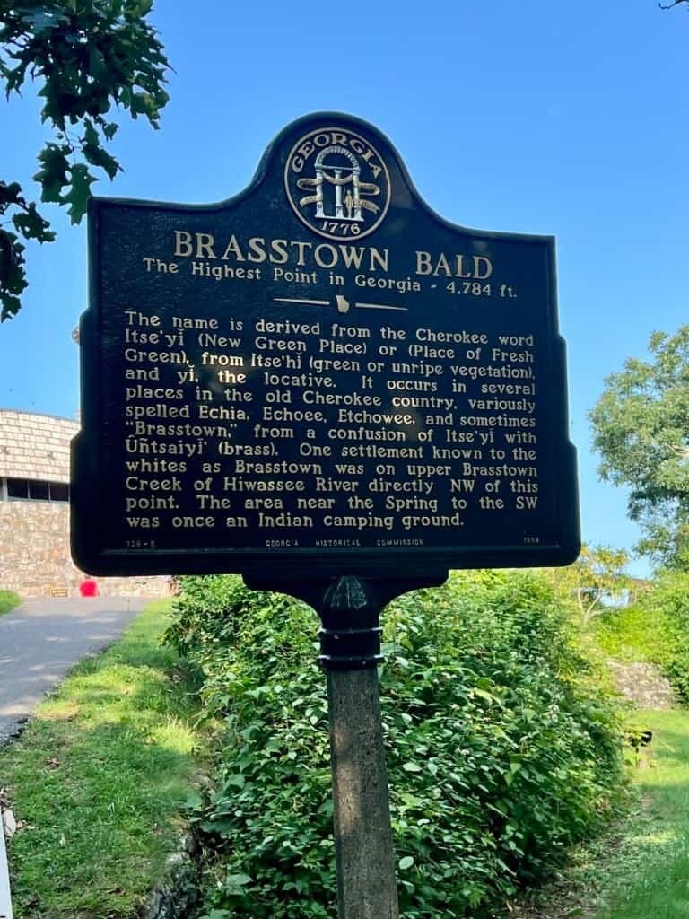
Photo: Brasstown Bald historical marker
Beware of rattlesnakes (getting to the top)
The paved trail to the summit is 0.6 miles one way. While it’s relatively steep, it’s not particularly difficult. I made it to the top in 14 minutes.
During visitor center hours, a shuttle runs as an alternative to walking. I chose to hike—and, thanks to posted rattlesnake warnings, did so in boots and with trekking poles. In hindsight, sneakers would have been just fine.
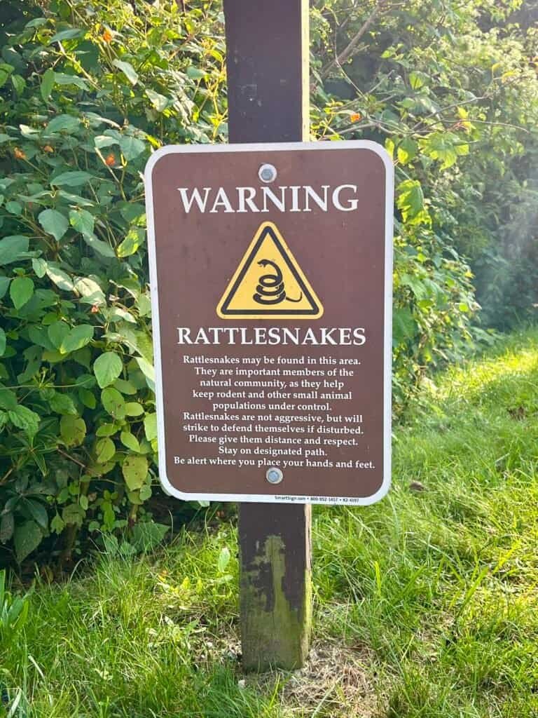
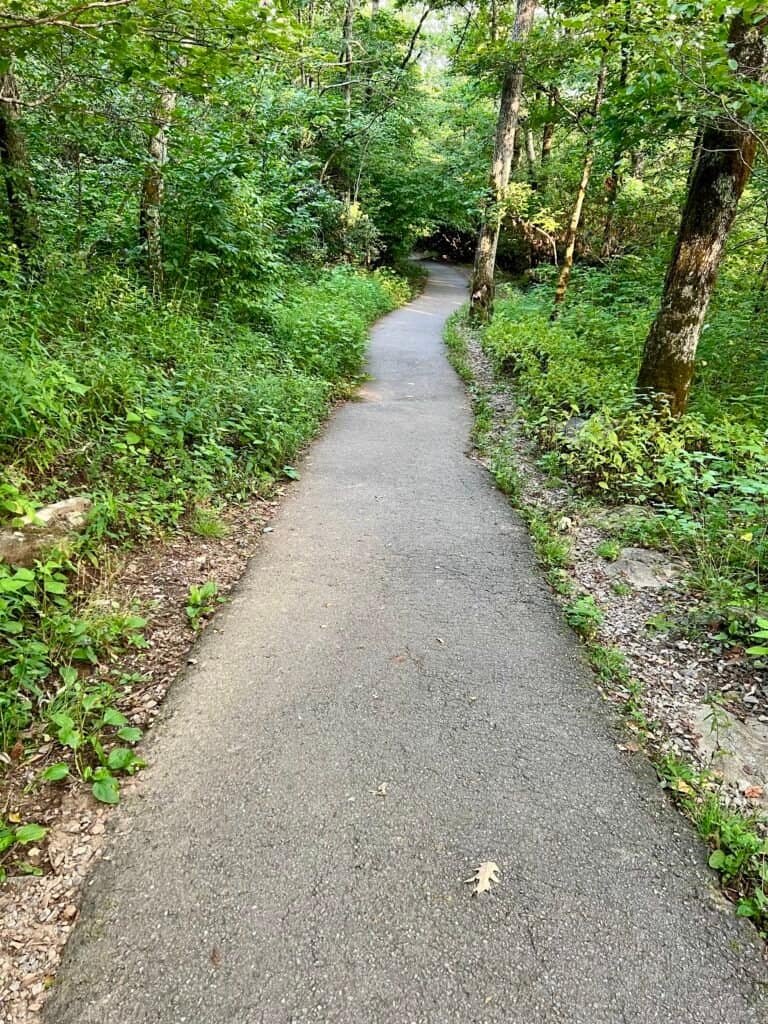
Photos: Rattlesnake warning | Paved trail to the summit
On the summit
As you reach the top, a historical marker notes that you’re standing on Georgia’s highest point. Since it was late in the day, the visitor center and observation tower were closed, but the observation deck remained open, offering spectacular views.
That said, one downside of arriving after hours: the geodetic marker is now locked inside due to repeated theft. You can only see it when the visitor center is open. A bit of a bummer.
At first, I wondered if I’d end up alone on the summit. However, that couldn’t have been further from the truth. An entire family was already on the observation deck—eating, playing games, and waiting for sunset. As I headed back, even more people were arriving.
Had I not needed to get back on the road, I absolutely would have stayed for sunset. Lesson learned… again.
Photos: Visitor Center and observation tower |
Summit selfie (the geodetic marker is locked behind the door)
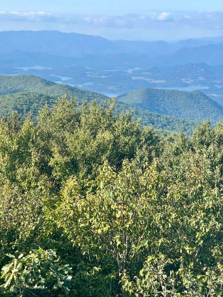
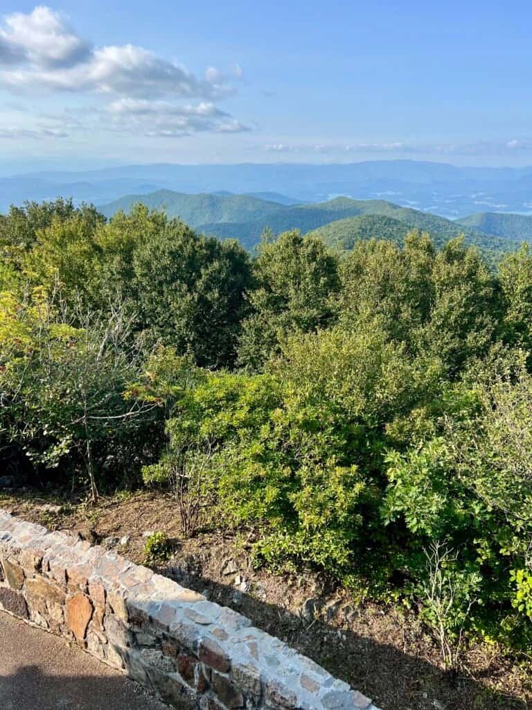
Photos: Views from the summit
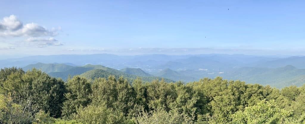
Photo: Panoramic view from the summit
Wrap-Up
Brasstown Bald may not be a long hike, but it delivers big rewards. Between the views, the legends, and the late-day atmosphere, it’s an unforgettable summit—especially if you time it right.
Seventeen high points down, thirty-four to go.
Catch you on the summit!
Date of Visit: 19 August 2020
Discover more from love cook adventure
Subscribe to get the latest posts sent to your email.
1 Pingback