Cheaha Mountain—Alabama’s natural high point—was my 16th state high point, rising to 2,407 feet above sea leveland ranking #35 among U.S. State High Points. The summit is located within Cheaha State Park, the oldest state park in Alabama, and the southernmost extension of the Appalachian Mountain chain.
The park sits about 80 miles east of Birmingham, roughly midway between Birmingham and Atlanta, just south of I-20. The entrance fee is $5 per person (ages 12 and up). I approached the park via the Skyway Motorway, a beautifully winding road with several standout views along the way.
As for the name—Cheaha comes from the Muskogee (Creek) word “Chaha,” meaning “high place.” File that away. You’re now ready for Jeopardy! 😉
Ricky Bobby
I wrapped up my hike earlier than expected at Tishomingo State Park in Mississippi—on the list of Best State Parks—and decided to continue on to Cheaha Mountain. Shortly after leaving Birmingham on I-20, you pass the iconic Talladega Superspeedway. If you’re a Will Ferrell fan, your mind immediately jumps to Talladega Nights: The Ballad of Ricky Bobby.
“Well, let me just quote the late, great Colonel Sanders, who said… ‘I’m too drunk to taste this chicken.’”
Alright—back to Cheaha.
Is driving to the summit cheating?
As you climb Skyway Motorway, there’s a turnoff for the High Point Spur Trail and the Pinhoti Trail. If you want to hike, you can start there, hike up to the park entrance (you’ll still need to pay the entrance fee), and connect to the Big Foot Trail. That option comes in at roughly 2 miles round trip, not including the short connector between trails.
Another approach is driving Cheaha Road (County Road 42) through Talladega National Forest and parking at the Lake Trailhead. From there, it’s about 2 miles round trip, plus at least another mile round trip to reach the high point inside the park.
Or—you can do what I did: drive directly into the park and park across the street from the high point.
Some may call that cheating. I call it practical. I’d already hiked all morning at Tishomingo, it was late in the day, and I made the executive decision to save my legs.
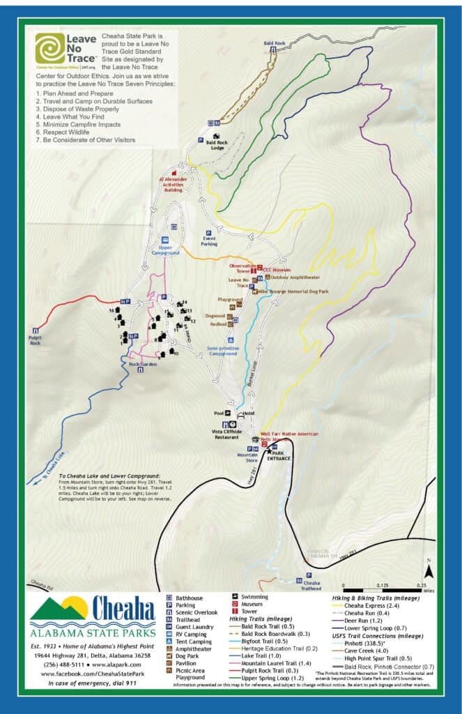
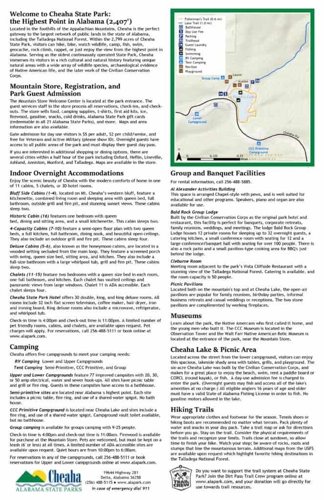
Photos: Park Maps and Guide
Big Foot sighting!
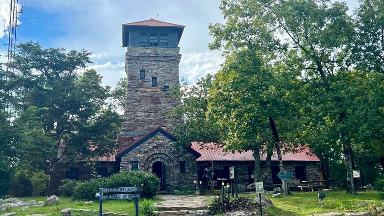
I drove straight to the high point and Bunker Observation Tower. Inside the park, follow the one-way Bunker Road. You’ll see a single road on the left—take it uphill. The observation tower appears on the right, with a parking lot on the left.
After parking, I noticed a building with large glass windows. As I walked closer, I realized it was home to Sully, a 9-foot-tall Big Foot. Despite his size, he seemed calm, gentle, and only mildly intimidating.
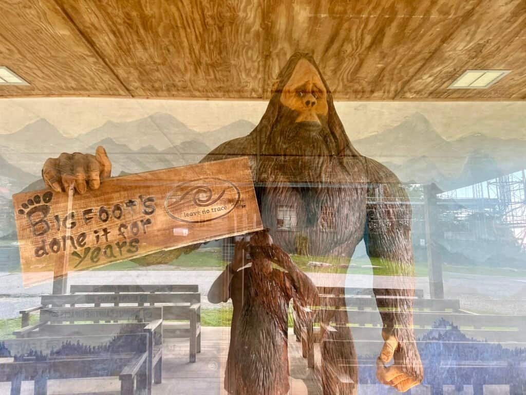
Photo: Sully – the park’s 9-foot high Big Foot!
Leave No Trace (the organization)
Cheaha State Park has been designated a Gold Standard Site by the Leave No Trace organization. Like many hikers, I was familiar with the principles, but I didn’t realize there was an organization behind them.
Leave No Trace pioneers science-based education and research to help protect the outdoors. I recently completed their Leave No Trace 101 course—it’s free, takes about 30 minutes, and is well worth the time.
Will the real High Point please stand up?
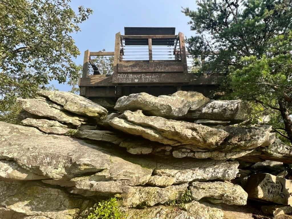
I climbed Bunker Observation Tower first. The tower was completed in 1935 by CCC Company 468. Inside, near the base of the stairs, there’s a small “X” carved into the stone floor, marking what is claimed to be the highest point in Alabama.
Or… is it?
Just outside the tower, along a short walkway, you’ll find the first of two survey markers on the summit. This marker sits prominently near the tower and is easy to spot.

Photos: Bunker Observation Tower | Statue Dedicated to the CCC

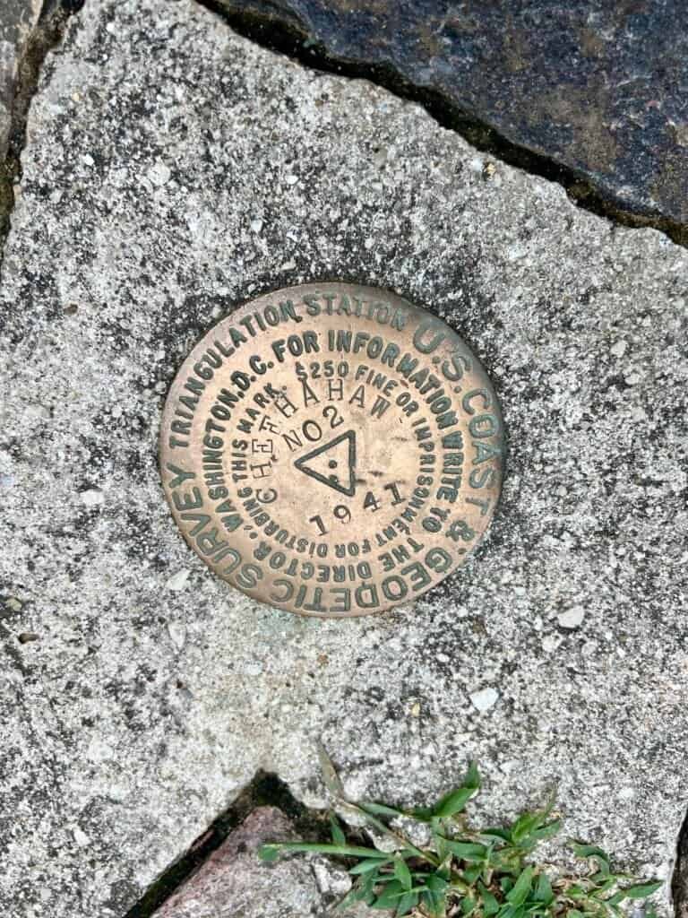
Photos: Survey Marker #1 in the center foreground | Survey Marker #1
The tower offers solid views and is an easy climb—even for those uneasy with heights. Like many state high points, Cheaha is also home to several radio towers.
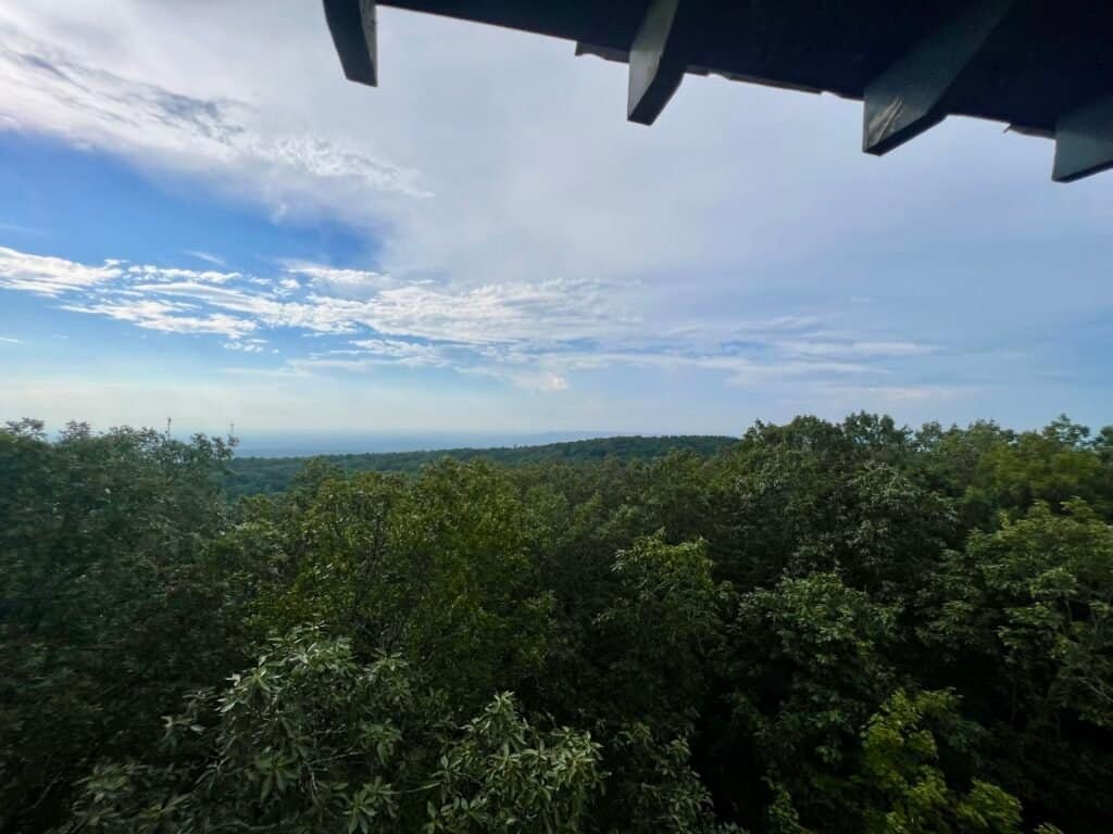

Photos: Views from Bunker Observation Tower, including the parking lot
After climbing down, I sat at a nearby picnic table and enjoyed a simple summit snack: brie and crackers. For most of my time there, I had the summit entirely to myself.
But my mission wasn’t complete yet.
Survey Marker #2
To find the second—and apparently official—high point, take the walkway to the left of the tower. Near the radio tower fence, you’ll find a rock with a turquoise-colored survey marker embedded in it.
So which one counts? The “X” inside the tower? The marker near the tower? Or the turquoise marker in the rock?
My advice: visit them all, just to be safe.


Photos: Path to the high point | Rock with Survey Marker #2
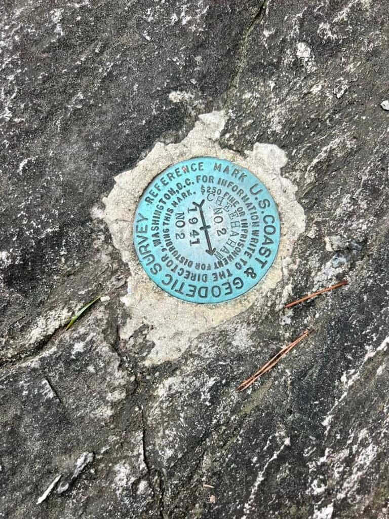
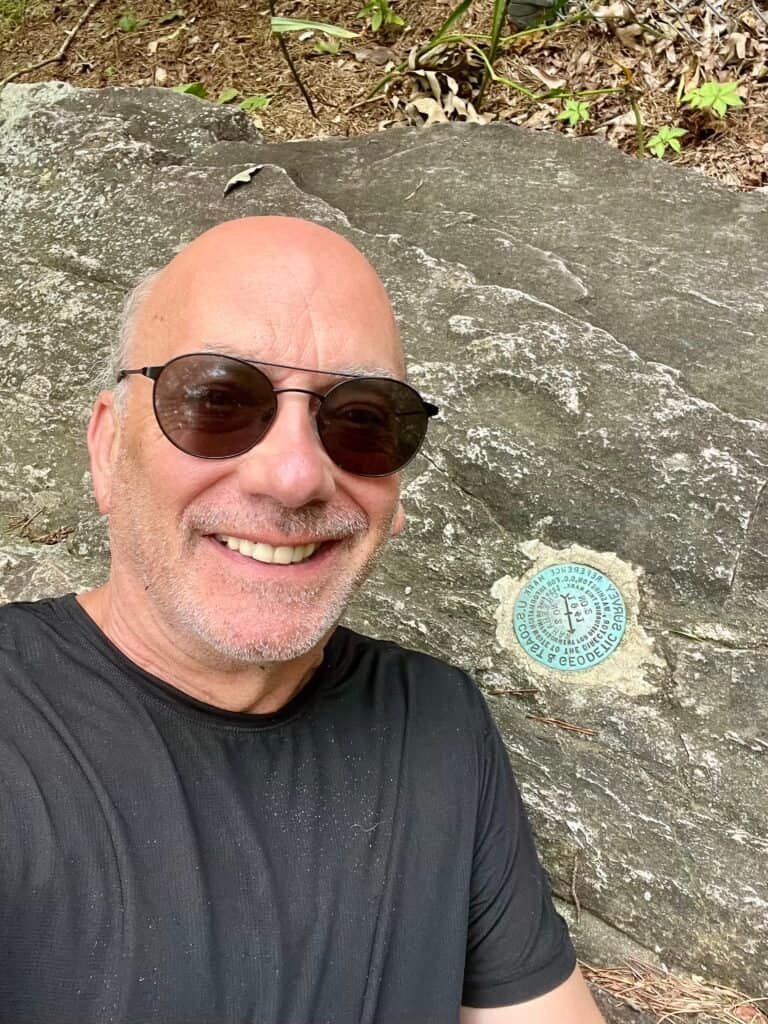
Survey Marker #2 | Summit selfie at Alabama’s highest point
More to see: Bald Rock
As mentioned earlier, the best views on Cheaha Mountain aren’t from the summit itself—they’re from Bald Rock. It’s a short drive back to Bunker Road and over to the Bald Rock Lodge parking area.
From there, it’s an easy 0.3-mile walk one way, via boardwalk, trail, or a combination of both. The walkway is well maintained and accessible—I did it in flip-flops.
At the end of the boardwalk, take the stairs down and walk toward the edge for incredible views across Alabama. I timed it perfectly and had Bald Rock entirely to myself—briefly. On the walk back, I passed a couple and then two large families with very energetic kids. Timing, as always, is everything.


Photos: Descent toward Bald Rock after leaving the boardwalk

Photos: Bald Rock Monument | Looking up at the upper observation area


Photos: Taking in the view from Bald Rock
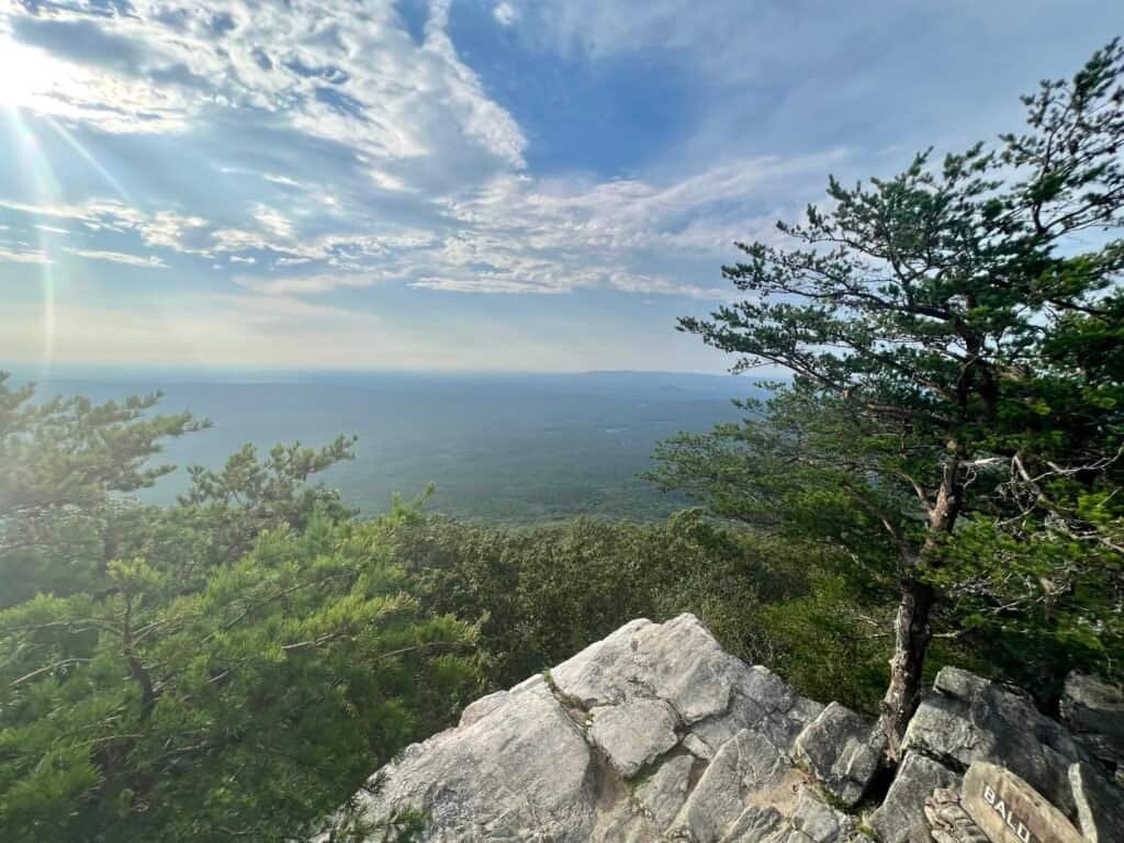
Photo: Final view from Bald Rock overlook
Wrap-Up
Cheaha Mountain may be accessible, but it delivers on history, scenery, and charm. Between the multiple “high points,” the unexpected Big Foot, and the views from Bald Rock, it’s a worthy stop on any Alabama itinerary.
Sixteen high points down, thirty-five to go.
Next up: Brasstown Bald | Georgia.
Catch you on the summit!
Date of Visit: 13 August 2023
Discover more from love | cook | adventure
Subscribe to get the latest posts sent to your email.
Leave a Reply