At 6,643 feet above sea level, Clingmans Dome—now officially known as Kuwohi—is the highest point in Tennessee, ranking #17 among U.S. state high points and rising along the border of Tennessee and North Carolina within Great Smoky Mountains National Park. This was my 18th state high point, and while reaching the summit itself turned out to be fairly straightforward, everything leading up to it was a reminder of why preparation—and a little patience—matters more than you think.
I tend to travel with the wind. Most of the time that works in my favor. Occasionally, it nearly costs me a summit. Clingmans Dome was almost one of those occasions.
Where I Stayed (and Why)
I chose to approach the park from the north and based myself in the familiar Smoky Mountain gateway towns of Sevierville, Pigeon Forge, and Gatlinburg. Sevierville, Dolly Parton’s hometown, blends local history with shopping and sprawl. Pigeon Forge leans hard into entertainment—Dollywood, dinner shows, and family attractions at every turn. Gatlinburg sits right on the edge of the park and feels like Myrtle Beach relocated to the mountains.
It’s not usually my scene, but it is practical. Hotel rooms were plentiful and inexpensive, and it put me close to the park. I woke early, ready to make the most of a day in the Smokies.
The Drive In (and the Mistake)
It was about a 45-minute drive from Pigeon Forge to the park, taking US-441 and then Clingmans Dome Road, with the Parkway Bypass helping me avoid downtown Gatlinburg traffic. The road climbs steadily, narrows to two lanes, and moves slowly—especially if you end up behind a camper grinding uphill.
That’s when I realized my mistake.
At the park entrance, a mobile road sign announced that Clingmans Dome Road was closed for the day. No warning. No backup plan. Just a reminder that winging it only works until it doesn’t.
Regrouping at Sugarlands
Rather than turn around frustrated, I pulled into the Sugarlands Visitor Center. It was busy, but after a short wait I spoke with a ranger and asked my usual questions: must-see spots, wildlife awareness, and closures.
Interestingly, even the rangers had limited information—the closure had been finalized the night before. So I did what I should’ve done earlier and checked the National Park Service website.
Clingmans Dome Road was closed for a special educational program serving schools in the Eastern Band of Cherokee Indians community, reopening at 1:00 PM.
My lucky day.

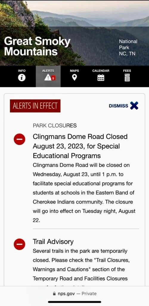
Photos: Park entrance sign | NPS website noting the closure
Killing Time the Right Way
Knowing the road would reopen, I bought my parking pass and headed back toward Gatlinburg for coffee and a little future-trip planning.
Fees: There is no entrance fee for Great Smoky Mountains National Park, but a $5 parking tag is required. Interagency passes (America the Beautiful, Access, Senior) are not accepted in lieu of the parking tag.
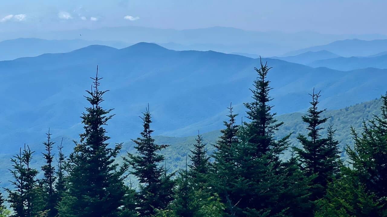
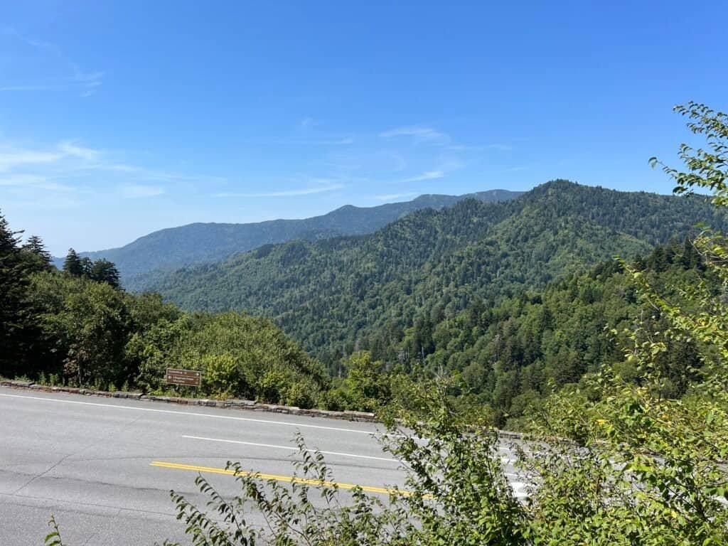
I returned to the park early and used the extra time to explore. First stop was the Charles A. Webb Overlook, where the Smokies stretched endlessly into the distance. Then I continued on to Newfound Gap, waiting quietly in my car as 1:00 PM approached.
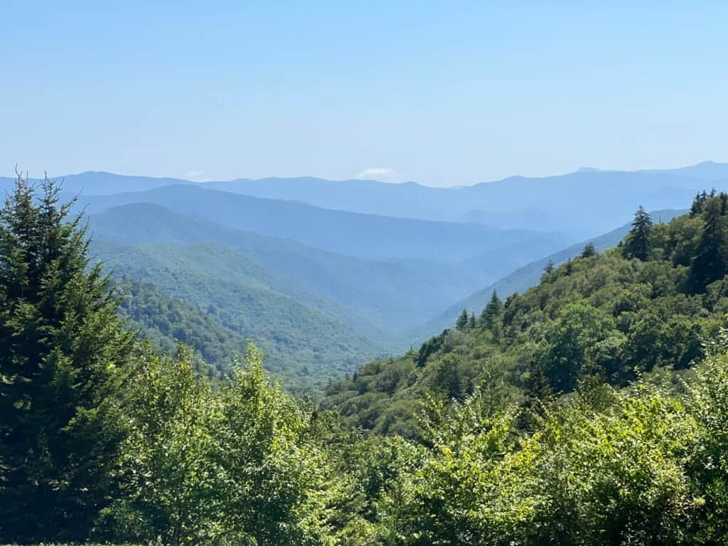
Photo: View from Charles A Webb Overlook
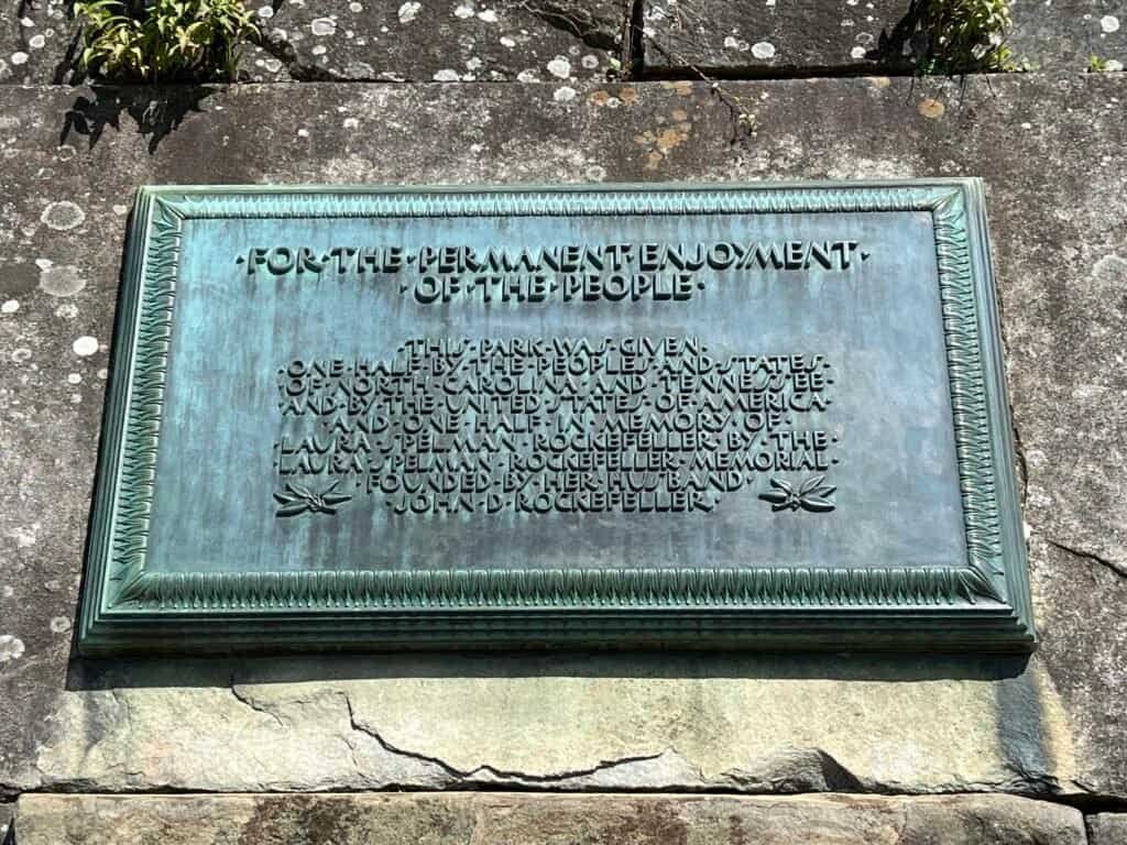
Photos: Plaque at Newfound Gap | View from Newfound Gap
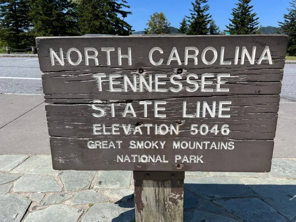
Photos: North Carolina – Tennessee Border at Newfound Gap
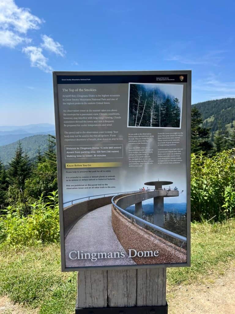
About Clingmans Dome
At 6,643 feet, Clingmans Dome is the highest point in Great Smoky Mountains National Park and the highest point in Tennessee. It’s also the third-highest mountain east of the Mississippi River. The summit is reached by a steep, paved half-mile trail that leads to a concrete observation tower offering 360-degree views. On clear days, visibility can exceed 100 miles.
The access road is closed seasonally, typically from early December through late March, and whenever weather conditions make travel unsafe.
Waiting at the Gate
Just before 1:00 PM, a small line of cars formed at the entrance to Clingmans Dome Road. I pulled in behind them and waited. Right on schedule, the road reopened, and the line crept forward.
It’s a seven-mile drive to the end of the road, with scenic pullouts revealing layered ridges and valleys along the way. The road ends at a large parking area where the final climb begins.
On the Summit
I parked, geared up quickly, and headed up the trail. Short but steep, it makes you work for it. At the top, the observation tower rises above the treeline, equal parts functional and iconic.
Everything worked out perfectly. The weather was clear, the views were incredible, and for a brief stretch I had the summit mostly to myself. I couldn’t locate a survey marker at the true high point, so I settled for a summit selfie in front of the tower.
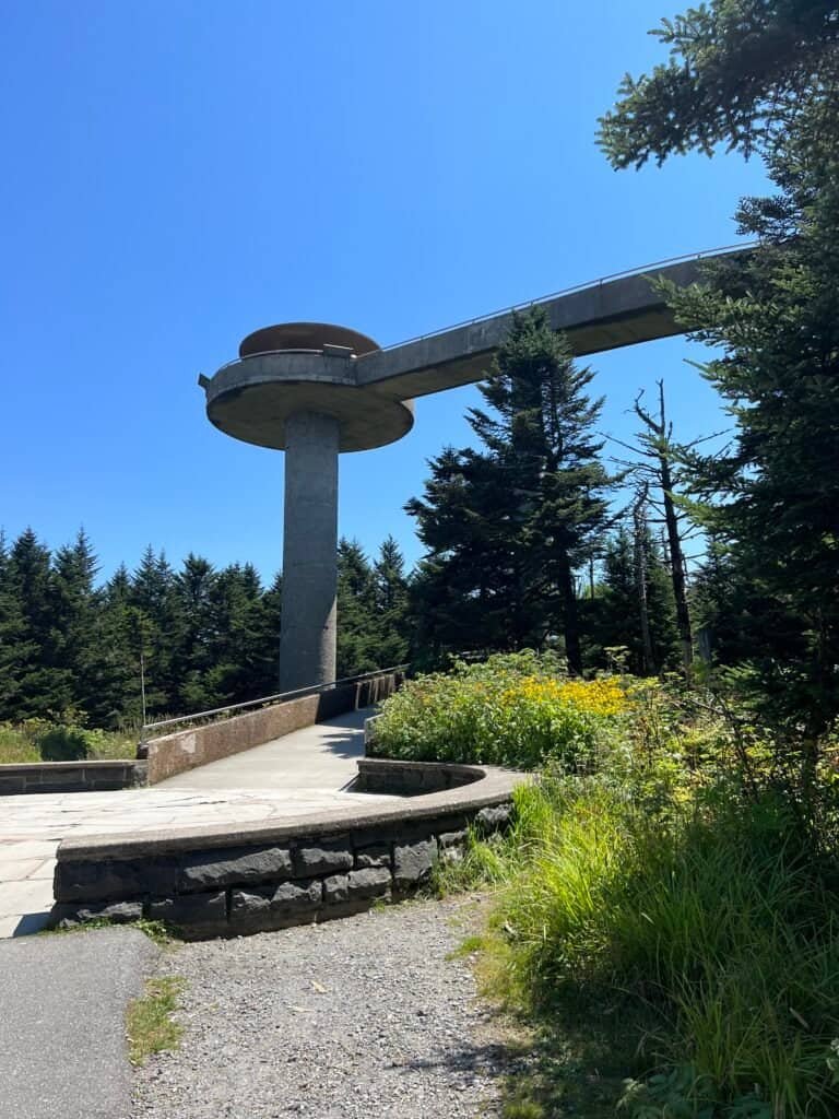
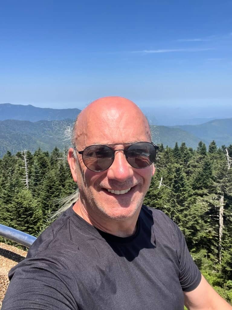
Photos: Clingmans Dome Observation Tower | Summit Selfie
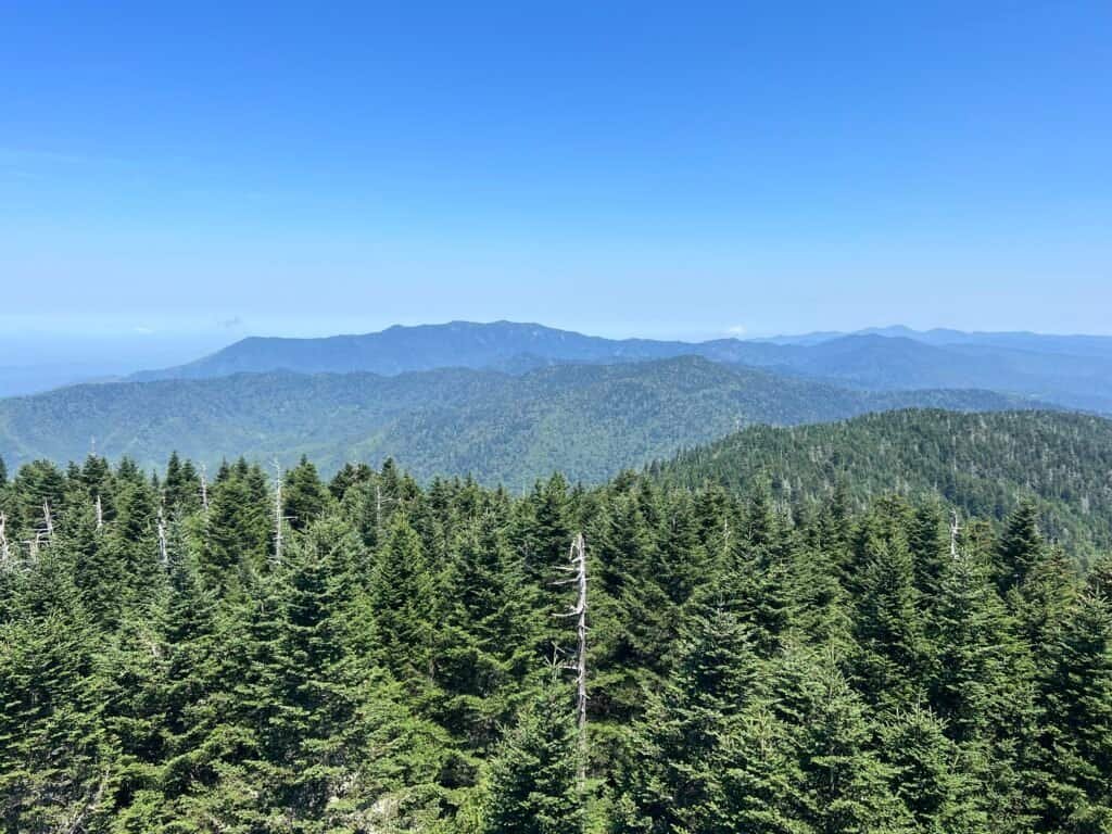
Photo: View from the Observation Tower
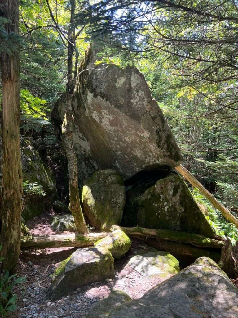
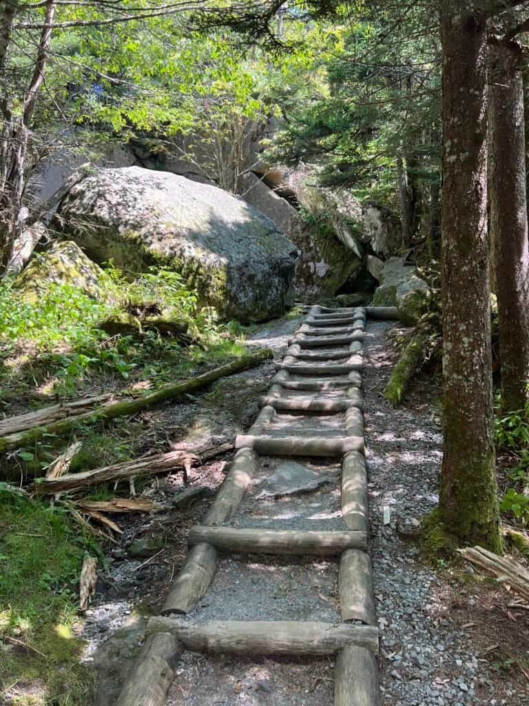
Taking a Path Less Traveled
As the summit grew more crowded, I chose a quieter way back down—the Clingmans Dome Bypass Trail. The Appalachian Trail crosses Clingmans Dome here, marking its highest point along the route from Georgia to Maine.
The bypass offered a more scenic descent, fewer people, and a chance encounter with rangers clearing fallen treesalong the trail.
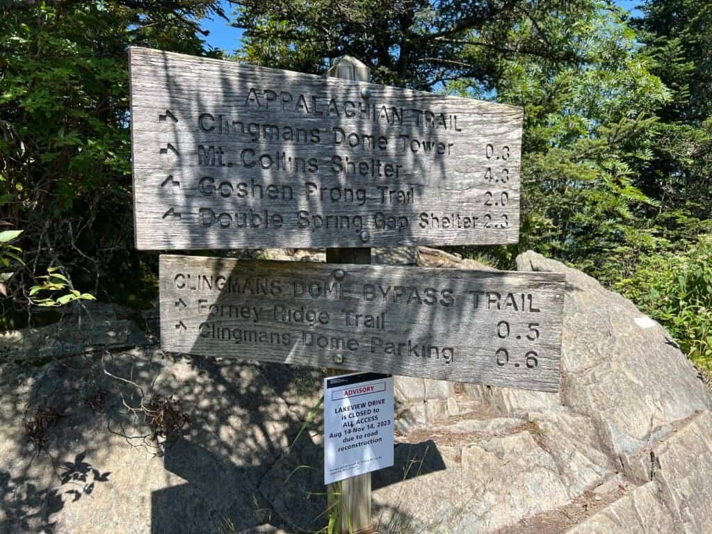
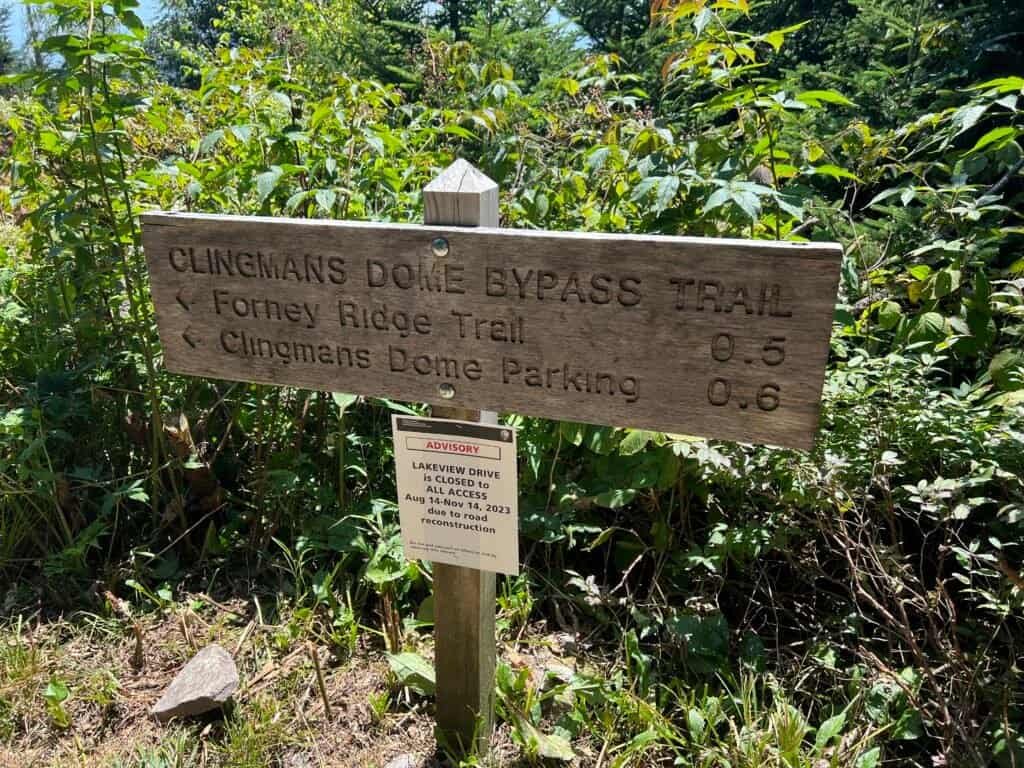
Photos: The AT (Appalachian Trail) | Directional sign for the Bypass Trail
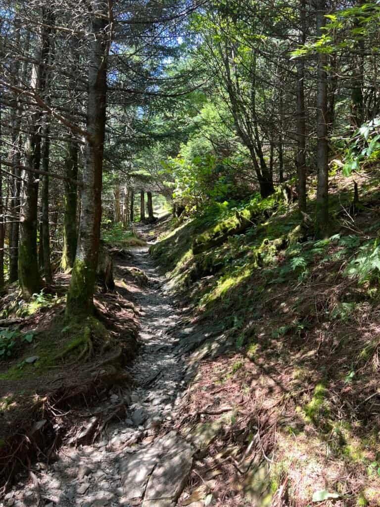
Photo: Along the Bypass Trail
Photos: Near the end of the Bypass Trail
High Point Verification (Sort Of)
Back near the parking area, I stopped by the gift shop for postcards and then spotted a USGS marker embedded in rock near where the tower trail meets the lot—elevation approximately 6,300 feet.
Not the official high point, but close enough to earn a photo.
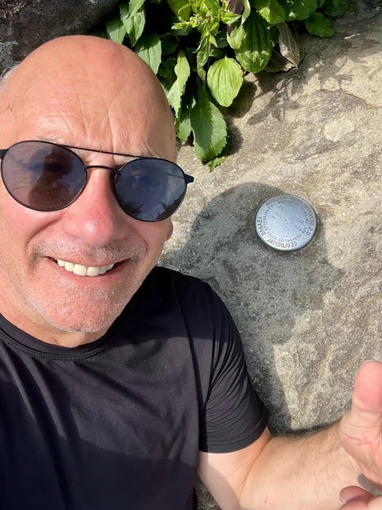
Photos: Information on Clingmans Dome | Not-on-the-Summit Selfie
A Smoky Goodbye
With the summit behind me, I returned to Newfound Gap for a few final photos before crossing into North Carolina. The transition is quick—Clingmans Dome sits right on the state line—but the scenery never lets up.
Crowds aside, the Great Smoky Mountains are stunning. This summit required flexibility, patience, and a little luck—but it delivered.
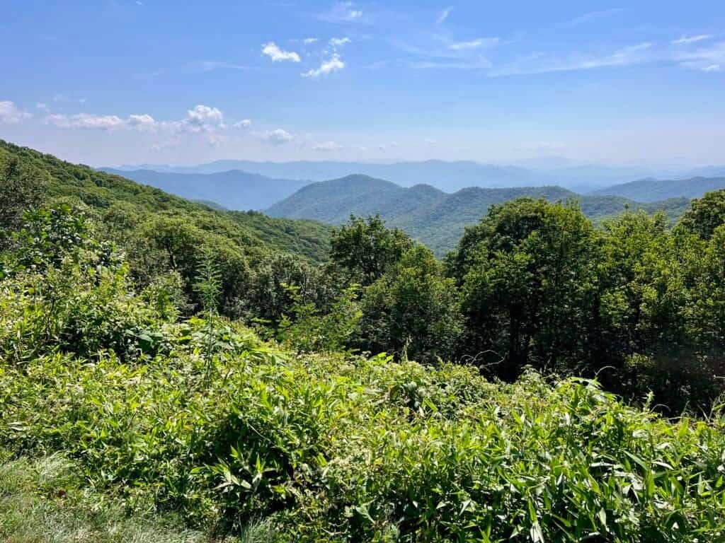
Photo: Parting view of the Smokies
Editor’s Note
Since my visit, the mountain historically known as Clingmans Dome has officially been renamed Kuwohi, restoring its Cherokee name meaning “mulberry place.” The change was approved by the U.S. Board of Geographic Names following a request from the Eastern Band of Cherokee Indians and with the support of the National Park Service. My visit took place prior to the official name change.
With Tennessee’s high point behind me, the journey continued south—next up: Sassafras Mountain in South Carolina.
Eighteen high points down. Plenty still ahead.
Catch you on the summit!
Date of Climb: 23 August 2023
Discover more from love cook adventure
Subscribe to get the latest posts sent to your email.
Leave a Reply