El Cajon Mountain:
The Hike That Hikes You Back
Let me start by saying this: El Cajon Mountain does not mess around. This isn’t one of those “wow, what a nice stroll through nature” kind of hikes. This is more like “why am I going uphill again?” with a side of “my quads might never forgive me.” And yet — I’d absolutely do it again.
This is an ~11-mile out-and-back with over 3,500 feet of elevation gain, and it earns every bit of its reputation. Short on paper, relentless on the trail — the kind of hike that doesn’t just test your legs, but your patience.
The Start (and the Parking Situation)
I hit the trail around 10:15 AM and managed to snag one of the last spots in the lot. If you’re planning to go, either get there early or be ready to park along Wildcat Canyon Road and tack on a half-mile, 250-foot climb just to reach the actual trailhead. Think of it as a free warmup.
There are pit toilets at the trailhead (you’ve been warned) and a picnic bench if you want to fuel up before the climb.
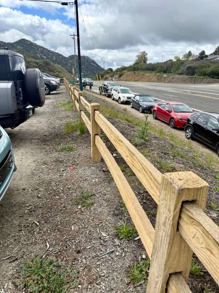
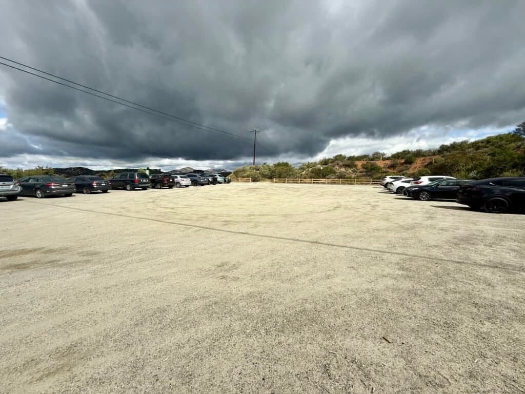
Photos: Parking along Wildcat Canyon Road | Stormy Skies over The Parking Lot
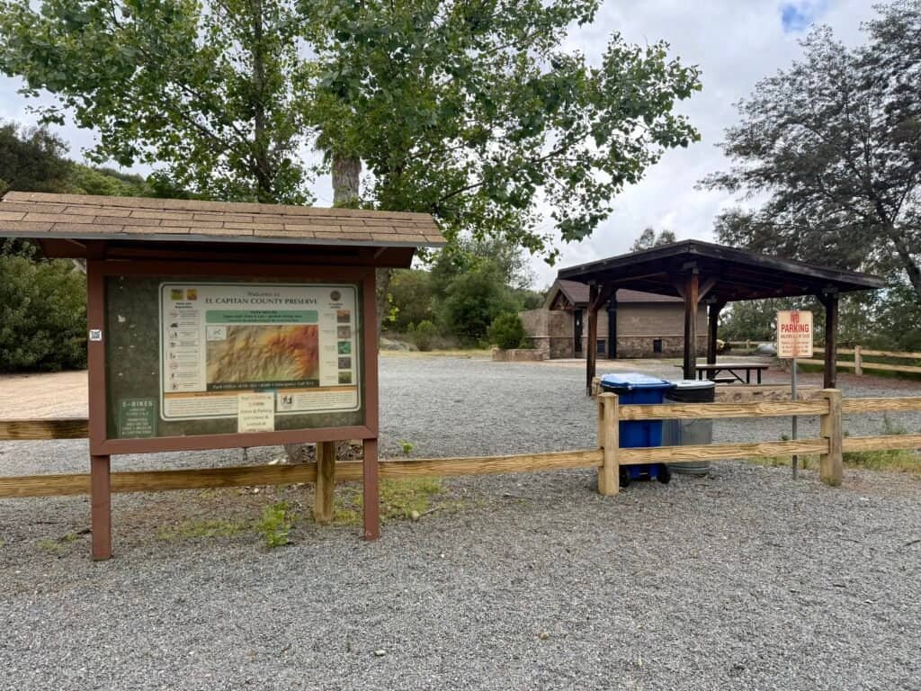
Photo: The real trailhead with picnic table and pit toilets
Weather: Moody But Perfect
I lucked out with classic post-rain weather — cool, slightly damp, and overcast. A few raindrops hit me on the way up, but they passed quickly. Honestly, it was ideal hiking weather. The kind that tricks you into thinking you’re invincible. (Spoiler: I wasn’t.)
Also, I’d run a 10K and did a brisk 3-mile walk the day before. Rookie mistake.
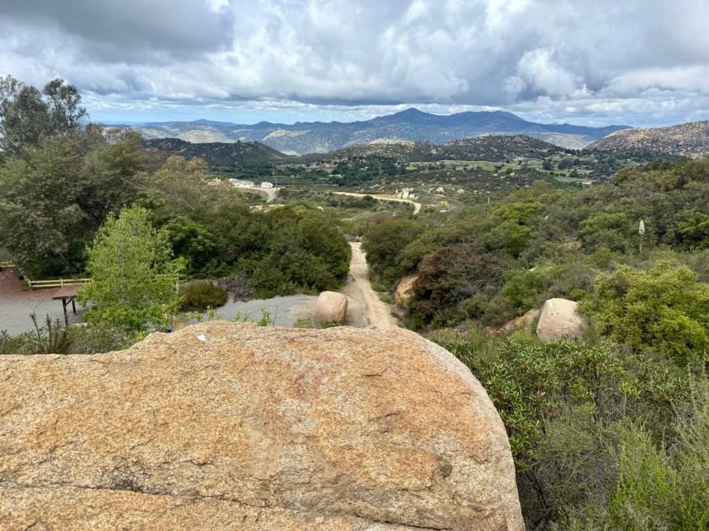
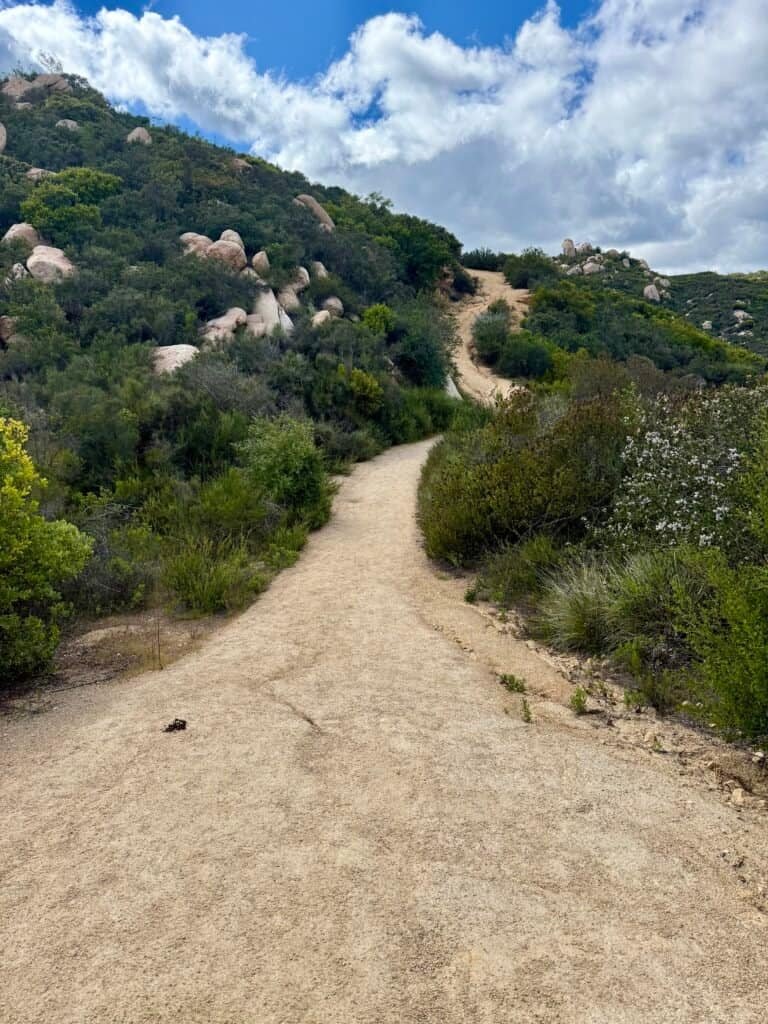
Photos: Early miles on El Cajon Mountain offer a look back at the trailhead and winding road below — a calm moment before the real climbing begins.
The Trail: A Sneaky Climb
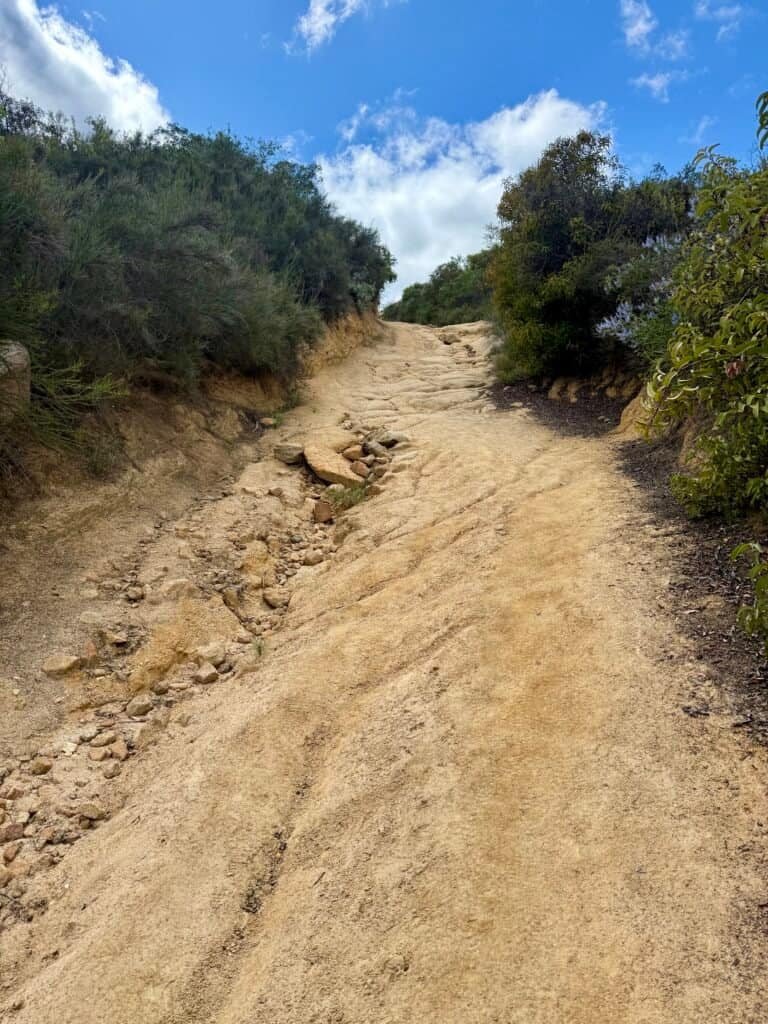
The first 2.7 miles lull you into a false sense of security — switchbacks with a mix of short climbs and some surprisingly steep descents. I kept thinking, boy, I’m going to have to climb back up all this on the return. And yep, I sure did.
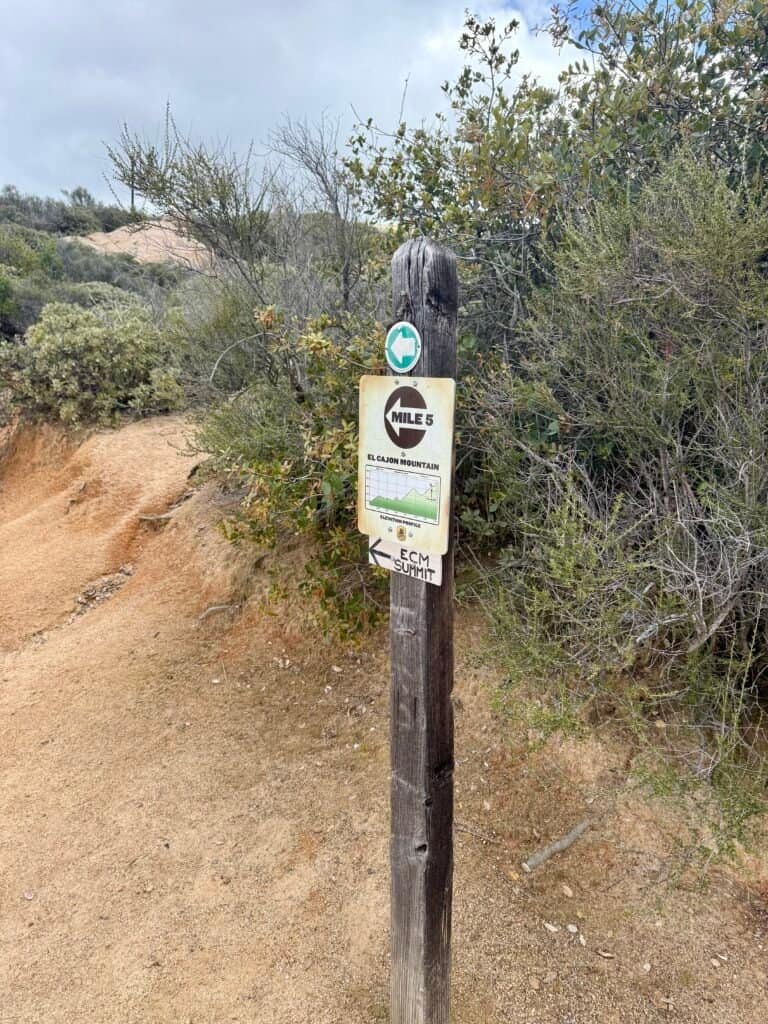
The trail is well-marked (with mile markers, thank you very much), and well-maintained — but don’t underestimate the rocks. Wear shoes with solid grip, or you’ll be dancing awkwardly down some of the steeper sections.
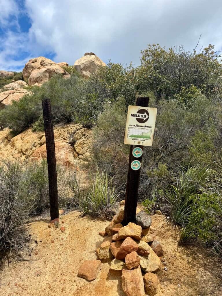
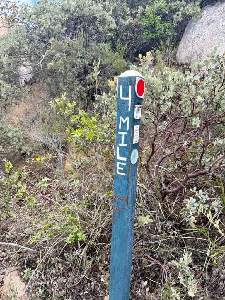
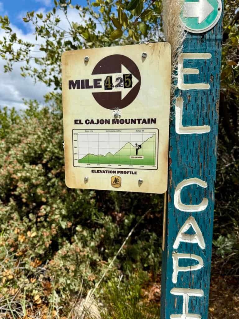
Photos: Trail Markers — Helping You Stay on Track Every Step of the Way
Also — the strange, echoing bird calls near the trailhead? That’s either the Blue Sky Ranch Community or the nearby Silverwood Wildlife Sanctuary (maintained by the San Diego Bird Alliance). Either way, it’s an unusual but oddly soothing sound. When I heard it on the way back, I knew I was almost home.
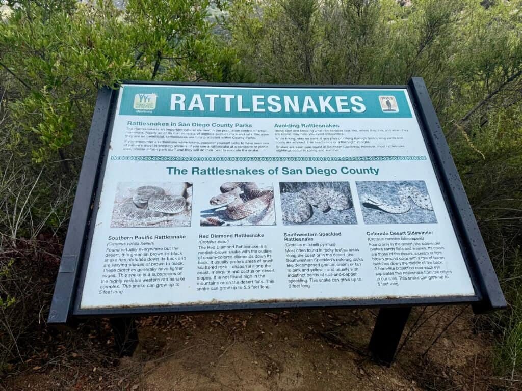
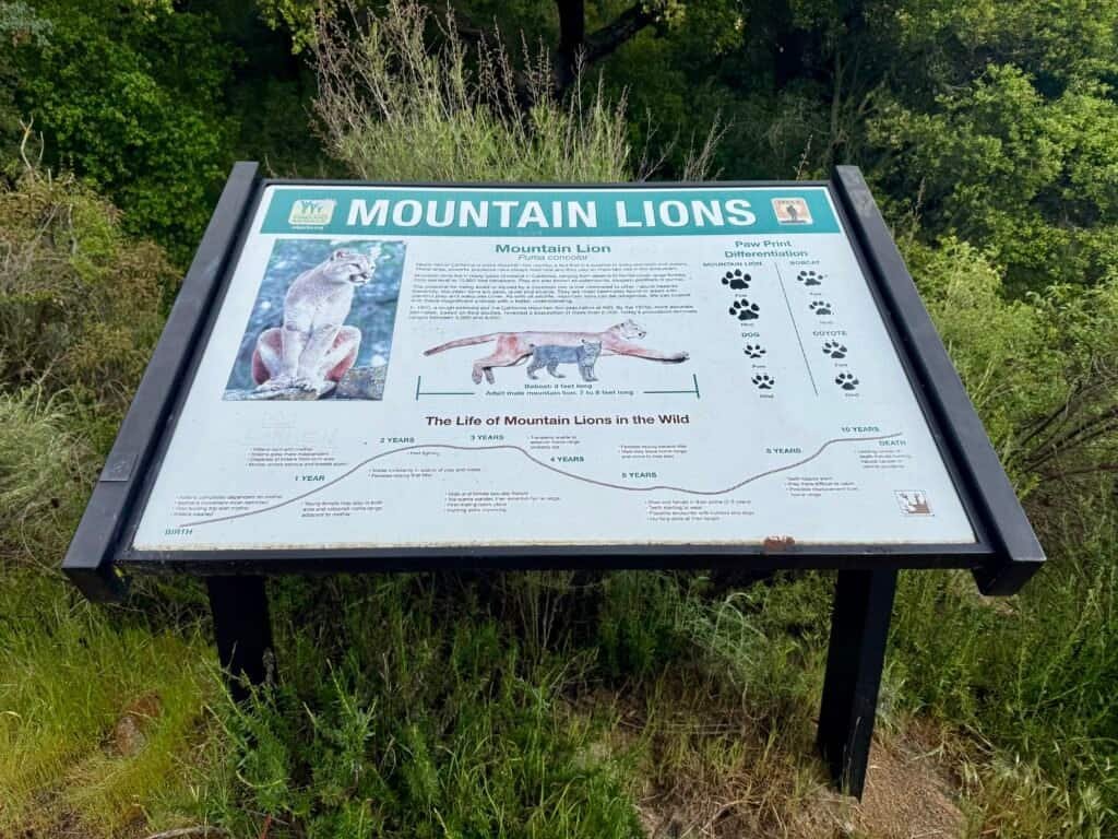
Photos: Local Wildlife You Might Meet on the Trail — Stay Alert and Be Prepared!
Forks in the Trail, Helpful Water, and Mental Games
Early on, you’ll pass a few trail forks. The first is clearly marked. The second one… not so much. Here’s the rule that worked for me: stick to the widest, most obvious trail and you’ll stay on course.
Around that second fork, I noticed a few Home Depot buckets filled with water. These are likely there for hikers who come unprepared — and judging by how many people I saw without enough water, they’re a welcome backup. That said, don’t rely on them. Bring plenty.
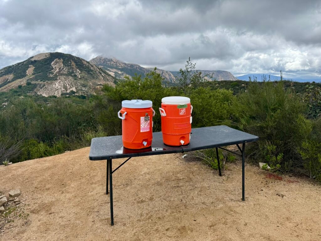
Photo: A makeshift water stop along the trail — helpful in a pinch
Heads-up: the trail’s early mix of ups and downs plays mind games. The elevation gain is real, but the constant change in rhythm makes it feel harder than it is. Don’t expect a straight climb. El Cajon makes you earn every step.
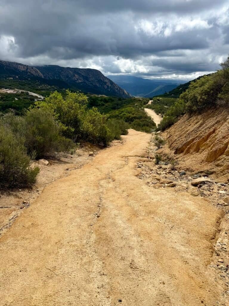
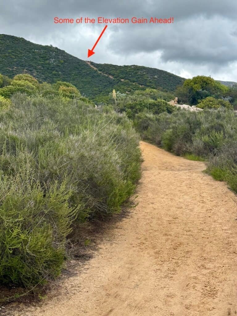
Photos: Looking Back at the Winding Path Behind | A Glimpse Ahead at the Climb Still to Come
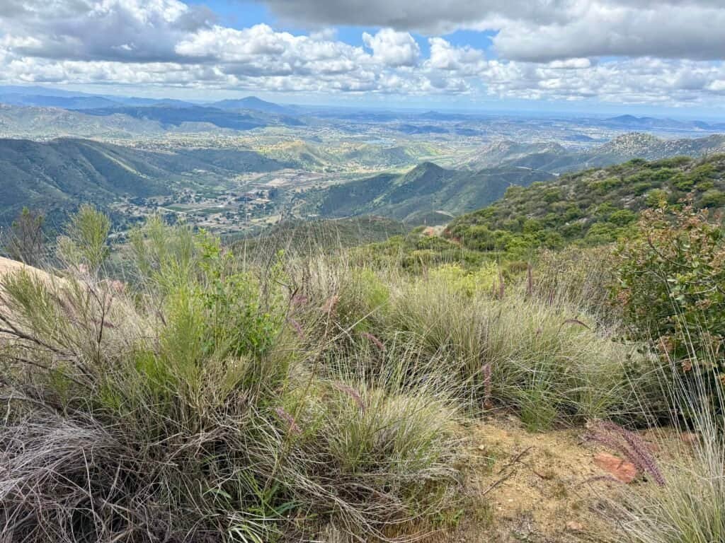
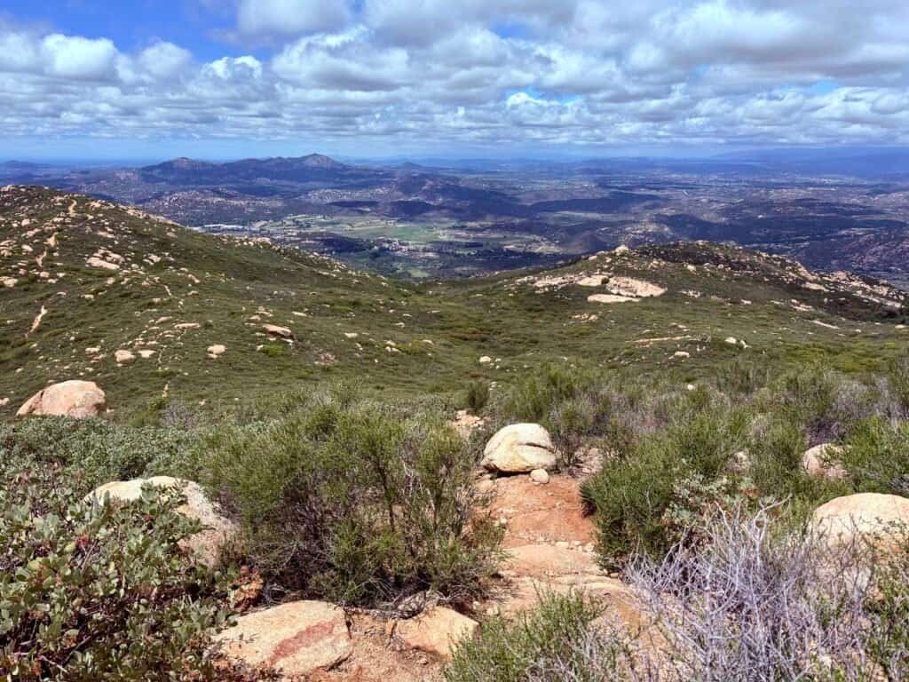
Photo: Views Like This Make Every Step Worth It!
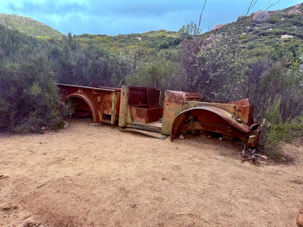
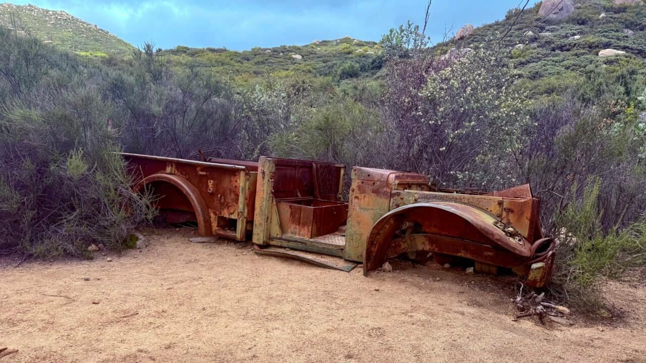
Photo: Reaching “The Ruins”, A Sure Sign You’re Closing In on The Plateau.
The Plateau (Where the Real Work Begins)
Eventually, you’ll reach a big, flat landing area with sweeping views and plenty of space to rest. It’s a natural spot to pause — and also where the trail splits. If you go left, you’re heading up to El Cajon Summit. Go right, and you’re on your way to El Capitan.
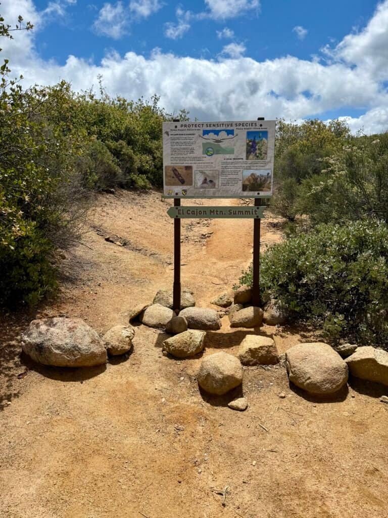
Photos: The Plateau Area | Summit Marker for El Cajon Mountain — Just a Short, Steep Climb. 😂
No surprises here — everything’s clearly marked, and you know exactly where you are. What you don’t know (or maybe you do, but you’re in denial) is how tough the final stretch will be. It’s a narrow, rocky scramble — about 0.6 miles and another 400+ feet of elevation gain. Brutal. But when you reach the summit? Totally worth it.
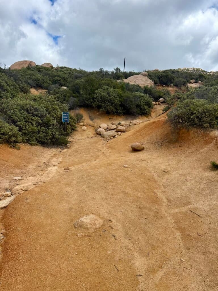
Photo: The Final Push — The Summit Awaits!
The Summit Scene
The summit is small but mighty. When I arrived, a group of women was joyfully taking group photos (respect), and I ended up chatting with a couple of nice guys. Shoutout to Eric from Seattle, who’d hiked up from the other (more challenging) side. He was thinking about Ubering back to his car, but I offered him a ride if he was still around when I finished. Good dude.
Another guy, Matt, ran the entire thing in 1 hour and 40 minutes.
I was impressed.
And mildly offended.
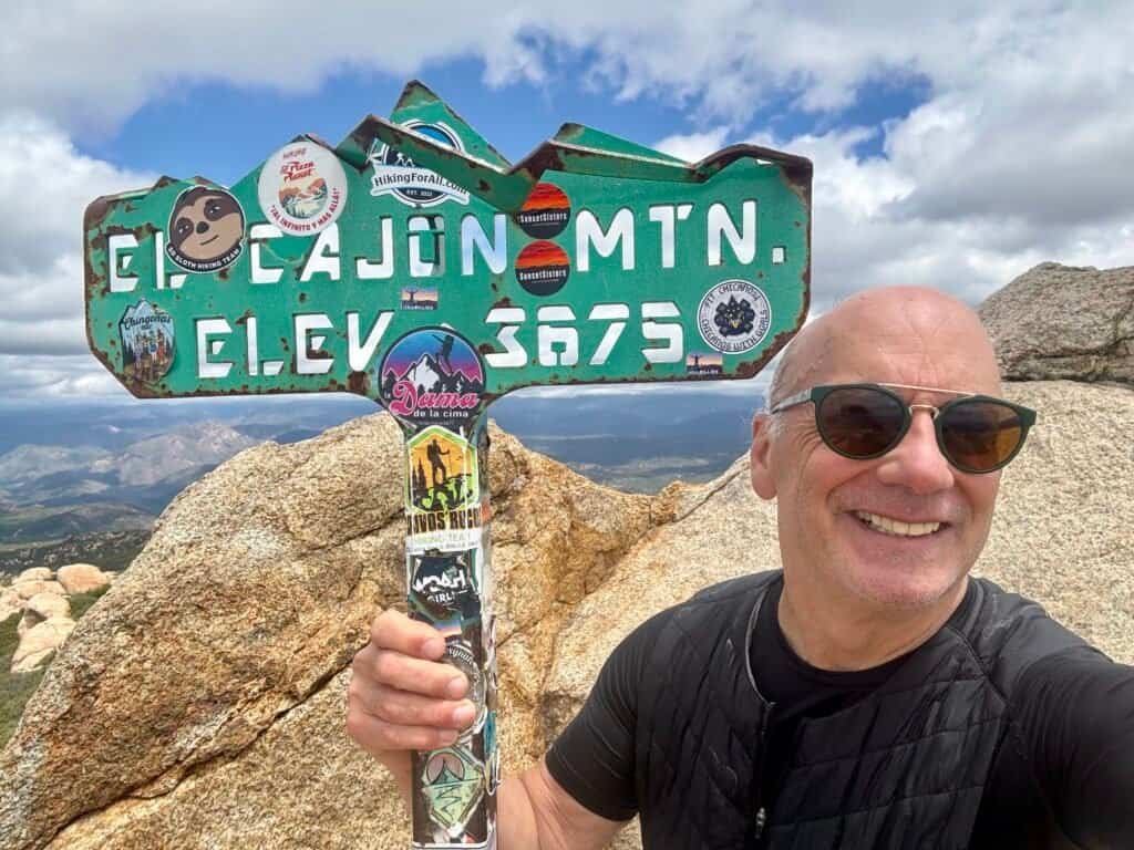
Photos: On the Way Up to the Summit | Summit Selfie
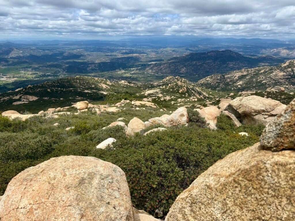
Photo: Breathtaking Views from the Summit!
The Descent: Watch Your Step
(and Your Soul)
Here’s the thing about El Cajon: it saves its punches for the return trip. The descent is not a victory lap. There are steep, rutted sections that’ll torch your knees and test your balance. And remember all those steep descents from earlier? Now you get to climb them back up. Surprise!
Take your time, watch your footing, and save some snacks for the way down. You’ll need them.
Photos: The Tough Uphill Stretches on the Last Miles — Not Easy When You’re Running on Empty!
What You Should Know Before You Go
- Trailhead location: Off Wildcat Canyon Rd. in Lakeside, CA.
- Total Distance: ~11 miles out-and-back.
- Elevation Gain: Over 3,500 feet.
- Time: Just under 5 hours with a 20-minute summit break.
- Difficulty: Challenging. No joke.
- Trail Conditions: Well-marked, rocky in parts, with steep and washed-out sections.
- Facilities: Pit toilets at the trailhead. No reliable water on-site (besides the backup buckets).
- Wildlife: A rabbit, a few hawks, and that haunting, oddly comforting bird call near the Blue Sky Ranch Community.
Final Tips
- Start early. The parking lot fills fast.
- Bring water. More than you think you’ll need.
- Pack snacks. You’ll be glad you did.
- Wear good shoes. Grip is essential.
- Trekking poles are a game-changer. They help on the steep climbs and save your knees on the way down.
- Mind the time and pay attention to closure signs. The trail is clearly marked when it’s closed, and the gates do lock on time. Hours are posted at the trailhead and change with the season — for my hike, it was 7 PM sharp.

Photos: One of My Go-To Protein Bars — IQBar |
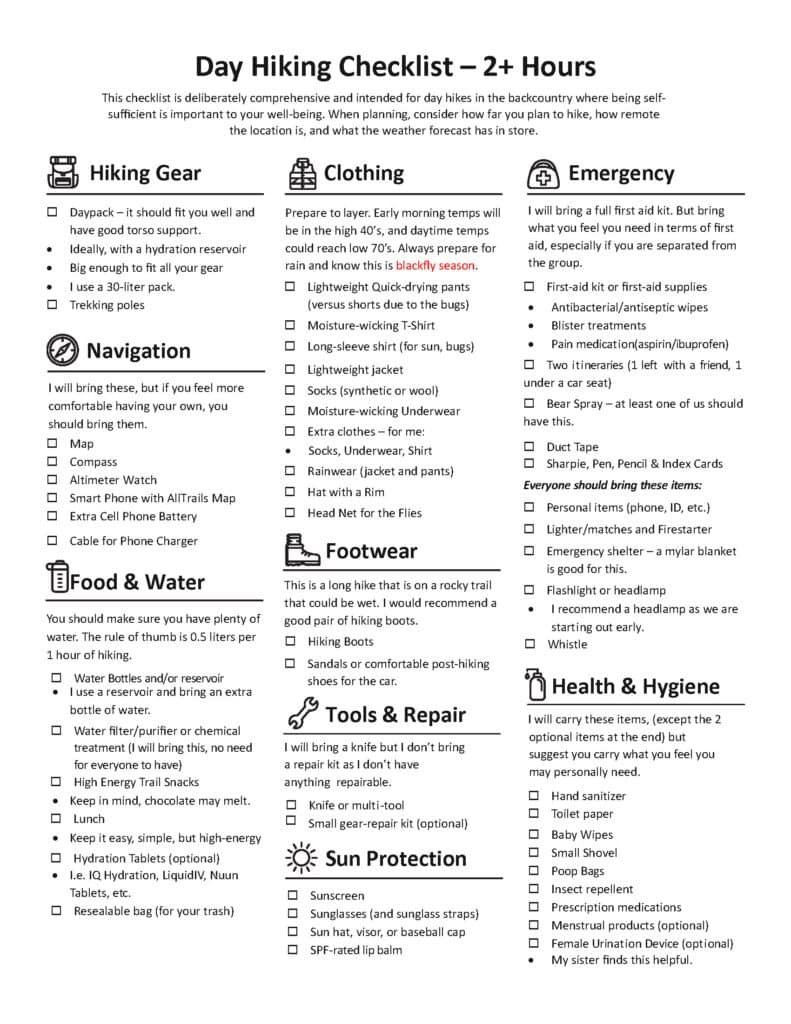
My Essential Day Hike Checklist
A Quick Note
This is a shameless plug for IQBars — the founder and CEO, Will Nitze, is a true hustler who’s done an incredible job building the brand. I keep these in my pack on longer hikes. You can grab their variety pack at Costco or check them out online at EatIQ.
For more ideas on what to bring, be sure to check out my Essential Day Hike Checklist post. You can download the full checklist at the end of that post.
Catch you on the trail!
Date of Hike: 27 April 2025
Discover more from love cook adventure
Subscribe to get the latest posts sent to your email.
Diana
Those are some angry looking skies, but some cool summit views!
Steve Anderson
They definitely looked ominous—more bark than bite, though! If I were back East, I probably would’ve been a lot more concerned. And yes great views.