
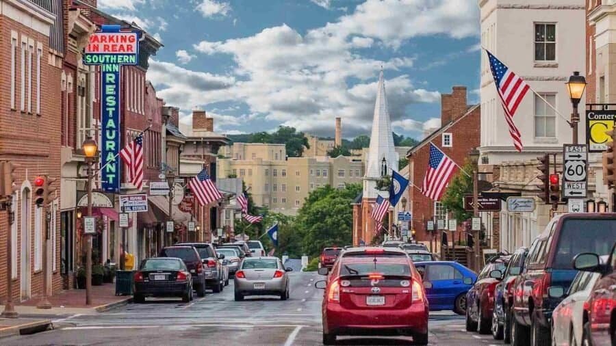
I recently went on a road trip, visiting towns throughout the Southeast and Mid-Atlantic. As I traveled, I was looking for cool small towns or cities with vibrant downtowns, great eats, a cool vibe and access to the outdoors. One such town was Lexington, Virginia. As it happens, I was there on a Wednesday – the day of their local Farmers Market. Lexington Farmers Market or FB @LexVAFM or IG @Lex_VA_FM) At first I was a little skeptical, due to the size (two rows of vendors) – but this skepticism passed quickly as I was surrounded by a huge variety of awesome food and products. (as a caveat, this was in February, and I am sure during the summer they have many more vendors) Some of my great finds…..

22 Waterfalls on One Incredible Loop
Of all the Best State Parks I’ve visited so far, Ricketts Glen State Park easily ranks as one of my favorites—and it’s a place I’d recommend making a special trip to see. Located about an hour west of Scranton, Pennsylvania, Ricketts Glen is one of the most scenic areas in the state.
The park spans 13,193 acres, features 22 named waterfalls, and offers more than 26 miles of trails. The star of the show is Ganoga Falls, plunging 94 feet, the tallest waterfall in Pennsylvania. Interestingly, when funding fell through during World War II and Ricketts Glen didn’t receive National Park designation, Pennsylvanians stepped in and purchased the land themselves, ensuring it would be preserved. Kudos to those who had the foresight.

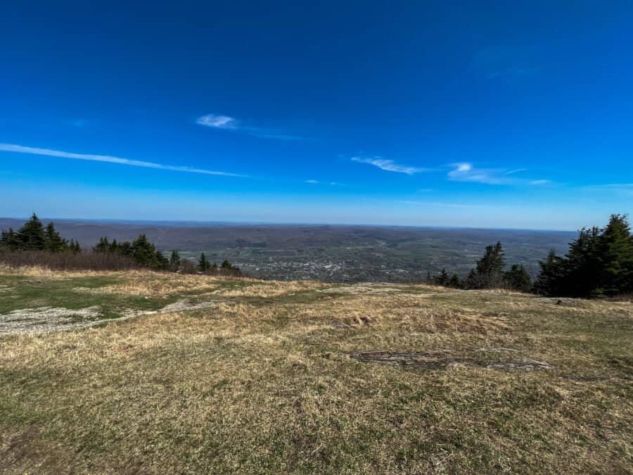
At 3,213 feet, Mount Davis is the highest point in Pennsylvania, ranking #33 among U.S. state high points and my 6th overall.
This was my second high point of the day, following Hoye Crest in Maryland, and as I headed north the weather steadily improved—a welcome change after an earlier cloudy start.

This is my first park to visit from The Discoverer’s list of Best State Parks in Each State. As I visit each state park, I will give you my thoughts, experiences and helpful hints.
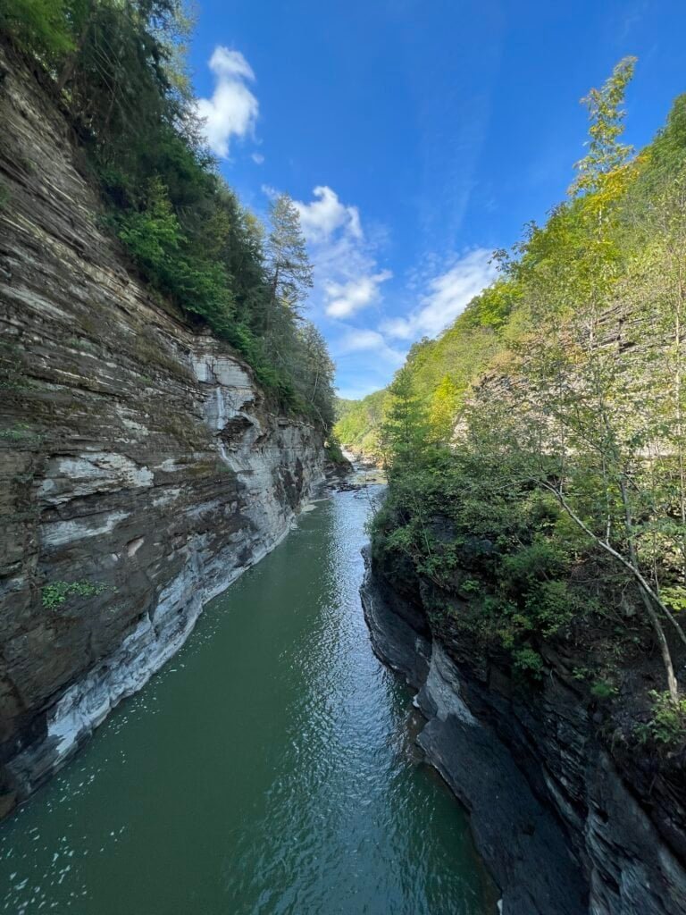
Letchworth State Park, renowned as the “Grand Canyon of the East,” is one of the most scenically magnificent areas in the eastern U.S. The Genesee River goes through the gorge over three major waterfalls between cliffs–as high as 600 feet in some places–surrounded by lush forests. Interestingly, when we visited the park, the water levels were very low as you can see by many of the pictures. We spent two days in the park, which I would highly recommend.

Photos: History of the Park | It certainly is a great park!

At 3,360 feet, Hoye Crest is the highest point in Maryland, ranking #32 among U.S. state high points and my 5th overall.
Located on Backbone Mountain near the West Virginia border, Hoye Crest is a relatively straightforward hike—but one that comes with a few interesting quirks along the way.
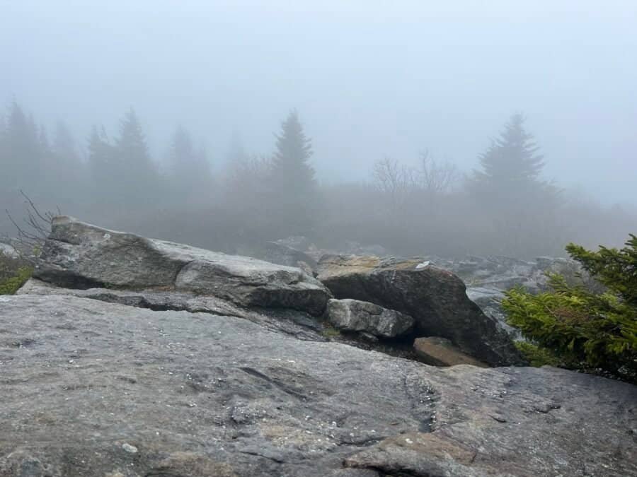
At 4,863 feet, Spruce Knob is the highest point in West Virginia, ranking #24 among U.S. state high points and marking my 4th overall.
Located within both the Monongahela National Forest and the Spruce Knob–Seneca Rocks National Recreation Area, Spruce Knob can be reached either by a long hike or by driving nearly to the summit—an option that proved useful on my visit.

At 2,380 feet, Mount Frissell marks the highest point in Connecticut, ranking #36 among U.S. state high points and becoming my 3rd overall.
Unlike many state high points, Mount Frissell is reached via a multi-state hike, with the trailhead located just across the border in Massachusetts. Add in rocky scrambles, border crossings, and rewarding views, and this turned out to be one of the more memorable early summits on my list.

At 1,803 feet, High Point is the highest point in New Jersey, ranking #40 among U.S. state high points and marking my 2nd overall.
Located within High Point State Park, near the New York–New Jersey border just southeast of Port Jervis and I-84, this summit is one of the most accessible high points in the country. After hiking Mount Greylock in Massachusetts, “summiting” High Point felt like a bit of a cheat—you park and walk roughly 700 feet to the monument.
As many of you know, I follow a travel blog called The Discoverer. They tout themselves as A Modern Travel Guide that transports you to far off destinations directly from your inbox. I enjoy reading the articles on my quest to discover the world. One such article listed the Best State Park in Each State. The writer Morgan Love, doesn’t say how each park was selected, but non-the-less, I thought it would be fun to visit each park and give you my take on the park. The impetus of the article is to pay tribute to our beloved State Parks as State Parks are giving National Parks a run for their money, drawing an average of 807 million visitors annually. And why the hype – well, for one, each state has a ton of protected land with State Park designation — a whopping 18,694,570 acres, to be exact. With 8,565 parks and 14,672 trails to explore, chances are there’s a beautiful park right in your backyard. But if proximity isn’t enough to entice you, our State Parks are also known to offer the same amount of grandeur, history, and natural beauty as any other wild place in the states.
So follow along and be transported to these State Parks!
The Start of My State High Point Journey
At 3,491 feet, Mount Greylock is the highest point in Massachusetts, ranking #31 among U.S. state high points and marking my first official summit in the journey to visit the highest point in every U.S. state and the District of Columbia.
Located in the Berkshire Mountains of western Massachusetts, Mount Greylock stands apart from many state high points in that it’s a true hike—and, on a clear day, offers views into five states. I tackled this inaugural summit alongside my sister, Vicki, making it an especially memorable start to the adventure.