love | cook | adventure

sharing my love for philanthropy, cooking, and adventure

Sunrise illuminating the summit glacier on Mount Kilimanjaro, with ice formations in the foreground and a sea of clouds in the background.

Backbone State Park | Iowa

Back At It!

I’m back at it after a winter hiatus from Highpointing and exploring the Discoverer’s List of The Best State Park in Each State! This month’s adventure revolves around “summiting” Charles Mound, the highest natural point in Illinois. This peak sits on private land, and the gracious owners open it to the public the first weekend of June, July, August, and September, from sunrise to sunset. More on that in my next post!

With these key dates in mind, I embarked on my journey. I flew from sunny San Diego, California, to Minneapolis, Minnesota, where I rented an SUV for my month-long journey through the upper Midwest. I’ll be mixing it up between camping in my trusty SUV and staying at a few hotels along the way. I opted to spend the night in Rochester, Minnesota, and picked up some sundries on the way to my hotel. I don’t normally do this, but I ordered everything ahead of time and drove up to the store to have it placed in the back of my SUV. Talk about a game changer and it saved me a ton of time! The next morning, after breakfast at the hotel, I headed for my first stop, Backbone State Park in Dundee, Iowa.

Should a Name Worry You?

We’ve all heard the story: Greenland and Iceland were named with a bit of strategy (and perhaps a touch of mischief). Greenland isn’t exactly a lush paradise, and Iceland isn’t just a block of ice. As I cruised through the charming back roads of Minnesota, I stumbled upon the towns of Harmony and Prosper. Did early settlers name these towns hoping to manifest a little extra luck and good vibes? I wouldn’t be surprised!

Picture: Harmony, Minnesota | Population 1,043

Then, as I meandered through Decorah, Iowa, I spotted signs for the Laura Ingalls Wilder Park and Museum. Shockingly, I learned she was a real person, not just a character from the 70’s and 80’s TV Show “Little House on the Prairie.” Who knew? Apparently, there are several museums, and this one marks her home from 1876-1877. Laura was a writer who penned a beloved series of children’s books about her childhood, aptly titled “Little House on the Prairie.”

And on a completely unrelated note: isn’t it funny how even the tiniest towns in America boast either a Mexican or Chinese restaurant? Next time you’re on a road trip, see if you can spot one!

Backbone State Park and the CCC

I’ve noticed a trend with the Discoverer’s List—many places owe their existence to the hardworking Civilian Conservation Corps (CCC) or were among the first state parks in their area and Backbone State Park fits both categories. The CCC built many of the park’s amenities, including roads, trails, and the historic Stone Lodge, which remains a popular spot for gatherings and events. Their craftsmanship and dedication are evident in the enduring structures that blend seamlessly with the natural environment.

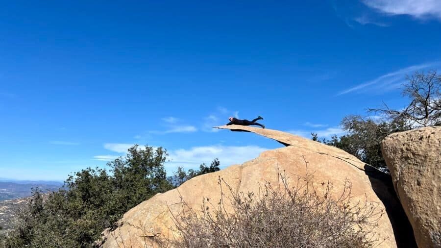
According to the park’s website, “Dedicated in 1920 as Iowa’s first state park, Backbone State Park is one of the most geographically unique locations in Iowa.” That’s no exaggeration! While Iowa may bring to mind sprawling farms and flat plains, Backbone State Park breaks the mold with its more rugged terrain. The Maquoketa River’s carved, steep ridge—dubbed The Devil’s Backbone—rises as the highest point in northeast Iowa, living up to its epic name with an 80-foot ascent above the river. This geological wonder not only defines the park but also offers visitors a glimpse into the area’s rich natural history.

Pictures: South Gate Entrance | About the Civilian Conservation Corp and Iowa Parks

Exploring Backbone’s Natural Wonders

I kicked off my adventure at Backbone State Park by entering through the south entrance and snagging a parking spot near the beach and boathouse. Since it was early and the recent rains had turned the lake a bit muddy, I had the whole place to myself—no one on the beach, no boats on the lake. The boathouse is pretty cool with its rustic charm and vintage vibes. It looks like you can rent paddle boats and canoes there, but it was all closed up on my visit. So after a look around, off I went to explore the rest of the park.

Picture: The Boathouse

Pictures: From the Boathouse – The Beach and the Rental Boats

I started my trek on the East Lake Trail, a 2.4-mile path skirting the lake. It wasn’t the easiest to find at first—I had to do a bit of wandering before finally spotting a trail marker.  The initial stretch was a little overgrown, not my idea of a fun hike, but certainly added to the adventure. But as I pressed on, the path opened up, becoming clearer and more inviting. The trail was surprisingly quiet, with only a few people around. I did spot three guys fishing, totally soaking in the peace and quiet. Navigating around a few fallen trees was no big deal, and the rock formations were giving me major upstate New York vibes, which was a cool surprise. Despite the muddy waters and high lake levels from recent rains, the trail offered nice views and a serene experience. About halfway through, I stumbled upon the Bluebird Trail, an easy and inviting 2.2-mile detour, perfect for those looking for a gentler hike.

Pictures: The East Lake Trail Marker? | Beginning of the East Lake Trail | One of the many fallen trees

Pictures: Some of the many Rock Formations

As I continued along the East Lake Trail, I ended up veering off track a bit. I quickly realized that the trails at Backbone State Park aren’t exactly the most well-marked. After crossing a bridge, I unintentionally went straight instead of taking the right path. After some backtracking, I found my way back on track, thanks to seeing some hikers in the distance coming from the direction I needed to go in. There were a few pesky flies buzzing around, but I chuckled seeing them donning full-head nets—I initially thought it was a bit over the top. Little did I know, they would have the last laugh as you’ll find out later.

Pictures: Another Rock Formation | The North End of the Lake | Part of the East Lake Trail

Enter in the City Folk

Ah, city folk—those urban adventurers who brave the great outdoors! The Backbone Trail seems to attract them like moths to a flame. It’s the park’s namesake, it’s flat as a pancake, and at just 0.8 miles, it’s perfect for a quick jaunt. As I came up to the parking lot, I braced myself for the urban invasion. Take a deep breath and prepare for the experience!

I’m pleased to report that, by and large, everyone was civilized and respectful on the trail. Having hiked all over the country and read up on this trail, I was expecting a bit more of an adrenaline rush. It’s wide enough, with a few spots near the edge that might make you gulp (especially for someone afraid of heights), but nothing too heart-stopping.

Pictures: The Backbone Trailhead | The Backbone Trail

Pictures: Views of the Maquoketa River as it winds around both sides of the Devil’s Backbone

Pictures: Along the Backbone Trail

Quirky Moment

From the Backbone Trail, I ventured towards the Six Pines Trail, a short 0.6-mile path that surprisingly led me directly to the Six Pines Campground. Getting to this trailhead was a mix of road and trail, making me wonder why the trails aren’t better connected in such a sprawling park. Later, heading from the East Entrance up to Richmond Springs, I encountered a similar situation—only road access was available.

Anyway, at the Six Pines Trailhead, a car pulled up, and out stepped a woman with a distinct foreign accent, casually puffing on a cigarette. She started up the trail ahead of me but then suddenly veered off into the woods between two marked paths. Not sure where she was headed, but hey, to each their own. This trail had some awesome elevation changes and plenty of valleys to explore.

Pictures: Along the Six Pines Trail

Lost Opportunity

Backbone State Park has camping options for everyone. The South Lake Campground offers modern amenities like electric hookups and showers, all nestled among the trees for that perfect nature-immersed experience. On the flip side, the Six Pines Campground gives off a more secluded, primitive camping vibe. Since it was a summer holiday weekend, online booking required a minimum stay of two nights—Friday and Saturday. Planning for just one night, I kept my options open, knowing walk-ups were possible if space was available. After a day of exploring the park, I set my sights eastward, prepping for my next adventure at Charles Mound.

It’s worth noting that when I stumbled upon the Six Pines Campground, it was completely empty—a missed opportunity in my opinion! While I didn’t check South Lake, there might have been some availability there too. Honestly, the Iowa park system could really benefit from a savvy revenue manager for their online bookings. Just a thought!

Picture: The Empty Six Pines Campground (this is Saturday, day 2 of the weekend requirement)

Oh, the Mosquito Saga!

The last trail before I ventured up to the northern part of the park was the West Lake Trail, a 3.0-mile journey that looped me back to the parking lot and boathouse. Right at the start, I crossed a bridge over a swollen, muddy creek—definitely not your average trickle. On the other side, the trail was a squelchy mess, teeming with mosquitoes. They let up once I pushed past the marshy spots, but it was still a battle of wills.

The hike itself was pleasant enough, though a tad monotonous. I was itching (literally!) to get back to the car and explore the northern reaches of the park. So, I trudged onward, and eventually, the trail wound me around from the beach and over the dam that created the lake.

Pictures: The bridge over the swollen creek and a warning sign about high water

Pictures: The View across the Lake | The Dam

Should of gotten the Ice Cream!

I finally made it back to the parking area, and the little shop was open. The park was getting busier and there were even people on the beach and swimming. (I guess the water wasn’t as muddy as I thought in the lake). I stopped by the little shop, tempted by the advertised smoothies. Unfortunately, it was more like a sugary slushy than a real smoothie – definitely a poor choice. Next time, I’ll stick with ice cream! Also, a shop without postcards? That’s a definite red flag. Lesson learned, folks!

Pictures: The Smoothie Sign | Inside the Shop | My Mango “Smoothie”

No easy way

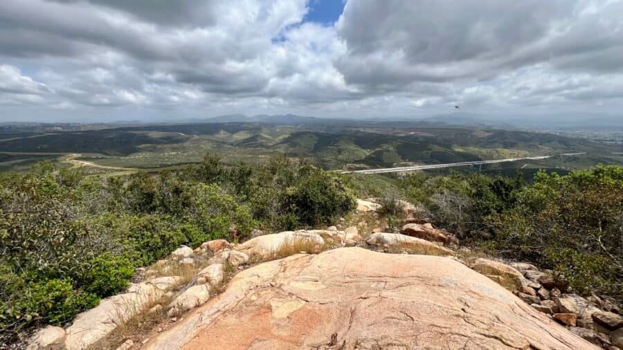
So, just like with the trails, the roads in the park aren’t exactly seamlessly connected. I had to exit through the South Gate and loop around to the East Gate—a bit of a detour, about a 3-mile trek. The East Gate boasts an old-school sign, likely put up by the CCC back in the day. As you drive in, you’ll spot the Maquoketa River Scenic Overlook, which I hiked below earlier in the day. Unfortunately, thanks to all the lush vegetation, the view wasn’t exactly panoramic right now.

Heading north, the road winds for a little over 3 miles. Near the end, there’s a trail called the Barred Owl Trail that I considered hiking initially, but it’s just 0.4 miles and didn’t seem too thrilling. Along the way, there are a few pit stops. The first one is Balanced Rock, which took me a hot minute to actually find—it’s not exactly conspicuous, unlike the one I’ll tell you about at Devil’s Lake State Park in Wisconsin.

Pictures: The East Gate Sign | Maquoketa River Scenic Overlook | The Overlook View?

A not so Scary Cave, but Scary Springs

Next on the road trip agenda was The Cave. It’s just a short hike from the parking lot—nothing too deep or terrifying, as caves go. Near the parking area, the creek flows under the road, and whoever designed it built tunnels that create these cool whirlpools before the water disappears under the road.

Pictures: The Cave Trailhead | Trail to the Cave | Cool Whirlpool

Picture: The Cave

The final stop on this tour was Richmond Springs. They say it’s a constant 48 degrees, but I wouldn’t dare jump in, even on a scorching hot day. The springs looked a bit spooky, filled with patches that seemed like algae or some kind of growth.

Pictures: Richmond Springs | The Growth in the Springs

My take on Backbone State Park

Reflecting on my visit to Backbone State Park brought back memories of my childhood trips to Green Lakes State Park in upstate New York. Living nearby, it was a fantastic spot for picnics, camping, fishing, hitting the beach on hot summer days, or hiking the many trails. It was the perfect getaway into nature. But in retrospect, would it be a park I’d make a special trip to as a destination? Probably not. When I think about the best park in each state, I feel it should rival a National Park, and honestly, Backbone State Park didn’t quite hit that mark. Is it a fun park? Absolutely. Would I go there if I lived nearby? Hell yes.

Date of Visit: 6 July 2024

Picture: Park Map

Big Bear Lake viewed from Bertha Peak in the San Bernardino Mountains

Bertha Peak | Big Bear Lake | CA

Finally Made It to Big Bear Lake

Sometimes, you don’t need to go far to feel like you’ve gone somewhere special. After living in Southern California off and on for years, I finally made it to Big Bear Lake — one of those places that had somehow stayed just out of reach.

Natural Bridge State Park | VA

An Intro for those Jeopardy! Players

Natural Bridge in Virginia is a geological marvel, standing at 215 feet high and 90 feet wide, carved by Cedar Creek. This natural limestone arch was considered sacred by the Monacan Indian Nation. George Washington surveyed the bridge for Lord Fairfax in 1750. Legend has it that Washington carved his initials into the rock, which visitors can still see today. Oh George, defacing our natural resources? 🤦‍♂️ Maybe the story about him chopping down his father’s Cherry Tree wasn’t a myth? In 1774, Thomas Jefferson purchased the bridge and 157 surrounding acres for 20 shillings, about £1 or $4.44 or roughly $7,200 today with inflation. Quite a steal for the bridge! The site also boasts rich biodiversity, with rare plants and wildlife. Natural Bridge became a National Historic Landmark in 1998, reflecting its historical and cultural significance.

Picture: The Natural Bridge

Camping Adventures

The night before my park visit, I stumbled upon Thunder BRidge Campground, a gem I found on HipCamp. This 100-acre site has quite a history—originally built by the Civilian Conservation Corps in the ’30s, then a boys’ juvenile detention center and a Big Brothers/Big Sisters camp until 2009. Thunder Bridge offers private tent sites, cozy cabins in the woods, and spacious RV spots on a well-kept green space. The host, Adam, was uber friendly, super chill and helpful.

I met Adam at the entrance and arranged to buy some firewood from him. Note: Always buy local firewood to avoid spreading invasive species—many parks ban non-local wood. Adam drove me to my cabin, Woodpecker 1, and dropped off the wood. I chose a cabin because it wasn’t much more expensive, and I didn’t want to hassle with setting up a tent for just one night. The cabin was spacious, had all I needed, and the bathhouse wasn’t far away, complete with a communal room to charge my phone and laptop.

Pictures: Woodpecker #1

Hungry upon arrival, I used some farm-fresh eggs from my previous Airbnb host to make a delicious egg sandwich. Later, I steamed tamales I’d picked up during my travels. Who says you can’t eat well while camping? It was a chilly night in early October, but I survived and enjoyed the adventure!

Pictures: My Egg Sandwich | Cooking Tamales over the Fire

Pictures: My campsite with the wood from Adam | I love making campfires!

Not All Natural Bridges Are Created Equal

A few months back, I had an amazing time at Kentucky’s Natural Bridge, so I was super pumped to check out Virginia’s version. Spoiler alert: it didn’t quite live up to the hype. Sometimes, beautiful spots get too popular and end up feeling more like theme parks than natural wonders, and that was definitely the vibe here. Let’s just say, Virginia’s Natural Bridge won’t be making my list of favorite state parks.

Pictures: The Visitor Center | LOVE sculpture next to the Visitor Center

First off, the entrance fee. If you’ve read my other posts, you know how I feel about high entrance fees. Sure, parks need money for upkeep, but charging $9 per person (13 and over) can make it pretty pricey for families, especially those on a budget. It gave me flashbacks to the pricey Flume Gorge in New Hampshire.

At the Visitor Center, you’ll find the usual suspects: a gift shop, exhibits, and restrooms. From there, it’s a trek down 137 steps to the Cedar Creek Trail. There are a few other trails in the park, but Cedar Creek Trail is the main event. It’s a fairly easy 2.0-mile round trip with a 400-foot elevation change—most of which is tackled by those stairs down to the Trail Store, where you pay your $9 fee at a small window.

Pictures: The start of the walk down to the Trail Store

Picture: Trail Map

A short walk from the store brings you to the Natural Bridge. It’s a cool geological formation, carved over millennia, but it didn’t quite wow me like Kentucky’s. And here’s where things get a bit theme park-ish: rows of benches and spotlights facing the bridge. For almost a century, the bridge has been illuminated on the last Saturday night of every month from April to October. They recreate the first light show from 1927, with the 200-foot-tall arch lit from above and below while Cedar Creek murmurs below. Sounds kind of magical, right? But still, at $9 a pop, it feels a bit commercial.

Pictures: The Natural Bridge – complete with a spotlight in the foreground | Natural Bridge from the other side – notice all the benches at the end of the trail

A Journey Through Time

Walking along Cedar Creek Trail at Natural Bridge State Park in Virginia is like stepping back in time. The trail offers a glimpse into the rich history of the Monacan Indian Nation through its living history exhibit, although it was closed during my visit. This exhibit usually showcases the Monacan way of life, offering insights into their daily activities, traditions, and skills. But based on the pictures, needs a little work.

Pictures: The Monacan Indian Exhibit

Continuing along the trail, you’ll encounter the Saltpeter Cave, a significant historical site used during the War of 1812 for mining saltpeter, a key ingredient in gunpowder. Cool history, but not much to it. Next, you’ll reach Lace Falls, a 30-foot waterfall that provides a serene and picturesque stop. It was nice, but wouldn’t hit my top 100 waterfalls that I have seen.

Pictures: The Saltpeter Cave

Pictures: Views along Cedar Creek Trail

Pictures: Cool Rock on the Trail | Asters or Symphyotrichum

Picture: Lace Falls

Lastly, the trail features the mysterious “Lost River,” which disappears underground, adding an element of natural wonder to your hike. Each of these sites along Cedar Creek Trail tells a unique story, weaving together the area’s cultural and natural heritage.

Pictures: The “Lost River”

I finished my visit back at the Visitor Center to buy some postcards and use the restroom. And since I was there, I decided head downstairs and check out the exhibits. The staff was super cool and showed me the star of the exhibits, a beautiful Eastern Indigo Snake, by the name of Margarita.

Picture: Margarita

Bookend Adventures: The Acorn Inn

Outside of Margarita and yes, the actual Naturall bridge, the hightlights of this trip were camping the night before and then my stay afterwards. Venturing northeast along the Blueridge Parkway from Natural Bridge State Park, I landed in the quaint hills of Faber, Virginia, at the Acorn Inn Bed & Breakfast, about an hour and a half away.

Picture: The Acorn Inn Bed & Breakfast

Nestled amidst the charming hills, Martin and Kathy run this delightful retreat with warmth and flair. Surrounded by lush forests and vineyards, the inn offers a serene escape. Each morning, Kathy’s homemade breakfasts tantalized my taste buds, while Martin brewed some coffee and shared stories and local tips. Turns out, Kathy’s brother shared my college alma mater and major—a small world indeed!

Picture: My Room at the Acorn Inn

Pictures: The Hallway – look at how wide the “stable” doors are! | Communal Men’s Bathroom

Pictures: Communal Living Room | Kitchen (FYI – not set up for cooking) | Banquet Room

Pictures: Outdoor Spaces

With the whole inn to myself for three nights, I soaked in the tranquility. My photos capture the cozy common areas and perfect porch relaxation spots, showing the charm and character oozing from every corner of the inn. How cool is it that the inn was once a stable, transformed by Martin himself? Martin’s craftsmanship is just the start—Kathy’s talent as an artist and photographer shines through the beautiful pieces adorning the walls. I wanted to buy so many of her art pieces! Before opening the Acorn Inn, they lived and worked in Mexico and South America, so the walls are also adorned with folk art, masks, and tapestries from their travels. It’s the perfect spot for remote work and nearby adventures, like exploring the charming town of Nellysford. I couldn’t resist grabbing wine and snacks from Basic Necessities. If you’re in the area, do yourself a favor and check out the Acorn Inn Bed & Breakfast! You won’t regret it.

Pictures: Some of Kathy’s Artwork

Pictures: Some of the Folkart from their Travels & Life in Mexico and South America

Picture: Basic Necessities in Nellsyford | VA

Wrapping Up the Adventure!

As we wrap up this adventure, let’s take a moment to reflect on the highs and lows, the triumphs and tribulations. While Natural Bridge State Park didn’t quite knock my socks off like we hoped (cue sad trombone), my journey wasn’t all doom and gloom. Oh no, my friends, Thunder BRidge Campground was an uber cool find and nestled in the hills of Faber, Virginia, lies a hidden gem—the Acorn Inn Bed & Breakfast, run by the dynamic duo, Martin and Kathy. After all, life’s too short for boring adventures! 🌟

Dates of Visit: 7-12 October 2023

Cape May | New Jersey

Travel Isn’t Alway Pretty

One of my all-time favorite chefs and globetrotters was the legendary Anthony Bourdain. He once said, “Travel isn’t always pretty. It isn’t always comfortable. Sometimes it hurts, it even breaks your heart. But that’s okay. The journey changes you; it should change you. It leaves marks on your memory, on your consciousness, on your heart, and on your body. You take something with you. Hopefully, you leave something good behind.”

Now, let’s talk about Cape May, New Jersey. This little beach hamlet managed to break my heart in ways I didn’t see coming. Sure, the journey was fun and educational, but it was also like an unseasoned clam chowder – something was missing. Granted, I visited during the off-season, which meant fewer crowds but also fewer attractions. But honestly, after hearing my travel buddy’s tales of the summer madness in these beach towns, I’m pretty relieved I dodged the peak tourist frenzy. Cape May might not have lived up to the hype, but hey, at least I got a history lesson out of it!

Picture: Map of Cape May

When on Holiday. . .

A little background on this excursion – I was visiting my buddy Phil and his wife Amanda in Lewes, Delaware. With Amanda tied up at work, Phil and I seized the opportunity for a boys’ day out, setting our sights on Cape May. Our journey began at the Lewes Ferry Terminal, one of the nicest I’ve seen, and the On the Rocks Dockside Grill. Now, ferry protocol: arrive early, check in, line up the car, head inside to chill, and wait for the call. And since work was the last thing on our minds, we cozied up to the bar for some top-notch Bloody Marys because, hey, when on holiday, it’s practically the law! Here is a link to the Cape May – Lewes Ferry.

Pictures: The Lewes Ferry Terminal

Pictures: The Lewes Ferry Terminal | The Breakfast of Champions

The “Call”

It’s like the iconic moment at the Indy 500 when they holler, “Drivers, Start Your Engines!” But here, at the ferry terminal, it’s our turn. A crackle over the PA system signals it’s time to hustle to our cars and prepare to board. These salty sailors work their magic, seamlessly ushering vehicles onto the ferry. Once aboard, we ascended to the upper deck, ready to soak in the 85-minute voyage to Cape May. Despite the November chill nipping at our noses, we braved the brisk air for a while before retreating indoors to explore the ship and chill a bit more. I bet the trip in the summer is even more amazing. But, alas, we made do. And just like that, as the shoreline drew near, the call echoed once more, beckoning us back to our car for the next leg of our adventure.

Pictures: Boarded and set to go! | Looking back at Lewes

Pictures: Bundled up for the Crossing | Approaching the Cape May Ferry Terminal | Passing a Ferry

Farm-to-Bottle

Southern New Jersey boasts rich farmland, offering bountiful harvests of fresh produce. This fertile region is known for its vibrant, community-driven agricultural traditions. Here, farmers cultivate a bounty of crops, from juicy tomatoes to sweet corn, under the sun-drenched skies of the Garden State.

Our next stop was Nauti Spirits, a true farm-to-bottle operation, which is also one of NJ’s largest distilleries, with two massive all-copper pot stills and a column still. It is located on a bucolic 60-acre coastal working farm that sits between the Atlantic Ocean and Delaware Bay, less than 5 minutes from (and between) downtown Cape May and the Cape May – Lewes Ferry. The distillery is unique in NJ, as they use much of what they grow on their farm to produce their spirits.

Picture: Nauti Spirits Distillery

Pictures: Cool Vibe inside Nauti Spirts

Walking in, you’re hit with that vibe—cool, laid-back, and totally inviting. The staff? Top-notch. The place? Gorgeous, with sunflowers swaying in the breeze like a scene from a postcard. We sampled their spirits, and while they were good, let’s just say the bourbon left a little something to be desired for the price. But hey, it’s all about the experience, right? So we kicked back, sipping our cocktails, soaking in the vibe, and reveling in the beauty of local agriculture. Cheers to that!

Pictures: Sunflowers at Nauti Spirits | Bourbon on the Rocks and a Nauti Mule

Not So Lucky

Our stomachs growling, we decided to grab a bite before diving into our Cape May adventure. The chosen spot? Lucky Bones Back Water Grill. Not that it would matter to me (I’m a pescatarian), but with a name like Lucky Bones and the aroma of a pit barbecue as you stepped out of your car, you’d think the menu would scream BBQ. Spoiler alert: BBQ wasn’t the star of this show.

Curious about the quirky name, I found out that “Lucky Bone” refers to the peculiar hook-like claw of the male horseshoe crab. Back in Cape May’s whaling days, sailors deemed these claws lucky charms, taking them to sea for protection. Hence, the name “Lucky Bones.”

Pictures: The “Sargeant Joe Friday” Mahi Sandwich | Beer with more Personality

Back to our dining experience: we opted for bar seating, as the dining room felt like a relic from another era—eerily cavernous and devoid of charm. The menu? A nostalgic trip to the 1980s, alongside Banana Seat Bikes, Miami Vice suits, and leg warmers. The food was just okay—nothing disastrous, but certainly nothing to write home about. I ordered a Mahi sandwich with house-cut fries. Note to restaurant owners: if you’re going to boast about house-cut fries, make sure you know how to cook them properly! The sandwich itself was as bland and uninspired as Sergeant Joe Friday from Dragnet. At least the beer had a bit of personality, which was more than I could say for the rest of the meal.

A Step Back in Time

Cape May is home to one of the highest concentrations of Victorian homes (second only to San Francisco), drawing visitors from all over. We parked near the Washington Street Mall—a pedestrian promenade brimming with unique shops, quirky boutiques, a variety of restaurants, and laid-back bars. We decided to dive in and explore. The mall had some cool spots but didn’t quite blow us away, so we wandered into the Historic District. The tree-lined streets were dotted with Victorian homes, most of them impressively well-maintained. These ornate, colorful houses definitely added a touch of charm and old-world elegance to the area and I get why people are drawn here.

Picture: Victorian Home in Cape May | NJ

Picture: Victorian Homes in Cape May | NJ

Sun, Sand, and Surf

No visit to Cape May is complete without hitting its pristine beaches—though maybe when it’s a bit warmer! On Cape May Beach, we stumbled upon a quirky beach bunker, a World War II relic standing strong against time and tides. This concrete sentinel adds a dash of history to the sandy shore, perfect for snapping unique photos or pondering its storied past while soaking up the sun. We’d dive deeper into history the next day at Cape Henlopen State Park in Delaware, discovering how differently the two states approach these historic sites. Sorry Jersey, Delaware has you beat here.

Picture: Cape May Beach

Pictures: Cape May Bunker | Cape May Bunker and Lighthouse

Beacon of History

Our final pit stop: the Cape May Lighthouse, a beacon calling out to explorers like us. Built in 1859, this iconic landmark boasts a height of 157 feet and a staggering 199 steps to the top. Its guiding light once served as a vital navigational aid for ships sailing along the bustling East Coast. While we missed the chance to peek inside, its majestic presence alone was worth the visit.

Pictures: Two views of the Cape May Lighthouse

Pictures: From Cape May’s Maritime Past

Adventures in Okay

As Anthony Bourdain wisely said, “Travel isn’t always pretty…but that’s okay.” So, let’s talk about Cape May, New Jersey. Sure, it didn’t steal the show for me, but hey, that’s part of the adventure, right? From exploring quirky beach bunkers to tasting local spirits, it was a journey sprinkled with surprises and lessons learned. Each stop, whether stellar or just okay, added a new chapter to my story. And isn’t that what travel’s all about? Happy Travels!

Date of Visit: 5 November 2023

Olivenhain Reservoir viewed from Elfin Forest Recreational Reserve in Escondido, California

Elfin Forest | Escondido | CA

Hiking the Elfin Forest: A Day of Adventure and Nature Wonders

If you’re craving an adventure that blends nature’s beauty with a solid workout, hiking at Elfin Forest Recreational Reserve is a must. On my most recent hike, I made my way up the Botanical Trail, transitioned to the Way Up Trail, looped toward the Lake Hodges Overlook, and then descended back down the Way Up Trail. Altogether, it’s a route that delivers steady elevation, wide-open views, and just enough challenge to feel earned.

Trust me—it’s a journey you’ll want to take.

Hiker lying on Potato Chip Rock on Mount Woodson in Poway, California

Mount Woodson | Poway | CA

Home of Potato Chip Rock

Some places become famous quietly. Others explode thanks to Instagram, hashtags, and gravity-defying photos. Potato Chip Rock is firmly in the second category.

Normally, I avoid viral trail spots like the plague. Between the wannabe influencers, endless selfies, and people blocking narrow trails for “just one more shot,” it can feel like more work than fun. But every once in a while, curiosity wins. And honestly? This one earned its hype.

Add in the fact that it’s a legit cardio workout, and suddenly I was in. So yes — I did take that photo on Potato Chip Rock. No, it never made it to Instagram.

View from North Fortuna Mountain overlooking Mission Trails Regional Park and the surrounding ridgelines

Mission Trails | San Diego | CA

Mission Trails Regional Park |
Five Peaks and a Story Years in the Making

It didn’t start out as anything more than a single hike.

On February 23, 2024, my sister Vicki and I went up Cowles Mountain—one of those San Diego classics that feels almost too easy to take for granted until you’re standing at the top, wind in your face, looking out at a city that suddenly feels smaller.

Trail Tales: Equip Yourself for Safe Hiking Adventures!

Hiking, even on a seemingly simple day trip, demands preparedness. Nature’s unpredictability underscores the importance of being equipped and knowledgeable, ensuring a safe and enjoyable outdoor experience.

Packing the essentials is paramount. Start with navigation tools like a map and compass or a GPS device, coupled with the skills to use them effectively. Sun protection such as sunscreen, sunglasses, and a hat shield against harmful UV rays, while appropriate clothing and footwear provide comfort and protection against changing weather and rough terrain. Hydration is key; carry an adequate water supply and a means to purify more if needed. Nourishment in the form of energy-rich snacks helps sustain energy levels during the hike. And last, but certainly not least, pack a first aid kit for EACH trip. The longer the trip and the more people you are responsible for, the larger the First Aid Kit should be.

Eroded sandstone cliffs with layered textures along the Annie’s Canyon trail in San Elijo Lagoon, California

Annie’s Canyon | Encinitas | CA

A Coastal Slot Canyon Adventure

Welcome to a slice of Southern California’s coast where lagoon trails, sandstone walls, and ocean air all come together in one surprisingly compact hike.

Tucked between Solana Beach and Encinitas, Annie’s Canyon is one of those places that feels like a hidden gem the first time you visit — playful, a little adventurous, and full of contrast. In just a few miles, you’ll move from wide-open wetlands to narrow slot canyon walls, with the option to finish the day all the way out at Cardiff State Beach.

It’s the kind of hike that delivers variety at every turn, proving that you don’t need long miles or big elevation to have a memorable coastal adventure.

City of Rocks State Park | New Mexico

Picture: Entrance with the City of Rocks in the distance

A Tale of Two CIties

As I sit here, I grapple with finding the words to capture the essence of this State Park. I want to remain positive, despite these arduous times where negativity often feels easier. So much like the opening lines of Dickens’ masterful narrative, A Tale of Two Cities, one could say that my experience embodies a paradoxical duality: “It was the best of times, it was the worst of times.” With that profound prelude, let’s embark on this journey and explore City of Rocks State Park.

A little about the park from their website

The park encompasses a one-square-mile area in the scenic Chihuahuan desert region of southwestern New Mexico at an elevation of 5,200 feet. The “city” is a geologic formation made up of large, sculptured rock columns, or pinnacles, rising as high as 40 feet and separated by paths or lanes resembling city streets and a city skyline. These rocks were formed about 34.9 million years ago when a very large volcano erupted. Then, erosion over millions of years slowly formed the sculptured columns seen today, creating a stunning, otherworldly landscape.

Located about halfway between Silver City and Deming, City of Rocks offers over 50 campsites, hiking trails, excellent mountain biking, wildlife viewing, birding, stargazing, picnic areas, and a desert botanical garden. The uniquely designed, new Visitor Center includes a large display area and modern restrooms with hot showers. The park charges a Day Use Fee of $5 per vehicle.

Pictures: Entrance with Visitor Center in the Background | Mural at the Visitor Center

Getting there and the Visitor Center

The night before my visit I stayed in Las Cruces, New Mexico, the second largest city in New Mexico. I remember Las Cruces fondly from childhood as we took a day trip to nearby White Sands National Park while visiting friends in El Paso, Texas. To get to the park from Las Cruces, you need to head west on Interstate-10 to Deming, which takes about 1 hour and 30 minutes and you’ll also pass through a US Customs and Border Patrol (CBP) checkpoint. Bet you didn’t know their jurisdiction spans 100 miles into the interior of the United States from any land or maritime border. Considering two-thirds of the U.S. population falls within this zone, you may want to read about their authority and your rights. Anyway, from Deming, it’s still a long drive to the park entrance and then a bit more to the visitor center.

I chatted with this really nice volunteer at the visitor center who gave me the lowdown on the park. She asked if I wanted to watch a 10-minute video about the park, and even though I wasn’t thrilled about it, I said yes because I could tell it was important to her. When I sat down to watch it, I felt like I had been thrown back in time – there were just a few chairs around a small TV and DVD player – something reminiscent of grade school.

Picture: Park Map – pretty easy not to get lost here

Why New Mexico?

While not exactly the Bastille, my visit to what felt like the Start Park Prison had me questioning if I had unwittingly stumbled into a rocks-and-boulders-themed incarceration. Imagine exploring the rocks or “the city,” only to discover that the campsites are cleverly hidden within the very rocks you’re trying to admire and to unknowingly gatecrash someone’s camping turf – talk about awkward rock encounters. Luckily, there were only a few campers during my visit. Now, if the park was bursting at the seams with campers, navigating the rocky metropolis would be a bizarre dance of dodging tents and campers – not my idea of a fun park visit. And consider the reverse: camping amidst the rocks, only to have enthusiastic rock enthusiasts meandering through your campsite – a perplexing scenario, indeed.

I just don’t understand why the State decided to do this? Why not keep the campsites in the serene outskirts, letting people camp in peace and explore the “city” without inadvertently intruding on someone’s tent/camper territory? After all, the “city” is THE focal point and reason to visit this park, you’re not coming here to stroll around campsites.

Pictures: Some of the campsites you’ll encounter

Pictures: More campsites you’ll encounter

Let’s get out of the city

Shortly into my walk through the rocks, I decided I needed a change of pace and decided to head towards the back of the “city” to the Hydra and Table Mountain Trailheads. My legs were feeling a bit like Jell-O from my hike the day before – Guadalupe Peak – so I wasn’t sure how far I would hike, let alone go up to Table Mountain. It’s 1.87 miles up to Table Mountain, with the last 1/4 mile having the largest elevation change. The trails are well marked and also dual-use – both for hiking and mountain bikes – so keep an eye out for bikers. I found it ironic that these trails were marked better than Guadalupe Peak, but much harder to get lost here. As you hike along the trails, you’ll see some cool desert floral and fauna, as well as some wildlife – holes in the ground.

Pictures: Some of the boulders on the “outskirts” of the city | Hydra Trail Directional Sign

Pictures: Hydra and Table Mountain Trailheads | Another campsite near the Trailheads

Pictures: Soaptree Yucca | A critter hole

Pictures: Another Hydra Trail Marker | Where Table Mountain Trail and Hydra Trail split | In both pictures Table Mountain is in the background

Picture: Looking up at the left side of Table Mountain and the trail to the summit

Worth the Hike!

As you start to ascend from the desert floor, the impressive scale of the “city” becomes apparent. The trail leading up to the summit is a gradual incline, with a few resting spots along the way to catch your breath and admire the views. There are also some sections of the trail that may make you wonder how mountain bikers navigate through them. The ascent to the summit has an elevation change of 695 feet and treats you to breathtaking views of the Chihuahuan Desert and the City of Rocks – definitely one of the highlights of my trip. Once at the top, I took a quick break before running back down the trail, which was a fun experience, despite my legs feeling like Jell-O and not having my knee braces on.

Pictures: View as you begin to rise above the desert floor | The trail

Pictures: One of the resting areas | The last push up to the summit

Picture: View from the summit with “City of Rocks” in the distance

Pictures: Summit Selfie | Looking down (It’s much higher than it looks in the picture)

Picture: Another view from the summit showing the vastness of “City of Rocks”

Picture: Another spot to rest | The desert below

Picture: The beautiful Chihuahuan Desert

The Desert Botanical Garden

Exploring the Desert Botanical Garden proved fascinating; it offered insights into the local fauna, and the opportunity to wander among rocks without maneuvering through campsites. They’ve got a couple of picnic tables too, so I grabbed my lunch there. It was a good spot, even though it was right by the dirt road. And it was peaceful until some yahoo in a pickup truck decided to blast up the road, kicking up sand and dirt in my direction. Seriously Dude?!

Pictures: The Botanical Garden | Info about the Chihuahuan Desert

Pictures: Barrel Cactus | Cholla Cactus

Pictures: Parry’s Agave | Cow’s Tongue Cactus

Pictures: Sotol | Engelmann’s Prickly Pear

Pictures: Rocks near the Botanical Garden, sans campsites

Pictures: More rocks near the Botanical Garden, sans campsites

Pictures: Picnic Area | Cool, almost petrified, trunk of the tree near the picnic tables

Let’s Tour the City – complete with City Folk!

After lunch, I headed down the trail right across from picnic tables, and into the heart of the “city.” The trail is about 1.4 miles out and back, but you’ll probably end up hiking more as the trail isn’t well marked and you just end up meandering through the rocks. It’s amazing to think as you walk around these massive boulders that they have spewed from a volcano millions of years ago. As I wandered around, I felt like I was in a city – complete with kid’s screaming and yelling at each other as they ran through the boulders and climbed on them. Ah, city folk.

Pictures: Trailhead | Part of the trail through the “City”

Pictures: Meandering through the “City”

Pictures: Some of the more interesting Rocks

Picture: Table Mountain from the “City”

Stars and Planets

The first state park astronomical observatory, equipped with a 14’’ Mead Telescope powered by solar energy, is located in the City of Rocks State Park, New Mexico. It offers a unique opportunity to observe planets, stars, and constellations. Together with the National Public Observatory, the park organizes a monthly Star Party, featuring programs that typically extend over a 2-hour duration. Informative signs about various planets are placed in the vicinity of the observatory. Interestingly, it was near the Observatory that I encountered wildlife, spotting a beautiful rabbit among the distinctive boulders.

Pictures: The Observatory | Planetary Informational Sign – this one is for Pluto

In Summary

City of Rocks State Park stands as a fascinating testament to the wonders crafted by Mother Nature while showcasing desert flora and fauna. But I would deem this a People’s Park and honestly, if I weren’t looking for a place to camp, I wouldn’t go out of my way to visit the park. Perhaps a convenient stopover on a trip to the Gila National Forest or if you happen to be exploring nearby Hatch, New Mexico, renowned for its famous Hatch Chile. While not claiming expertise, I can’t help but feel that a more thoughtfully designed park could enhance the overall experience. Perhaps it has something to do with the fact that State Parks fall under the jurisdiction of the Energy, Minerals and Natural Resources Department?

Date of Visit: 18 November 2023

Page 4 of 14

Powered by WordPress & Theme by Anders Norén