At 2,380 feet, Mount Frissell marks the highest point in Connecticut, ranking #36 among U.S. state high points and becoming my 3rd overall.
Unlike many state high points, Mount Frissell is reached via a multi-state hike, with the trailhead located just across the border in Massachusetts. Add in rocky scrambles, border crossings, and rewarding views, and this turned out to be one of the more memorable early summits on my list.
Getting to the trailhead
I chose to hike the Mount Frissell Trail, starting in Massachusetts near the Connecticut border, and completed it as an out-and-back. The trailhead is accessed via a dirt road, and while parking is somewhat limited, it was manageable when I arrived.
From start to finish, the hike totaled about 2.8 miles round trip and took roughly 1½ hours, not including stops. Despite the relatively short distance, the terrain keeps things interesting.
About the trail
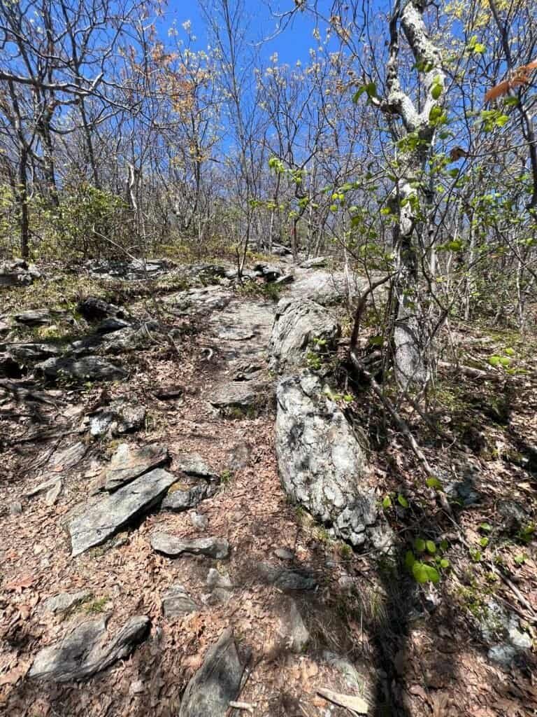
Overall, the trail was dry and easy to follow, though the lower sections were a bit warm and buggy. Fortunately, as I climbed higher, a steady breeze kicked in and the bugs all but disappeared.
At first, the hike feels deceptively gentle—a gradual uphill that lulls you into thinking it will stay that way. Then, suddenly, the character changes. The trail steepens noticeably, and you’re met with a series of rock and boulder scrambles that demand both attention and effort.
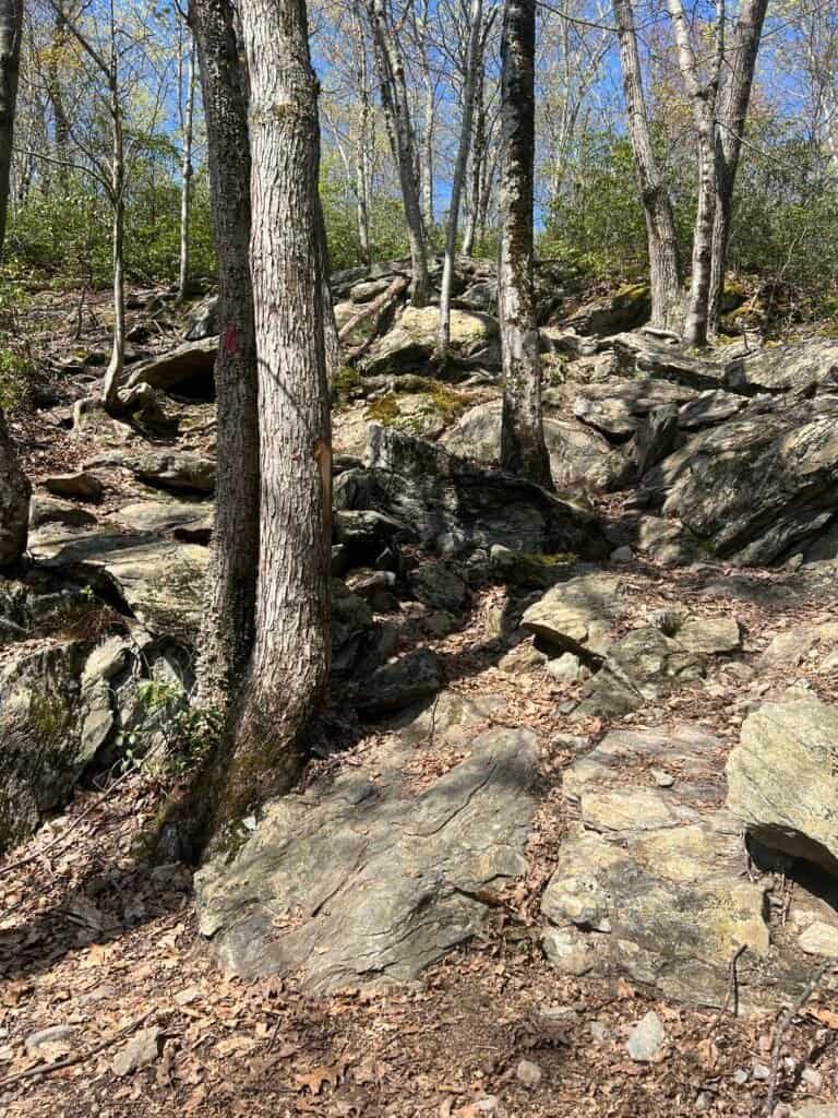
Photos: A couple of the Rock/Boulder Scrambles
Crossing borders and reaching summits
As you continue upward, the trail begins to crisscross the Massachusetts–Connecticut border, adding a fun geographic twist to the hike.
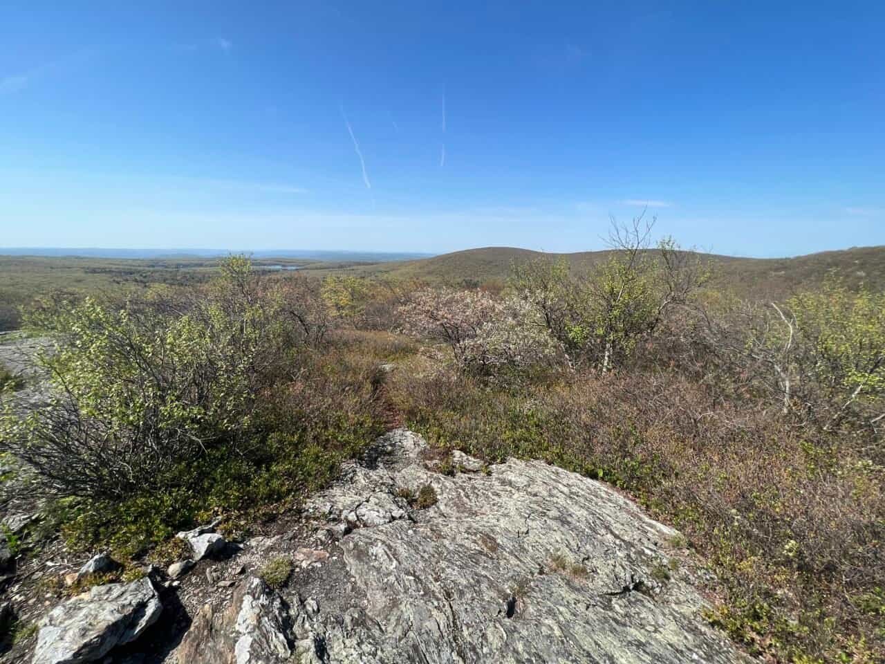
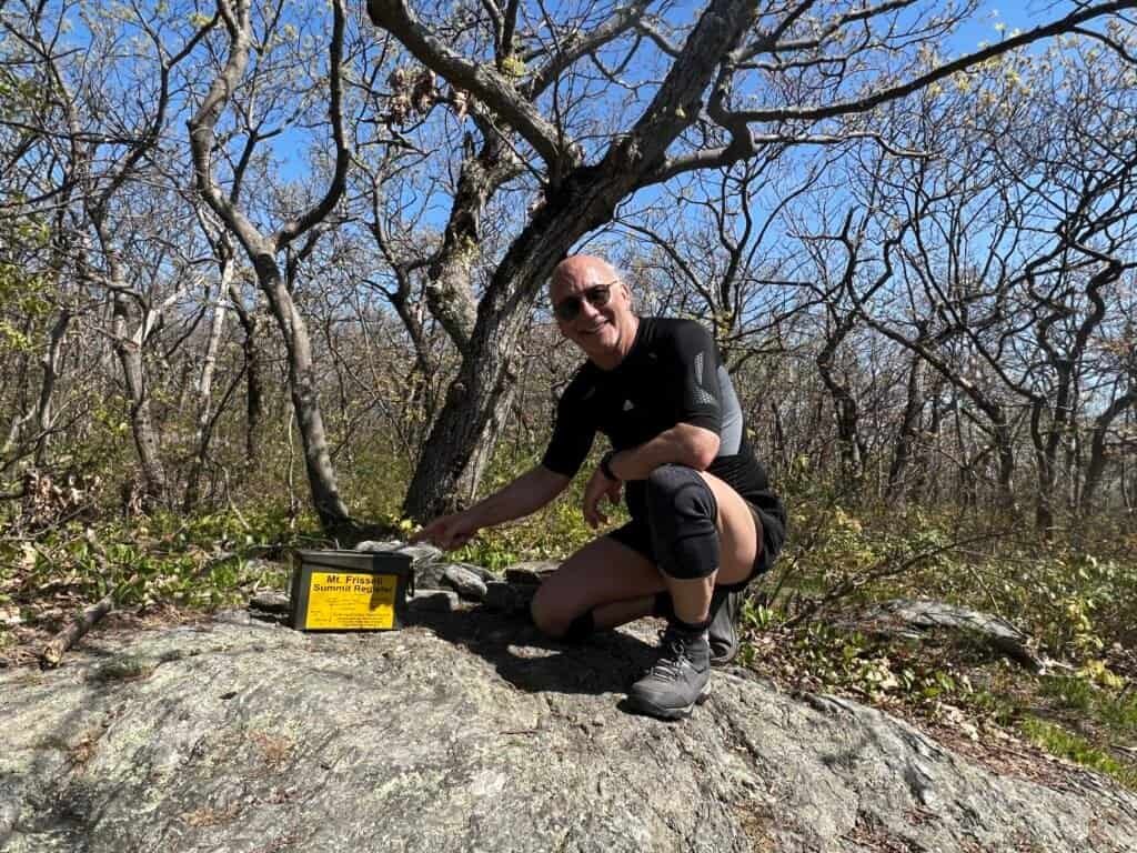
The first major milestone is Round Mountain Peak (Connecticut), which offers excellent views and makes for a perfect pause. From there, the trail dips briefly before climbing again to Mount Frissell (Massachusetts). Be sure to sign the summit register here—though it’s worth noting that this summit is wooded, so views are limited.

Photos: View from Round Mountain Peak, CT | Me atop Mt. Frissell, MA
From there, the trail descends and then climbs once more to reach Connecticut’s true high point, located on the southern slope of Mount Frissell. This spot delivers some of the best views of the hike, making the effort well worth it.
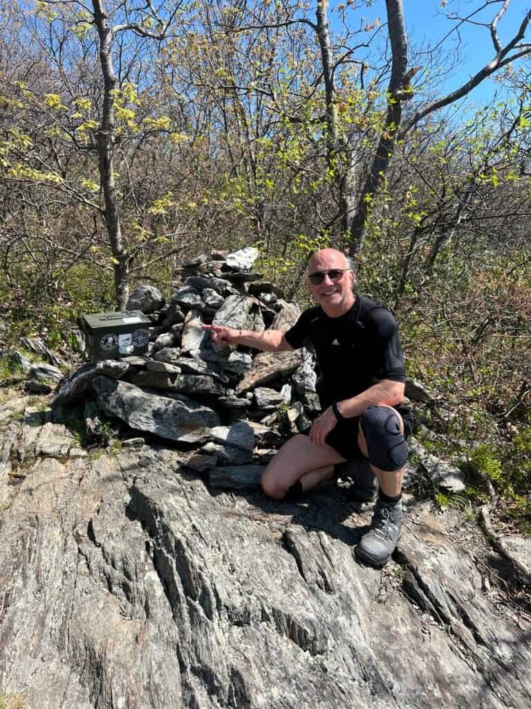
Photos: Me at the highest point in Connecticut – Mt. Frissell |
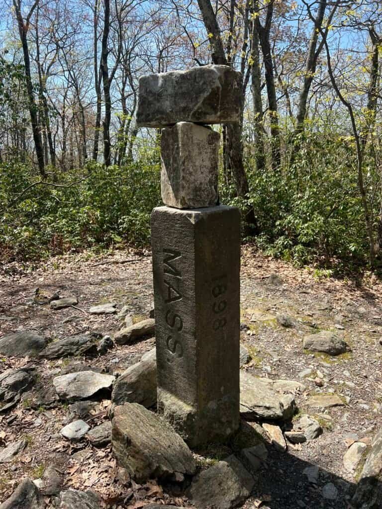
The NY/MA Marker from two sides.
Three states at once
Three states at once
After tagging Connecticut’s high point, I continued west toward the New York–Massachusetts border marker. The descent includes more boulder scrambling, but the payoff is a classic highpointer moment: standing in three states at once.
Wrap yourself around the marker and—just like that—you’re in New York, Connecticut, and Massachusetts simultaneously.
From there, I turned around and retraced my steps back to the trailhead.
Final thoughts
This hike was a solid cardio workout and slower than expected due to the scrambles, but it never felt overwhelming. Along the way, I even spotted a beautiful snake crossing the trail—harmless, as far as I could tell, and a reminder of just how alive these mountains are.
Mount Frissell turned out to be a fantastic find, blending challenge, scenery, and geography into one compact adventure. And since I still had daylight left, I capped off the day with a visit to Bash Bish Falls State Park just across the border in Massachusetts—one of the parks featured on The Discoverer’s list of the Best State Park in Every State, a project I’ve been checking off alongside my high points.
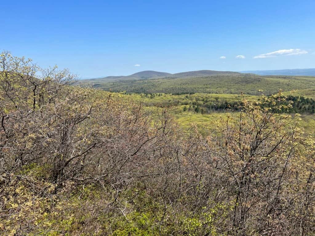
Photo: View of Massachusetts on the descent back to the trailhead.
Catch you on the summit!
Date of visit: 12 May 2023
Discover more from love cook adventure
Subscribe to get the latest posts sent to your email.
Leave a Reply