I’ve been hesitant to write this post. Not because I didn’t want to relive the experience—but because I’m not sure I fully recovered from it.
Climbing Mount Katahdin took more out of me—physically and emotionally—than any hike I had done up to that point. And yet, it gave me more in return.
The contrast alone was striking. Just days earlier, I had stood on Jerimoth Hill in Rhode Island, a gentle walk to a high point barely rising above the surrounding trees. Now I was staring up at Katahdin—the “Great Mountain”—rising to 5,268 feet above sea level, ranked #22 among U.S. state high points, and marking my 10th high point overall.
Katahdin didn’t just challenge me.
It exposed me.
And I loved it.
Preparation Is Not Optional
Katahdin sits squarely in the middle of Baxter State Park, a place that takes preservation—and preparedness—seriously. Access requires a reservation, and if you don’t show up by 7:00 a.m., your parking spot is gone. No grace period. No sympathy.
One blogger described Katahdin as an exclusive nightclub—you’ve got to be on the list. That analogy stuck, because it’s true.
I managed to secure a reservation at the Abol Trailhead, which is both a blessing and a curse. Abol is direct, efficient, and absolutely unforgiving. If you choose it, you need to know what you’re signing up for.
And I thought I did.
What You Should Bring
(and What I’d Do Differently)
I won’t sugarcoat this: preparation matters here. A lot.
Recommended gear includes proper hiking footwear, trekking poles (useful early, useless later), layers, rain gear, illumination (required by the park), navigation tools, emergency supplies, and plenty of food and water. At least two quarts, and honestly, more.
I’ll be blunt—I made mistakes.
I didn’t have my usual hiking pack with a waist strap. I overpacked. And I paid for it on the way down, when every step sent pain through my shoulders and lower back. The weather can change instantly on Katahdin, so preparation is critical—but smart preparation matters just as much.
Base Camp: Millinocket
I spent two nights in Millinocket at Big Moose Inn, Cabins and Campground, a strategic decision that paid off. I didn’t want to break camp at dawn, and I wanted somewhere to return to—physically and mentally—after the climb.
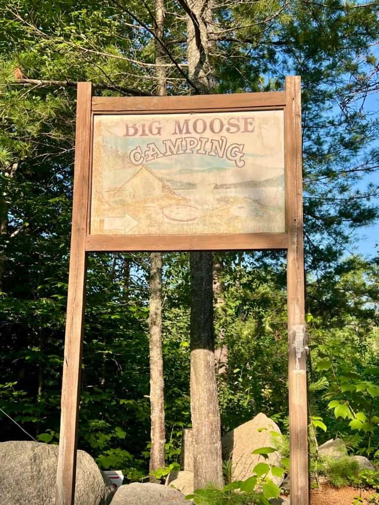
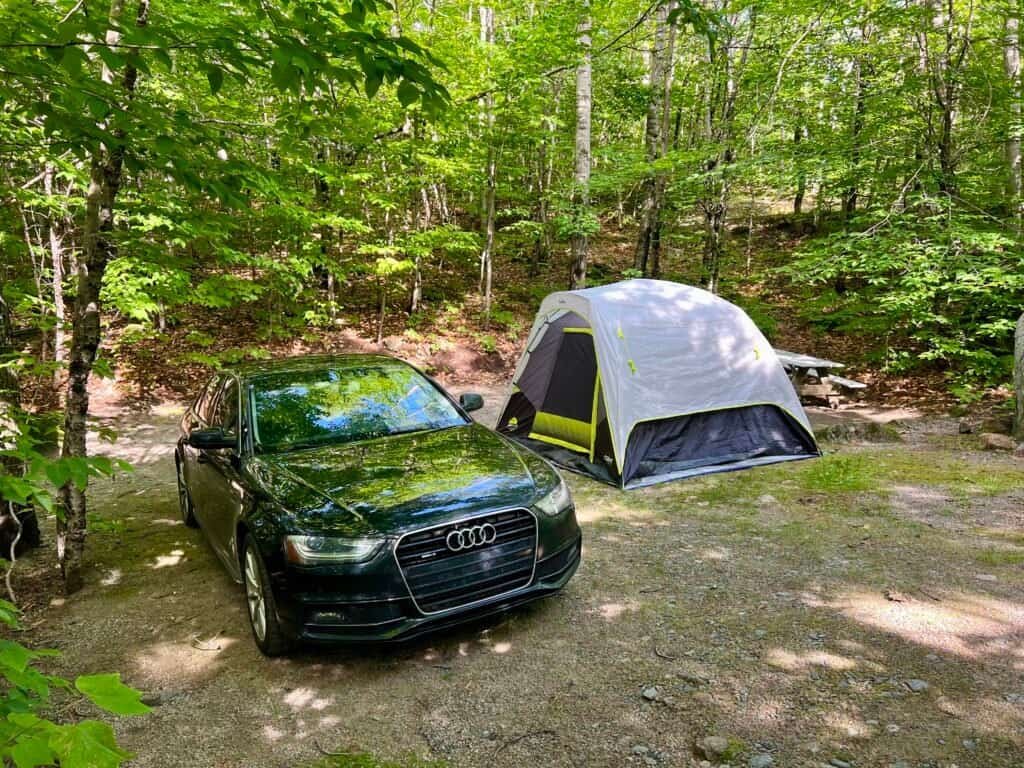
Photos: Entrance to the campground | My camp
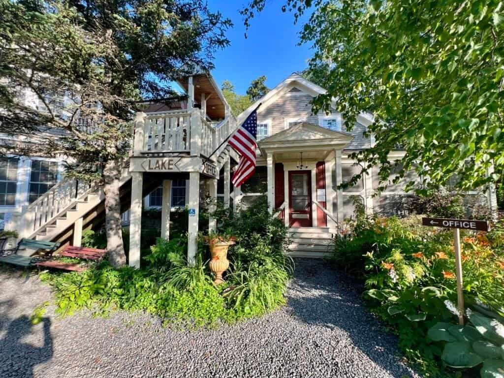
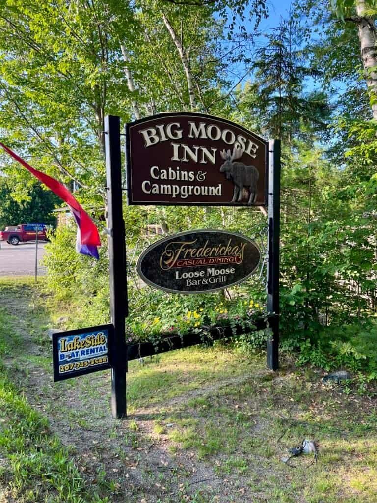
Photos: Big Moose Inn, Cabins and Campground
The campground sits between Millinocket Lake and Ambajejus Lake, both stunning, both calm. Floatplanes skimmed the water in the evening light, a reminder of just how remote this place still is.
That night, I made a fire and talked with a family from North Carolina camping next door. They were hiking Katahdin too, but via the Hunt Trail—with two young boys. It was humbling and inspiring all at once.

Photo: Ambajejus Lake
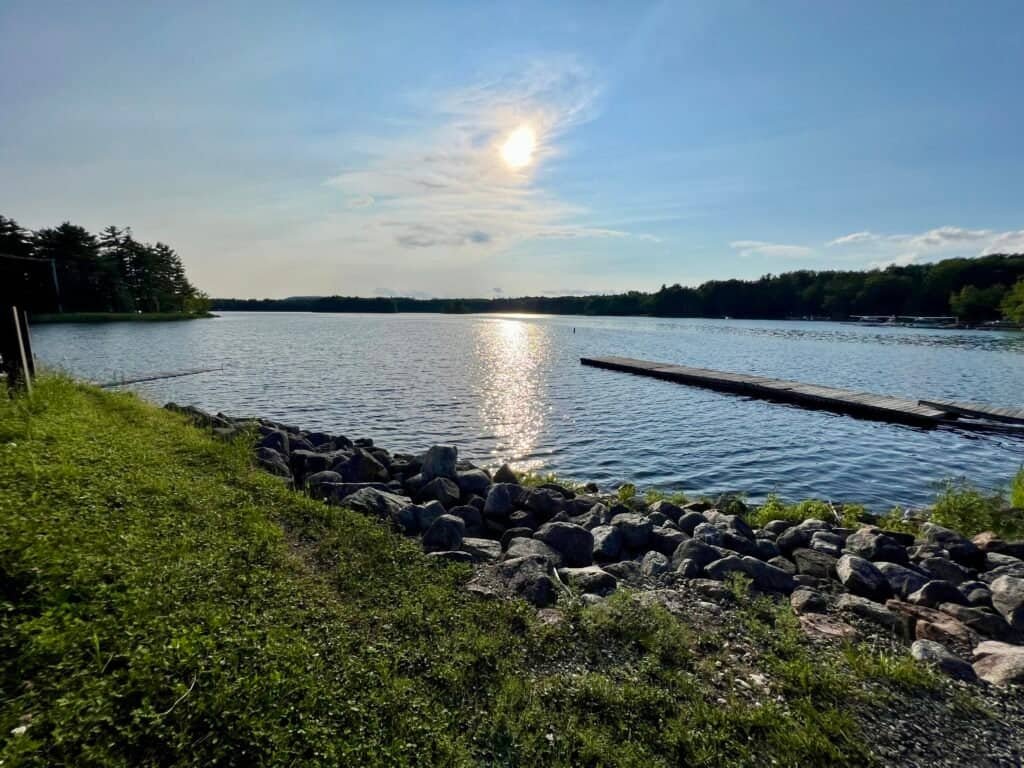

Photos: Millinocket Lake | Floatplanes
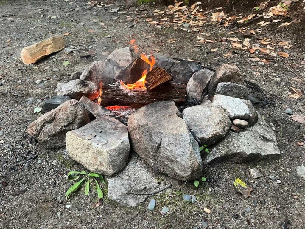
Photo: First nights fire
The Gate, the Ranger, and the Trailhead
I was up early the next morning and drove the short distance to the Togue Pond Gatehouse. Entry was slow—not because of bureaucracy, but because people weren’t prepared. Cell service is unreliable at best. Print your confirmations. Know your plan.
Once inside the park, the drive to Abol is another reminder of where you are. The speed limit is 20 mph. Not because they’re strict—but because the road demands it.
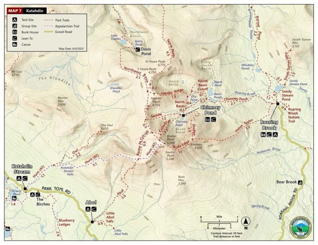
Photo: Baxter State Park Trail Map
After checking in with the ranger and making one last stop at the outhouse (never skip that), I headed toward the trailhead—briefly missing it thanks to a truck parked in front of the marker. For reference: it’s between lean-tos 11 and 12.
And then, it began.
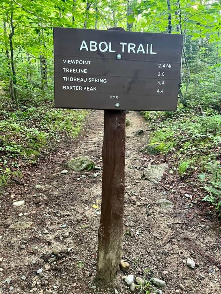

Photos: Abol Trailhead | Subtle Foreshadowing
Into the Mountain
The first stretch of the Abol Trail winds through beautiful mixed forest. It’s calm. Almost deceptive.
Around 1.4 miles in, the trail turns rockier and the climb begins in earnest. By 2.4 miles, you reach a viewpoint—and shortly after that, the trees disappear.
From here on, you are exposed.
This is where Katahdin changes tone.
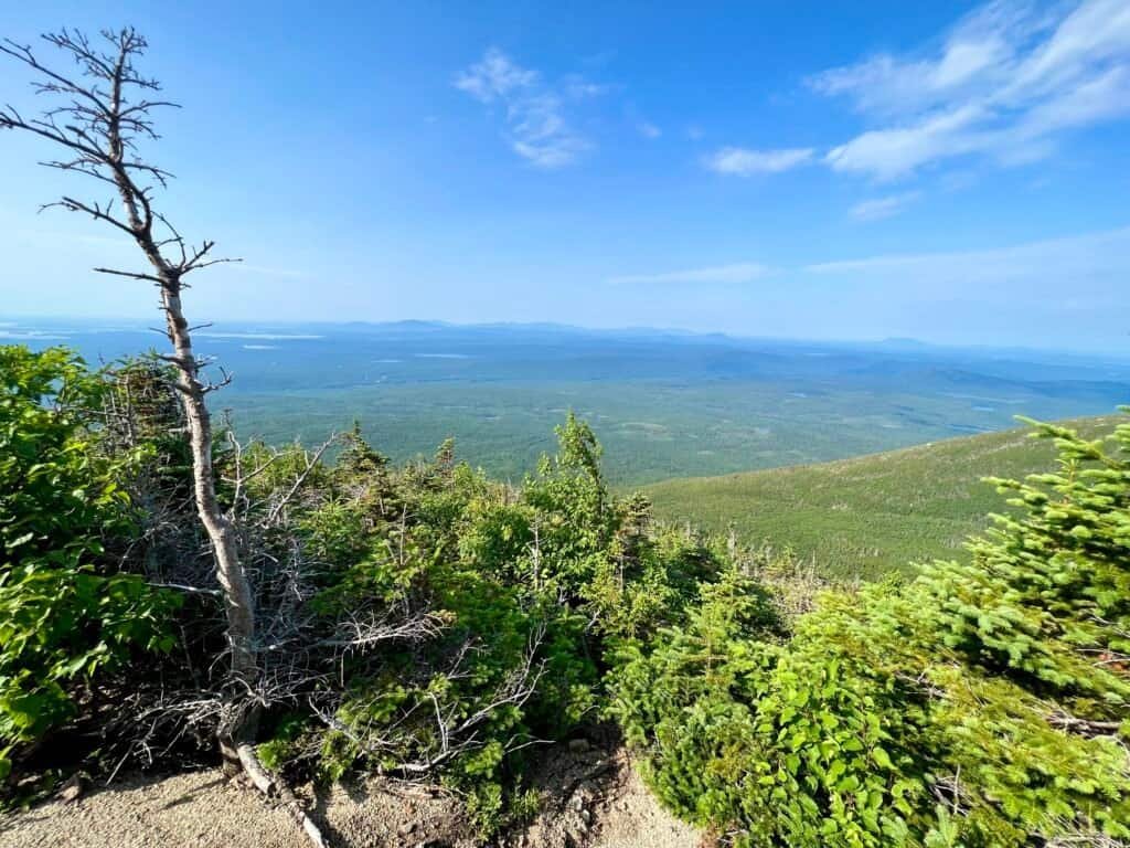
Photo: From the view point as you enter into the treeless alpine terrain
Shared Miles
As I cleared the trees and entered the alpine terrain, I began crossing paths with a father and daughter—she was 18. We’d pass each other as one of us stopped to rest, then fall into the same rhythm again a few minutes later. Eventually, her father and I began hiking together while she pushed ahead, clearly in her element.
We talked as we climbed, sharing the trail in that unspoken way hikers do—part encouragement, part quiet understanding of what it takes just to keep moving forward. When we reached the boulder scramble, we separated again, each navigating it at our own pace. Later, we met back up at the summit.
It was a small thing, but meaningful. Katahdin demands a lot, and sharing even a portion of the climb with someone else—the camaraderie of the mountain—made it just a little lighter. They headed down before I did, so we didn’t hike out together, but I carried that shared stretch of trail with me.
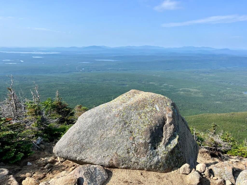
Photo: A pause along the Abol Trail during shared miles
The Scramble
The boulder scramble is only about half a mile—but the final quarter mile is relentless. Large, angular rocks stacked at impossible angles. No clear path. No margin for error.
This novice climber took it slow. Carefully. Deliberately.
And step by step, I made it.

Photo: The Abol Trail boulder scramble
The Tableland
Reaching the Tableland feels like emerging onto another planet. Wide open. Windswept. Vast.
It’s here that Abol meets the Hunt Trail and Thoreau Spring, named for Henry David Thoreau, who climbed this mountain in 1846. The history feels close here—earned, not commemorated.
From this point, the summit still lies nearly a mile away.
Baxter Peak
The final push leads to Baxter Peak, the northern terminus of the Appalachian Trail—the end or the beginning, depending on your direction.
I reached the summit after 4 hours and 30 minutes.
I was exhausted. Elated. Overwhelmed.
Standing there, knowing what it took to get up—and what still lay ahead on the descent—I felt something deeper than accomplishment. I felt gratitude.

Photo: Earned the hard way on Baxter Peak!

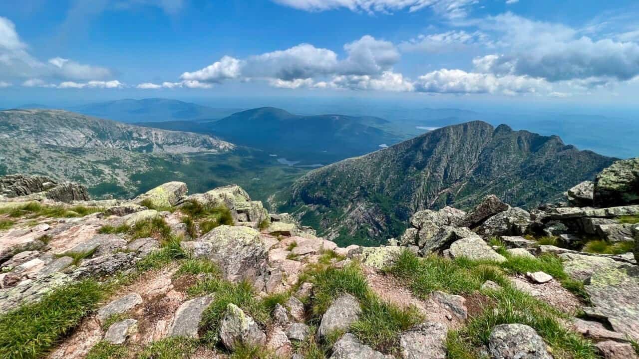
Photo: Looking towards the rugged line of the Knife Edge.
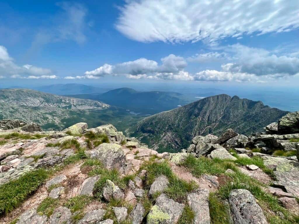
Photo: The amazing view from the summit!
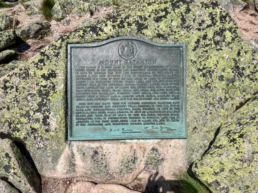
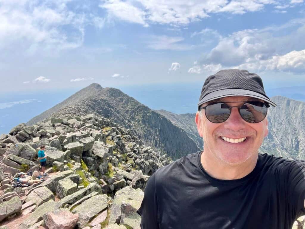
Photos: Mount Katahdin Summit Plaque at Baxter Peak | Summit Selfie
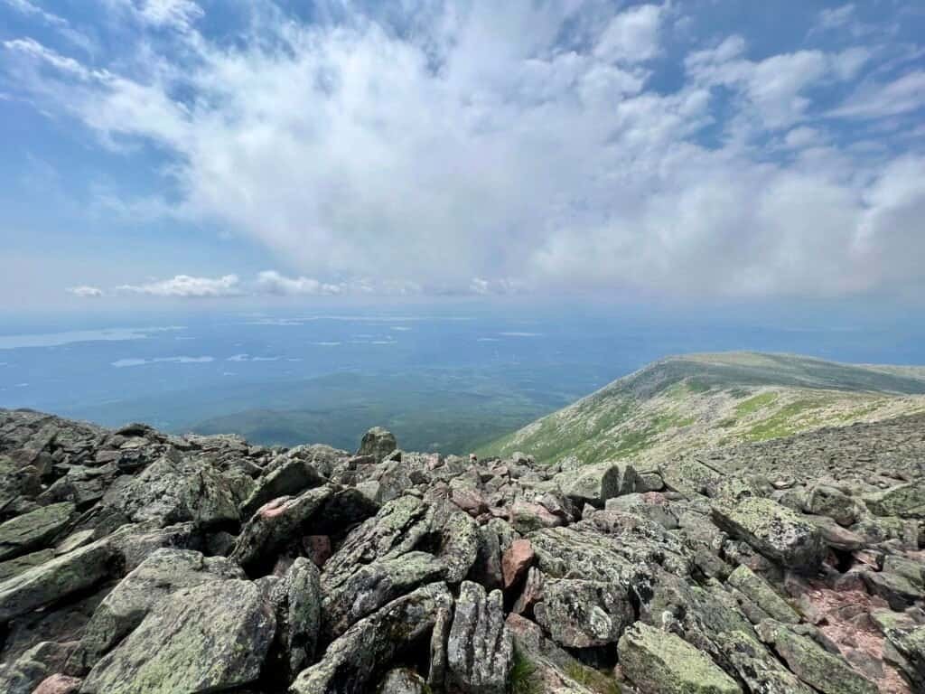
Photo: Looking back from where I started with the Tablelands to the right
The Long Way Down
The descent was harder than the climb. My legs felt like jelly. The scramble demanded as much focus going down as it did going up. I followed other hikers when I could, grateful for company.
One sound kept me going: the waterfall I’d passed earlier. I told myself that when I heard it again, I’d know I was close.
It took four hours to reach the parking lot.
Every bit of energy I had was spent.
Reflection
I met incredible people on this mountain—many of them over 60—sharing stories, encouragement, and quiet determination. Katahdin doesn’t care who you are. It asks only that you show up prepared, humble, and willing to work.
I would absolutely do it again.
Next time, I’d do it smarter.

Photo: Last night’s fire, post-hike
Catch you on the summit!
Date of Climb: 12 July 2023
Discover more from love cook adventure
Subscribe to get the latest posts sent to your email.
7 Pingbacks