
At 5,429 feet above sea level, Panorama Point is Nebraska’s highest natural point, tucked into the far southwestern corner of the state where Nebraska, Wyoming, and Colorado quietly meet. Ranked #20 among U.S. state high points, this marked summit #34 in my ongoing high-pointing journey. And despite the name, Panorama Point isn’t about sweeping views—it’s about subtlety, solitude, and the story of getting there.
The Almost-Flat High Point Club
Nebraska’s highest point feels… unexpectedly low-key. Panorama Point sits in the middle of an open field, shaped more by time, weather, and farm equipment than dramatic geology. The Kimball Chamber of Commerce placed a modest marker so visitors know they’ve arrived—blink and you might miss it. A metal desk nearby holds a register book, offering a quiet moment to sign in and reflect.
On a clear day, you might catch a glimpse of the Rockies far off in the distance. Still, the real payoff here isn’t the view—it’s the experience.
Red Tape & Bison Buddies
Panorama Point lies on private land, part of the High Point Bison Ranch, where Glen and Jill Klawonn generously allow access for a $3 donation (or more, if you’re feeling generous). The bison roam freely, and access depends heavily on road conditions—mud, snow, or ice can close things down quickly.

Photo: The vast plains where bison roam—just not when I was visiting. Better luck next time!
Fog, Frost, and a Winter Gamble
Winter high-pointing always comes with risk, and this day was no exception. I started the morning in Sterling, Colorado, checking the forecast and seeing warnings for heavy fog and an incoming snowstorm. There was no guarantee Panorama Point would even be open—but I went for it anyway. At worst, it would be an adventure.
The drive began calmly enough on paved roads, but once I turned onto dirt, the mood shifted. Dense fog swallowed the landscape, frost coated fences and fields, and the wind howled across the plains. There were no other cars, no people—just me, the road, and a growing sense of isolation. Every bump added a little adrenaline.
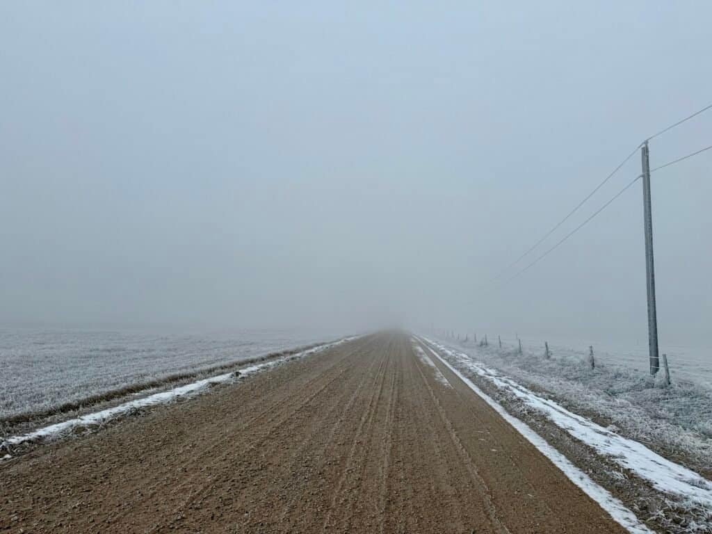
Photo: Embracing solitude on foggy dirt roads
Almost There
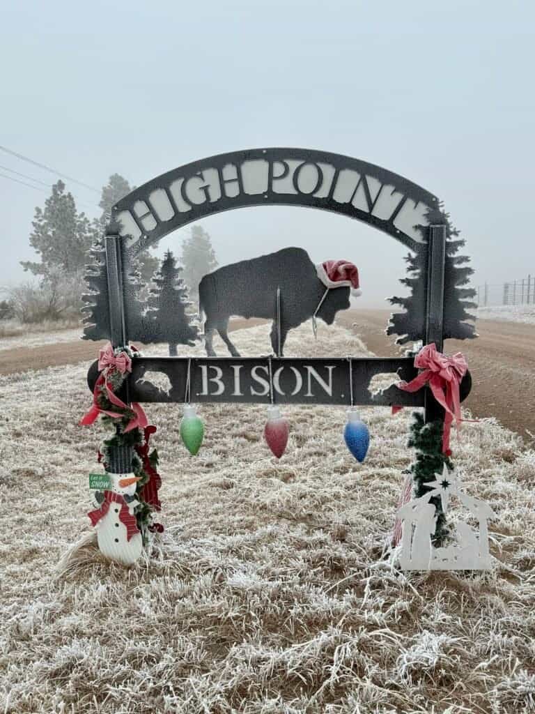
When I reached CR 111, the anticipation ramped up. Crossing into Nebraska felt like entering another world. A large “High Point / Bison” sign appeared as I turned onto Rd 5 W—confirmation I was close. Moments later, I reached the entrance: a red, ice-covered donation box waiting patiently.
I happily dropped in $5, thrilled the road was open and the gamble had paid off.
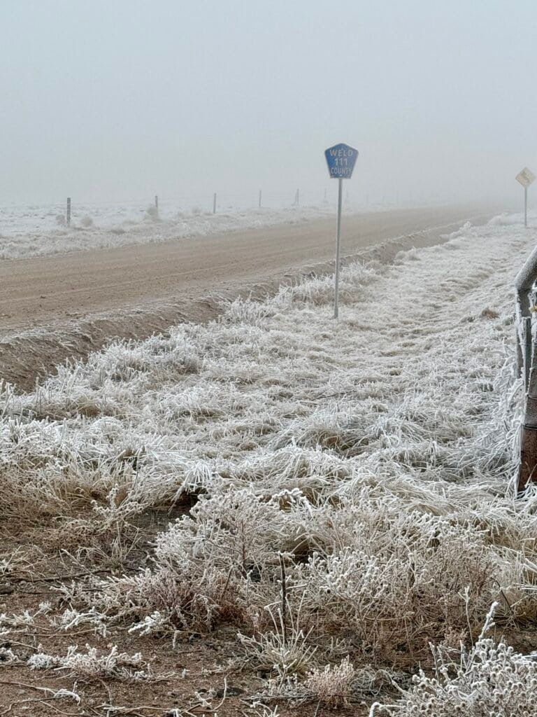
Photos: Cruising down CR 111 into Nebraska |
Welcomed by the High Point Bison sign—so close!
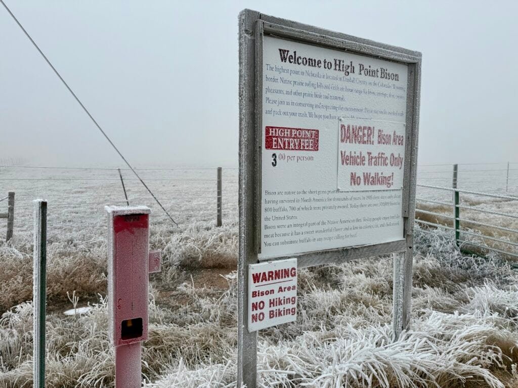
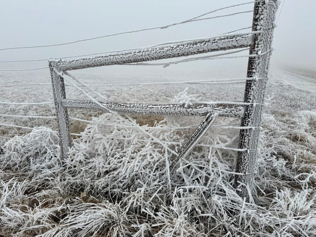
Photo: The entrance marked by the red donation box and
welcome / warning sign
A Frosted Final Stretch
The last mile felt surreal. Fog erased the horizon, wind rocked the car, and everything sparkled with frost. When I reached the summit, the landscape felt quiet, cold, and almost storybook-like.

Photo: Setting off on the final stretch
A Chilly Summit with a Side of Solitude
At the summit stood a simple monument marking Nebraska’s high point, alongside a frost-dusted bench and the familiar metal desk with the register. No bison appeared, and thanks to the fog, there was no view at all—but the stillness was striking.

Photo: The summit featuring the marker, steel desk with register, and Highpointers bench
At 18 degrees, with wind biting at my face, I felt a deep sense of accomplishment. This was summit #34—not flashy, not dramatic, but memorable in its own way. I signed the register, snapped a few photos, and retreated to the warmth of my car.


Photos: Summit selfie | Summit marker
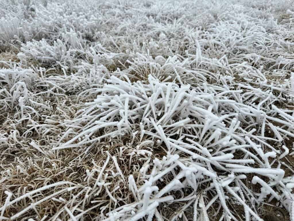
Photos: Frosted grass and a chilly, icy landscape
The Tri-State Tease
Before leaving, I hoped to visit the nearby tri-state marker where Nebraska, Wyoming, and Colorado meet. Unfortunately, the access road was closed, so I had to skip it. Instead, I headed north to Pine Bluffs, Wyoming, grabbed gas, then cruised east to I-80 and Cheyenne before turning south toward Fort Collins.
Gearing Up and Looking Ahead
In Fort Collins, I stopped at REI to finally pick up microspikes and a neck warmer—gear I’d been meaning to buy since a frosty Vermont high point reminded me winter doesn’t mess around. From there, I headed to Trinidad, Colorado, debating a detour to Amache National Historic Site.
Amache is a powerful WWII-era Japanese American incarceration site, but between feeling under the weather and learning the site is still developing, I decided to save it for another visit—one where I could give it the attention it deserves.
Knowing When to Pause
By the time I reached Trinidad, I felt awful. My next planned summit was Black Mesa, Oklahoma, an 8.8-mile hike—but common sense won. Instead of pushing through flu-like symptoms, I headed west to Flagstaff, Arizona, for urgent care and rest. Sometimes, the most important decision is knowing when to stop.
Final Thoughts
Panorama Point may not deliver panoramic views, but it offers something different—quiet roads, unexpected solitude, and the satisfaction of progress. Coming just a day after Mount Sunflower, Kansas, it reinforced how varied and surprising state high points can be. Whether you’re chasing all 50 or just passing through, this one is worth the stop—fog, frost, and all.
For official high-point details and access notes, the Highpointers Foundation is a solid reference. You can also find local context via the Visit Kimball County.
Catch you on the Summit!
Date of Climb: 4 January 2025
Discover more from love cook adventure
Subscribe to get the latest posts sent to your email.
Leave a Reply