At a Glance
At 409 feet, Point Reno is the highest point in the District of Columbia. It ranks #50 among U.S. state and district high points (with Florida at #51) and was my 12th overall.
It still feels a little funny checking off a “high point” in Washington, D.C.—especially coming on the heels of Mount Washington and Mount Katahdin—but it’s on the list, so off I went to the nation’s capital.
About Fort Reno Park
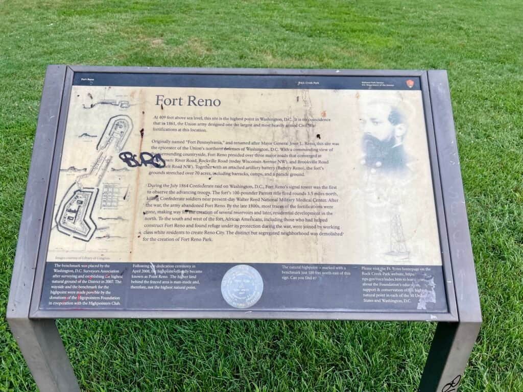
Point Reno is located within Fort Reno Park, an urban park in the Tenleytown neighborhood of Northwest Washington, D.C. The park is named after Fort Reno, one of the few sites in the District that saw combat during the American Civil War.
The history here is layered and sobering. In the 1920s, the park was created by clearing a predominantly Black neighborhood known as Reno, as the surrounding area transitioned into an affluent white suburb. It’s an important reminder that even the simplest “summits” often sit on complicated ground.
The Long Trek (Urban Edition)
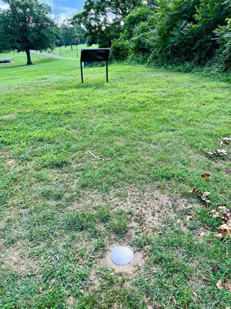
The hardest part of this high point wasn’t the elevation gain—it was finding parking. I eventually found a spot on Chesapeake Street NW, and from there it was a short walk along a paved path toward the high point area.
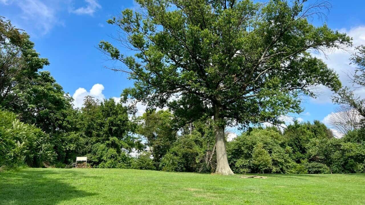
At the park entrance, a historical marker provides context for the site. As you walk toward Alice Deal Middle School, you’ll notice a grassy knoll off to the right—that’s the high point. It’s easy to miss if you’re not looking for it, which somehow feels appropriate here.
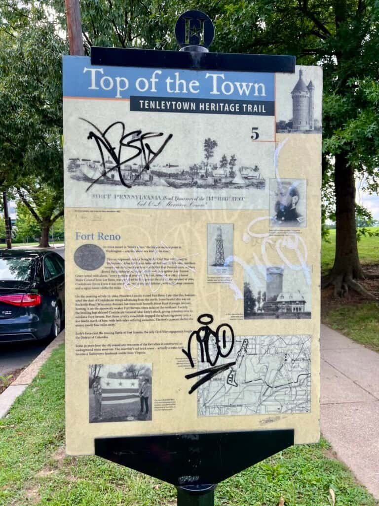

Photos: Tenleytown Heritage Trail Sign | Civil War Defenses Marker
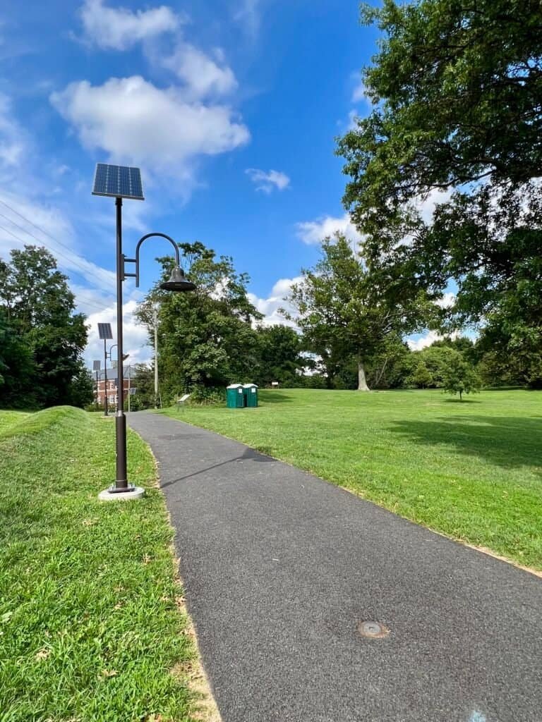

Photos: Paved Path to “Summit” | Grassy Knoll – The “Summit”
Landmarks Along the Way
As you continue down the path, two towers rise on the left. One is a red brick water tower; the other is a 60-foot pumping station built in 1929 to resemble the turret of a French Norman castle. Look closely and you’ll spot the whimsical weather vane on top—a small Dutch water boy silhouetted against the sky.
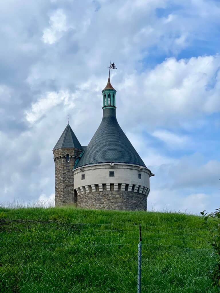
Photo: The Pumping Station with the Dutch water boy weather vane
The Summit (Mission Accomplished)
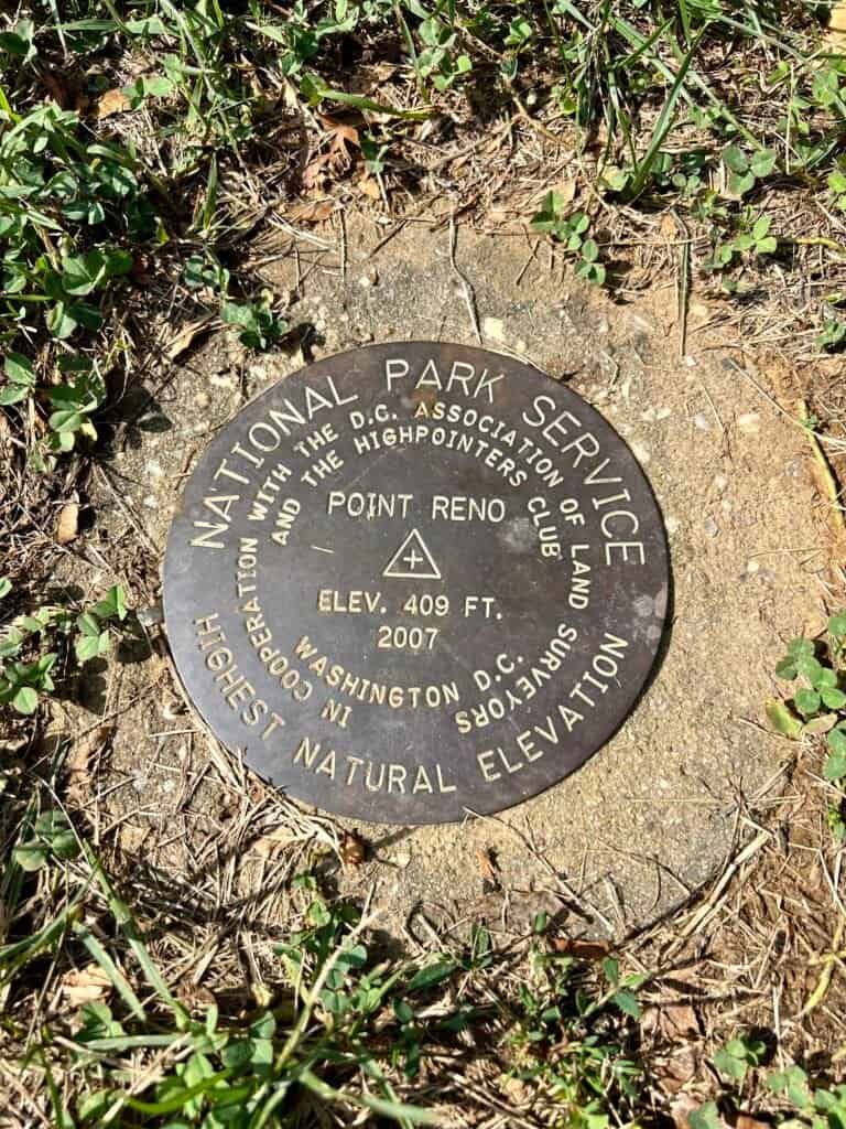
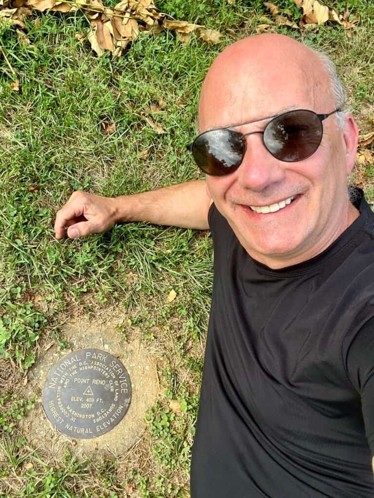
A historical sign stands on the knoll. Walk about 15 feet past it and you’ll find the actual high point and survey marker. I snapped a few photos, then did what any highpointer might do—laid down next to the marker and took a selfie.
Mission accomplished!
Photos: Historical sign | Looking from the summit towards the path.
Photos: Survey Marker | “Summit Selfie”
Final Thoughts
Point Reno may rank near the bottom in elevation, but it still earns its place on the list. Even in the middle of a dense city, the high-point journey continues—sometimes quietly, sometimes uncomfortably, and always with something to learn along the way.
Catch you on the summit!
Date of Visit: 7 August 2023
Discover more from love cook adventure
Subscribe to get the latest posts sent to your email.
1 Pingback