
Sassafras Mountain rises to 3,553 feet, making it the highest natural point in South Carolina and ranking #29 among U.S. state high points. Sitting right on the border with North Carolina, Sassafras is one of those summits you can drive to—but after days of moving through the Carolinas, I wanted this one to feel earned.
This stop marked my 19th state high point, and while Sassafras Mountain is approachable by design, it still offered a choice: convenience or effort. I chose the longer way up.
About Sassafras Mountain
Sassafras Mountain is located in the Blue Ridge Mountains of northwestern South Carolina, about 70 minutes northwest of Greenville. The summit sits within the Mountain Bridge Wilderness Area, and there is no entrance fee to visit.
A stone observation tower completed in 2019 crowns the top, replacing the older structure and opening up views that had long been limited by tree cover. On a clear day, you can see into South Carolina, North Carolina, Georgia, and Tennessee—a rare four-state vantage point in the Southeast.
Access is straightforward via F Van Clayton Memorial Highway (Sassafras Mountain Road), which climbs nearly to the summit.
The Journey There
I arrived at Sassafras Mountain knowing that Mount Mitchell, North Carolina’s high point, was coming up next. Sassafras felt like a natural connector between states—both geographically and mentally—a quieter pause before heading higher.
Along the way, the drive up was calm and scenic, winding through dense forest with long stretches of green and very little traffic. It was the kind of approach that slows you down without asking—no rush, no crowds, just a steady climb toward the border.
When I reached the lower parking area, I could have driven the rest of the way. Instead, I parked, shouldered my pack, and started walking uphill.
Hiking vs. Driving Options
Sassafras Mountain is often labeled a “drive-up” high point. However, there’s also a solid hiking option via a portion of the Foothills Trail, which is the route I chose.
The hike is 5.1 miles round-trip with 1,305 feet of elevation gain. I reached the summit in about 70 minutes, and the descent took roughly 55 minutes.
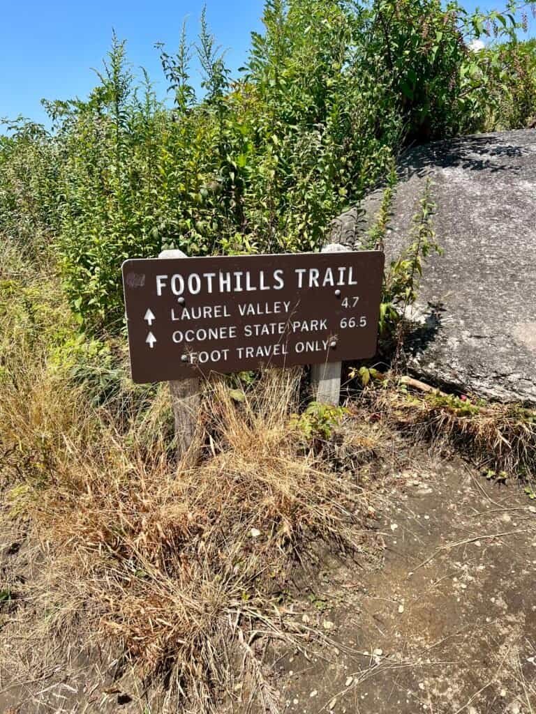
I parked at a small lot off F Van Clayton Memorial Highway / Sassafras Mountain Road, downhill from the intersection with Pinnacle Point and Glady Fork Road. In the parking lot, you’ll see signage for both the Foothills Trail and Beech Bottom Falls Trail—but that section of trail heads away from the summit.

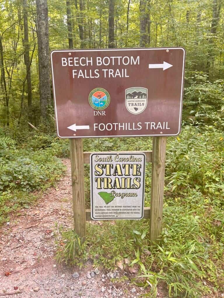
Photos: From the Parking Lot, looking up the road where you need to go | Trail Marker at the Parking Lot
Instead, stand in the parking lot facing the road, turn right, and walk uphill. You’ll see the Chimney Gap sign on the right side of the road. Directly across the street, on the left, is the trail entrance with a short staircase and railing.
From there, that’s the trail you want.
Is hiking here necessary? No. But for me, walking into a summit—even one this accessible—changes how it feels when you arrive.
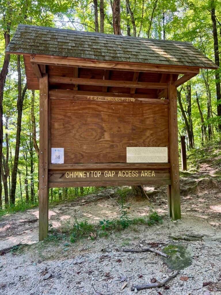
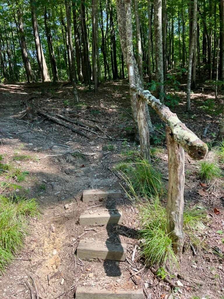
Chimney Gap sign on the right side of the road | Foothills Trail on the left side of the road – take this!
On the Trail
Once on the trail, it’s well maintained and climbs steadily through a series of switchbacks that keep the grade manageable. I hiked in boots and used trekking poles, moving deliberately and keeping an eye out—late August in the Southeast means snakes are part of the equation.
I saw one baby garter snake, walked through more than a few cobwebs, and dealt with the usual bugs. Nothing dramatic—just a normal day in the woods.
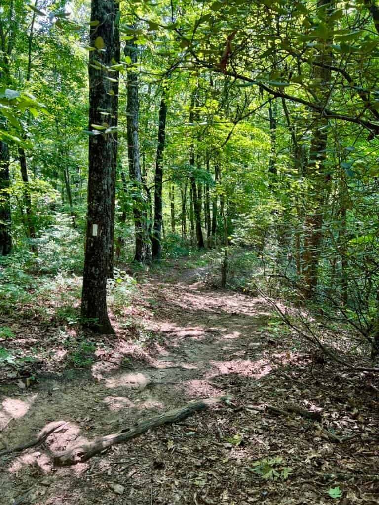
Photos: From the Foothills Trail before the second parking lot
The Final Push
Eventually, the trail reconnects with Sassafras Mountain Road at a higher parking lot. If you’re looking for a shorter hike with a good uphill push, this is a solid alternative starting point.
From here, it’s a short but noticeable climb up another set of stairs. Before long, the observation tower appears through the trees.
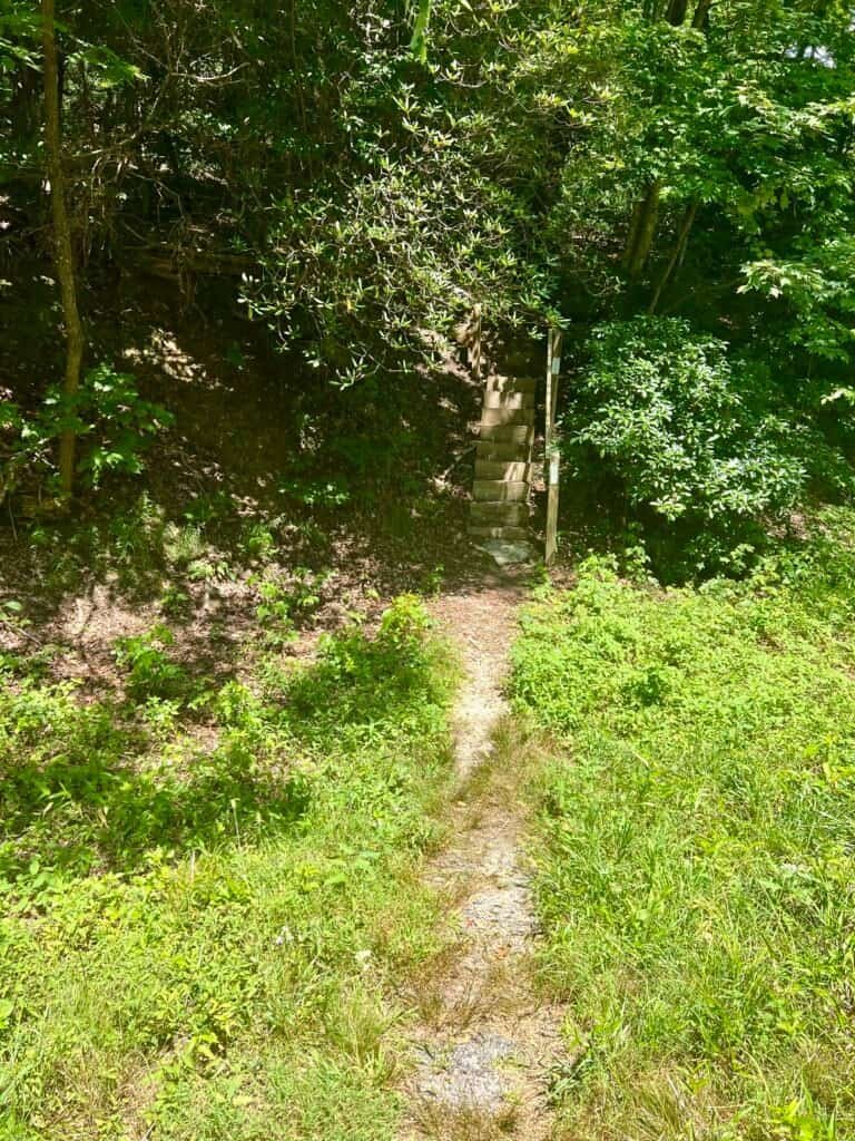
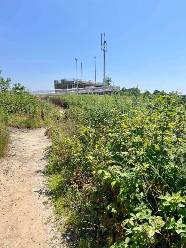
Photos: Foothills Trail & Stairs leading to the summit | Observation Tower
On the Summit
Despite its accessibility, the summit area was surprisingly quiet when I arrived, giving me space to slow down and take it all in. The circular stone observation tower measures 44 feet in diameter and features a compass rose etched into the floor.
The state line runs directly through the center of the compass. Standing with one foot in South Carolina and the other in North Carolina felt like a fitting moment on a journey built around borders.
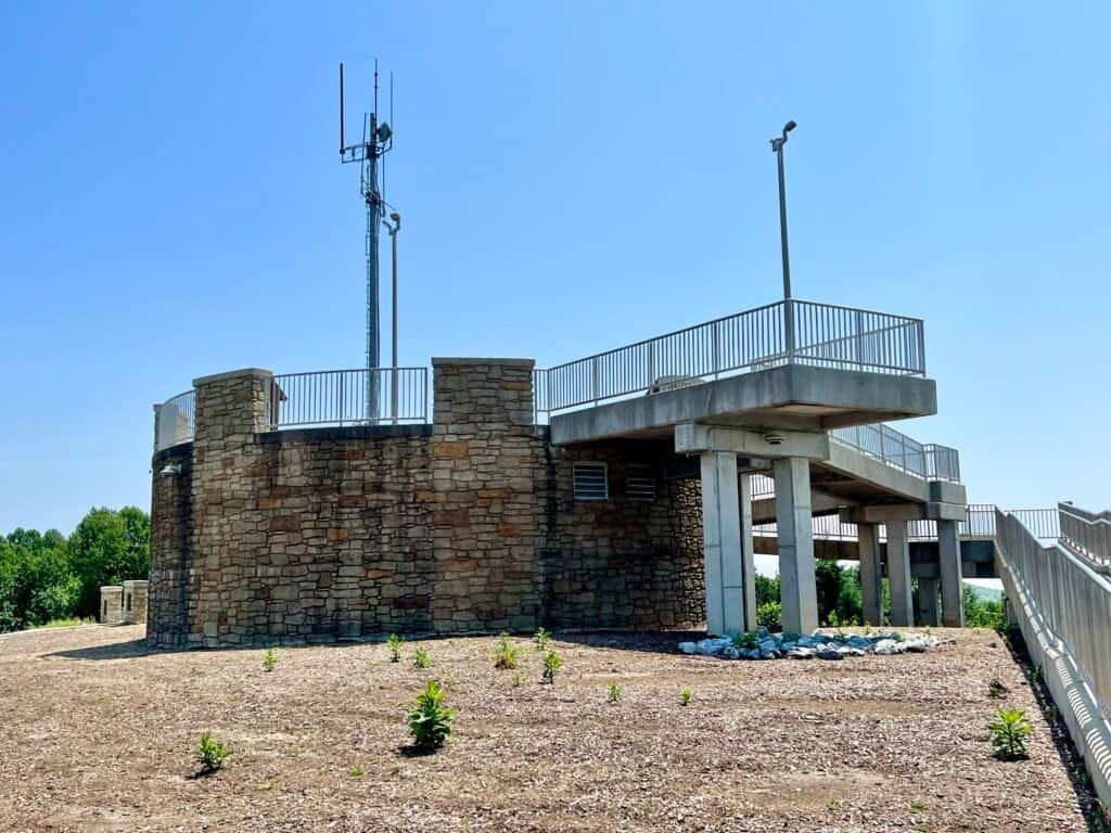
Photo: Observation Tower
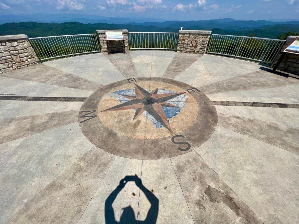
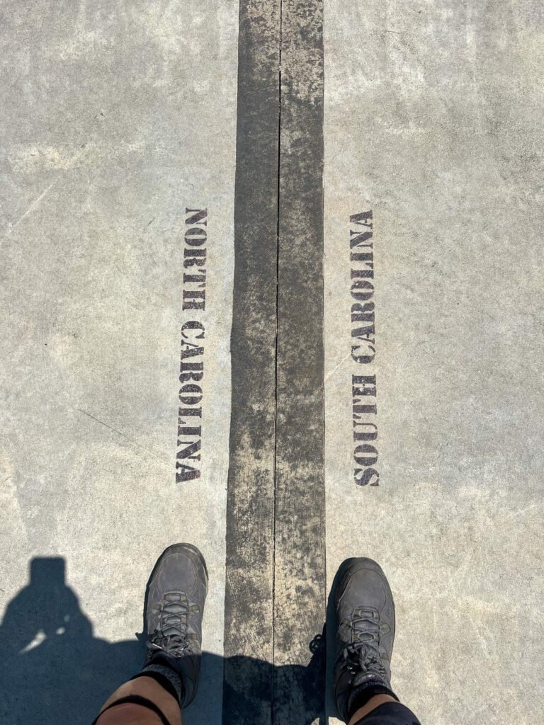
Photos: Compass | Me in two states at one time!
The Actual High Point
That said, the observation tower gets most of the attention, but the actual high point is easy to find if you know where to look. Just behind one of the concrete benches near the tower—close to the Highpointers Organization bench—you’ll find the geodetic survey marker.
If there’s ever any doubt, I make a point of checking every possible spot. Here, there wasn’t much mystery. Still, finding the marker made the summit feel complete.
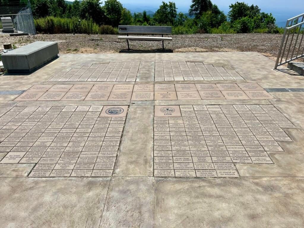
Photo: Bricks at the base of the tower | Highpointers Organization bench


Photos: Geo Marker | Summit Selfie
Best Views & Timing Tips
The best views are from the observation tower, especially when crowds are light. Visiting earlier in the day or outside peak weekends will give you more space and better light. While the summit itself is compact, the elevated perspective makes the most of it.
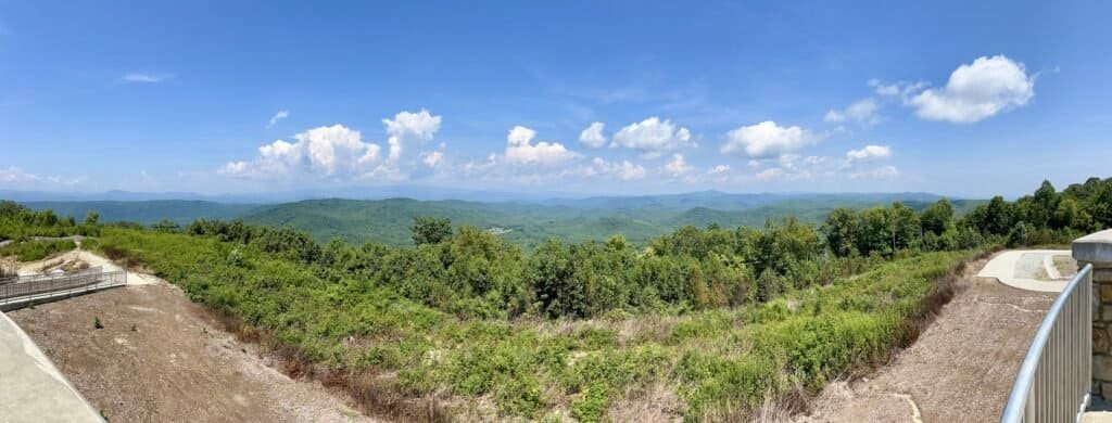
Photo: Panoramic View
Final Thoughts
Ultimately, Sassafras Mountain may be one of the more accessible state high points, but choosing to hike instead of driving made it far more memorable. It was a quiet, satisfying summit—and a perfect lead-in to the higher elevations waiting just across the border in North Carolina.
Nineteen down, momentum building.
Catch you on the summit!
Date of Visit: 24 August 2023
Discover more from love cook adventure
Subscribe to get the latest posts sent to your email.
1 Pingback