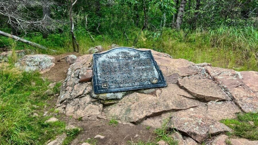
Nestled in the northeastern corner of Minnesota, Eagle Mountain may not look as dramatic as some of the country’s towering giants. Still, it is absolutely Minnesota’s crown jewel. At 2,301 feet, Eagle Mountain ranks 37th among U.S. state high points, and this hike marked my 32nd state high point. While it doesn’t scream “epic” at first glance, it quietly calls to outdoor lovers, promising a day filled with solitude, scenery, and a little bit of adventure.
Nestled in the heart of Michigan’s Upper Peninsula, Tahquamenon Falls State Park is a treasure trove of natural wonders and breathtaking beauty. With nearly 50,000 acres of pristine wilderness, this park is home to one of the most impressive waterfall systems east of the Mississippi, drawing nature enthusiasts, photographers, and adventure seekers alike. Beyond the falls, Tahquamenon Falls State Park boasts over 35 miles of hiking trails that weave through dense forests, scenic overlooks, and along the picturesque Tahquamenon River. So, grab your bug spray, lace up those hiking boots, and let’s dive into my adventure through this U.P. gem!
Pronunciation Tip: Tahquamenon is pronounced tuh-KWAH-muh-non.
The Mighty Tahquamenon Falls
The crown jewels of Tahquamenon Falls State Park are undoubtedly the waterfalls themselves. The park features two main sets of falls: the Upper and Lower Falls. The Upper Falls, often referred to as the “Root Beer Falls” due to their distinctive amber color, are a sight to behold. Spanning 200 feet across and dropping nearly 50 feet, this waterfall is the second largest in volume east of the Mississippi River, only trailing Niagara Falls in size! The unique hue of the water is thanks to tannins leached from the cedar swamps that feed into the river—nature’s very own chemistry experiment. Visiting the UpperFalls offers multiple viewing platforms and trails that allow you to marvel at the roaring waters from various angles.
Photo: The Upper Falls
The Lower Falls offer a more intimate yet equally mesmerizing experience. This series of five smaller cascades encircle an island, accessible by rowboat or a charming footbridge. Exploring the island and the surrounding waters is like stepping into a tranquil escape—perfect for a leisurely day of picnicking, swimming, and photography.
Photo: Two of the Smaller Cascades that make up the Lower Falls
Roadtrips and Sunsets
I arrived in the afternoon, eager to explore. After checking into my campsite at the Rivermouth Campground, I couldn’t resist a quick detour north to Whitefish Point (check out my other post on Road Trippin’: The U.P.) – Great Lakes Shipwreck Museum and the historic Whitefish Point Lighthouse. On the way back to camp, I made a couple of stops that were just too good to pass up.
First, I swung by the Rivermouth Roadside Park, a small but scenic spot on the Lake Superior shoreline. Michigan seems to have a thing for these roadside parks, and honestly, I’m here for it. They’re like little oases for travelers, offering a place to picnic, rest, and soak in the scenery. A short hop down the road brought me to Clark Point Trail. Calling it a trail is a bit generous—it’s more like a quick walk from the parking lot to the lake—but it was fun exploring the shoreline. This spot is also a birdwatcher’s paradise, so bring your binoculars if that’s your thing.
Photos: Views from Rivermouth Roadside Park | And from the Clark Point Trail
Back at camp, I settled in for the evening with a campfire and dinner. But the real treat came later, as I headed to the campground’s beach on the Tahquamenon River. With golden hour approaching, I grabbed a cold one, found a log to perch on, and let nature’s show unfold before me. There’s something magical about watching the sun dip below the horizon while the river flows quietly by—it’s the perfect way to end a full day of adventure.
Photos: My Campsite | The Evening’s Fire
Photos: The Tahquamenon River – great for Kayaking | Enjoying a Cold One!
Photos: Enjoying Nature’s Show | Golden Hour at the Tahquamenon River
Photo: The Perfect Way to End the Day!
No time to wait on late rangers
First, A note to fellow adventurers: Tahquamenon Falls has two main entrances, one at the Upper Falls and the other at the Lower Falls. It’s not uncommon to see long lines, especially in the morning or around 3 PM when campers are checking in.
Photo: Lower Falls Entrance from the Parking Lot | Hard to Get Lost Here!
Photos: Lower Falls Map | Upper Falls Map
Photo: Tahquamenon Falls State Park Map
The next morning, I was up early and ready to hit the trails. My first stop was the Lower Falls. After waiting a bit for the entrance booth to open on time at 8:00 AM (spoiler alert: it didn’t), I decided to get a head start on my day. I wasn’t going to let the rangers late start ruin my plans! Just up from the parking lot, there’s a handy area with bathrooms, the Lower Tahquamenon Falls Café & Gift Shop, and even rowboat rentals for exploring the Tahquamenon River. The hike from the gift shop to the Lower Falls is only a half-mile, mostly on a raised boardwalk. Being early, I had the place almost to myself, save for a few other early risers. Along the way, you’ll spot a wooden plaque featuring the Prayer of the Woods—a reminder to be mindful and respectful of the natural beauty around us.
Photos: Bear Cubs at Play – a sculpture at the entrance | Rowboats for Rent
Photos: The Boardwalk to the Lower Falls | The Prayer of the Woods
The Lower Falls consist of a series of five smaller falls cascading around an island. You can either view them from the riverbank or cross the Ronald A. Olson Island Bridge to explore the island. I’d recommend the latter—it’s a short half-mile loop around the island, and you get to see all five falls up close. Plus, the bridge itself is pretty cool, especially with the river roaring below after the recent rains.
Photos: Ronald A. Olson Island Bridge
Photos: The Island Loop – It’s pretty flat until you hit the boat dock area, where you’ll find a few stairs
Photos: Morning Views from the Island Loop
Photos: A few views of the Cascades at the Lower Falls from the Island
Feeling inspired and ready for a bigger adventure, I changed into my trail runners, grabbed my poles, and lathered myself in bug spray. My next challenge: the 4-mile one-way hike from the Lower Falls to the Upper Falls along the River Trail, known for its scenic beauty, winding through old-growth forests and along the river.
The River Trail: A Hiker’s Delight with Otters
Now, let me give you a heads-up: this trek is not for everyone. It’s got its fair share of exposed roots, hilly terrain, numerous staircases, and was a bit overgrown in some areas. But if you’re up for the challenge, the rewards are more than worth it. At one point, I even stumbled upon a group of river otters frolicking along the riverbank. They didn’t notice me at first, but when I “clicked” to get their attention for a photo, they weren’t too thrilled and quickly disappeared into the water. I guess not everyone is a fan of the paparazzi!
One thing to note is that the trail isn’t always the best marked or maybe I just wasn’t paying attention. I may or may not have taken a wrong turn at one point, but hey, getting lost is part of the adventure, right?
Photos: River Trailhead at the Ronald A. Olson Island Bridge | Time to walk the plank and dodge some roots on the River Trail!
Photos: The River Trail – A fun combo of dirt paths and wooden boardwalks!
Photos: The Otters – Before they knew I was around | And after – when they gave me an earful!
Photos: Check out one of the amazing views of the Tahquamenon River along the trail! | And yep, even on the way up to the Upper Falls, you’ll hit some stairs going down—perfect cardio workout!
Stairmasters and Nature’s Powerhouse
After what felt like a mini-marathon, I reached the Upper Falls. The 181 stairs down to the Gorge View seemed like child’s play after my hike, and the view was nothing short of spectacular. From here I got my first glimpse of this massive cascade with a nearly 50-foot drop and a width of over 200 feet. The sheer volume of water crashing down is mesmerizing—it’s said that during peak flow, over 50,000 gallons of water rush over the falls every second, hence getting the title of the second largest east of the Mississippi.
Photos: Coming off the River Trail and hitting the Upper Falls Viewing Areas | First stop: the Gorge View!
Photos: Stairmaster Workout – 181 stairs down to the Gorge, then back up
Photos: Boardwalk to the Viewing Area | Along the Gorge
Photos: The Upper Falls from the Gorge Viewing Area
If you’re a sucker for scenic spots, the Brink View area is another must-visit. After another 94 steps down, you’ll be rewarded with a front-row seat to one of nature’s most powerful shows. This area was definitely more popular, and I had to navigate around a few selfie-taking tourists, but the view was worth it. After taking in the sights, I headed to the Upper Falls parking lot, a short 0.3-mile walk on a paved walkway. This spot has some nice perks too, like the Tahquamenon Falls Brewery & Pub, Camp 33 Gift Shop, an outdoor picnic area, and even a food truck, though it wasn’t open when I visited.
Photo: The “Root Beer Falls” from the Brink Viewing Area
After all that hiking, I figured I deserved a reward, so I made my way to the Brewery & Pub. Unfortunately, nothing on the menu really caught my eye, but I couldn’t pass up the chance to try one of their beers. I went with the Falls Tannin, an American Red Beer. It had that deep amber hue, just like the Upper Falls, but the taste was… well, just okay. Not exactly something to write home about, but it hit the spot after a long day on the trails.
Photos: Tahquamenon Falls Brewery | Tried the Falls Tannin – does it look like the falls? | Today’s brews!
Trail Running and Campfire Bliss
Rested and refreshed, it was time to head back down the River Trail to the Lower Falls parking lot—a solid 4+ miles back. This time, I took the Nature Trail to the River Trail, the path I had hiked up earlier. Feeling a bit adventurous, I decided to turn the hike into a trail run. The path was getting busier with other hikers, so I had to weave around a few people, but it was a fun way to end the day.
Back at the Lower Falls parking lot, I packed up and headed to my campsite for the night—The Lower Falls Portage Campground. Back at the campsite, I treated myself to a hot shower, made another campfire, and settled in for the night. I had a 7-hour drive to Duluth, Minnesota, ahead of me the next day, so I knew it would be an early night. But as I sat by the fire with a cold drink in hand, I couldn’t help but feel a sense of contentment. Tahquamenon Falls State Park had lived up to every expectation and then some.
A Memorable Adventure
Tahquamenon Falls State Park is more than just a place to visit—it’s a place to experience. Whether you’re marveling at the mighty falls, exploring the serene hiking trails, or simply soaking in the natural beauty, this park offers something for everyone. And if you’re lucky, you might even have a few memorable encounters with the local wildlife. Just don’t forget to pack your bug spray, plan to camp in the park, and get ready for an adventure you won’t soon forget. So, what are you waiting for?
The Pasty Pursuit: A Culinary Quest
As I drove through the U.P., I kept seeing signs for pasties (pronounced pass-tee, not pay-stee.) —what are these mysterious pastry things? As a curious foodie, chef, and restauranteur (also a pescatarian), I had to find out. After some quick research, I found a place in Ishpeming that had a vegetarian option. I headed to Lawry’s Pasty Shop, only to be disappointed—apparently, they don’t cook the vegetarian ones on-site. Determined not to leave empty-handed, I backtracked to Irontown Pasties in the heart of Negaunee. After a bit of a wait (perfect for catching up on Words with Friends), I finally snagged a veggie-cheese pasty. The staff was super friendly, and when I asked about the “proper” way to eat it, they handed me a no-name ketchup bottle and said, “With ketchup!”
My first impression? Well, let’s just say it looked like an Irishman on the beach in Miami—stark white. The dough was a bit undercooked, especially where it was folded. The filling was a mix of broccoli, cauliflower, carrots, onion, potato, cream cheese, cheddar cheese, mozzarella cheese, and spices. It wasn’t horrible, but it wasn’t great either. It was like winning a match by default—you get the victory, but it feels a bit anticlimactic. With that, I headed for Duluth, Minnesota.
Photos: Irontown Pasties | My Veggie-Cheese Pasty – with a side of ketchup, of course!
In my previous post about Mount Mansfield, I mentioned that the weather was not ideal for camping, and hotel rooms were expensive. As a result, I decided to stay in a hostel named Round Hearth Cafe and Market in Stowe, which I booked through Airbnb. Christopher, the host, was extremely friendly and an excellent host at the cafe as well. Additionally, the stay included complimentary coffee and a discount on food at the cafe. The hostel is not luxurious and is mainly intended for skiers, as indicated by the industrial carpet in the hallways (suitable for ski boots and snow). The rooms are plain but comfortable, and the shared bathrooms are super clean and well-lit. Since it was the off-season, I felt like I had the entire place to myself.
Pictures: Entrance to the Cafe and Hostel | Outdoor Seating Area
Pictures: Stairway to Rooms | Upper Hallway
Pictures: Hostel Room | Men’s Bathroom
That night, I decided to check out the area and found the Idletyme Brewing Company which was just down the road. I hung out in the bar area and had a chat with some of the locals. We talked about what to order for dinner and what to see at Smugglers Notch State Park. But then, an ambulance went by and they told me something creepy – apparently, the locals think someone has fallen at Bingham Falls every time they hear an ambulance. On that happy note, I had a great time and the food was pretty good.
Pictures: Idletyme Brewing Co. | Doubletyme IPA 7% | Fish and Chips
Work First, then a Hike
The next morning I had to do some work for a client, so I had breakfast in the cafe downstairs and worked on my project. It took a bit of time to complete, but there was still some daylight and I decided to head to the dreaded Bingham Falls – only a 5-minute drive up Mountain Road to the Trailhead.
Pictures: The Double Diamond Breakfast Sandwich with Avocado and Home Fries | The Cafe Interior
Pictures: The Round Hearth | Round Hearth Cafe Interior
First, a little about the park
Nestled in the heart of Vermont, Smugglers Notch State Park is a nature lover’s paradise that seamlessly blends breathtaking landscapes with outdoor adventure. Spanning over 1,000 acres, the park is a haven for hikers, boasting an extensive trail network that caters to all skill levels. Towering cliffs and dense forests create a picturesque backdrop, offering a serene escape from the hustle and bustle of everyday life. The park’s crown jewel, the famed Smugglers Notch, is a scenic mountain pass that weaves through rugged terrain, providing an exhilarating journey for those seeking a challenge. Visitors can relish in the park’s rich history, discovering tales of smugglers who once navigated these hidden paths. Whether you’re a seasoned trekker or a casual stroller, Smugglers Notch State Park invites you to explore its vast beauty and uncover the secrets held within its sprawling expanse.
Pictures: Trail Map | Trail Descriptions
There’s a reason it’s called Smugglers Notch
In 1807, President Thomas Jefferson passed an embargo act forbidding American trade with Great Britain and Canada. This was a severe hardship for northern Vermonters since Montreal was closer than other markets in the US. Many local people continued illegal trade with Canada, herding cattle and carrying other goods through the Notch. Later, fugitive slaves used the Notch as an escape route to Canada. During the Prohibition years, liquor was smuggled from Canada over the improved road built in 1922.
Top 5 Things to See
Smugglers Notch: The iconic mountain pass itself is a must-see. Marvel at the breathtaking rock formations and immerse yourself in the rich history of the area, where 19th-century smugglers once navigated through this hidden gem.
This is not hard to miss as the road runs right through the notch.
Sterling Pond: Hike to the pristine Sterling Pond, the highest trout pond in Vermont. Surrounded by mountains, this alpine lake offers a serene setting for picnics and a chance to connect with nature.
Compete – more later in the post.
Bingham Falls: A natural wonder awaits at Bingham Falls. Cool off in the refreshing cascades and pools, surrounded by lush greenery. It’s a perfect spot for a rejuvenating dip after a day of hiking.
Despite the warnings – I checked this off the list.
Long Trail: Traverse a section of the famous Long Trail, which runs through the park. Whether you’re an avid hiker or a casual walker, the trail provides stunning views of the Green Mountains and an opportunity to explore the park’s diverse ecosystems.
Although I didn’t do the entire Long Trail, I did portions near the Chin (see my Mount Mansfield post) and near Sterling Pond.
Moss Glen Falls: A short drive from the park, Moss Glen Falls is a picturesque waterfall worth visiting. Surrounded by lush foliage, it’s a photogenic spot and a tranquil setting to appreciate Vermont’s natural beauty.
Not to be confused with the Moss Glen Falls near Hostel Tevere that I wrote about in my Mount Mansfield post. I didn’t go to this particular Moss Glen Falls.
Let’s Conquer the Falls!
With my work complete, I decided to get a late afternoon hike in and headed towards Bingham Falls. The falls are named after Hiram Bingham, an American missionary, explorer, politician, and early settler in the area. It was carved by glaciers during the last Ice Age and has been a local favorite for cooling off and unwinding for generations. The park has numerous educational signs and well-marked trails, including those at the falls.
Pictures: Some of the educational signs you’ll discover
From the parking lot off Mountain Road, the trail is just a short 0.8 miles out and back. There’s a bit of elevation change, with the biggest challenge being the descent to the base of the falls. It’s a beautiful walk through the forest, which leads to the Upper Falls area. From there, there are steps down to the base of the falls. As I explored the area, I realized why people often get hurt or even die here – the rocks are incredibly slippery and there are no fences to prevent accidents. Therefore, it’s important to take your surroundings seriously and be cautious. I can only imagine how many people have been injured while trying to take a “cool” pic for Instagram.
Pictures: The initial portion of the trail
Pictures: The Upper Falls area
Picture: The West Branch Little River flowing into Bingham Falls
Pictures: Upper Falls
Picture: Bingham Falls
Pictures: The steep and slick trail down to the base of the falls
Trail Therapy
As I headed back to the parking lot, I decided to take a hike along the river. While on the trail, my attention was drawn to a young woman seated by the riverbank, immersed in her thoughts with headphones on. Respecting her space, I continued cautiously. Eventually, reaching the trail’s end, I retraced my steps. This time, our eyes met, and she removed her headphones. Greetings were exchanged, and I sensed an unease. As we chatted, she confided in me about her health struggles, likely stemming from mold in her flood-affected apartment, a result of recent Vermont floods. With empathy, I shared some fatherly advice, ranging from seeking legal assistance to moving out or finding a roommate. Encouraging and positive, I ensured she felt supported before I left her. This situation echoed a moment near my sister’s home, where a stranger stopped, concerned about my well-being – not that I looked distraught – but due to a recent suicide at the nearby falls. Compassion is priceless, reminding us to be attuned to others and their experiences. I believe fate guided me on that trail, and I sincerely hope she found a solution to her challenges.
Boxed Wine, Cheese and Crackers
After an emotional finish to the day and having successfully survived the hike to Bingham Falls, I headed to the market to buy some cheese, crackers, and boxed wine for dinner. Yes, I am a fan of boxed wines and have found some really good ones. In fact, years ago, I went to an incredible restaurant in France that only served boxed wine. So, I set up a spot outside at one of the cafe’s outdoor tables and enjoyed the sunset before heading to bed as I had a big day of hiking ahead of me.
Hiking: Day 2
The next morning, I packed up and headed out for a day of hiking. I had hoped to get out early, but had to tend to some business before hiking as I knew cellphone coverage would be spotty in the mountains. With my business finished, I headed to the Smugglers Cave parking area where I would first head to Sterling Pond and then Smugglers Cave. For a Tuesday with overcast weather, the parking lot was filling up fast, but I was fortunate to get a spot. I stopped at the information booth and spoke with the volunteer about the trails and such. He was a super interesting guy who had been a ranger in the Adirondack Mountains.
Picture: Informational Sign at Smugglers Notch
Pictures: Boulders at the Parking Lot | Overcast Weather
A Steep Climb and Lookout for Bears
The trail up to Sterling Pond is a moderately challenging route – keep in mind you are hiking up a trail to a peak that people ski down. The Sterling Pond trailhead is across the street and the trail is 2.1 miles out and back to just Sterling Pond with an elevation gain of 1000 feet – with most of the gain at the beginning of the hike. And just like Bingham Falls, the rocks were wet and slick, lending to a slower-than-normal hike.
Pictures: Sterling Pond Trailhead
Pictures: The steep and slippery hike to Sterling Pond
Pictures: More of the steep incline | One of the “pop-up” waterfalls and streams along the trail
At the top of the mountain, you reach a portion of the Long Trail – the same Long Trail that connects the Chin to the Nose to the Forehead on Mount Mansfield. The entire Long Trail spans 272 miles from Massachusetts to the Canadian Border and was the first long-distance hiking trail in the U.S. Although this portion of the hike wasn’t too steep, it was sheer rock and super slick due to the wet weather.
Pictures: Joining the Long Trail | Warning Sign | Slick Rocks
I hiked up to Sterling Pond, which is the highest-elevation trout pond in Vermont. It was a peaceful and beautiful spot, that is until a loud family could be heard in the distance. I continued my hike around the pond. The loop trail is about 1.4 miles long and includes some narrow sections and a few inclines, but nothing too difficult to navigate. The beginning of the trail was a bit challenging because some parts had been washed out, but I managed to make my way through. At the top of the ski mountain, which was still wet and swampy from recent rains, I checked out the chair lift platform, which was pretty cool. The trail around the pond wasn’t always easy to follow, and I ended up wandering around the summit a bit until I found a clearing and the trail again.
Picture: Sterling Pond
Pictures: Washed out Trail | View of Sterling Pond
Pictures: Ski Trail Sign | Top of the Notch Lodge
Pictures: Chair Lift Platform | Where the trail continues – through the opening in the trees
Shortly after I re-entered the woods, I came across a picnic table and a couple enjoying their lunch. I think I startled them as there were few hikers in this area. From here I headed down the Elephant’s Head Trail and this is where things got a little interesting. To begin with, it was super quiet and I was the only person on the trail. Then the initial part of the trail, along Sterling Pond, is quite narrow and there are a series of small inclines and declines through narrow rock gorges. It wasn’t anything I couldn’t navigate, but challenging at a couple of points.
Pictures: Elephant’s Head Trail Marker | The “loud” family that was behind me – now off in the distance
Picture: Sterling Pond – from the other side
Pictures: One of the narrow gorges to maneuver through | The beauty of the forest
After you leave the area around the pond, there is another intersection and you continue on the Elephant’s Head Trail, which now takes you through the forest. From here it is an uphill climb, then back down. It was at this point that I began to see tracks in the mud. I had seen several dogs on the way up to Sterling Pond, but these were much bigger than the average dog. I suspected they were bear tracks! As a note: When I got back to the parking lot, I showed the ex-ranger and volunteer my photos of the tracks and he confirmed that they were bear tracks. I’m glad I was hiking with my bear spray! Eventually you connect back to the Long Trail.
Picture: Bear paw print in the mud
Pictures: Back to the Long Trail | The Long Trail – heading towards Sterling Pond Trail
Once I got back to the Sterling Pond Trail, I headed back down the mountain to the parking lot. Along the way, I ran into a guy who was taking pictures of birds. He said it was a quiet day and he hadn’t seen many birds, but what I thought was cool – he was there on his lunch break from work. How cool to have this in your backyard and hike on your lunch break!
Looking for Smugglers!
After returning to the parking lot, I unloaded my backpack and poles and took a break to eat and drink. The weather was improving and the area was getting busier with more cars waiting for parking spots. Once I finished my lunch, I went back to the information booth to ask about the bear tracks and to get more information about the Smugglers Cave. I was happy to find out that the cave was located right behind the booth and there was a short loop up and around the caves. The cave was quite interesting, and I could imagine smugglers hiding out there in the past. It was a great way to end my day. I am happy that I split my visit into two days, as there is so much to explore and enjoy at Smugglers Notch State Park! I would definitely recommend a visit to this beautiful park.
Pictures: To Smugglers Cave | The History of Smugglers Notch
Pictures: Smugglers Cave
Picture: Smugglers Notch
Time for a Beer
With the day relatively young, and Burlington, Vermont close by, I headed east to check out their craft brewing scene and to see a town I have been wanting to visit for some time. My first stop – Queen City Brewery – where I enjoyed a flight of beer and met a nice couple from the West Coast of Florida. We chatted about Florida Breweries and I mentioned my love for IPAs. They suggested I try Zero Gravity Brewery across the street as are known for their IPAs.
Pictures: Queen City Brewery
Pictures: Beers of the Day | My Flight of Beer
After finishing my flight, I headed across to the street to Zero Gravity Brewery where I picked up a few different IPAs in cans. With beers in hand, snacks in my cooler, and the golden hour approaching, I headed to nearby Oakledge Park to see the sunset on Lake Champlain. I sat on the rocks and watched an incredible sunset. It was a great way to end an incredible day!
Pictures: Waiting for Sunset | Ferry crossing Lake Champlain