A little park history…
Located in the foothills of the Appalachian Mountains, Tishomingo State Park is steeped in history and scenic beauty. Archaeological excavations confirm the presence of Paleo Indians in the area now encompassed by the park as early as 7000 B.C.! The park takes its name from the leader of the Chickasaw nation, Chief Tishomingo. Today’s visitors to Tishomingo State Park discover the same timeless natural beauty that enchanted the Indians centuries ago. Tishomingo offers a unique landscape of massive rock formations and fern-filled crevices found nowhere else in Mississippi. Massive boulders blanketed in moss dot the hillsides, and colorful wildflowers border trails once walked by Native Americans.
Getting there…
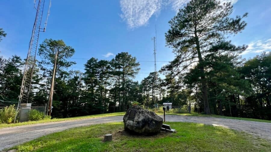
The park is located 20-minutes south of Woodall Mountain – the highest natural point in Mississippi – which I blogged about recently. Here’s a link to that post Woodall Mountain Post. To get here, I drove on a portion of the famous Natchez Trace Parkway, the premier highway of the early 1800s and a modern scenic parkway, which runs directly through the park. I have more information on the Natchez Trace in my Woodall Mountain post.
Once you exit the Natchez Trace Parkway, you’ll get on State Park Road (Mississippi-90), then you’ll pass a park sign and then eventually a larger park monument sign, before you get to the entrance. The entrance fee is $2.00 per person, so pretty inexpensive as parks go. But free is best in my opinion.


Pictures: Park sign on Mississippi-90 | State Park Road/Mississippi-90 | Larger park monument sign
First Stop – The Office
It should come to no surprise for anyone who has followed this blog, my first stop was the office to chat with rangers about the park, to get a lay of the land, to find out which hikes were must-do’s and to find out what wildlife I should be aware of – Bears? Snakes? Big Foot? As it stands, I did see a bear near the office when I was about to start my first hike!


Pictures: My bear sighting! | Map of Tishomingo State Park Trails
I’m in for a hot, humid and buggy day!
The ranger recommended I start out with the Flat Rock Trail, which was right by the office. There is a small parking lot on the right of the entrance – where I parked. This trail is a 3-mile loop, but I opted shorten it at the suggestion of the ranger and just go to the campground and turn around – a 1.6-mile out and back hike. The trail starts out crossing a creek – which has a small wooden bridge. You’ll also see that State Park Road (the road you enter into the park) also has a bridge over the creek. The ranger suggested I go up and under the bridge, which I did – it was pretty cool!


Pictures: State Park Road Bridge | The start of the Flat Rock Trail | The Trailhead Area
The first half of the hike was the best part as you go by some really cool rock formations and boulders, and through some neat passageways. I can only imagine back in the day – would these passageways be safe or would I be easy prey for the Chickasaw? The rest of the trail is nice and you’re basically hiking through the woods. There are a couple of areas that are up and down, but nothing too difficult. The trail was 99% dry and there were a few bugs out, but the day was just starting and it was getting quite humid and hot. I found the trail well marked and outside of a couple of trees down, it was pretty clear and easy to navigate.


Pictures: Rock formations and boulders at the beginning of the hike


Pictures: One of the rock passageways | Rock formation


Pictures: One of the down trees | My turnaround point for the Flat Rock Trail. The trail comes in from the upper right corner of the picture.
Once back at the office, I drove further into the park and stopped by the Pioneer Cabin and Well House for a quick visit.


Pictures: Pioneer Cabin | Well House


Pictures: From the area near the Pioneer Cabin
I would have been part of the CCC…
I then drove down and parked near the park’s famous Swinging Bridge. It was constructed in 1939 by the Civilian Conservation Corps. The CCC was a voluntary government work relief program that ran from 1933 to 1942 in the United States for unemployed, unmarried men ages 18–25 who had difficulty finding jobs during the Great Depression in the United States. The program was a major part of President Franklin D. Roosevelt’s New Deal that supplied manual labor jobs related to the conservation and development of natural resources in rural lands owned by federal, state, and local governments. If I had lived back then, I probably would have been part of the CCC. After all, I have the right physique as I think my abs look like the one in the statue! lol.


Pictures: Statue and plaque commemorating the Civilian Conservation Corps Worker
Five Person Limit
Back to the Swinging Bridge which has a sign noting a “5 person limit.” Somehow, I think this rule has been violated a bit in the past – just saying. Since it was a quiet day, I was the only person on the bridge – and even with me on it solo – it did swing a bit. I can only imagine how much it moves when 5 people are on the bridge! The bridge spans Bear Creek – which was quite muddy and flowing at a good pace due to the recent rain. After you cross the creek, you’ll connect with the Outcroppings Trail – my next hike.


Pictures: The Swinging Bridge and 5-Person Limit Sign


Pictures: Swinging Bridge | Muddy Bear Creek

Rare Salamanders and Scorpions?
I decided to take the trail to the right and follow along Bear Creek. You meander along the river for 9/10 of a mile. It is an easy hike with some small ravines, lots of rocks and a small brook. At one point I came across really cool tree that over time grew at a bent angle. I love how mother nature and trees adapt to their surroundings and sometimes they don’t just grow up as straight trees – rebels that buck the system. As I hiked, I kept an eye out for two rare species of creatures that are found predominately in the park and Tishomingo County – Vaejovis carolinianus, commonly called the Southern Devil Scorpion or unstripped scorpion – and the state endangered Green Salamander (Aneides aeneus). The ranger at the office gave me the heads up about these creatures – yet another reason to stop by the office or visitor center.
Interestingly, at least to me, while scorpions frequently live in hot and dry areas, there are at least two scorpion species are at home in Mississippi’s often cold and wet climate – Vaejovis carolinianus, which I noted above and found only in northeast Mississippi where I am; and Centruroidis vittatus, known as the striped scorpion, found sporadically in central and southern parts of the state. Unfortunately, I didn’t come across any, I think you have to really search for them, in essence stop and pull up rocks to find such creatures. But I did see a frog! And according to Google Lens – I think it is a Pickerel Frog.


Pictures: Outcroppings Trail along muddy Bear Creek | Cool Bent Tree on the Trail
Magic Mushrooms?
I came across some cool mushrooms – one of my fascinations in nature – and this pool of water that had an iridescent hue to it. And no, I didn’t eat the mushrooms before I saw the water – so I wasn’t tripping out and hallucinating from eating the “magic mushrooms.”


Pictures: Mushrooms | Iridescent pool of water
The trail soon goes up and away from the creek. Personally, I think this is where the trail gets more interesting. You get a nice view of the valley below and will come across some neat boulders, rock formations and caves – I’m guessing at this point you’re learning about my fascination with rocks and boulders as well. I later found out that the Chickasaw Indians actually lived in these caves when they inhabited the area. I did see any in the caves, but I did see one on the roadside as I drove through the park.


Pictures: Boulders and rocks on the upper portion of the trail


Pictures: Caves and overhangs where the Chickasaw lived


Pictures: More rock formations | Looking down from the rocks above
A Full Day of Hiking
The trail loops back the Swinging Bridge – where I was parked. I got back into my car and was off for my next hike – the CCC Camp Trail. I drove back up to the Pioneer Cabin, and parked across the street, near the picnic area. I should note that I later realized I could have just kept my car at the Swinging Bridge as you’ll see as you read on, but I ended up being happy that I drove to this parking spot. It helped break up the day for me, it gave me an opportunity to have some water, a quick snack and to be in the comfort of my car’s air-conditioning, and it gave me time to figure out where the CCC Camp Trail started. This trail is a 3-mile loop that starts out generally flat, then drops down to the Swinging Bridge, then goes along Bear Creak and finally back uphill to the parking lot.
As I sat across the street and looked at the Pioneer House, I scanned the roadside and to far left of the Pioneer House, was a set of stairs – this is the CCC Camp Trailhead. So up the stairs I went on my last excursion in the park. Soon after you ascend the stairs, you’ll pass some more rock formations and boulders that are heavily covered in moss due to the shade.


Pictures: Moss covered rocks | CCC Camp Trail
Is that a UFO?
The trail follows the road for a bit – not my favorite – but you’re up high enough above the road and luckily there were only very few cars – so not alot of street noise. Otherwise it would have reminded me of Lincolnwood State Park in Rhode Island – which was not a favorite hike. You’ll eventually head down the hill, past the Swinging Bridge and through a parking lot. At the far end of the parking lot, the trail resumes and it’s at this point that you hike parallel to a Disc Golf Course – so keep a keep eye out for flying discs!


Pictures: The Disc Golf Course
Shortly after you pass the course, you’ll cross a bridge and then the trail got a bit dicey as there were alot of trees down in this section of the park. It wasn’t difficult to follow the trail, you just had to take a few detours around the downed trees. Before you head back up the hill, there is a directional sign – one of the few signs I saw on the trails. So up the hill I went to the Pioneer Cabin, past some more downed trees and back to the car.


Pictures: Bridge | Downed Trees | Directional Sign
On the way out of the park, I stopped by the glamping tent sites, courtesy of TENTRR. I have yet to stay at a TENTRR campsite, but do have the app on my phone. Tishomingo State Park is an interesting park with some cool rock formations and history. I’d definitely recommend a visit if you’re in the area, but it’s definitely not a destination state park like Ricketts Glen State Park. At least in my opinion.

Date of Visit: 13 August 2023