Confession time: I’m a closeted Wheel of Fortune fan. And when I found out they were hosting their first live auditions since the pandemic—with Ryan Seacrest as the new host, no less—I knew I had to go.
The audition was happening at Sycuan Casino in San Diego. So I set my alarm early, fueled up with coffee, and made the hour-long drive southeast.
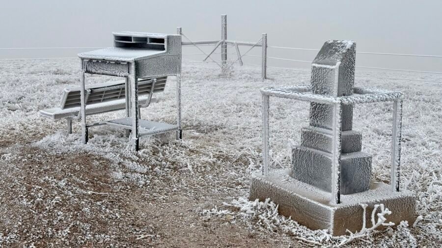
At 5,429 feet above sea level, Panorama Point is Nebraska’s highest natural point, tucked into the far southwestern corner of the state where Nebraska, Wyoming, and Colorado quietly meet. Ranked #20 among U.S. state high points, this marked summit #34 in my ongoing high-pointing journey. And despite the name, Panorama Point isn’t about sweeping views—it’s about subtlety, solitude, and the story of getting there.
In far western Kansas, near the Colorado border, lies Mount Sunflower, a towering summit by Kansas standards at 4,039 feet above sea level. As the highest point in the Sunflower State, it ranks #28 among U.S. state high points by elevationand marks my 33rd summit on this ongoing high-pointing journey. While it may not boast rugged peaks or dramatic cliffs, Mount Sunflower is a subtle reminder that Kansas has more topography than it often gets credit for.
Instead of jagged ridgelines, this summit owes its height to the gradual rise of the High Plains as they slope toward the Rocky Mountains. It’s understated, yes—but that’s part of the charm.
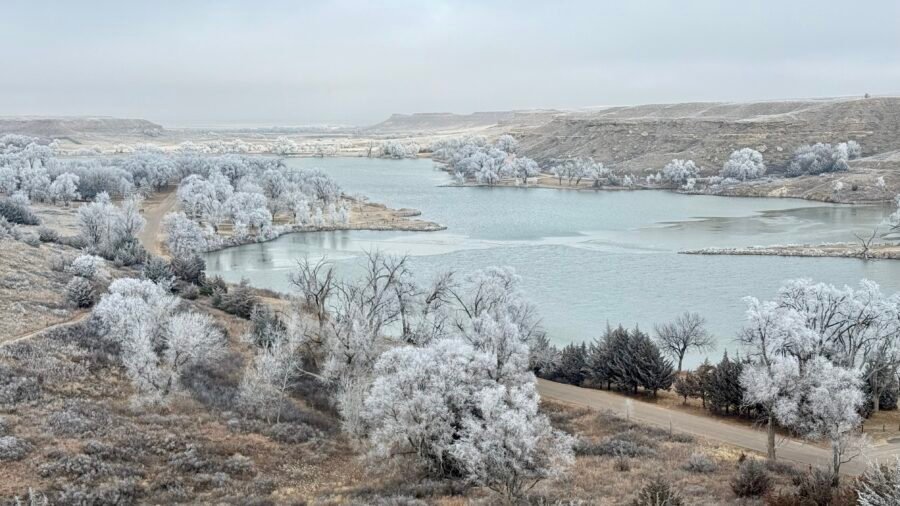
Happy 2025! After a fun New Year’s Eve in Nashville — raving to Sofia Kourtesis at Night We Met — I decided to kick off the year with something equally energizing: exploring, hiking, and high-pointing. If you’re going to start a new year, why not begin on a literal and figurative high note? Historic Lake Scott made for the perfect start to 2025.
So far, I’ve visited 32 of the 50 Best State Parks in the U.S. (as ranked by The Discoverer). I’ve also stood atop 32 of the 51 State High Points — yes, including Washington, D.C., because why not? That leaves some serious ground to cover.
I’ve logged a lot of miles on Double Peak over the years. It’s one of those hikes I keep coming back to—reliable, familiar, and somehow still surprising.
Recently, though, I started pushing beyond my usual routine. I added side trails, longer spurs, and eventually… yes, the San Elijo Hills 10K Loop, which I once swore I’d never hike.
Never say never, I guess.
You’ll find those updates toward the end of this post. But first, let’s rewind to why Double Peak keeps pulling me back.
You know those places that aren’t on your radar but end up being a cool surprise? That was Mount Rubidoux Park for me.
I was en route to Las Vegas to catch up with an old friend, but first, I had to scratch that hiking itch. So, a quick AllTrails search led me to Mount Rubidoux—a quirky hike tucked right into the middle of Riverside.
After the high of conquering Eagle Mountain and exploring Grand Marais, it was time to return to Tettegouche State Park and settle into my new campsite. The drive back along Minnesota’s North Shore was a scenic hour, and before heading in, I swung by the visitor center to officially check back in (see Part 1 of my adventure here).
This new site, tucked deeper into the Baptism River Campground, immediately impressed me. The layout here is top-notch — each campsite has breathing room, which means you’re not cheek-to-cheek with your neighbors. That said, there was one guy with a generator humming in the distance. I thought most of these sites had electricity? Maybe he missed the memo.
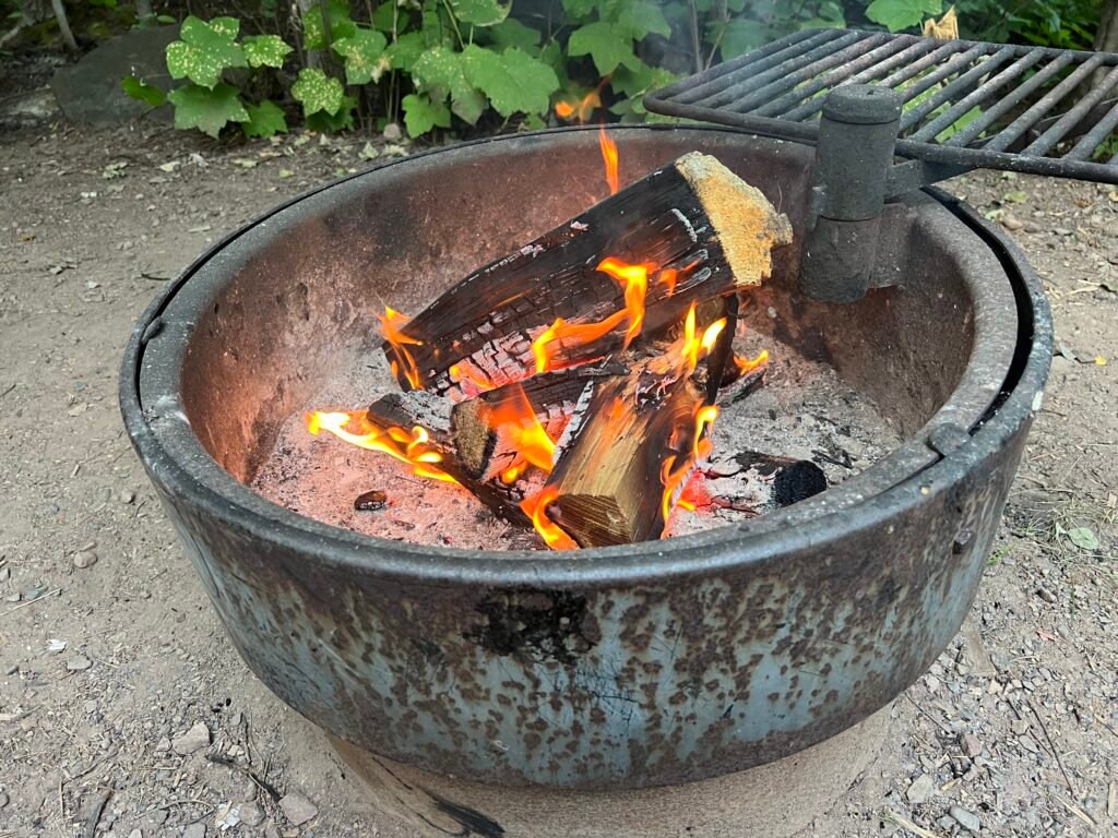
As evening settled in, I built a roaring fire, poured a glass of red wine, and pulled out one of my reliable camping staples: Yellow Tadka Dal from Trader Joe’s paired with Earthly Grains Basmati Rice from Aldi. Shelf-stable, easy, and surprisingly satisfying. Even better, I cooked it in my trusty cast iron skillet — which, frankly, is a miracle I managed to wedge into my suitcase.
Photo: Fireside Bliss Under the Evening Sky
Morning Visitor: The Hare-Raising Encounter
Up and at it early — again.
I started the morning with cold brew coffee and a splash of Coffee Mate (not ideal, but it lasts longer than real half-and-half in the wild). While soaking in the stillness along the Baptism River, I had a surprise visitor: a snowshoe harecasually hopping through camp.
Here’s the fun part — in Minnesota, these hares are dark brown in summer. However, when winter arrives, their coats turn snowy white in a seasonal shift known as leucism. Nature’s wardrobe change at its finest.
Photo: My Morning Visitor
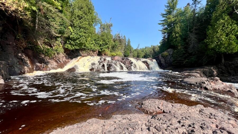
Two Waterfalls, Twice the Fun
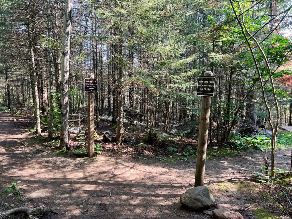
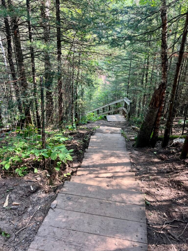
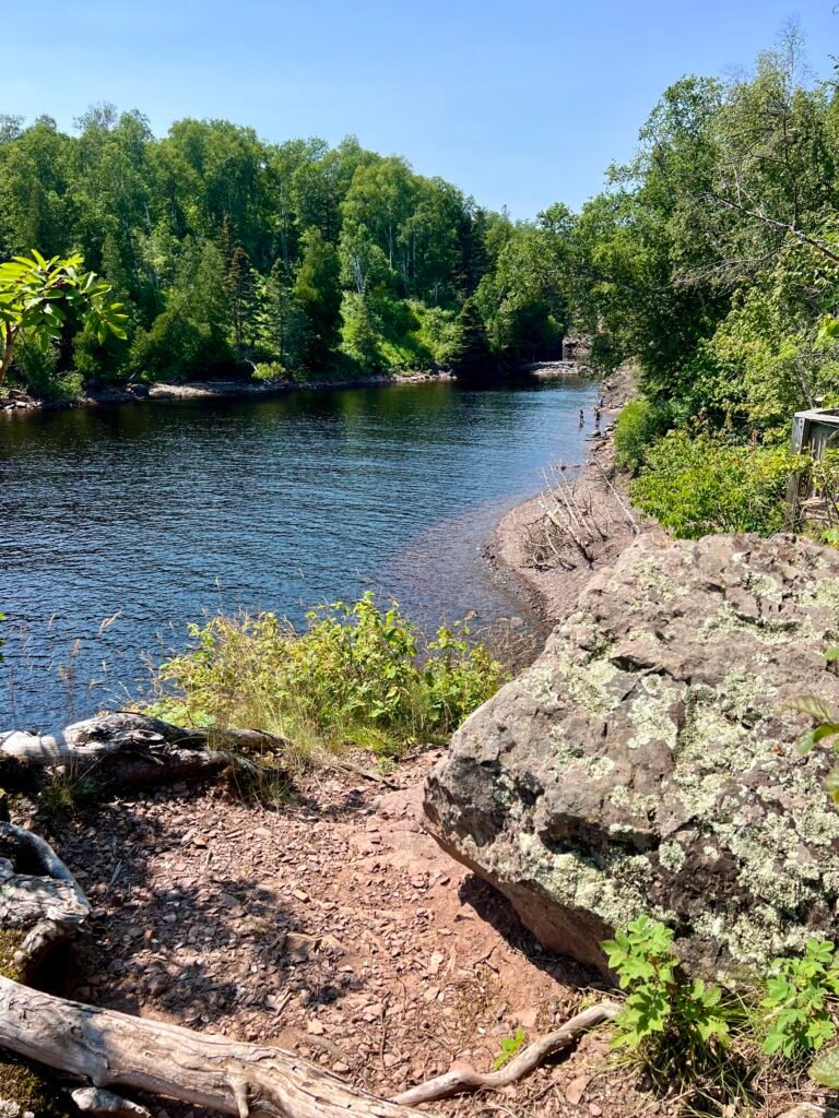
With clear blue skies overhead, I set out to revisit Two Step Falls and High Falls — this time from the opposite side of the river. The trailhead near Baptism River Campground offers a completely different perspective, and because of that, it felt like an entirely new experience.
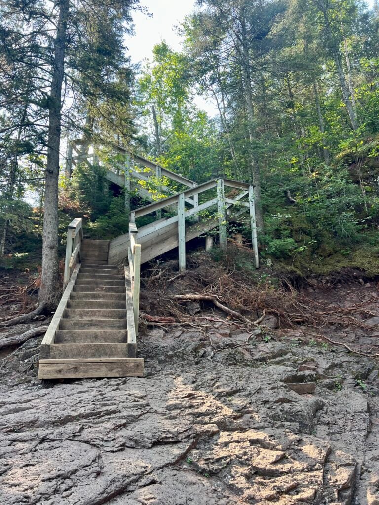
I began with Two Step Falls, which requires a 200-step descent. In other words, you earn this view.
Photos: The Trail and the Stairway to Two Step Falls
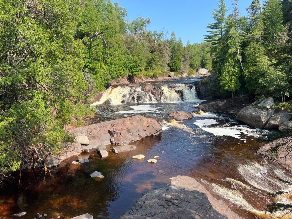
The payoff? Absolutely breathtaking. From this angle, Two Step Falls was easily my favorite viewpoint of the trip. The cascade felt more intimate, more powerful. Naturally, I waded through the shallow water to get closer.
Soon after, a couple of guys arrived with their dogs — who, I’m convinced, were eyeing the water longingly. If they could’ve ditched the leashes, they would’ve been splashing in seconds.
Photo: Descending to Two Step Falls—Morning Magic in Every Step!
Photo: Getting Up Close and Personal with Two Step Falls
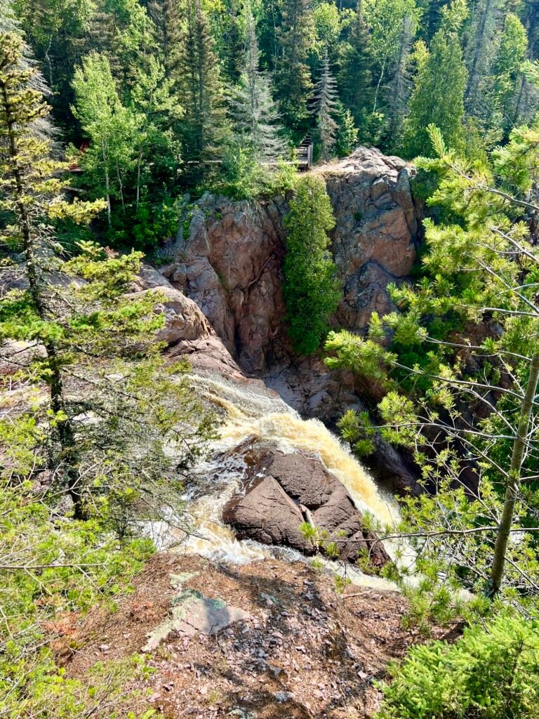
High Falls: The Pulpit and the Power
As I continued hiking, I reached a fork in the trail — left toward the parking lot or straight ahead to High Falls. Obviously, I went straight.
The overlook was spacious and dramatic, complete with what I can only describe as a pulpit-like platform. Naturally, I delivered an impromptu sermon to the forest creatures below.
Photos: High Falls Viewing Area | The Legendary Pulpit Spot!
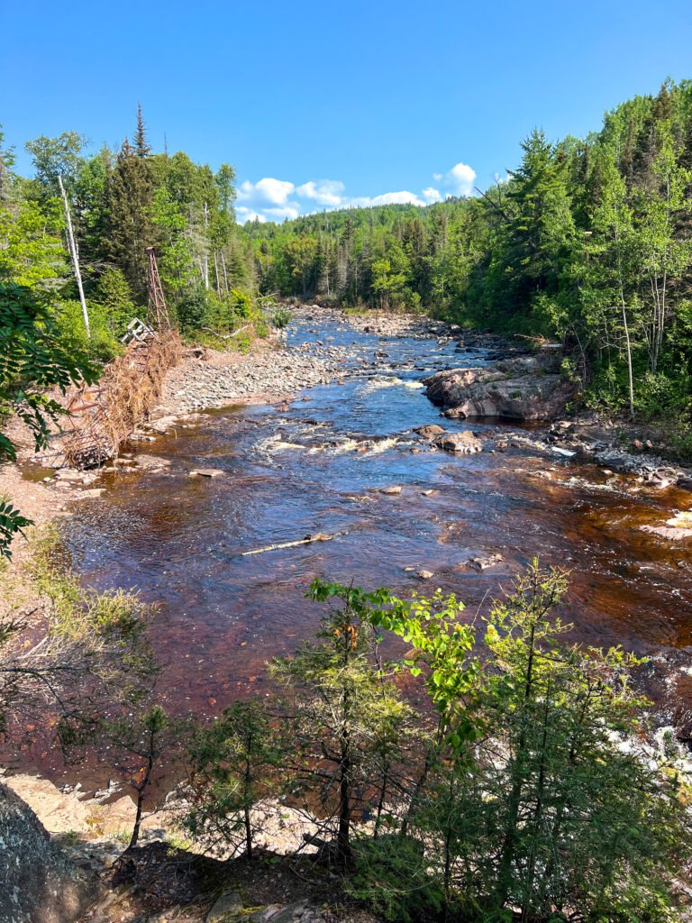
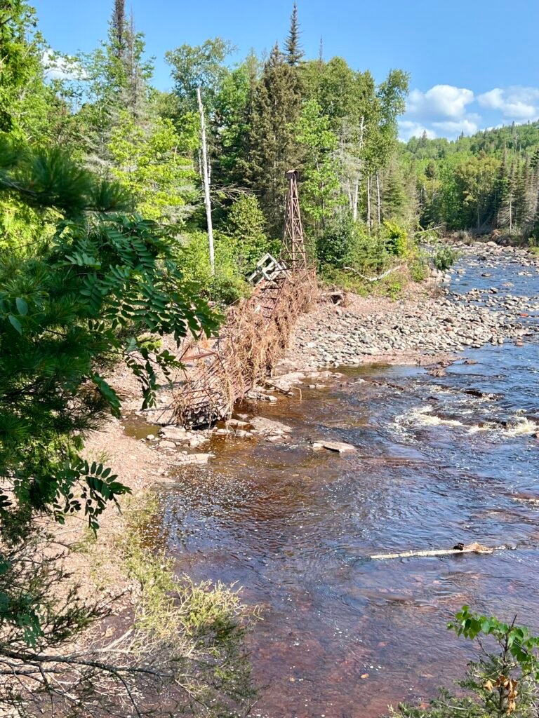
The views along the Baptism River were spectacular. Although the opposite side offers a more dramatic view of High Falls itself, this perspective gave a sweeping look at the surrounding gorge. Meanwhile, I also stumbled upon the twisted wreckage of the old swinging bridge — a powerful reminder of the storm that tore through the area.
Photos: Breathtaking Views of the Baptism River
Photos: High Falls from a Different Angle—Less Spectacular, but Still Stunning | The Twisted Swinging Bridge
Take Two: Shovel Point and the River Mouth
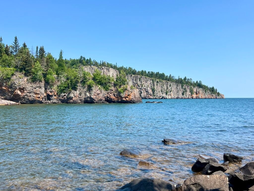
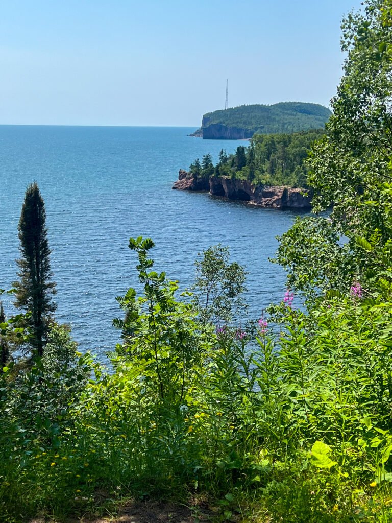
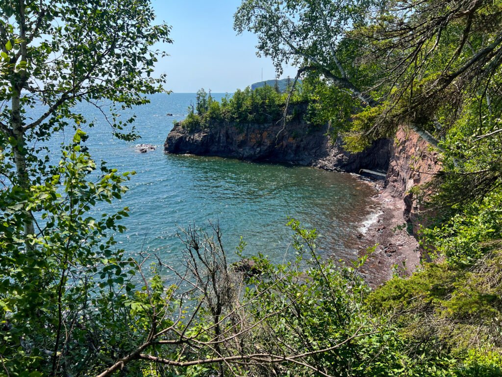
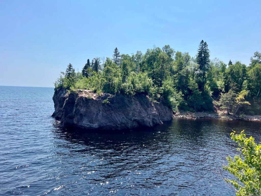
After packing up camp, I made my way back toward the visitor center and then out to Shovel Point and the Baptism River Mouth. What a difference a couple of days makes.
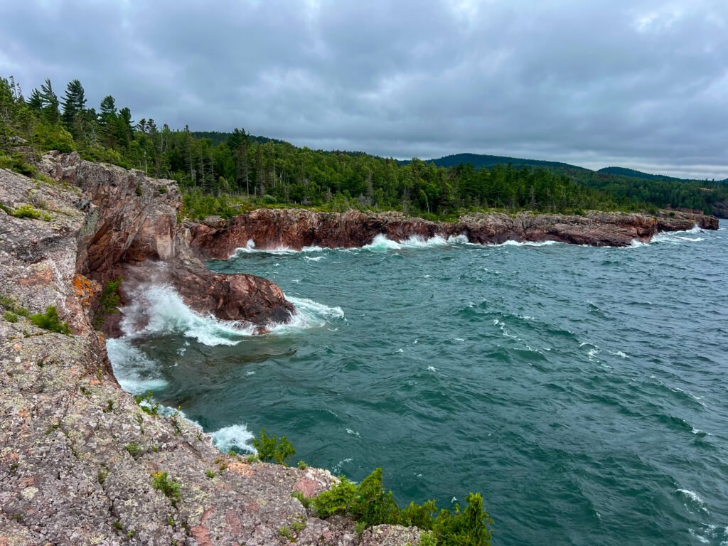
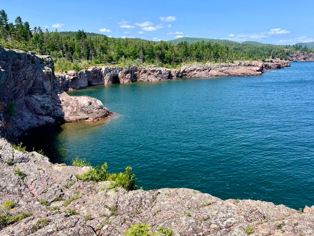
Previously, Lake Superior had been moody and gray. This time, however, it was calm, turquoise, and almost Caribbean-looking. The contrast was stunning.
At Shovel Point, I chatted with a friendly couple and simply soaked in the view. The cliffs, the clear water, the fresh breeze — this is why people fall in love with Minnesota’s North Shore.
Photos: A Calmer Lake Superior – View from the Beach | Palisade Head in the Distance
Photos: Lake Superior’s Dual Personalities—Two Days, Two Vibes!
Photos: Lake Superior – Turquoise Water and Incredible Views
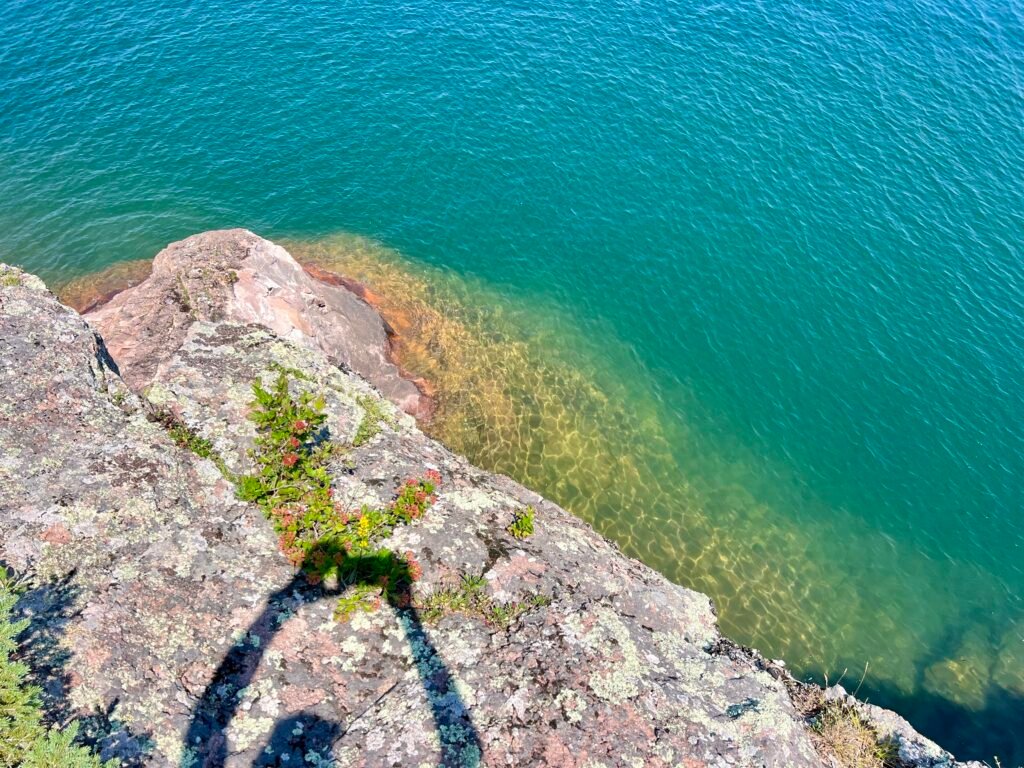
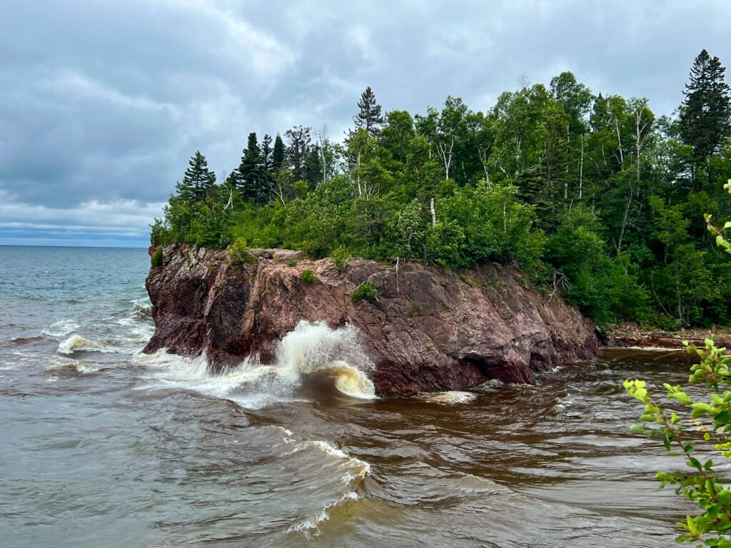
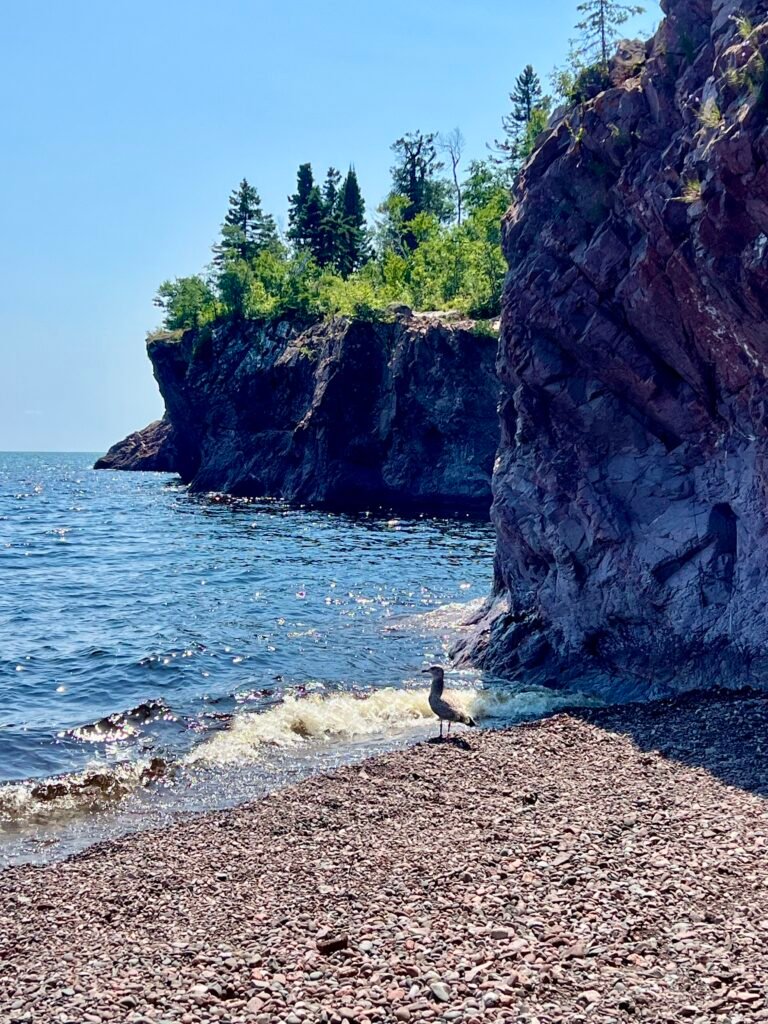
At the River Mouth, I climbed onto the rocks and, unexpectedly, found myself background scenery in someone’s FaceTime call. Seriously — do we need to broadcast every conversation to the world?
So instead, I slipped away to the rocky beach where I shared a quiet moment with a lone seagull. However, when a group of teens descended with towels and chatter, I knew it was time to make my exit.
Photos: The River Mouth—Totally Different Feels!
Photos: Chillin’ with a Seagull | The Baptism River—A Much Calmer Day
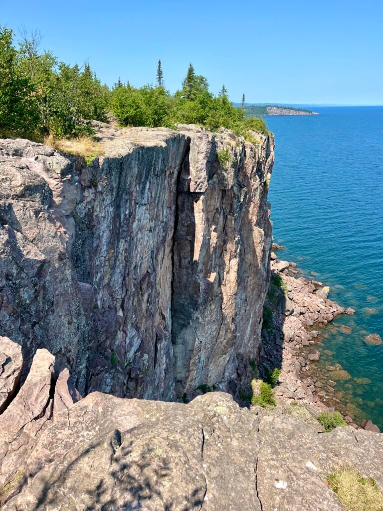
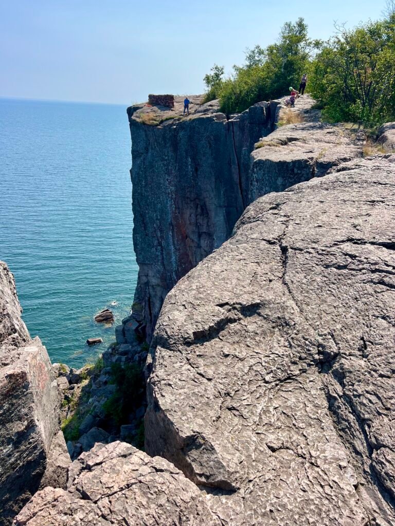
Palisade Head: Glad for Visit #2
As I drove south on MN-61, I decided to give Palisade Head another chance — this time from the top.
The overlook was buzzing with motorcyclists, cars, and rock climbers prepping their gear. Now that I could fully explore the cliffs, I finally understood the hype. The vertical drop-offs are dramatic, and for climbers especially, it’s a playground of granite and adrenaline.
In short, I was glad I made the detour.
Photos: Palisade Head – Views Towards Shovel Point | Climbers Preparing to Conquer Palisade Head
Wrapping Up: Tettegouche State Park, What a Gem
What started as a place I barely knew anything about quickly became one of the highlights of my Upper Midwest trek.
Tettegouche State Park exceeded every expectation. Between the rugged North Shore cliffs, the power of High Falls, the beauty of Two Step Falls, and the peaceful moments along the Baptism River, this park delivers diversity at every turn.
Moreover, this was my first deep dive into Minnesota’s North Shore — and it absolutely won’t be my last. If you haven’t explored Tettegouche State Park yet, put it on your list. The waterfalls alone are worth the drive.
Trust me — you need to see this one for yourself.
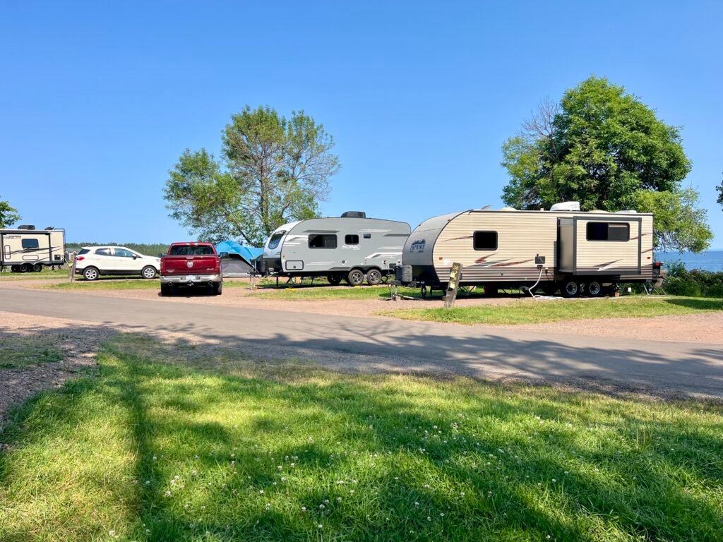
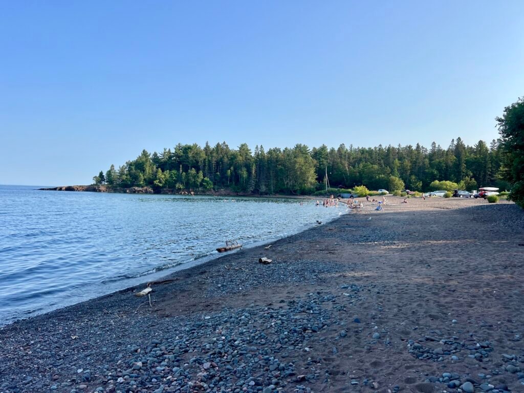
Two Harbors: Campground Chaos and Sweet Treats
Next up was Two Harbors, just 30 minutes down MN-61. I stayed at Burlington Bay Campground, which, in contrast to Tettegouche, felt like sardine city. Campsites were tightly packed with little privacy.
Photos: Burlington Bay Campground—Sardine City! | Two Harbors Beach
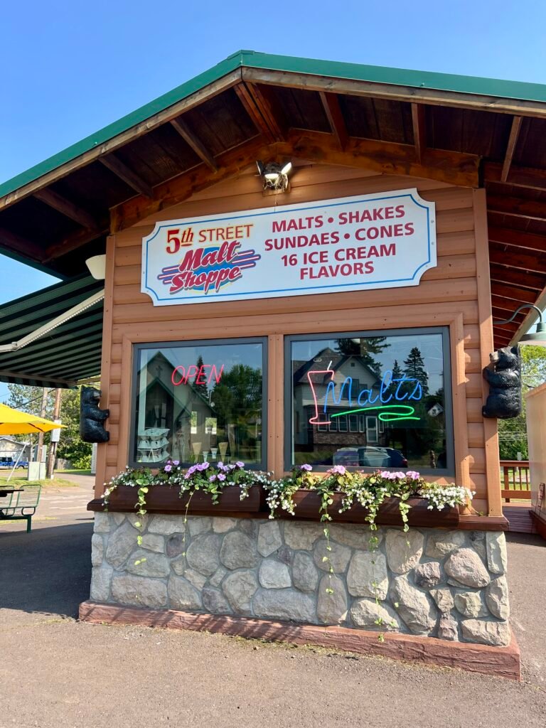
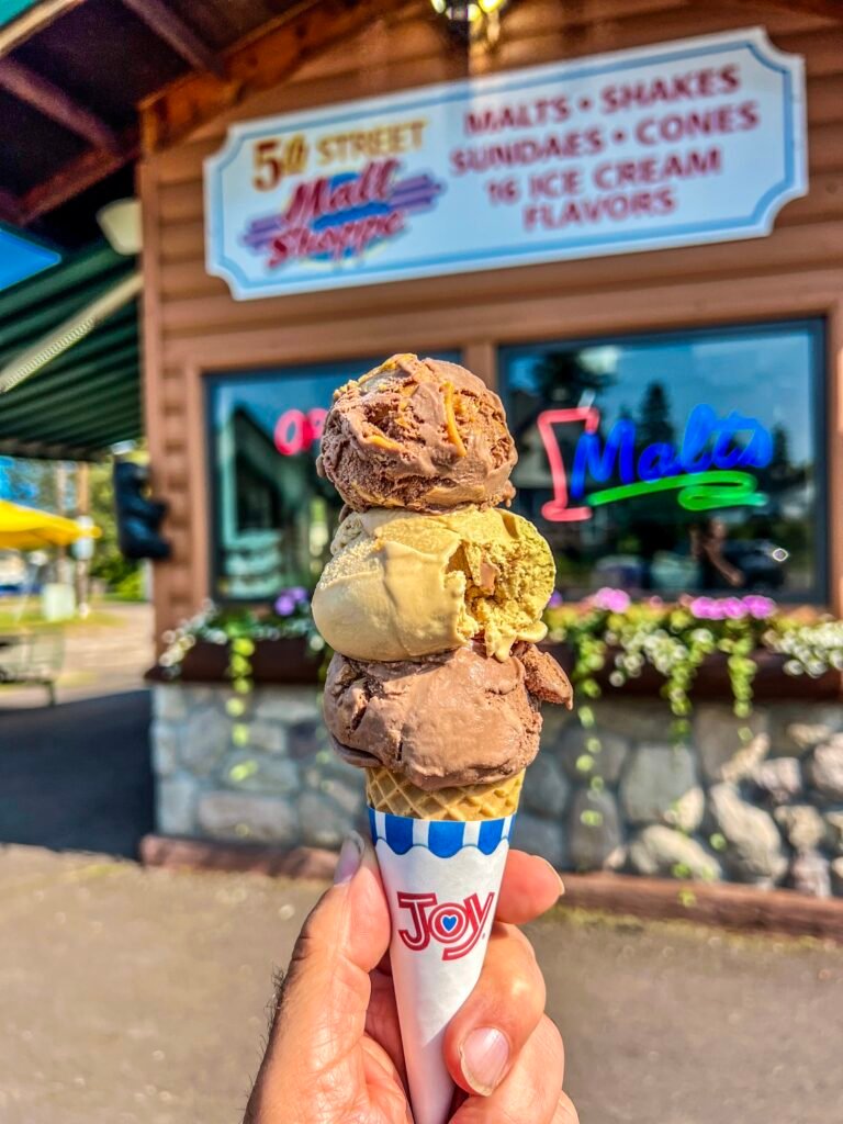
Naturally, I sought redemption in ice cream.
I made a beeline for the 5th Street Malt Shoppe and ordered Chocolate Peanut Butter alongside Coffee Ice Cream. Back at the campground, I ended the day with red wine on the beach, watching Lake Superior settle into evening.
Photos: 5th Street Malt Shoppe | My Delicious Reward!
Minneapolis Finds: Kowalski’s and More
In Minneapolis, I had to check out Kowalski’s Grocery, a renowned local chain. It did not disappoint! The fish counter was impressive, the prepared foods section was next-level, and the pizza was tasty — though a bit light on basil. Definitely worth a visit if you’re in town. I also stopped by Goodwill to donate some camping gear I couldn’t take home — like a folding lounge chair that had served me well.
Photos: Kowalkski’s in Minneapolis | Impressive Fish Counter!
Photos: Epic Prepared Goods Counter | My Pizza—Needs More Basil
Finally, I was off to the airport and then to Chicago for an REI Backcountry Navigation and Map Reading class. Pro tip: Use TSA-approved locks for your luggage. I learned this the hard way when TSA had to cut off my lock due to my hastily purchased one not meeting their standards. Oh well — lesson learned.
Photo: Parting Shot—Oops, Lesson Learned!
And with that little adventure, my month-long trek through the Upper Midwest comes to an end. What a summer to remember!
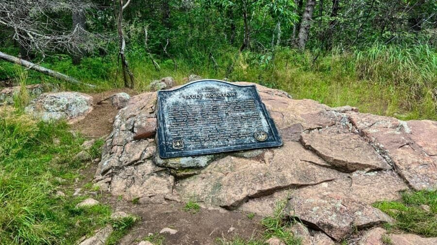
Nestled in the northeastern corner of Minnesota, Eagle Mountain may not look as dramatic as some of the country’s towering giants. Still, it is absolutely Minnesota’s crown jewel. At 2,301 feet, Eagle Mountain ranks 37th among U.S. state high points, and this hike marked my 32nd state high point. While it doesn’t scream “epic” at first glance, it quietly calls to outdoor lovers, promising a day filled with solitude, scenery, and a little bit of adventure.
Tettegouche State Park, perched along the rugged North Shore of Lake Superior in Minnesota, is more than just a park — it’s a treasure trove of natural beauty, history, and adventure. Spanning nearly 9,400 acres, it boasts six inland lakes, four stunning waterfalls, and 22 miles of hiking trails. Plus, it’s one of just four state parks in Minnesota with rock climbing.
Whether you’re an adrenaline-pumping hiker or climber, an eagle-eyed birdwatcher, or just someone looking to soak in some serious tranquility, Tettegouche has got you covered.
And trust me, this place is anything but ordinary.
Nestled in the heart of Michigan’s Upper Peninsula, Tahquamenon Falls State Park is a treasure trove of natural wonders and breathtaking beauty. With nearly 50,000 acres of pristine wilderness, this park is home to one of the most impressive waterfall systems east of the Mississippi, drawing nature enthusiasts, photographers, and adventure seekers alike. Beyond the falls, Tahquamenon Falls State Park boasts over 35 miles of hiking trails that weave through dense forests, scenic overlooks, and along the picturesque Tahquamenon River. So, grab your bug spray, lace up those hiking boots, and let’s dive into my adventure through this U.P. gem!
Pronunciation Tip: Tahquamenon is pronounced tuh-KWAH-muh-non.
The Mighty Tahquamenon Falls
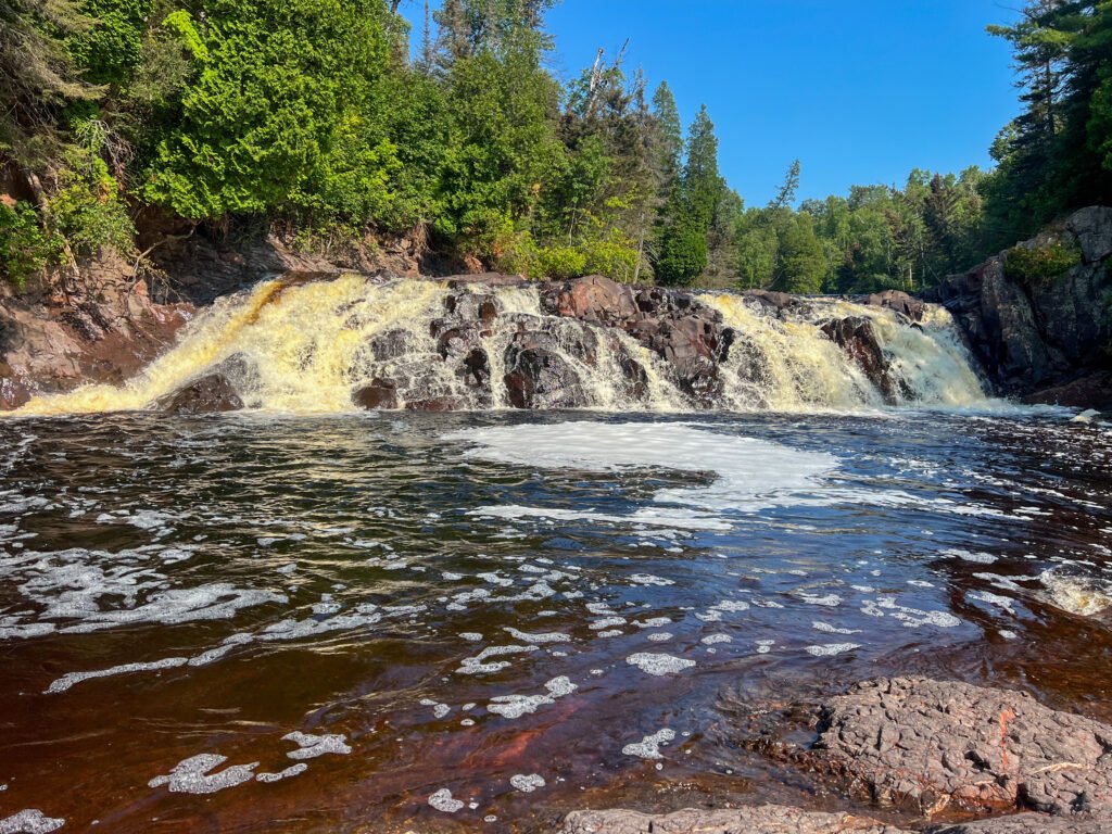
The crown jewels of Tahquamenon Falls State Park are undoubtedly the waterfalls themselves. The park features two main sets of falls: the Upper and Lower Falls. The Upper Falls, often referred to as the “Root Beer Falls” due to their distinctive amber color, are a sight to behold. Spanning 200 feet across and dropping nearly 50 feet, this waterfall is the second largest in volume east of the Mississippi River, only trailing Niagara Falls in size! The unique hue of the water is thanks to tannins leached from the cedar swamps that feed into the river—nature’s very own chemistry experiment. Visiting the UpperFalls offers multiple viewing platforms and trails that allow you to marvel at the roaring waters from various angles.
Photo: The Upper Falls
The Lower Falls offer a more intimate yet equally mesmerizing experience. This series of five smaller cascades encircle an island, accessible by rowboat or a charming footbridge. Exploring the island and the surrounding waters is like stepping into a tranquil escape—perfect for a leisurely day of picnicking, swimming, and photography.
Photo: Two of the Smaller Cascades that make up the Lower Falls
Roadtrips and Sunsets
I arrived in the afternoon, eager to explore. After checking into my campsite at the Rivermouth Campground, I couldn’t resist a quick detour north to Whitefish Point (check out my other post on Road Trippin’: The U.P.) – Great Lakes Shipwreck Museum and the historic Whitefish Point Lighthouse. On the way back to camp, I made a couple of stops that were just too good to pass up.
First, I swung by the Rivermouth Roadside Park, a small but scenic spot on the Lake Superior shoreline. Michigan seems to have a thing for these roadside parks, and honestly, I’m here for it. They’re like little oases for travelers, offering a place to picnic, rest, and soak in the scenery. A short hop down the road brought me to Clark Point Trail. Calling it a trail is a bit generous—it’s more like a quick walk from the parking lot to the lake—but it was fun exploring the shoreline. This spot is also a birdwatcher’s paradise, so bring your binoculars if that’s your thing.
Photos: Views from Rivermouth Roadside Park | And from the Clark Point Trail
Back at camp, I settled in for the evening with a campfire and dinner. But the real treat came later, as I headed to the campground’s beach on the Tahquamenon River. With golden hour approaching, I grabbed a cold one, found a log to perch on, and let nature’s show unfold before me. There’s something magical about watching the sun dip below the horizon while the river flows quietly by—it’s the perfect way to end a full day of adventure.
Photos: My Campsite | The Evening’s Fire
Photos: The Tahquamenon River – great for Kayaking | Enjoying a Cold One!
Photos: Enjoying Nature’s Show | Golden Hour at the Tahquamenon River
Photo: The Perfect Way to End the Day!
No time to wait on late rangers
First, A note to fellow adventurers: Tahquamenon Falls has two main entrances, one at the Upper Falls and the other at the Lower Falls. It’s not uncommon to see long lines, especially in the morning or around 3 PM when campers are checking in.
Photo: Lower Falls Entrance from the Parking Lot | Hard to Get Lost Here!
Photos: Lower Falls Map | Upper Falls Map
Photo: Tahquamenon Falls State Park Map
The next morning, I was up early and ready to hit the trails. My first stop was the Lower Falls. After waiting a bit for the entrance booth to open on time at 8:00 AM (spoiler alert: it didn’t), I decided to get a head start on my day. I wasn’t going to let the rangers late start ruin my plans! Just up from the parking lot, there’s a handy area with bathrooms, the Lower Tahquamenon Falls Café & Gift Shop, and even rowboat rentals for exploring the Tahquamenon River. The hike from the gift shop to the Lower Falls is only a half-mile, mostly on a raised boardwalk. Being early, I had the place almost to myself, save for a few other early risers. Along the way, you’ll spot a wooden plaque featuring the Prayer of the Woods—a reminder to be mindful and respectful of the natural beauty around us.
Photos: Bear Cubs at Play – a sculpture at the entrance | Rowboats for Rent
Photos: The Boardwalk to the Lower Falls | The Prayer of the Woods
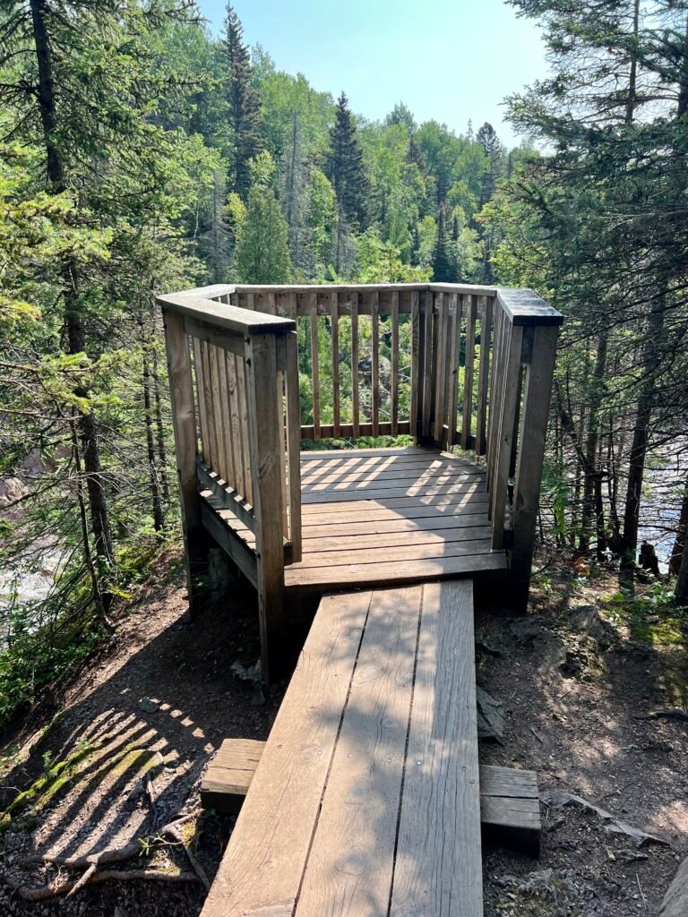
The Lower Falls consist of a series of five smaller falls cascading around an island. You can either view them from the riverbank or cross the Ronald A. Olson Island Bridge to explore the island. I’d recommend the latter—it’s a short half-mile loop around the island, and you get to see all five falls up close. Plus, the bridge itself is pretty cool, especially with the river roaring below after the recent rains.
Photos: Ronald A. Olson Island Bridge
Photos: The Island Loop – It’s pretty flat until you hit the boat dock area, where you’ll find a few stairs
Photos: Morning Views from the Island Loop
Photos: A few views of the Cascades at the Lower Falls from the Island
Feeling inspired and ready for a bigger adventure, I changed into my trail runners, grabbed my poles, and lathered myself in bug spray. My next challenge: the 4-mile one-way hike from the Lower Falls to the Upper Falls along the River Trail, known for its scenic beauty, winding through old-growth forests and along the river.
The River Trail: A Hiker’s Delight with Otters
Now, let me give you a heads-up: this trek is not for everyone. It’s got its fair share of exposed roots, hilly terrain, numerous staircases, and was a bit overgrown in some areas. But if you’re up for the challenge, the rewards are more than worth it. At one point, I even stumbled upon a group of river otters frolicking along the riverbank. They didn’t notice me at first, but when I “clicked” to get their attention for a photo, they weren’t too thrilled and quickly disappeared into the water. I guess not everyone is a fan of the paparazzi!
One thing to note is that the trail isn’t always the best marked or maybe I just wasn’t paying attention. I may or may not have taken a wrong turn at one point, but hey, getting lost is part of the adventure, right?
Photos: River Trailhead at the Ronald A. Olson Island Bridge | Time to walk the plank and dodge some roots on the River Trail!
Photos: The River Trail – A fun combo of dirt paths and wooden boardwalks!
Photos: The Otters – Before they knew I was around | And after – when they gave me an earful!
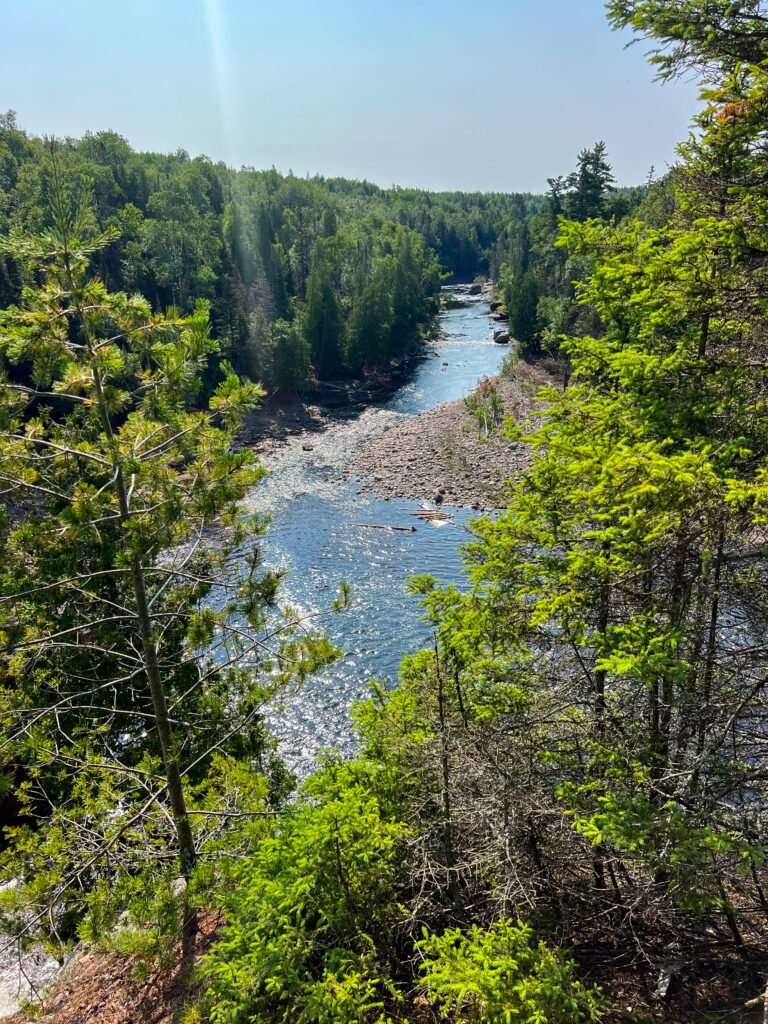
Photos: Check out one of the amazing views of the Tahquamenon River along the trail! | And yep, even on the way up to the Upper Falls, you’ll hit some stairs going down—perfect cardio workout!
Stairmasters and Nature’s Powerhouse
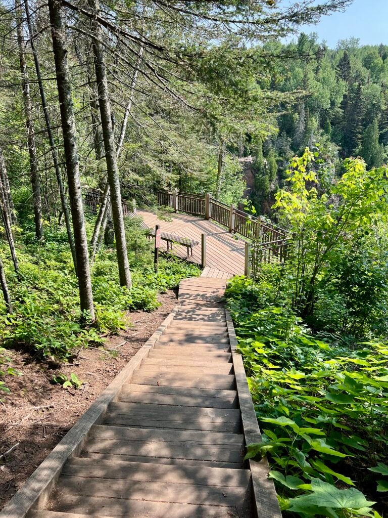
After what felt like a mini-marathon, I reached the Upper Falls. The 181 stairs down to the Gorge View seemed like child’s play after my hike, and the view was nothing short of spectacular. From here I got my first glimpse of this massive cascade with a nearly 50-foot drop and a width of over 200 feet. The sheer volume of water crashing down is mesmerizing—it’s said that during peak flow, over 50,000 gallons of water rush over the falls every second, hence getting the title of the second largest east of the Mississippi.
Photos: Coming off the River Trail and hitting the Upper Falls Viewing Areas | First stop: the Gorge View!
Photos: Stairmaster Workout – 181 stairs down to the Gorge, then back up
Photos: Boardwalk to the Viewing Area | Along the Gorge
Photos: The Upper Falls from the Gorge Viewing Area
If you’re a sucker for scenic spots, the Brink View area is another must-visit. After another 94 steps down, you’ll be rewarded with a front-row seat to one of nature’s most powerful shows. This area was definitely more popular, and I had to navigate around a few selfie-taking tourists, but the view was worth it. After taking in the sights, I headed to the Upper Falls parking lot, a short 0.3-mile walk on a paved walkway. This spot has some nice perks too, like the Tahquamenon Falls Brewery & Pub, Camp 33 Gift Shop, an outdoor picnic area, and even a food truck, though it wasn’t open when I visited.
Photo: The “Root Beer Falls” from the Brink Viewing Area
After all that hiking, I figured I deserved a reward, so I made my way to the Brewery & Pub. Unfortunately, nothing on the menu really caught my eye, but I couldn’t pass up the chance to try one of their beers. I went with the Falls Tannin, an American Red Beer. It had that deep amber hue, just like the Upper Falls, but the taste was… well, just okay. Not exactly something to write home about, but it hit the spot after a long day on the trails.
Photos: Tahquamenon Falls Brewery | Tried the Falls Tannin – does it look like the falls? | Today’s brews!
Trail Running and Campfire Bliss
Rested and refreshed, it was time to head back down the River Trail to the Lower Falls parking lot—a solid 4+ miles back. This time, I took the Nature Trail to the River Trail, the path I had hiked up earlier. Feeling a bit adventurous, I decided to turn the hike into a trail run. The path was getting busier with other hikers, so I had to weave around a few people, but it was a fun way to end the day.
Back at the Lower Falls parking lot, I packed up and headed to my campsite for the night—The Lower Falls Portage Campground. Back at the campsite, I treated myself to a hot shower, made another campfire, and settled in for the night. I had a 7-hour drive to Duluth, Minnesota, ahead of me the next day, so I knew it would be an early night. But as I sat by the fire with a cold drink in hand, I couldn’t help but feel a sense of contentment. Tahquamenon Falls State Park had lived up to every expectation and then some.
A Memorable Adventure
Tahquamenon Falls State Park is more than just a place to visit—it’s a place to experience. Whether you’re marveling at the mighty falls, exploring the serene hiking trails, or simply soaking in the natural beauty, this park offers something for everyone. And if you’re lucky, you might even have a few memorable encounters with the local wildlife. Just don’t forget to pack your bug spray, plan to camp in the park, and get ready for an adventure you won’t soon forget. So, what are you waiting for?
The Pasty Pursuit: A Culinary Quest
As I drove through the U.P., I kept seeing signs for pasties (pronounced pass-tee, not pay-stee.) —what are these mysterious pastry things? As a curious foodie, chef, and restauranteur (also a pescatarian), I had to find out. After some quick research, I found a place in Ishpeming that had a vegetarian option. I headed to Lawry’s Pasty Shop, only to be disappointed—apparently, they don’t cook the vegetarian ones on-site. Determined not to leave empty-handed, I backtracked to Irontown Pasties in the heart of Negaunee. After a bit of a wait (perfect for catching up on Words with Friends), I finally snagged a veggie-cheese pasty. The staff was super friendly, and when I asked about the “proper” way to eat it, they handed me a no-name ketchup bottle and said, “With ketchup!”
My first impression? Well, let’s just say it looked like an Irishman on the beach in Miami—stark white. The dough was a bit undercooked, especially where it was folded. The filling was a mix of broccoli, cauliflower, carrots, onion, potato, cream cheese, cheddar cheese, mozzarella cheese, and spices. It wasn’t horrible, but it wasn’t great either. It was like winning a match by default—you get the victory, but it feels a bit anticlimactic. With that, I headed for Duluth, Minnesota.
Photos: Irontown Pasties | My Veggie-Cheese Pasty – with a side of ketchup, of course!