About Woodall Mountain — History 101
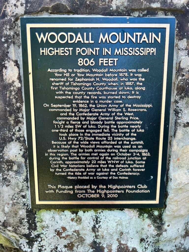
Woodall Mountain is the highest natural point in the U.S. state of Mississippi at 806 feet and ranks #47 in State High Points. It is located just off Mississippi Highway 25, south of Iuka in Tishomingo County in the northeast part of the state. I also happened to combine this trip with my visit to Tishomingo State Park (on my list of Best State Parks), which I will blog about at a later date.
It was originally called Yow Hill and was the scene of fighting during the American Civil War. On September 19, 1862, the Battle of Iuka took place there. Union General William Rosecrans occupied the mountain and used it to launch artillery barrages on the town of Iuka, at the time under the control of General Sterling Price, who avoided capture despite the Union victory.
The hill was later renamed after Zephaniah Woodall, sheriff of Tishomingo County, who purchased it and surrounding land in 1884. Describing this hill as Woodall Mountain is often lampooned by locals. Some nearby stores sell souvenir T-shirts with the phrase “Ski Woodall.”
So there you have it — the history of Woodall Mountain.
The Natchez Trace Parkway
As I was starting my journey from Nashville, I decided to take a more scenic route to Mississippi, so I took the Natchez Trace Parkway. Having lived in Middle Tennessee for some time, I had driven — and even hiked — portions of the Parkway and always loved its scenery and peacefulness.
The entire Parkway is 444 miles long and spans three states, starting (or ending) in Nashville and heading south to Natchez, Mississippi.
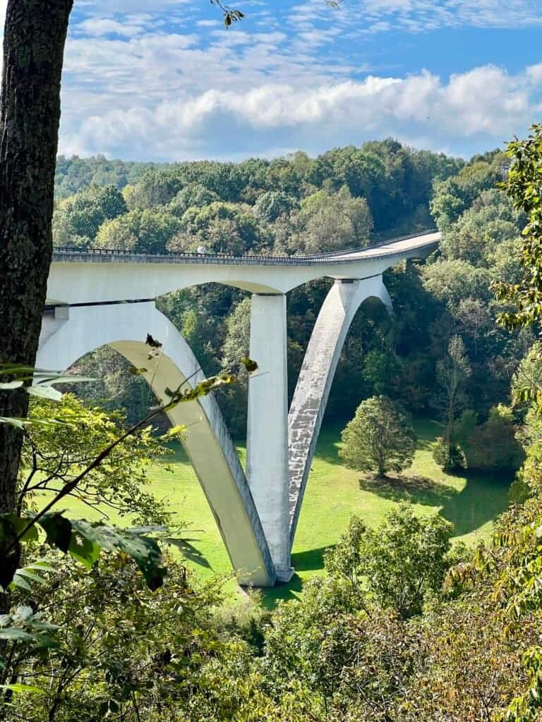
Photos: Natchez Trace Parkway Bridge near Franklin, TN |
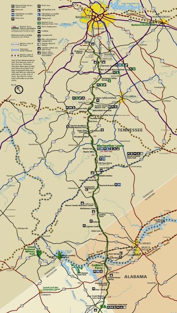
Natchez Trace Parkway map from Tennessee to northern Alabama
The Parkway is a beautiful, winding, and hilly two-lane road. With that said, you need to be somewhat prepared if you plan to drive it. First, the speed limit is 50 mph, so if you’re in a hurry, you’ll want an alternate route. Second, there can be a lot of cyclists on the Parkway, and they are allowed to occupy the roadway just like cars. You need to stay alert as you round corners and crest hills.
I followed the Parkway to Cherokee, Alabama, then took US-72, which leads into Mississippi and brings you close to Woodall Mountain.
A Rocky Road to the Top!
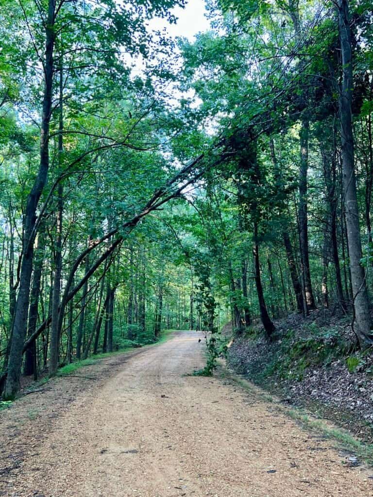
From US-72, with a few twists and turns, you’ll eventually reach Mississippi Highway 176. From there, you turn onto Mississippi Highway 185, a steep, unpaved, rocky, and bumpy incline roughly one mile long leading to the summit. The final 1,000 feet is easily the steepest and roughest section of the drive.
This is one of those high points where driving is clearly the best option.
As a helpful note: at the intersection of 176 and 185, there is a Woodall Mountain sign, so you’ll know you’re in the right place.

Pictures: Woodall Mountain sign at MS-176 & MS-185 |
The rocky road to the top
Ski Woodall?
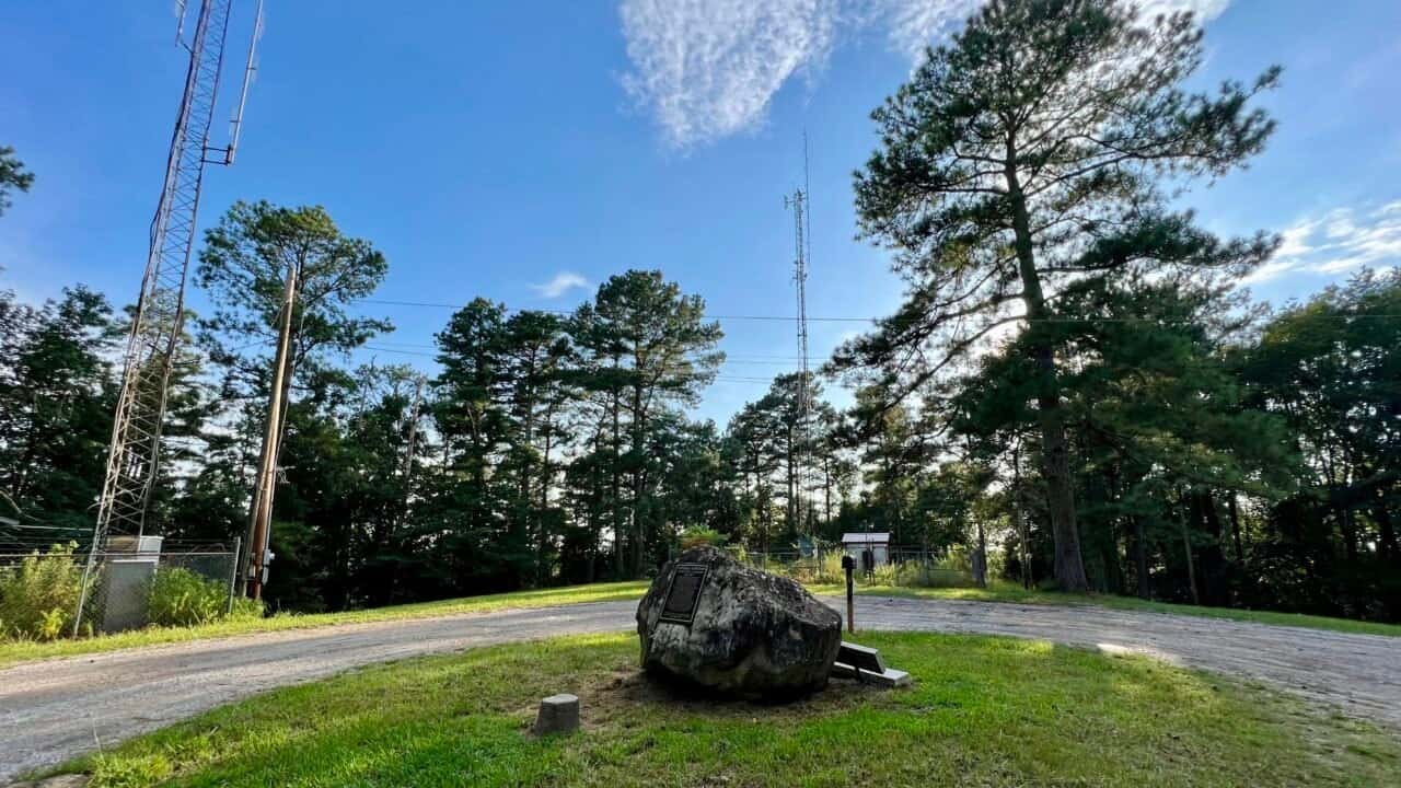
At the top of the hill, you’ll find a bench, a high-point register mailbox, and a gravel loop that allows parking for several vehicles. A wooden observation tower once stood in the center of the gravel circle, constructed in the 20th century. Over time it deteriorated, with several steps rotting, and it was eventually torn down in 1998.

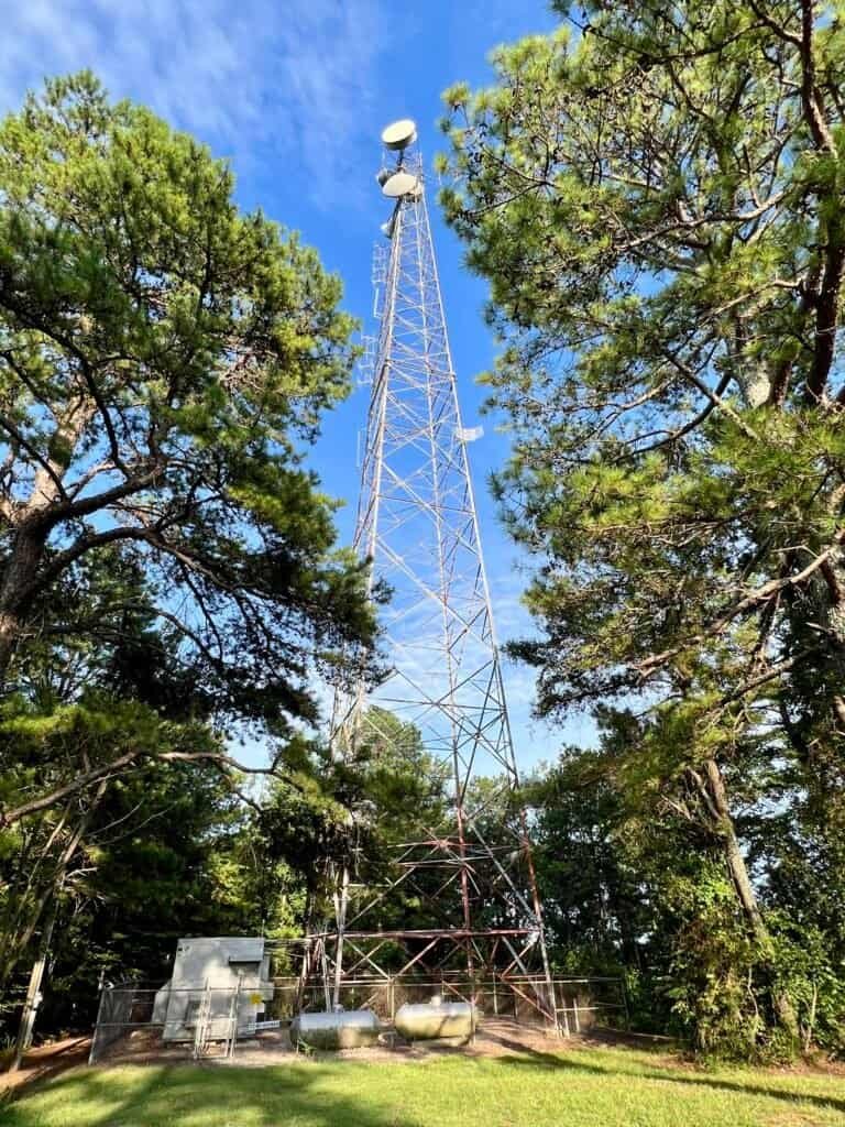
Photos: Mailbox with high-point register | Radio towers on the summit
The summit is marked by a National Geodetic Survey triangulation station disk and three radio towers. There really isn’t much of a view — although there is a small opening with a slight look down the hillside. And honestly, if it ever snowed here, I think you really could Ski Woodall.
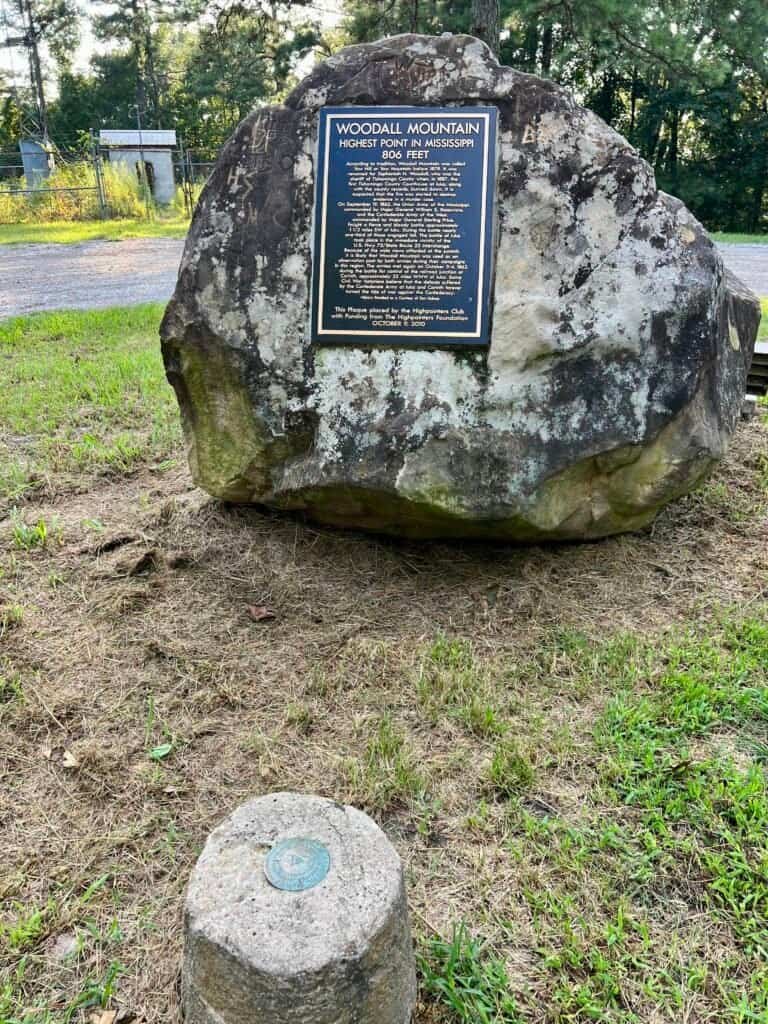
Photos: Boulder with summit plaque and survey marker |
Historical plaque at Woodall Mountain

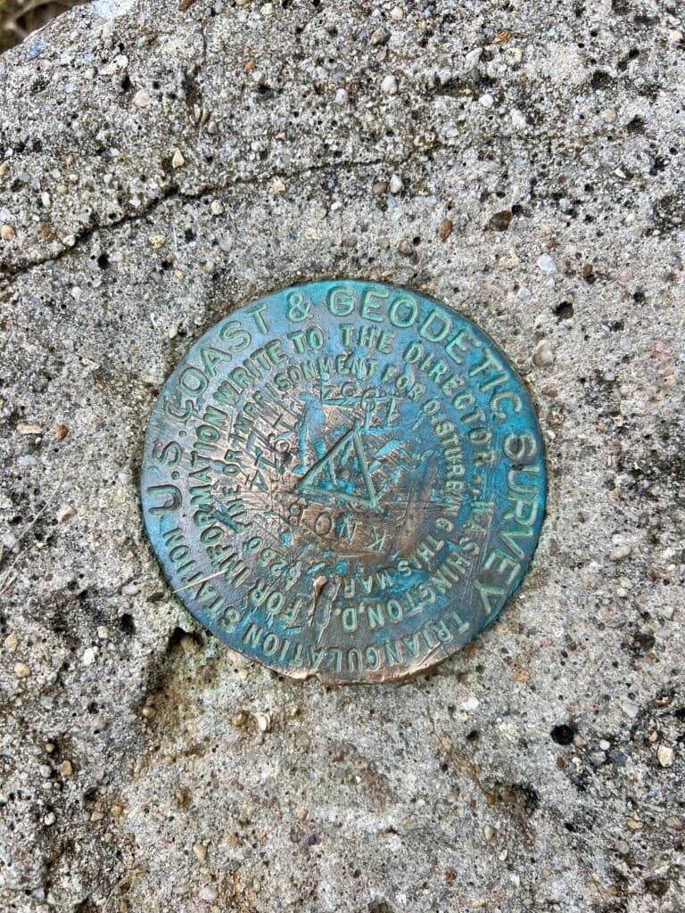
Photos: Summit selfie | National Geodetic Survey Marker
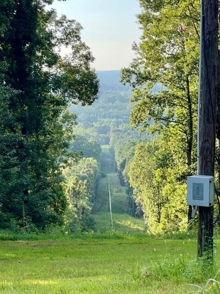
Photo: The limited view from the summit — “Ski Woodall?”
Overall, this isn’t the most exciting high point—but it still counts.
Fifteen summits down, thirty-six more to go.
Catch you on the summit!
Date of “Climb”: 12 August 2023
Discover more from love cook adventure
Subscribe to get the latest posts sent to your email.
2 Pingbacks